Thursday PM Update: Christmas Weekend Outlook

We've been watching a system closely all week for a weekend system and its potential impacts along the Front Range Christmas Day and night. Models have come into agreement that this is not a big snow maker for the lower elevations, aside from the potential for a few snow showers during the day Sunday as the system passes to our north. Welcome news to many who are traveling Christmas Day or would otherwise have to work if it snowed, but a let down for others hoping for a white Christmas to be sure. Travel elsewhere, particularly the Dakotas, will not be advisable.
This storm's trough will dig pretty far south into the Great Basin on Saturday, but will then eject northeast quickly during the day Sunday. As it does, it'll put the main energy associated with the system too far north for a good northeast Colorado snowfall. This is the scenario we shared with our Insiders earlier in the week.
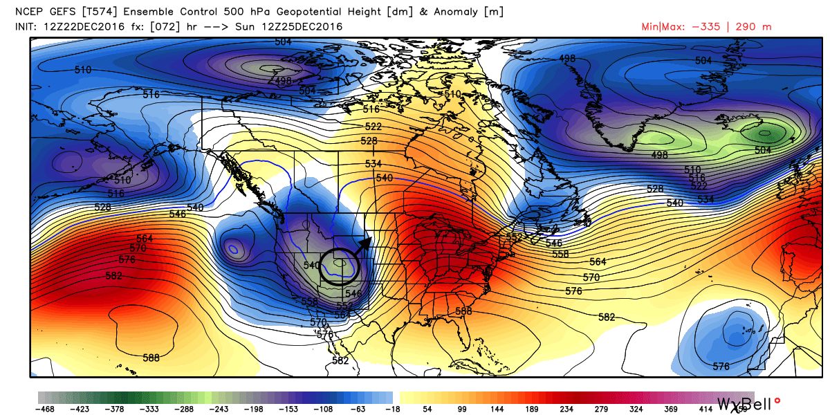
Here's a look at 500mb early Sunday, the trough digging across Utah and into Colorado. By Sunday night the main Low has moved into Nebraska and South Dakota.
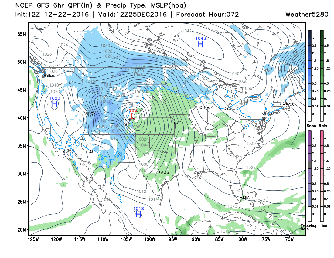
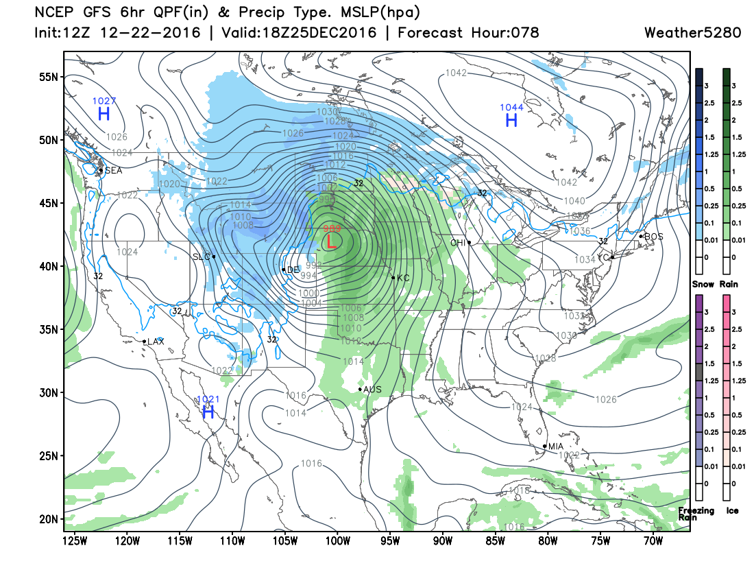
At the surface, we see the low track across northern Colorado, into northeast Colorado by Sunday morning, then into Nebraska during the day Sunday. If you find Denver (DEN) in both maps below, you'll see lots of rain and snow surrounding the city, but not much happening overhead. This particular track would favor downsloping winds along the northern Front Range, and not a huge chance for accumulating snow.
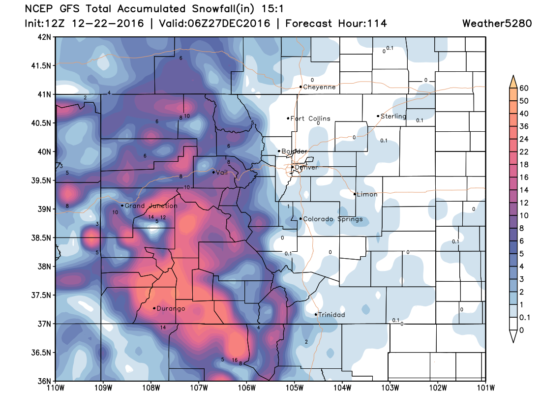
In the mountains, this will be a different story. We're seeing some snowfall there today (especially across the southwest) and will likely see more Saturday and Sunday as this next system moves through the state. Here's a look at the GFS snowfall forecast through Monday for the state. Good snowfall for the mountains continues; not a lot expected across the plains at this time:
Of course, this could all change if something happens with the current forecast track. As we said in the State of the Atmosphere this past weekend, the storm track models once had with this system was likely too far south... and since they've all corrected north - with nearly identical tracks now between the EURO/GFS/GEM models - all are not favorable for snow across northeast Colorado.
If that track moves a bit further south (50 to 100 miles) we'll have to watch for potential changes to the current forecast. And, of course if it does, we'll offer updates as we head into the holiday weekend. For now, plan for mountain snow if you're heading west, a cool and blustery day on Sunday across the plains, with only pockets of snow showers at lower elevations as the low pushes northeast.