Final Check on Forecast as Snow Starts to Fly

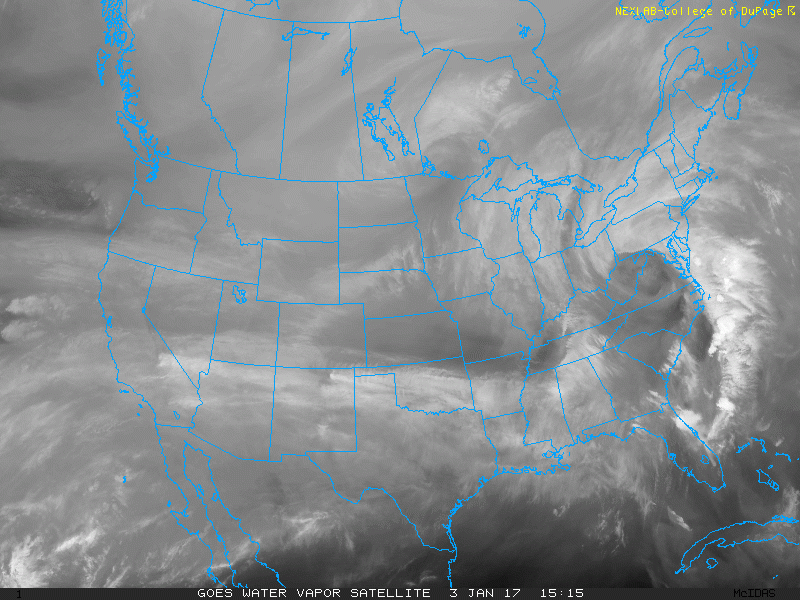
We're already seeing some snow across northern Colorado this morning as our latest winter storm gets underway. Snow will increase in coverage and intensity throughout the day, with the heaviest snowfall for the Denver metro area expected from Wednesday evening through Thursday morning.
A Winter Storm Warning goes into effect for all of the northern I-25 urban corridor at 2 pm Wednesday afternoon and expires at 11 am on Thursday.
Latest
We're not making any huge adjustments to the forecast we put out yesterday. Latest observations are showing very moist low-levels this morning, which lends some confidence in the potential for high-end snowfall totals for many. We should see moisture start to increase through a greater depth of the atmosphere as the jet approaches northeastern Colorado. This continues to look like a good snowstorm for those that end up under heavier snow bands expected to form later this evening, with at least some snow for all locales up and down the I-25 corridor.
Track the storm: Latest storm reports and forecast maps
If you have travel plans between now and Thursday afternoon across Colorado, please plan for a slow and snow-packed drive, with very tough driving conditions Wednesday night across most of northern Colorado. If you are traveling by plane, check ahead with your airline as some are already offering waivers in anticipation for delays and or cancelations to come.
Latest forecast guidance continues to suggest the heaviest snowfall will be north and northwest of Denver. As we all know from our similar event in December that depending on where exactly that banding sets up, this could change a bit.
A look at NCAR's ensemble forecasts shows this quite well. Here's the latest forecast for Denver (DIA) (top) compared to Broomfield (bottom). It would suggest totals from 3 - 7" for the Denver area (especially east), and closer to 8 - 12" for those northern/northwest suburbs:
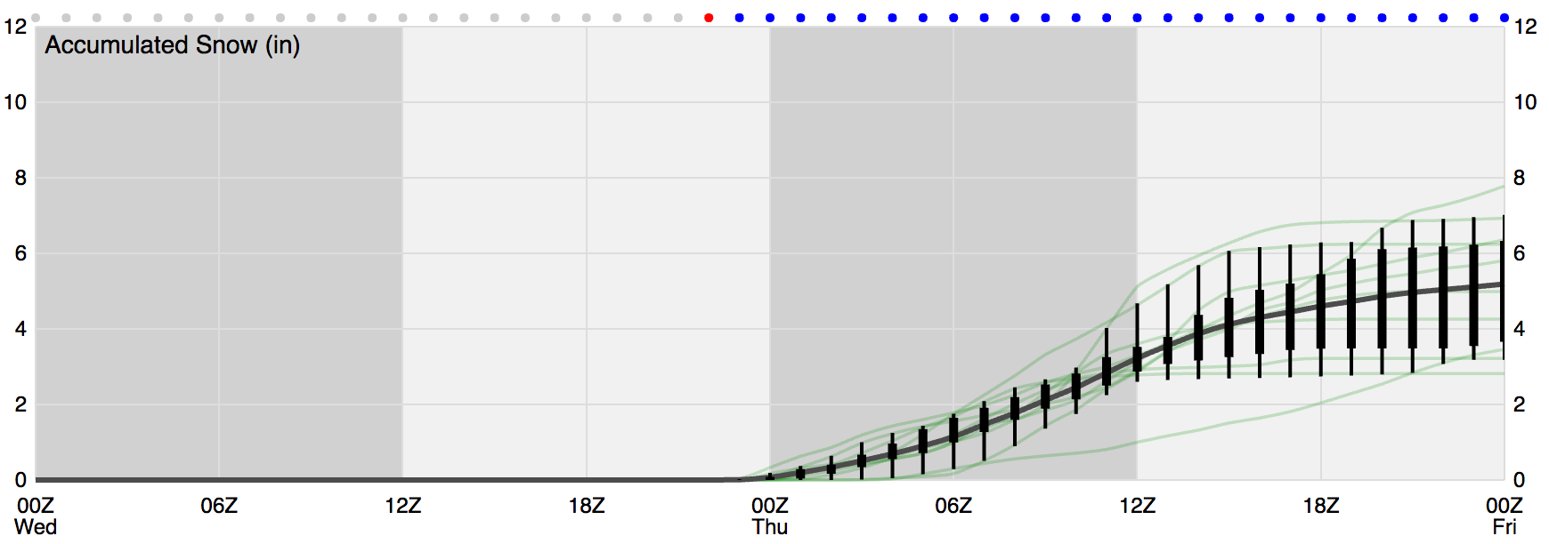
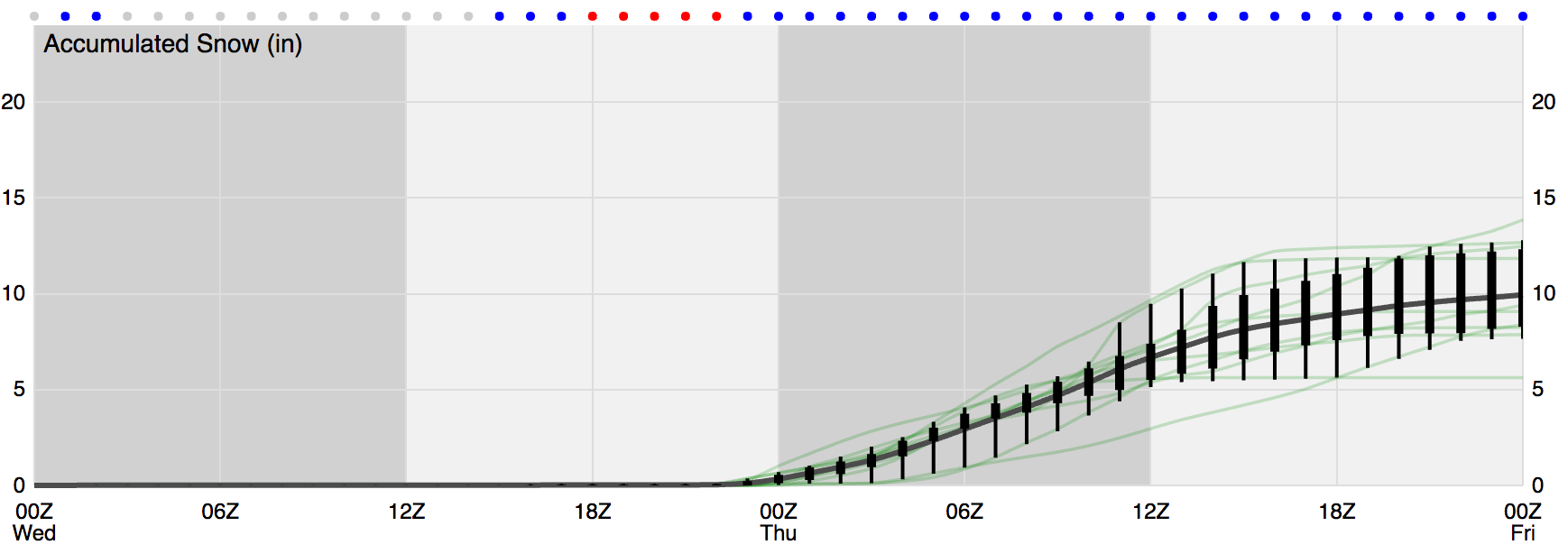
This lines up with our thinking. Those living along and east of I-25 generally see lower totals, while those living along and west of the interstate see higher totals. Broomfield, Boulder, and those surrounding communities may do very well with this storm, while at the same time those living across the Palmer Ridge may struggle a bit more to reach forecast totals.
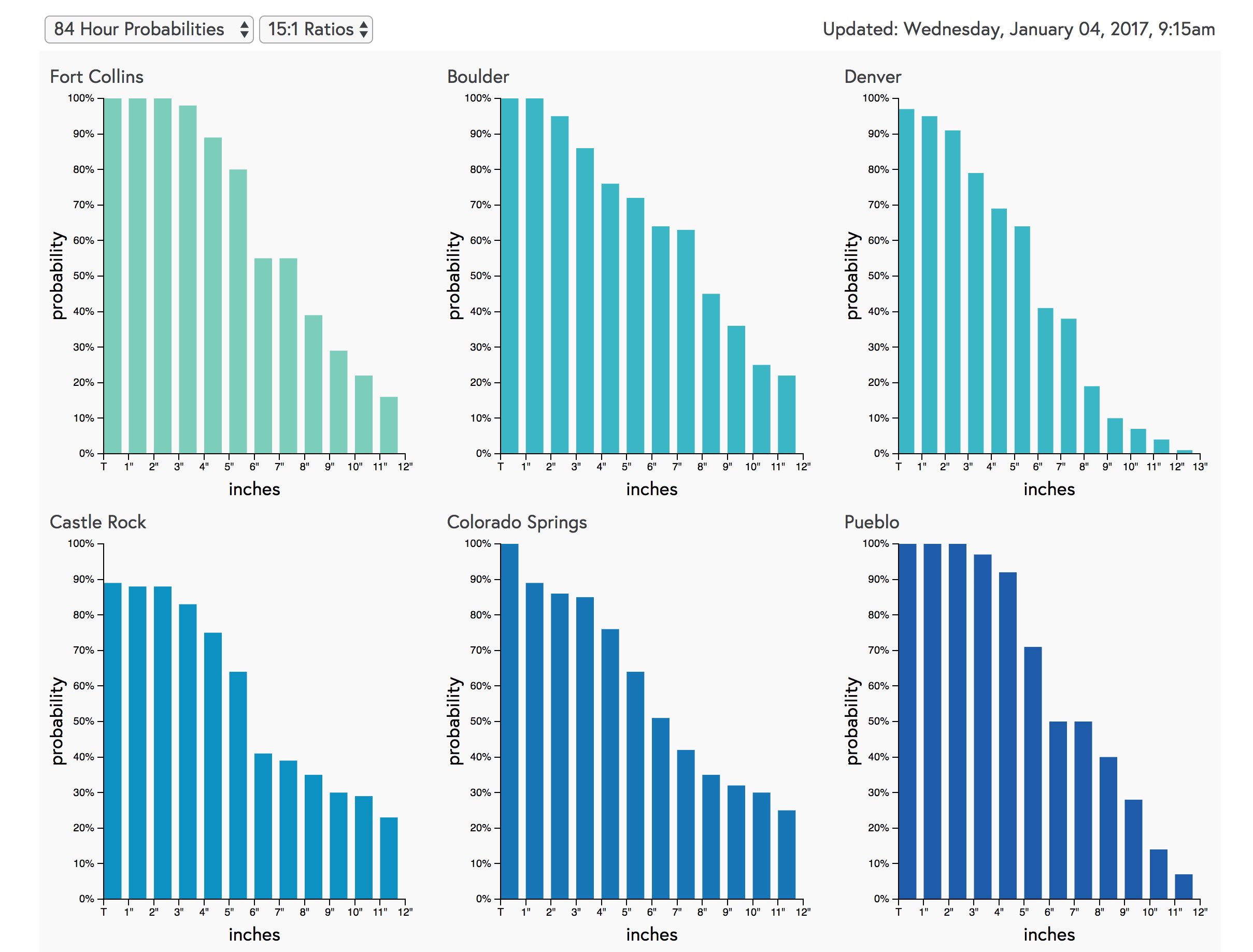
A look at our forecast probabilities shows a similar story. Denver's odds for 5" of snow are upwards of 60%, but then we see those probabilities drop after that. Boulder and Fort Collins see higher probabilities for those 6 - 12" totals. Keep in mind, probabilities are for 15:1 snow/liquid ratios, and we'll likely be closer to 20:1 or even 25:1, so actual probabilities are bit higher than this.
With that, here's our latest forecast map. No big changes from yesterday, but we have upped our 4 - 8"+ range to 5 - 10".

Denver is looking at 5 - 10" with pockets of higher totals possible given banding. For those north and west of Denver totals from 8" up will be common. For Fort Collins we're looking at 5 - 10", closer to 9/10" west, lower east/southeast. And finally, for Colorado Springs we're looking at 3 - 6" of snow, with greatest totals to the west side.
Cold, cold, cold
Not to be forgotten in all the snow talk... temperatures are set to plummet as well. We are currently in the teens in Denver, and won't do much better than that until Friday. Overnight lows Wednesday will be near zero for Denver, with daytime highs Thursday in the single digits and teens across eastern Colorado.
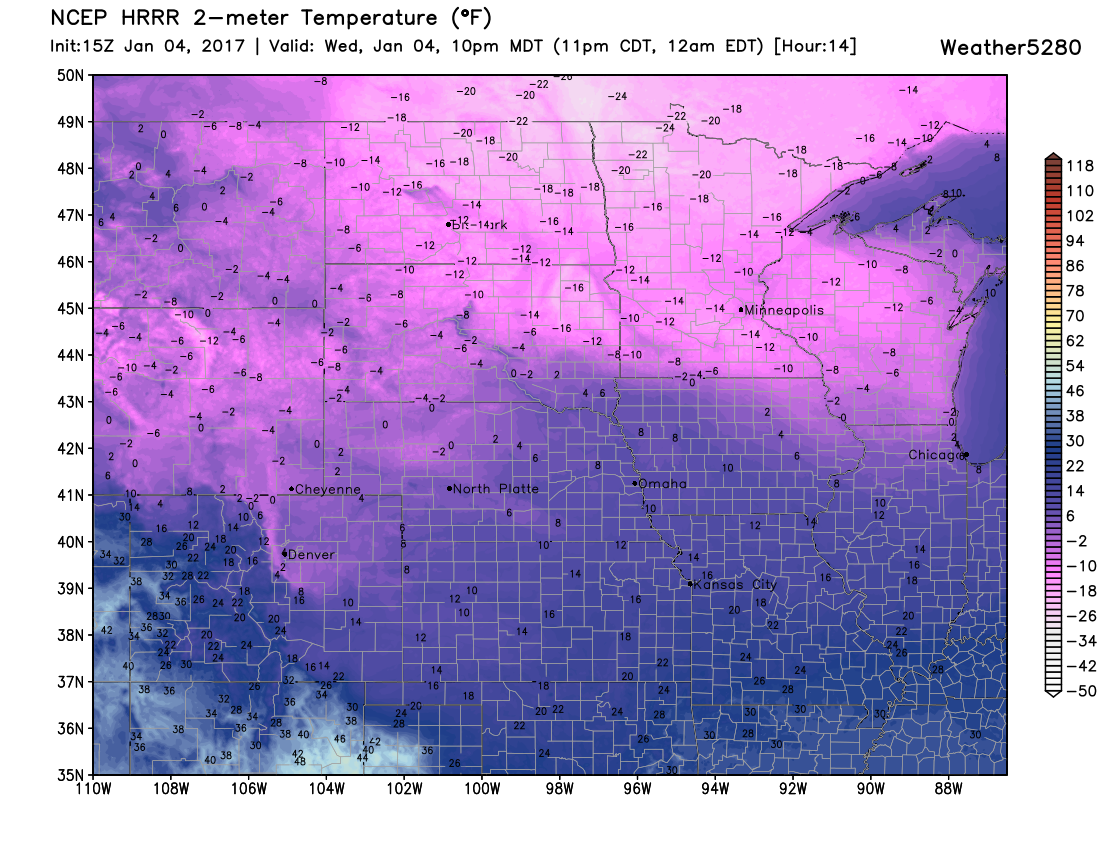
Here's a look at the HRRR forecast for 10 pm tonight across the north-central U.S. – cold!
Timing and impacts
We're already seeing snow across the northern portions of Colorado. Coverage and intensity will increase throughout the day. Wednesday's evening drive may be difficult as snow becomes more widespread, and temperatures fall into the teens and single digits.
Travel will not be advised Wednesday night. For the mountains, we're expecting heavy snow today through Thursday (several feet possible there), with gusty winds and pockets of heavy snow across the plains Wednesday night.
Thursday morning's commute will again be slow, though it may very well be improving north of Denver, with the worse conditions moving south into Castle Rock, Colorado Springs, and points south.
We'd love for you to share your reports! Please stay safe (and warm!) and keep us posted in the comments below!