Sunday PM Update: Snow Falling Across the Plains, Continues Off and On Through Monday

We're just a few hours away from Denver's best chance of accumulating snow now, and there's still a considerable divide in possible outcomes between the various models.
Overall, models are still in better agreement with the track of the main system – it should end up too far east for big time totals across the region -- than they are with the finer details and precipitation amounts. At the same time, hi-res models (and the EURO) remain pretty bullish with snow, while the GFS continues to produce next to no snow in Denver.
Our general take is... don't throw out the EURO, its ensemble mean has been VERY consistent for several days, but, in all likelihood it's overdoing moisture and upslope for the urban corridor.
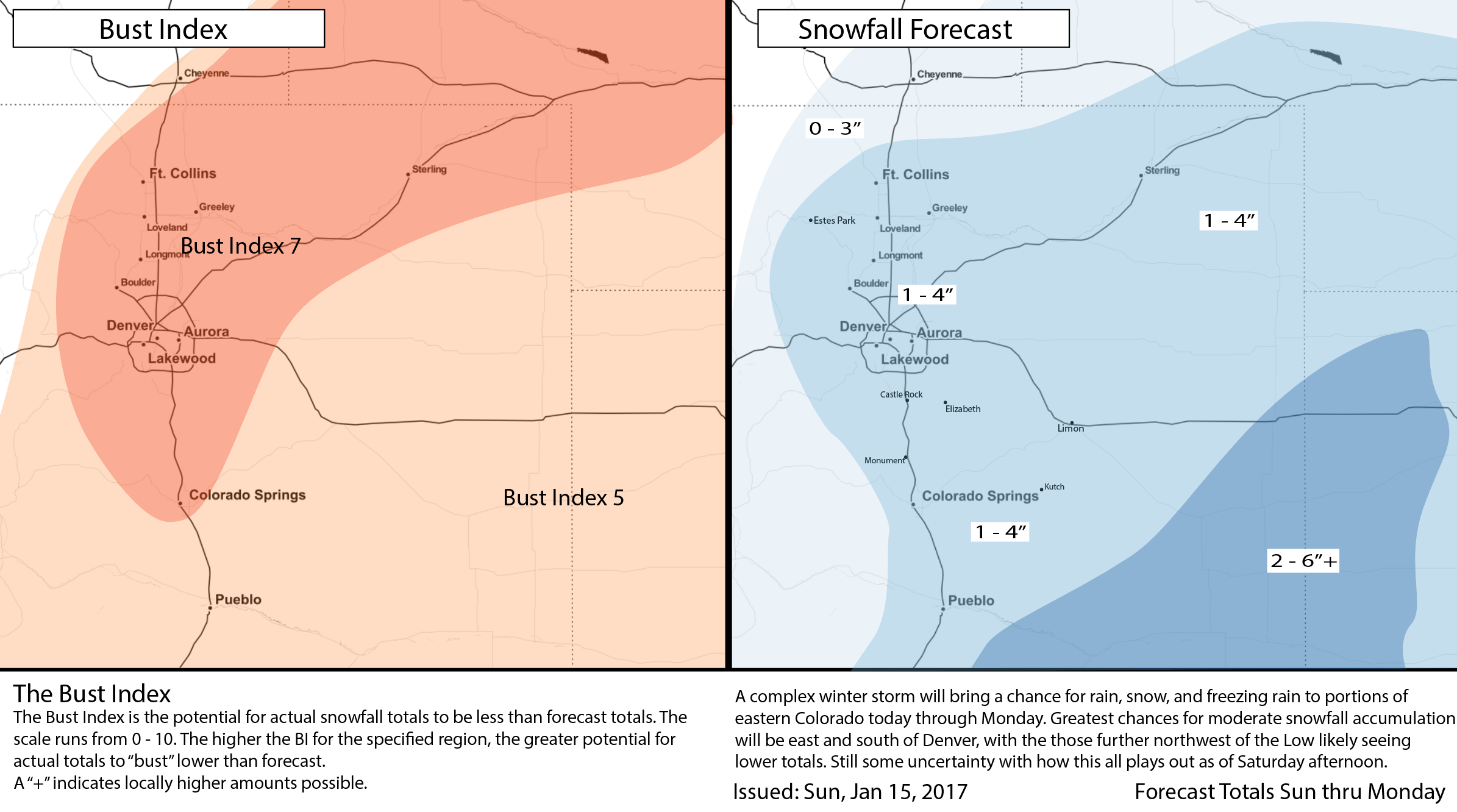
A compromise leaves us pretty much where we were yesterday: a broad-brush of 1 - 4" for Denver, with perhaps a bit more to the south, and southeast. If the EURO (the higher totals model) ends up verifying, better upslope may help out foothill locations to Denver's west, but we're skeptical on this given how far east the low races tonight. In many respects we're leaning closer the the GFS with this one, with our high-end more inline with a EURO-type outcome.
Upslope flow and how much moisture is available this far west is key. If the Euro is right, our current forecast amounts will likely be a bit low. Some hi-res models like the 09z SREF continue to put 4 - 6" across the metro areas as well. Meanwhile the 3km NAM is been far too bullish to the south, and isn't all that impressive in the city proper, and the HRRR through tomorrow afternoon has about 1-2" of snow for Denver. Not impressive.
The SREF ensemble probabilities for more than 6" across eastern Colorado remain decently impressive (top) while the GEFS ensemble probability is zero for most of the region (bottom):
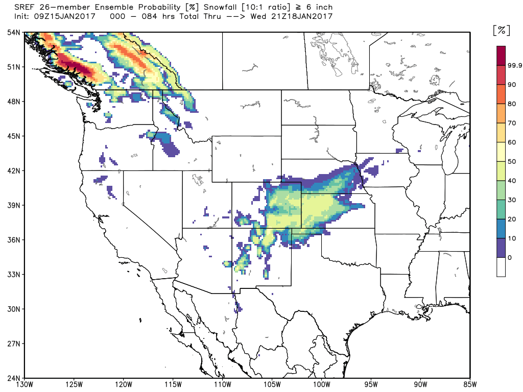
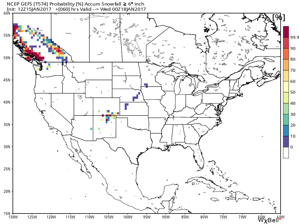
So, you see our forecast dilemma!
Given how this storm has evolved over the week, we think the GEFS has a better handle overall. The low is going to scoot east tonight, and pull a lot of moisture with it.
If you live out east and south you should do a bit better than we will in the immediate Denver area. Some locales across southeast Colorado have already seen 3" or so this morning, and another 2 - 6"+ will be possible through Monday.
Some models are also still putting a heavier bullseye across the Palmer Divide. We've weighed going 2 - 6" here, but in the end it's splitting hairs a bit. Given temperatures, and how poorly models have handled this... we'll hedge lower here too (1 - 4"), with the potential for some across the Palmer Divide to see 5 - 6" should a more favorable setup come to fruition.
Lastly, even as many of the hi-res models are more bullish on snow Monday than we are... temperatures will be an issue with this event, and unless we end up with most of that snow falling before dawn, much of what falls during the day will have an uphill battle sticking with highs forecast to be above freezing on Monday. What falls vs what sticks will be an issue tomorrow.
Tough forecast. We hope those of you that have Monday off enjoy the chilly, unsettled day, and with any luck at all, some snow! Keep us posted...