The State of the Atmosphere: Sunday, February 19, 2017

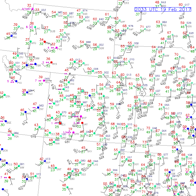
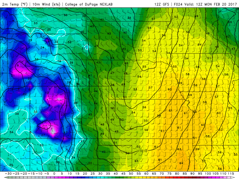
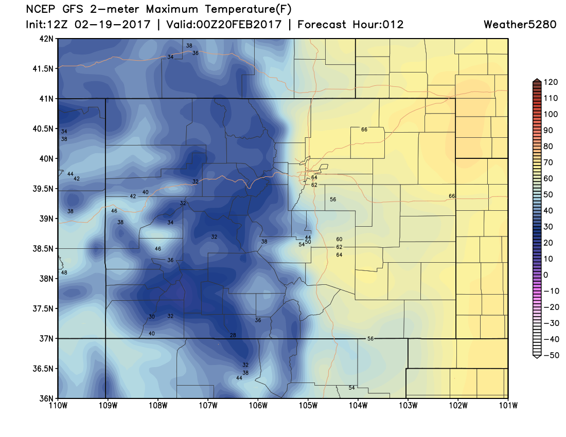
It was another very mild week across Northeastern Colorado, with Denver recording yet another day in the 60s today. DIA managed to hit 64°F despite the cloud-cover ahead of our next system. Check out the mild temperatures and the gusty southerly flow this afternoon across Eastern Colorado:
This put our high °F above our average high temperature of 47°F. This trend of above average temperatures will continue into the first half of the week before seeing some cooler and potentially wetter weather Thursday and into Friday.
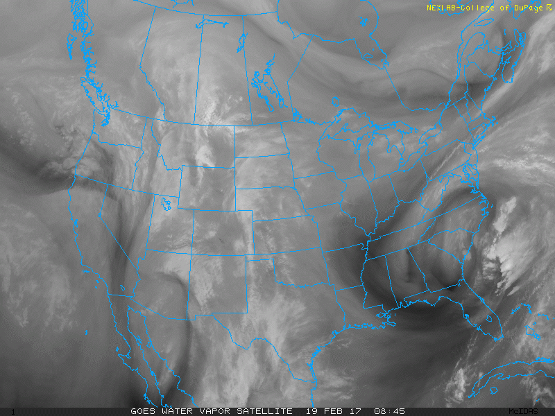
Looking at water vapor imagery, we can see the broad fetch of mid-level southerly flow bringing us mid and high-level clouds over Denver. This is associated with an upper-level low that is centered over the Four Corners at the time of the loop.
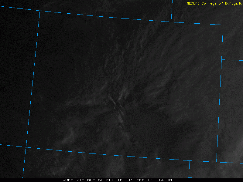
Also notice that there is some convection occurring over the mountains and along the foothills which can be seen on visible satellite. A welcome sign that spring is right around the corner!
This system is quite progressive, meaning that it likely won't impact our weather too much in Denver despite bringing some snow to the mountains. As we saw on the surface observations, it is very dry at the surface with dewpoint depressions (the difference between the temperature and the dewpoint) around 25-30°F. This will make it difficult for any rain to reach the ground unless we manage to moisten the low-levels.
Looking at a forecast sounding from the 12Z NAM for DIA at 06Z (11 PM MST), we can see that there is some moistening in the mid-levels but it is still dry at the surface. Locations on the plains that do manage to see a shower will likely see more wind than rain.
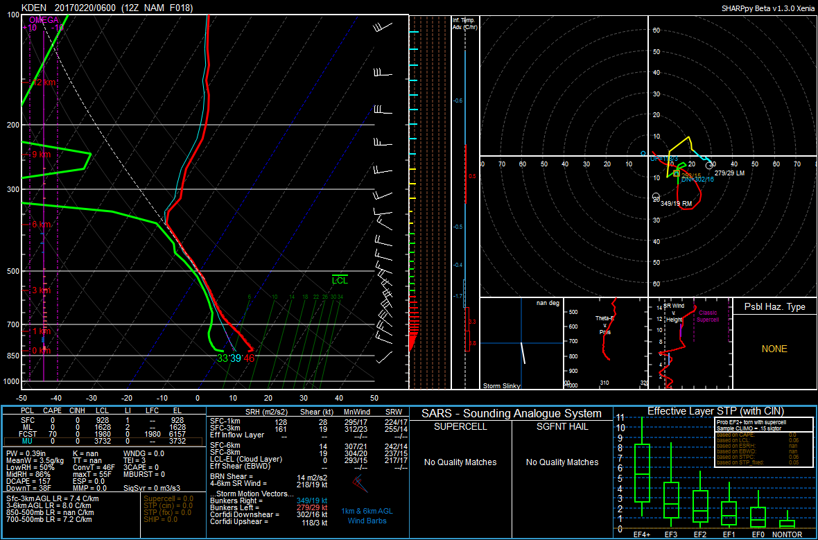
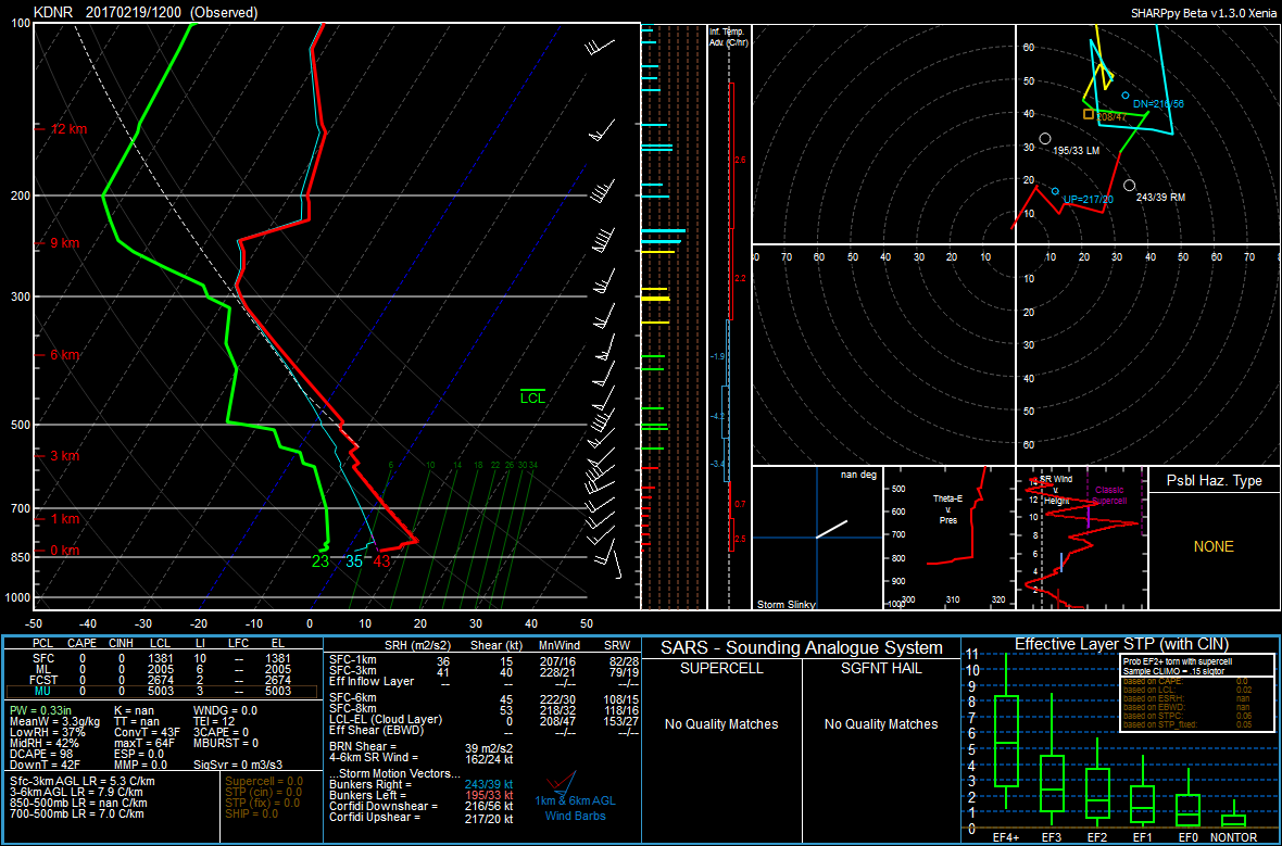
Also note the mild overnight temperatures under the veering wind profile (clockwise turning of the winds with height) implying warm air advection, along with cloud cover and downsloping given the northwesterly flow aloft. This profile is quite different from this morning's sounding, which shows dry mid-levels. Synoptic-scale systems like the one that is currently over the Four Corners act to moisten a large depth of the atmosphere as they provide a source for lift, which allows for air parcels to expand and cool to the temperature of their surroundings. This eventually results in condensation and cloud formation.
There is a weak cold front that pushes through Denver into the overnight hours, but winds shift to northwesterly behind the front which will result in downsloping and therefore warming east of the Front Range.
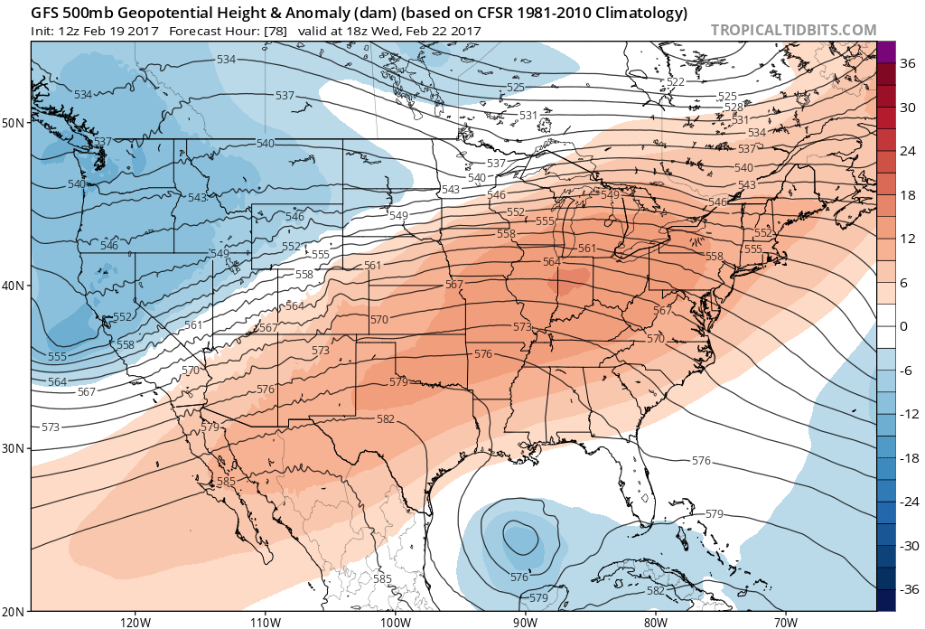
Tomorrow temperatures look to remain well-above average again for Denver as ridging starts to build back in over the Southwestern US. This will again allow temperatures to climb well into the 60s across Northeastern Colorado.
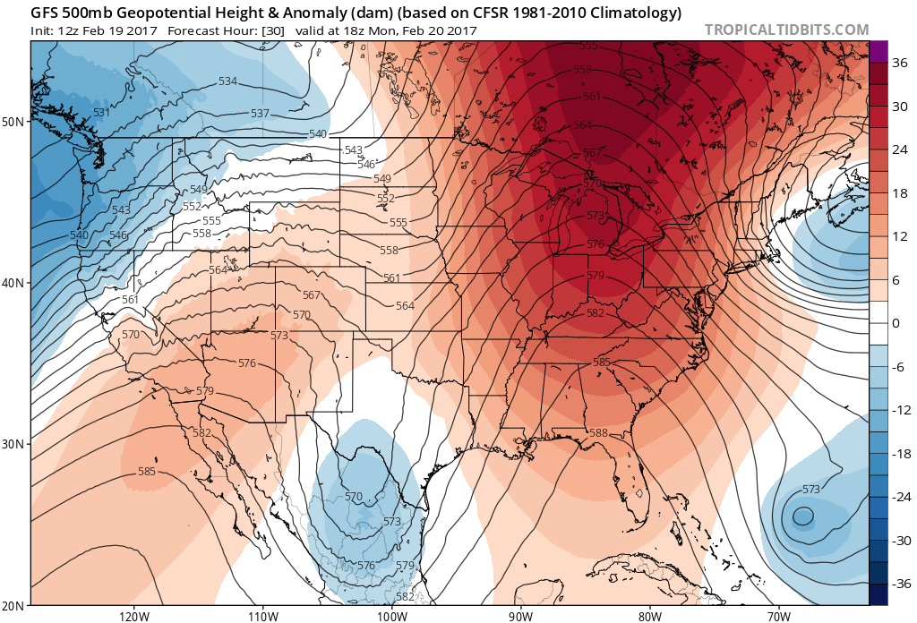
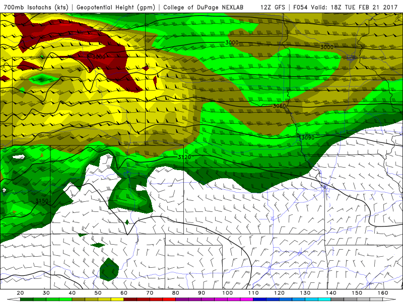
Tuesday we could be pushing record highs in Denver as ridging continues to build over Colorado and with downsloping in place. Notice how the 30-35 knot winds at 700 mb (roughly mountain-top) are perpendicular to the Front Range.
The old record high temperature for Denver on February 21 (Tuesday) is 71°F.
We will see one last mild day on Wednesday ahead of our next system of interest. Again, temperatures will likely peak in the 60s for Denver on Wednesday as the ridge flattens out and downsloping continues to take place east of the Front Range.
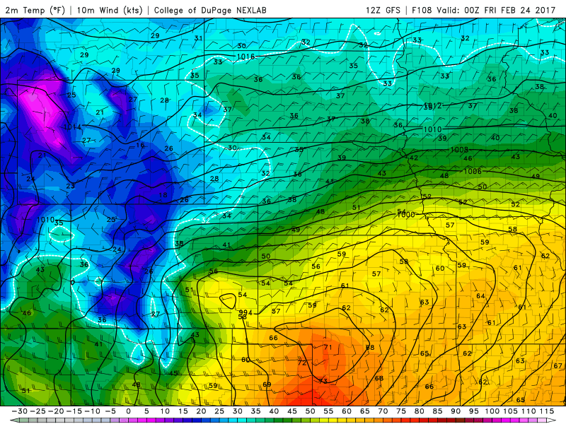
On Thursday we will transition into a cooler and potentially wetter pattern. A cold front looks to slice across Northeastern Colorado sometime Thursday evening in association with a weak shortwave trough that looks to push off to our north. This isn't our ideal setup for snow here in Denver, however the 12Z GFS does hint at some post-frontal upslope Thursday night into Friday. Note the 10-20 knot northeasterly flow at the surface. High temperatures on Thursday will likely be reached early in the day ahead of the cold front. Depending on the timing of the front, we might not make it out of the low 40s for highs.
We will continue to keep you updated on this system as we head into the middle part of the week.
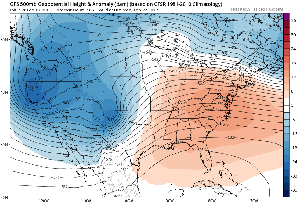
The long term pattern looks to remain active with a series of shortwaves digging down from the north over California and eventually lifting off to the north and east. We will focus on the overall pattern for now, but March will likely start off being cooler than normal for Denver. The track of these systems will ultimately determine our potential for seeing any significant snowfalls here across Northeastern Colorado.