The State of the Atmosphere: Sunday, March 5, 2017

Meteorological winter came to an end in unremarkable fashion this last week. And, while the calendar says there are still two more weeks of winter... another day of warm temperatures and high fire danger across the plains may have you thinking otherwise.
March is Denver's snowiest month, with the city recording 11.4" of snow on average between 1882 and 2015.
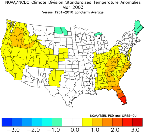
It can also be a very warm month as we begin our transition from the cold months of winter, to eventual (or sudden) summer. Many of Denver's snowiest March's have also been warm ones, including 2003 – the city's snowiest March on record at 35.2" of snow – which ended warmer than average statewide:
In recent years, March has been a bit of a mixed bag for snow-lovers along the Front Range. Last year was a pretty good March for the city, with 18.4" recorded at Denver International Airport. The two years prior were significantly less impressive, with just 2.9" in 2015 and 6.0" in 2014. Then of course there was 2012, when summer came early and we recorded just a Trace of snowfall for the month.
With a string of recent weeks featuring primarily well above average temperatures and little to no snow, the question of course is what will March 2017 have to offer?
The short answer is, while climatologically we'd expect to see a good chance for some snow before the month is over, the pattern for the next 10 to 15 looks mostly unfavorable. That said... there are some pretty remarkable disagreements in the modeling right now, with some solutions suggesting there's a chance we see some flakes by next weekend, while others (hi, EURO) say nope, no way.
Our take remains much as it has all winter long. We're not terribly excited about the next 10 days or so, but aren't exactly willing to discount completely some snow riding a front by the 12th - 14th timeframe, either. The pattern this entire winter has been one to favor the western U.S., Colorado high country, and northern tier, and for the foreseeable future – that looks to remain true. In many respects, at 19.3" on the season (average is 35.1" to date) I'd consider us lucky we've done this "well" considering the dominant flow.
Which brings me to this: we NEED moisture east of the Rockies. While our water supply is solid thanks to a good snowfall season in the high country (so far), drought creep across eastern Colorado continues:
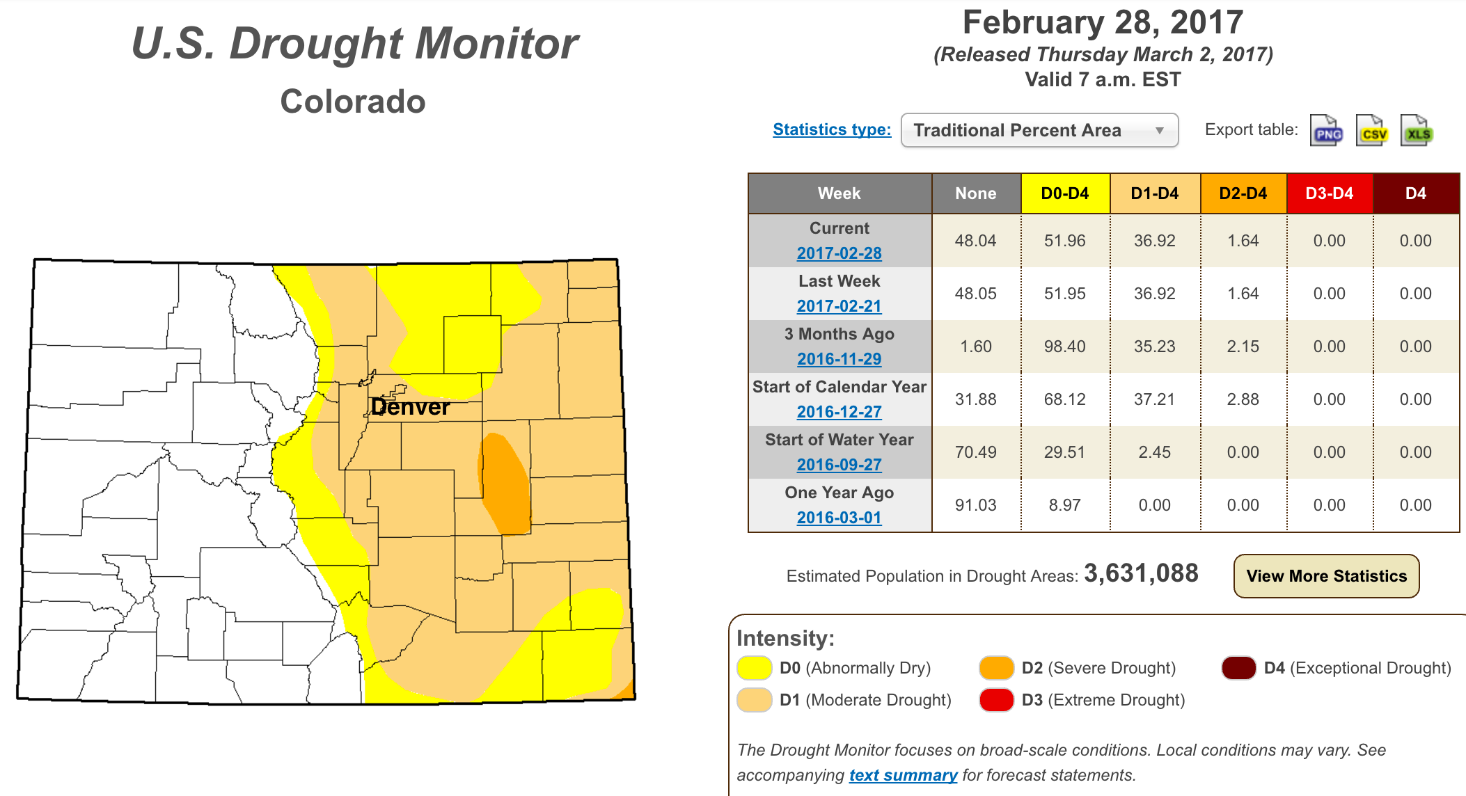
A year ago, just 8.97% of the state was classified as being Abnormally Dry or worse, today that number is 51.96%, with a pretty stark east/west division – a clear indication of who this winter has favored and who it has not.
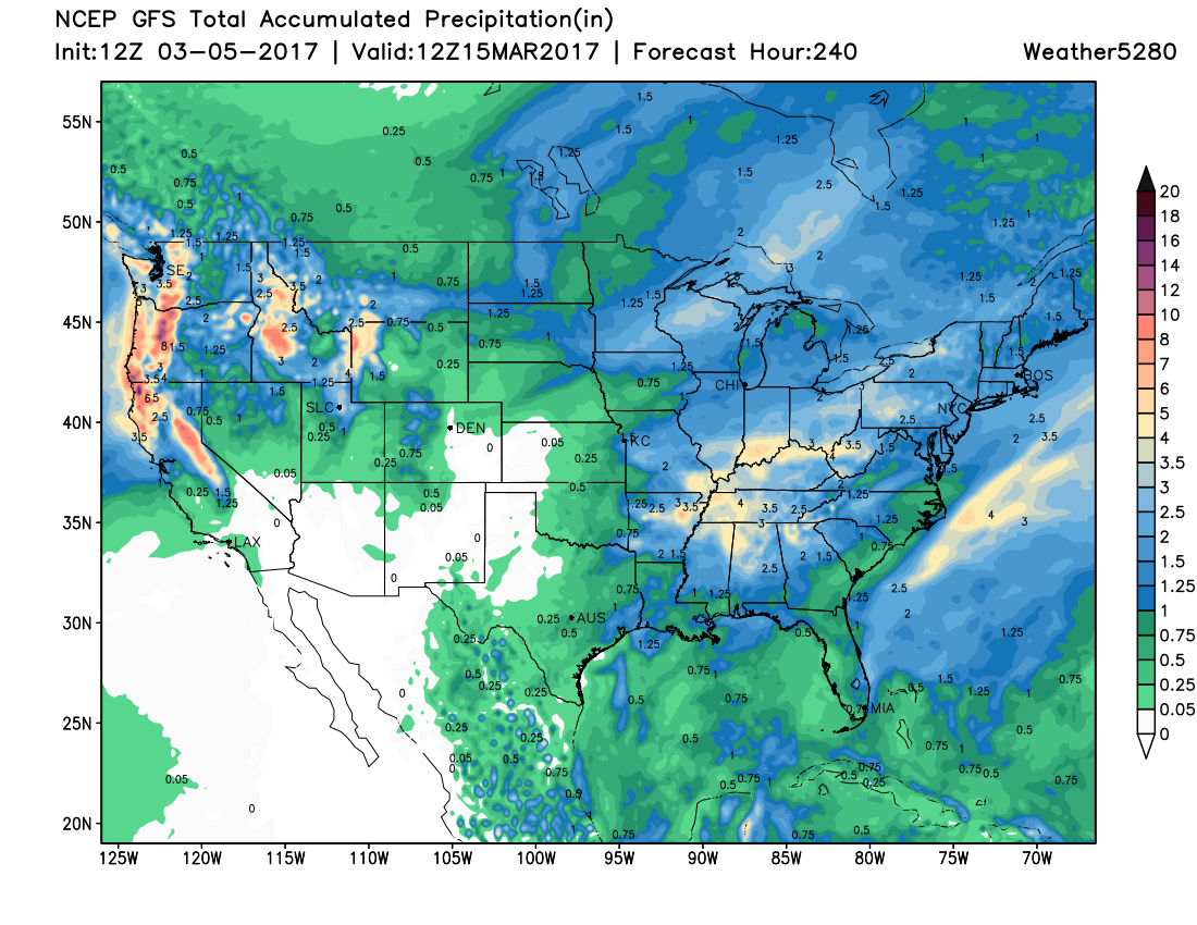
Unfortunately, the upcoming pattern doesn't look all that helpful in that regard. A look at the 10 day precipitation forecast from the GFS shows the pattern: big time rain and snow for the Pacific northwest, a northerly storm track over the middle of the country, with some troughing across the east. Ridging over the southwest should keep us mostly warmer than average, drier than average, and windy across eastern Colorado for the foreseeable future:
The week ahead
For the week ahead, expect a mixed bag of temperatures, with plenty of wind to start the week. In fact, Denver which is under a Red Flag Warning now, will see another issued Monday as well as a High Wind Warning as well. Temperatures which have soared into the 70s for some locales today will be cooler Monday, but the wind will be whipping.
Wind is about the only weather action we'll see at lower elevations through the end of the work week. Thus, periods of high to extreme fire danger will remain the big story.
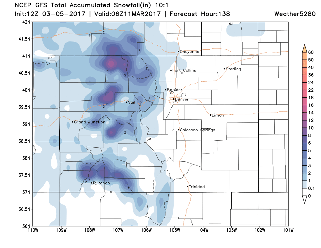
For the mountains, a Winter Weather Advisory goes into effect late tonight through Monday where anywhere from 5 - 10" of snow will be possible for higher terrain, mainly along and west of the Divide.
Below is the GFS snowfall forecast for the upcoming week. Nothing epic up high, but given where we sit across eastern Colorado, not too shabby either:
We'll keep an eye on next weekend, but wouldn't worry too much about it right now. Latest data has trended drier and warmer than some earlier runs had shown – cruising the cold air north of Colorado and on into the Great Lakes and northeast. It could end up we at least get clipped with some chillier weather, so keep an eye here through the week as we wait to see how things evolve.