The State of the Atmosphere: Sunday, April 9, 2017

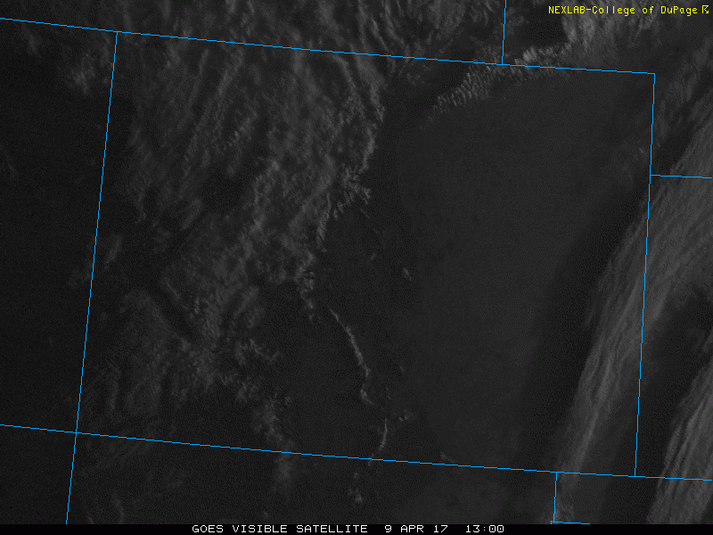
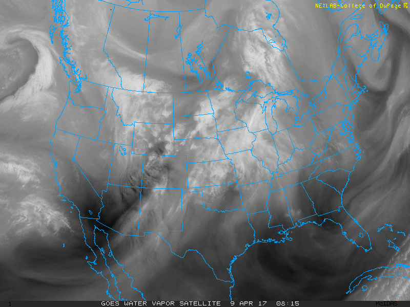
After hitting 77°F for a high at Denver International Airport on Saturday, we saw a 20-25°F drop in high temperatures along the I-25 corridor after a cold frontal passage yesterday evening. Our average high for this time of year is around 60°F. Looking at visible satellite imagery from earlier this afternoon, we can see that there were a few thunderstorms across the Northeastern Plains. Spring is definitely here!
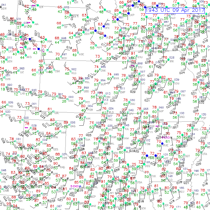
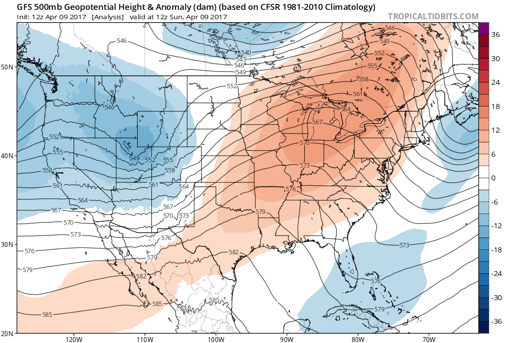
Despite the cooler, post-frontal airmass, we still managed to warm up to near seasonal highs today given some downsloping. Notice how winds at the surface are primarily out of the west or northwest east of the Front Range.
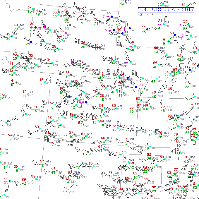
We can also see a dryline across Western Oklahoma and into Central Kansas which is noted by the sharp dewpoint gradient, with ~60°F dewpoints (green numbers) on the east side of the boundary. Although convective initiation will be a struggle due to a strong cap (very warm temperatures aloft), any storm that does manage to develop will have the potential to produce large hail and damaging straight line winds.
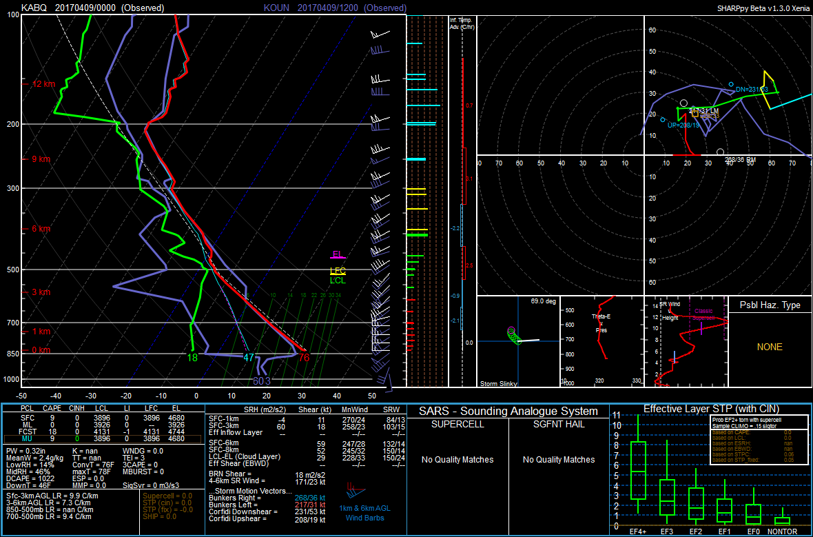
We can see this cap on the 12Z Norman sounding.
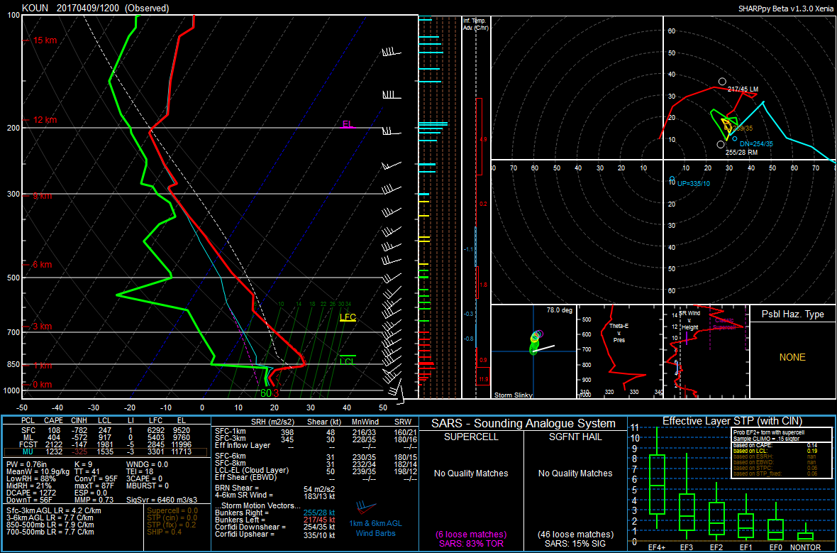
This cap is due to what we call an elevated mixed layer, which can be denoted by the steep, nearly dry adiabatic lapse rates in the mid-levels (roughly the 850-600 mb layer). If we overlay the 00Z Albuquerque sounding from yesterday evening, which is upstream from Norman, we will notice that the surface-based mixed layer at Albuquerque is being advected east off the higher terrain under 25 knot southwesterly flow in the mid-levels. Look at how the mixed layer at Albuquerque yesterday lines up directly with the elevated mixed layer at Norman this morning!
Focusing on the large-scale pattern, water vapor imagery shows a subtropical jet over the Desert Southwest along with an upper-level low spinning off the coast of British Columbia that will bring the Pacific Northwest some rain into tomorrow.
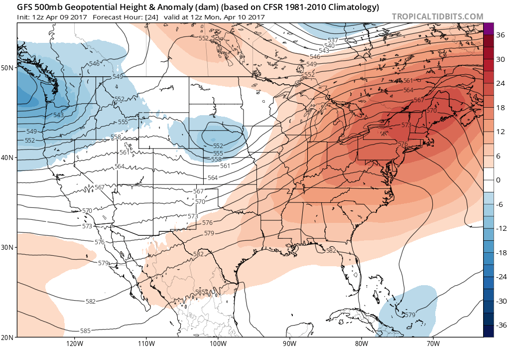
Unfortunately, the overall storm track looks to be well to our north throughout the week, as ridging builds in across the Great Basin and Desert Southwest. This will mean dry conditions and above average temperature for us here in Denver. The weak shortwave that can be seen over Utah and Wyoming on the analysis hour of the 12Z GFS will lift off to the north of Colorado.
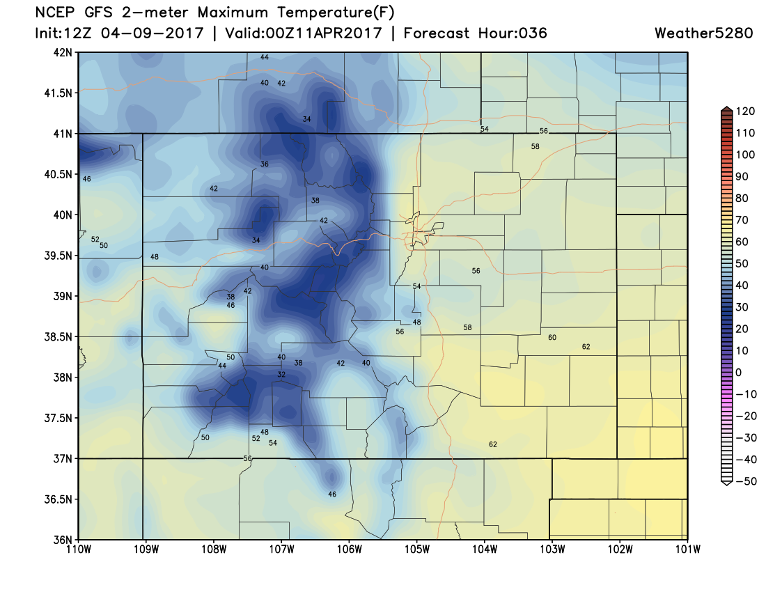
Under weak ridging building in from the southwest, tomorrow should be a fairly seasonal day here in Denver, with high temperatures in the low 60s.
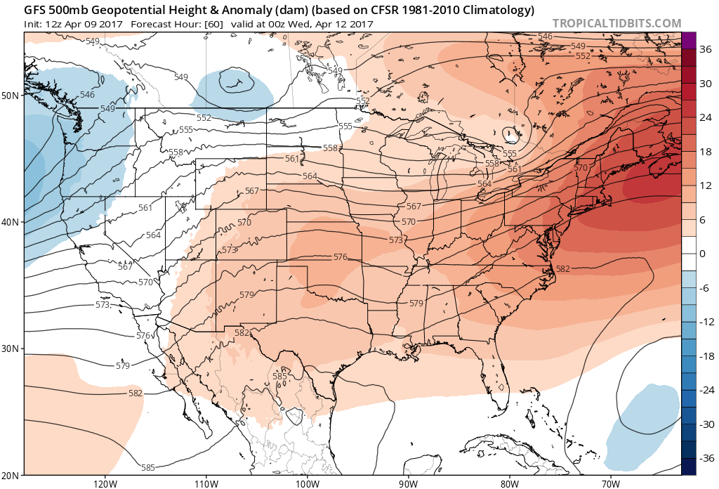
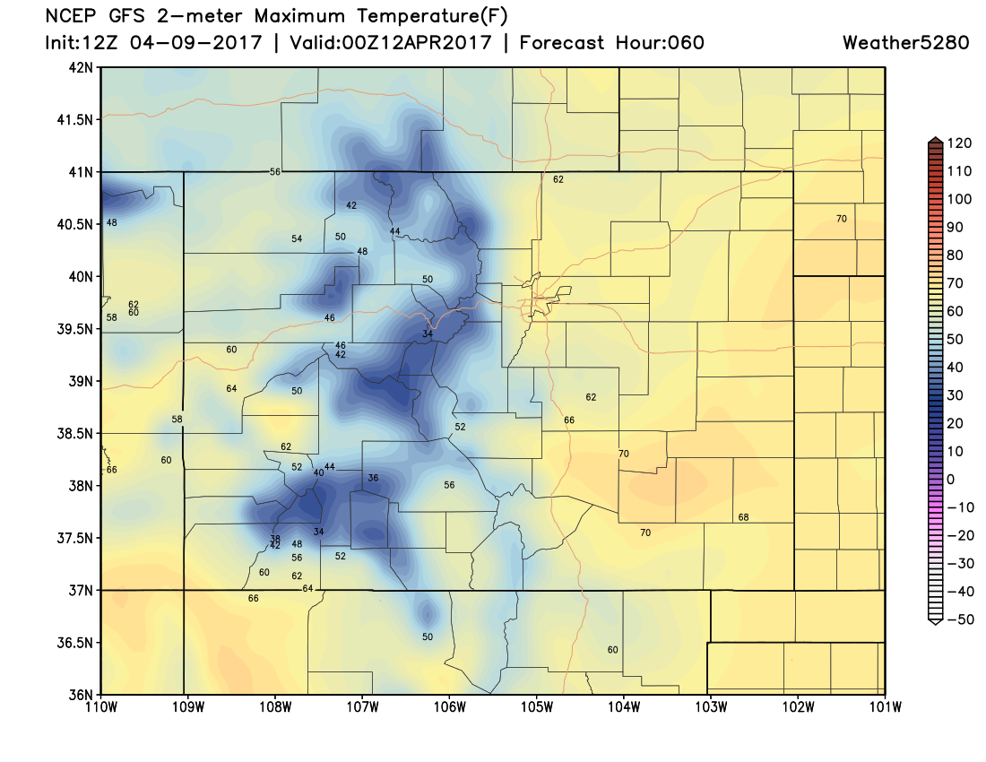
We start to warm up even further on Tuesday as the ridge continues to build over Colorado. This should allow high temperatures to climb another 5-10 degrees on Tuesday.
Thursday will likely be the warmest day of the week, with high temperatures flirting with the 80 degree mark here in Denver as ridging dominates the overall pattern. This dry and warm weather will continue into the weekend. There are some hints that a trough will make its way over the state in the April 20-24 time frame, but this is still 10 days out. We will certainly take any moisture that we can get here east of the Front Range. We will continue to keep you updated here at Weather5280!