The State of the Atmosphere: Sunday, July 23, 2017

Today was a fairly typical day for the books here in Denver, with high temperatures around the metro reaching the mid to upper 80s (DIA hit 90°F), with readings in the low to mid 90s over the northeastern plains. Climatologically speaking, this is typically the hottest time of the year in Denver with an average high temperature of 90°F.
Here is a look at temperatures at 1:00 PM MDT across northeastern Colorado:
Notice how winds at the surface contain an easterly component. This upslope flow is helping to bring in 45-55°F dewpoints to the Denver area. Looking at current GOES-16 mid-level water vapor imagery, we can see a weak shortwave trough centered over southern Montana and into Wyoming:
GOES-16 visible satellite also shows the typical diurnal pattern of convection initiating over the higher terrain. You can even see the anvils, or thunderstorm tops, being sheared off by weak northwesterly flow aloft along the northern Front Range.
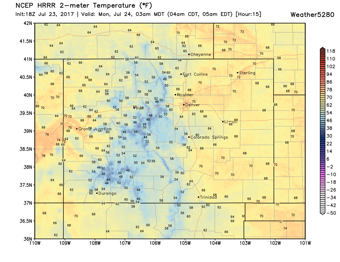
Similar to what we saw yesterday, storms will likely be confined to the higher terrain west of Denver and should fizzle out shortly after sunset with the loss of daytime heating and any lifting mechanism. Storm chances on the plains will likely be dependent on any outflow boundaries that can make it off the higher terrain. Otherwise, expect tonight to be mild and dry with temperatures hovering in the low to mid 60s.
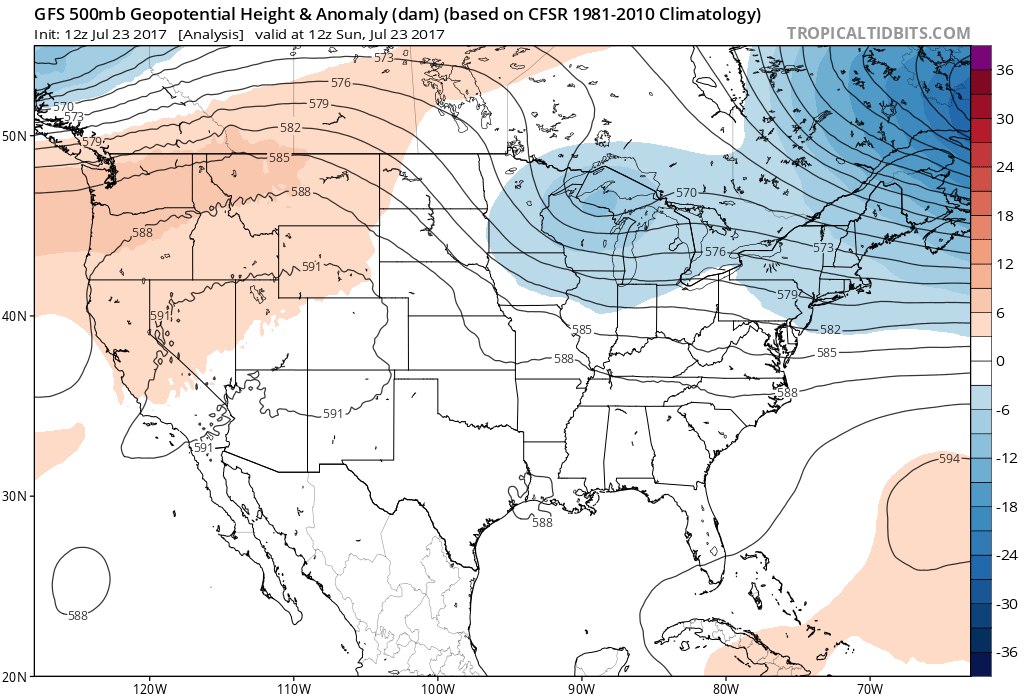
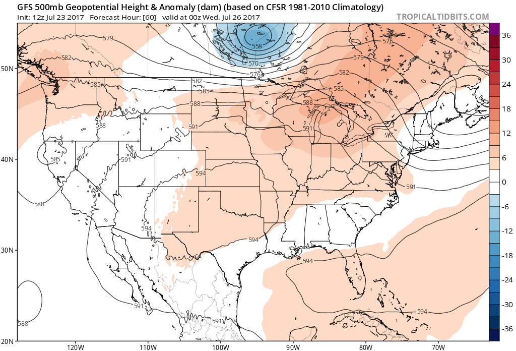
Taking a look at the analysis hour of the 12Z GFS, we can see the ridge centered over the Great Basin, with weak northwesterly flow aloft over northeastern Colorado.
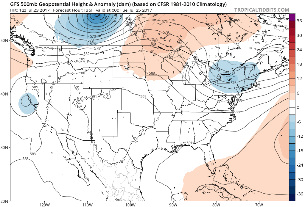
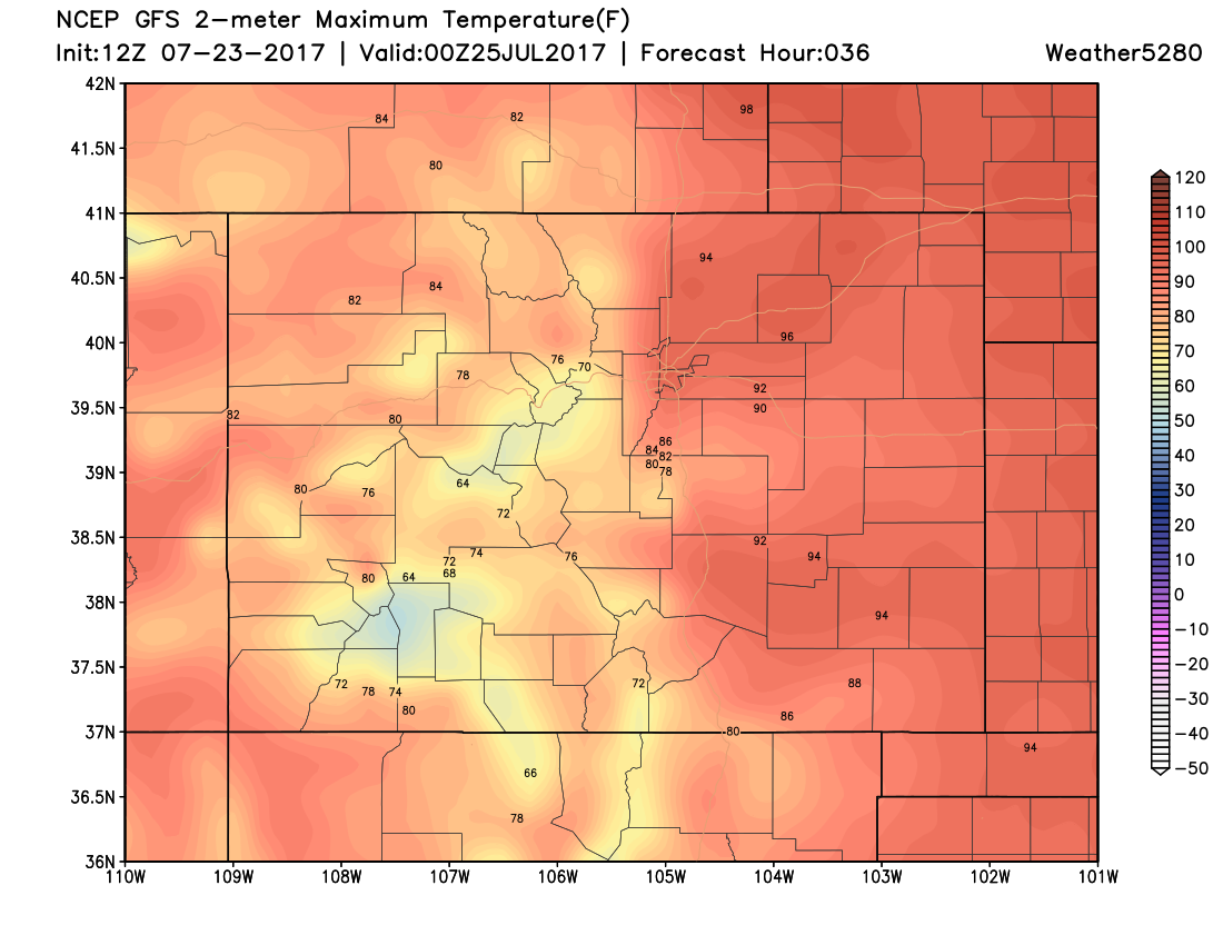
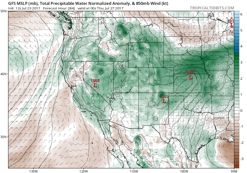
Heading into tomorrow, we see that the ridge shifts further east and becomes centered over New Mexico. This will allow for more subtropical moisture to push into Colorado from the southwest which should result in a slightly higher coverage of afternoon showers and thunderstorms over the higher terrain in comparison to what we saw this weekend. Monday will also be slightly warmer than today in Denver due to the position of the ridge. Expect high temperatures in the upper 80s to low 90s for Denver, depending on how much cloud cover we see in the afternoon.
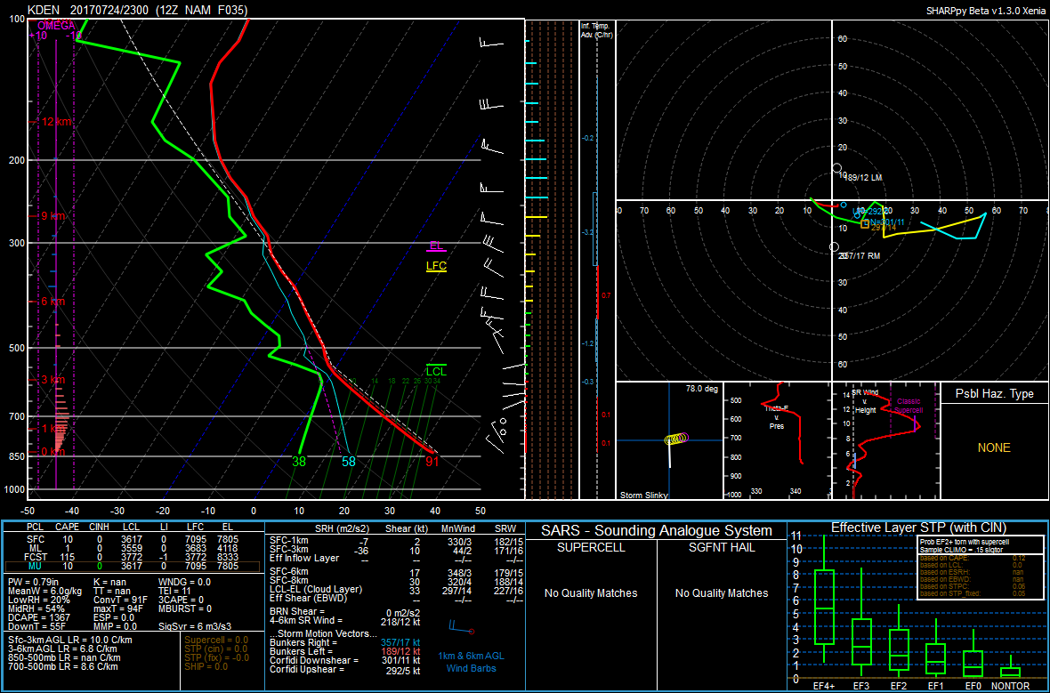
Any shower or thunderstorm that manages to develop on the plains tomorrow will likely produce more wind than rain as shown by the dry sub-cloud layer. This is what we refer to as an inverted-v profile, which indicates the potential for dry microbursts.
Tuesday will likely be the hottest day of the week in Denver due to height rises and the ridge continuing to shift east. We can also expect a greater chance of seeing showers and thunderstorms on the plains due to a weak shortwave to our north, slightly richer moisture at the surface, and precipitable water values hovering around an inch.
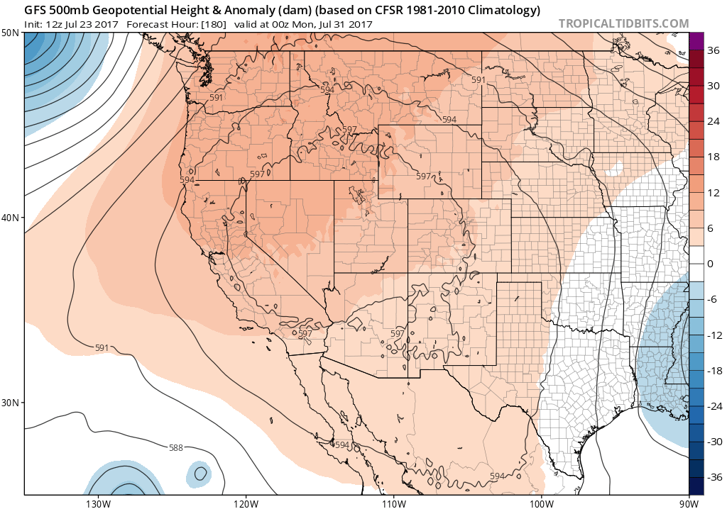
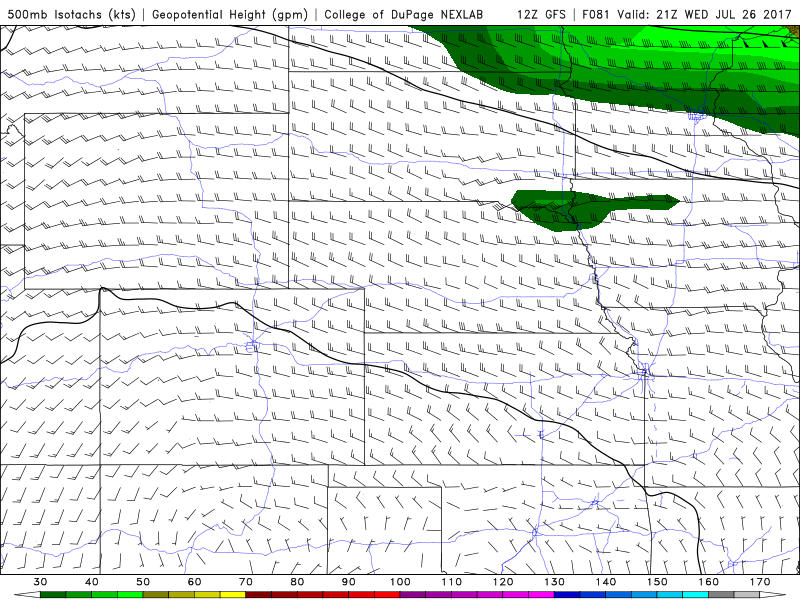
As we head into the second half of the week, the mid-level ridge will remain centered over the Four Corners region. Slightly stronger zonal flow (15-20 knots at 500mb) may help with bringing storms off the mountains and onto the plains. Depending on whether or not storms can sustain themselves on the plains, temperatures will likely be slightly cooler than average due to the increase in cloud cover and the threat of heavy rain with any thunderstorm as precipitable water values will remain around one inch.
The pattern will remain similar into the weekend as the ridge continues to build, bringing with it a slight increase in temperatures to Denver. Highs should top out near 90°F as we head towards the end of the week, with a slight chance of showers and thunderstorms each afternoon and evening. Although there is no widespread moisture for us in the near future, we will certainly appreciate any drop of rain that we can get.