The State of the Atmosphere: Monday, July 31, 2017

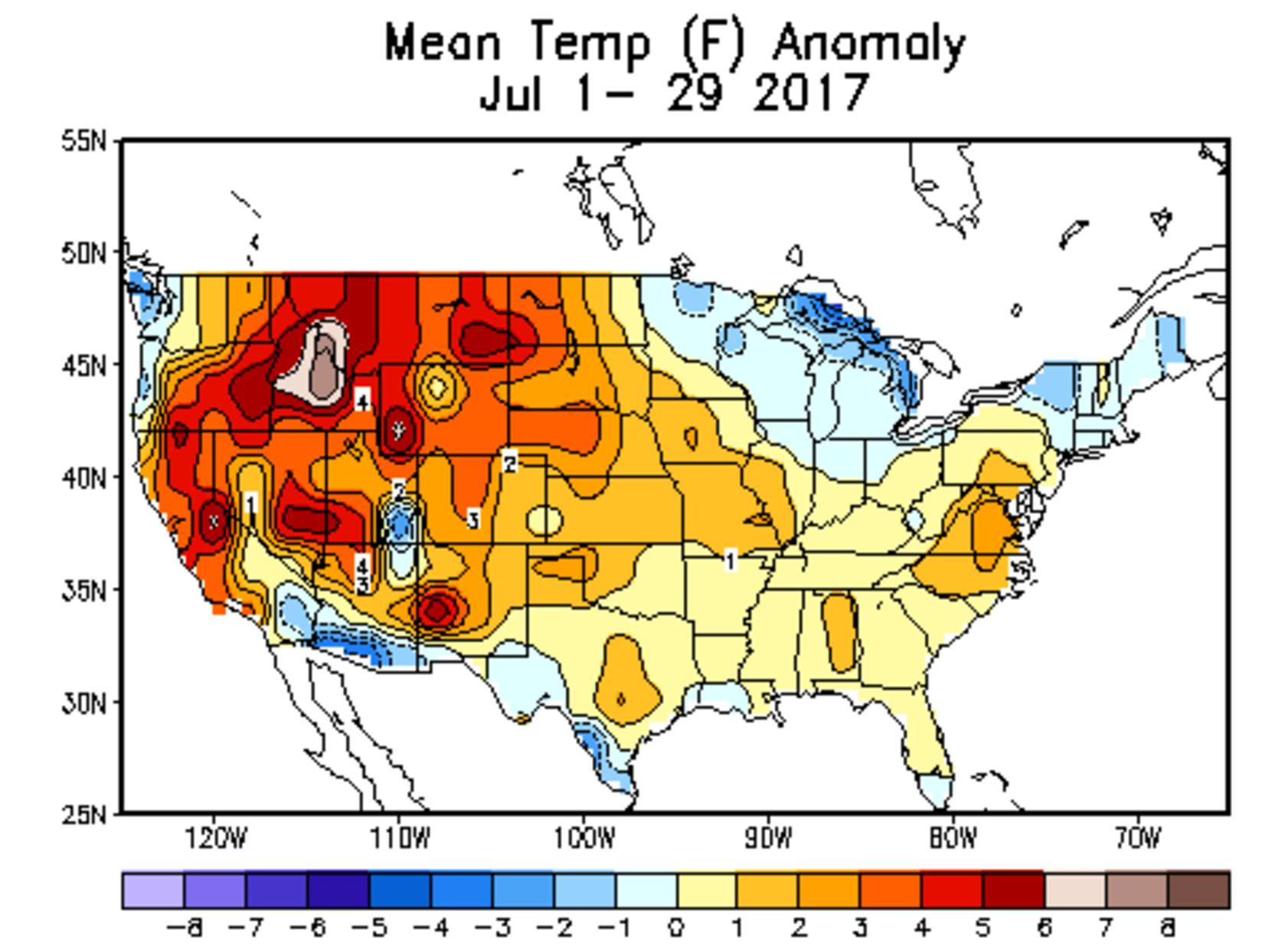
July 2017 was another warm one for Colorado, running from 1 - 3° above average for the month with just one afternoon to go. The warmest anomalies have been focused along the Front Range (Denver is running 2.4°F above average for the month despite the recent cooler weather), with the "coolest" anomalies across southeast Colorado. On the whole, it's been very warm regionally, with high pressure delivering very hot temperatures across the intermountain west this July:
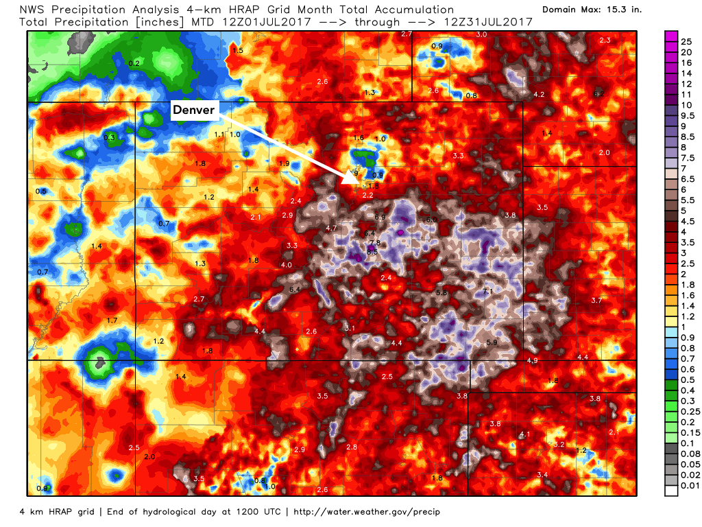
The state as a whole did see some appreciable precipitation this month, the exception being much of Denver and the northern suburbs. Take a look at totals month to date totals across the state – and note the rather remarkable dry spot over the metro area as compared to our neighbors:
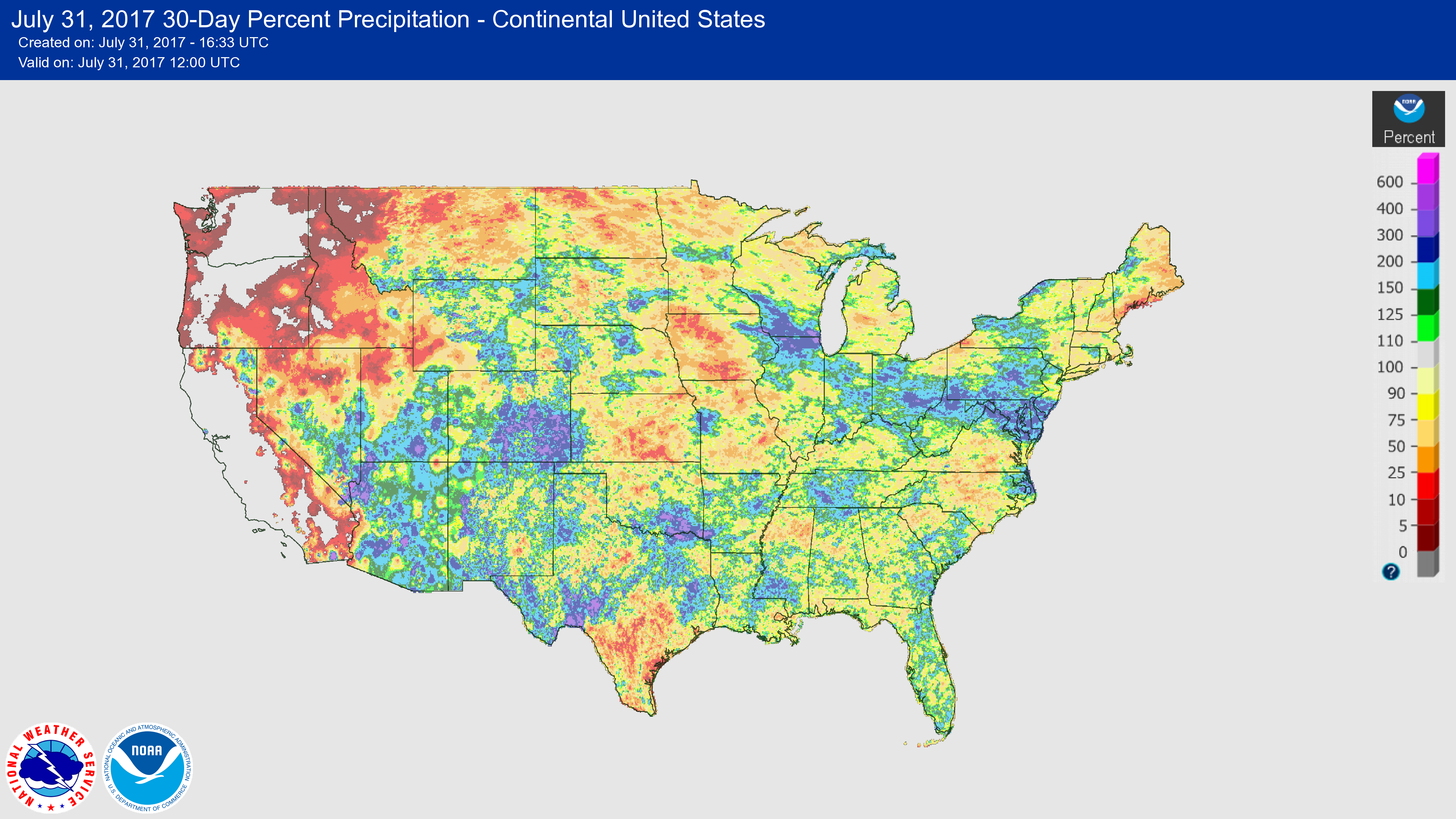
Monsoonal moisture, especially in the last two weeks, has really delivered for many others, however. Southeast Colorado saw ample rain, with totals in excess of 200% of average for many locales. A national look at precipitation as a percent of average for the last 30 days shows that tropical flow of moisture across the desert southwest and on into Colorado:
Officially, Denver has just seen 0.47" of precipitation at DIA, which is -1.31" below average for the month from start of record. At our station in central Denver, we've only done slightly better, with 0.91" recorded to date.
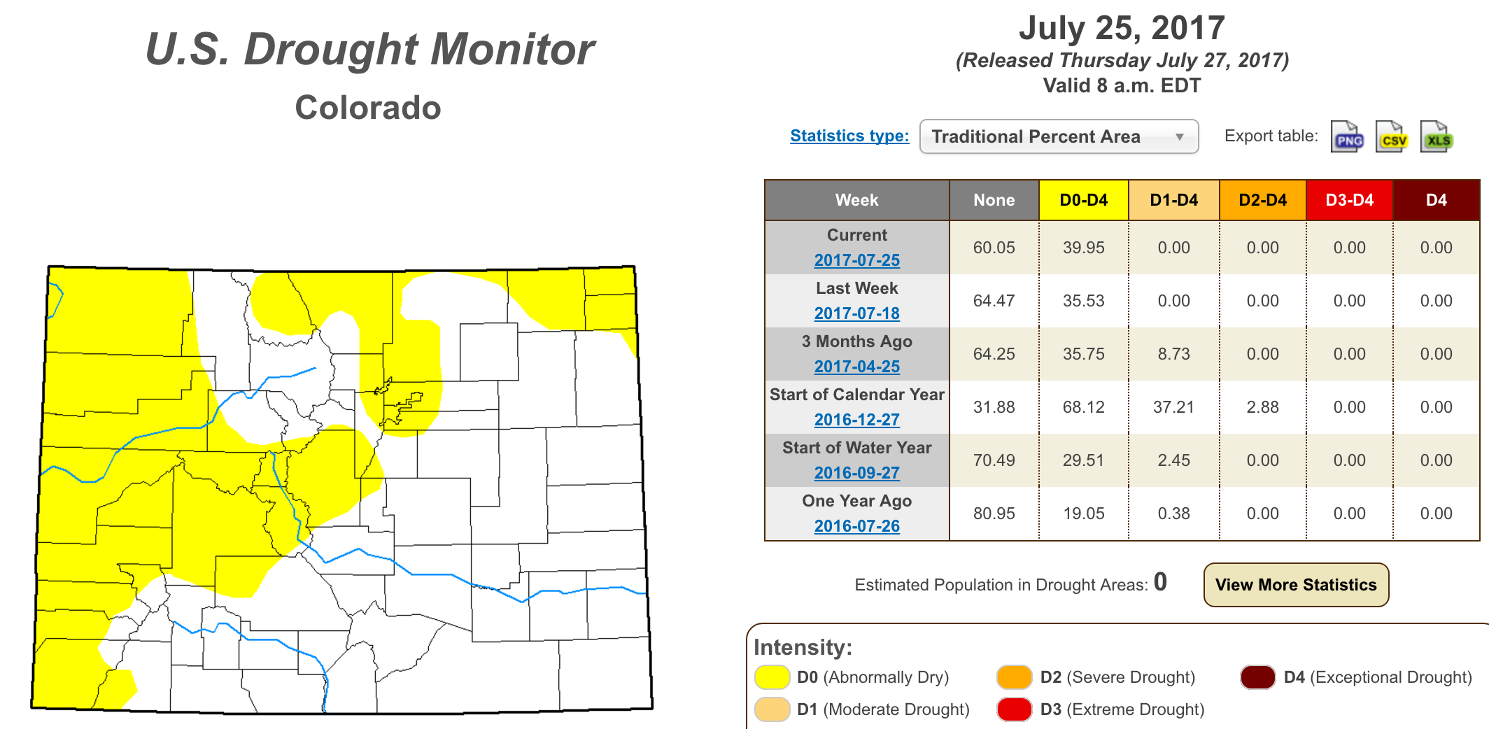
With all this said, the Drought Monitor from last week makes sense. We're still fighting abnormally dry conditions along the northern Front Range, but overall it's certainly a could be better, but could be much worse scenario statewide.
The week ahead
August begins tomorrow, and with that also does the slow transition toward cooler weather through the end of the year:
August also has the distinction of being the month where Denver's average high temperature begins to fall again after reaching a max of 90° to end July. On August second the average high drops from 90 to 89°, eventually falling to 84° by month-end. The average low dips from 60° on August 1st to 54° degrees by August 31st. The average high will continue to fall from now through December 26, where it eventually bottoms out at 42° F.
This year, the shift will try to be more dramatic (at least to start) with highs through the middle of next week looking to stay below average (even well below at times).
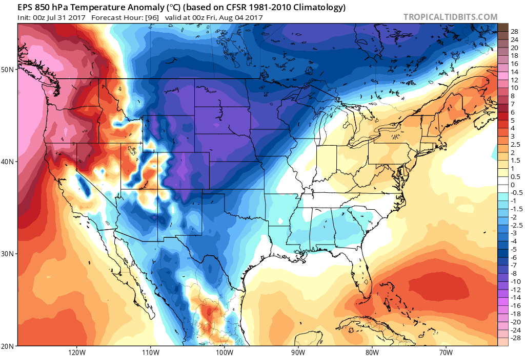
Highs this coming week will primarily be in the 80s for Denver, the exception being Thursday when very chilly air for this time of the year will pool in to much of the central U.S. Look for daytime highs to be in the upper 60s and low 70s across northeast Colorado on Thursday, with a pretty stunning anomaly map for this time of year:
Beyond Thursday temperature look to warm, but most ensemble forecasts keep us on the average to below average side of things through at least the start of next week, with highs in the 70s and 80s for northeast Colorado through the period.
As for precipitation... still some monsoonal moisture around that will keep at least a chance for daily storm activity in the forecast through the week. We may see a bit of an uptick in storm coverage Wednesday depending on the timing of the front set to cool us off for Thursday, but will need to keep an eye on things and see how it shakes out.
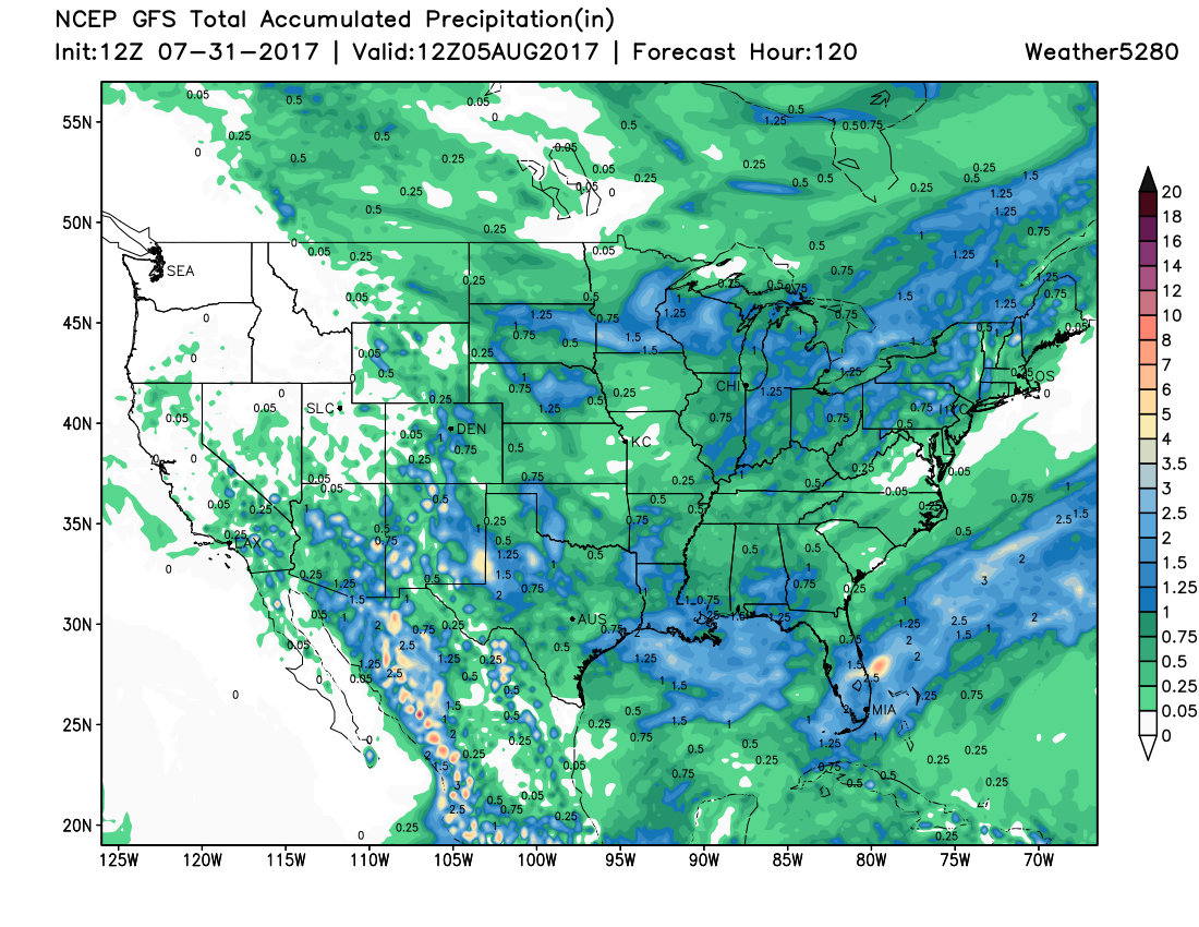
For now, plan on 10 - 20% storm chances today and Tuesday, with perhaps 30%+ for Wednesday, before dropping a bit again as we head into the weekend. By early next week we could see a resurgence of monsoonal moisture across the state, which would again enhance those storm chances across the region. For now, here is the operational GFS precipitation forecast through the end of the week, I'll take it: