Winter Storm Warning Posted for Denver as First Snow of the Season Is on the Way

The National Weather Service in Boulder has issued a Winter Storm Warning for much of the urban corridor, Front Range mountains, and the Palmer Divide. It goes into effect at midnight tonight, and runs through 3pm Monday.
Their forecast remains a bit more bullish for snow in Denver than ours, but the impacts remain the same: this will be the region's first winter storm of the season, so please make plans and prepare for winter driving conditions (especially Monday AM) if you need to be out during the duration of the storm.
While beautiful and sunny this morning, those changes will arrive quickly as we head through the day Sunday. A stiff northerly wind will drop temperatures in a hurry, and we'll be watching rain develop across northern Colorado as we head into Sunday evening; rain should quickly change to snow from north to south by midnight. Snow will become heavy at times during the overnight hours through Monday morning, before coming to an end during the middle of the day Monday.
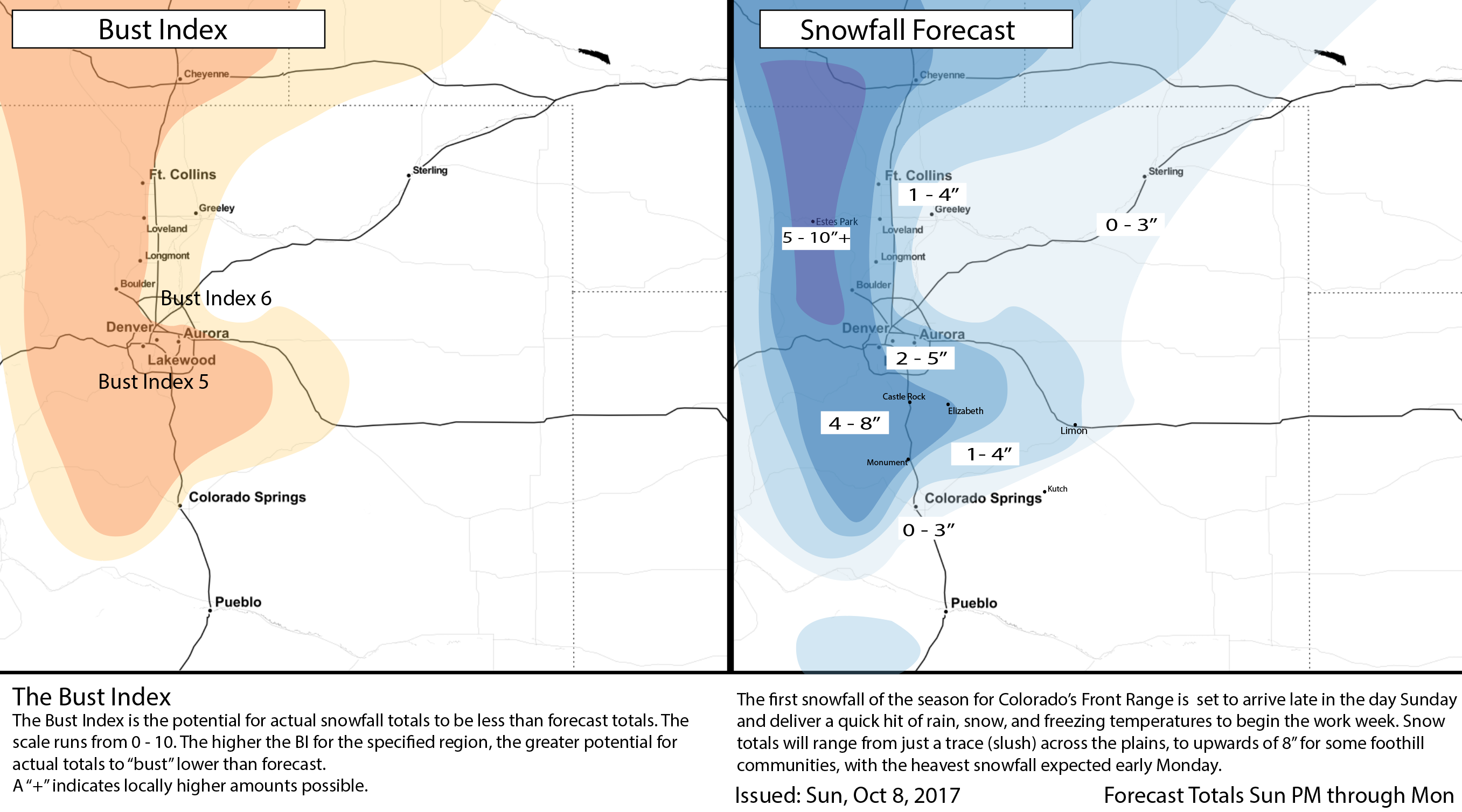
Snowfall forecast
Overall we're still very happy with our numbers we put out yesterday, with only a few minor adjustments today. While less bullish on totals for Denver proper as compared to some other outlets this morning (NWS is 4 - 7" vs our 2 -5") we do think outside of the urban heat islands higher-end totals will certainly be possible. Within the city proper we think melting will keep numbers down a bit. As we said yesterday, what falls vs what sticks may be different for many areas at lower elevations and within cities.
With that, we're anticipating 2 - 5" for most cities along the I-25 urban corridor (Fort Collins, Loveland, Denver) with higher totals possible for the western portions of these locales, and lower totals east. For communities tucked up closer to the foothills and across the Palmer Divide (i.e. Boulder, Golden, Monument) 4 - 8" should cover in most cases, with 5 - 10"+ for the northern Front Range mountains.
Here's our updated snowfall forecast map, with only minor tweaks from yesterday:
Again, if you're commuting Monday morning give yourself extra time as this will be the first time in some months we'll be dealing with winter driving conditions. While most of the snow will stick to elevated/cooler surfaces, it's likely we'll see some slushy and icy roads for the morning commute Monday as well – especially west of I-25 as elevation gets just a little higher. The storm will wind down on Monday afternoon with a clearing sky Monday night.
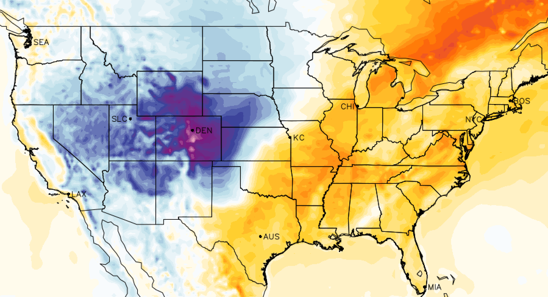
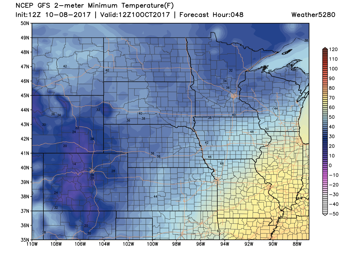
And finally, another reminder that not only will we be dealing with some snow, but the temperatures are also set to drop dramatically from the 80s we saw yesterday. The latest temperature forecast from the GFS for early Tuesday shows mid 20s along the urban corridor, with teens in the high country! (As such, note that the National Weather Service in Boulder has issued a Freeze Warning through Tuesday morning.)
The good news is, we warm up nicely after this storm, with 60s back in the forecast for Wednesday.