The State of the Atmosphere: Sunday, December 3, 2017

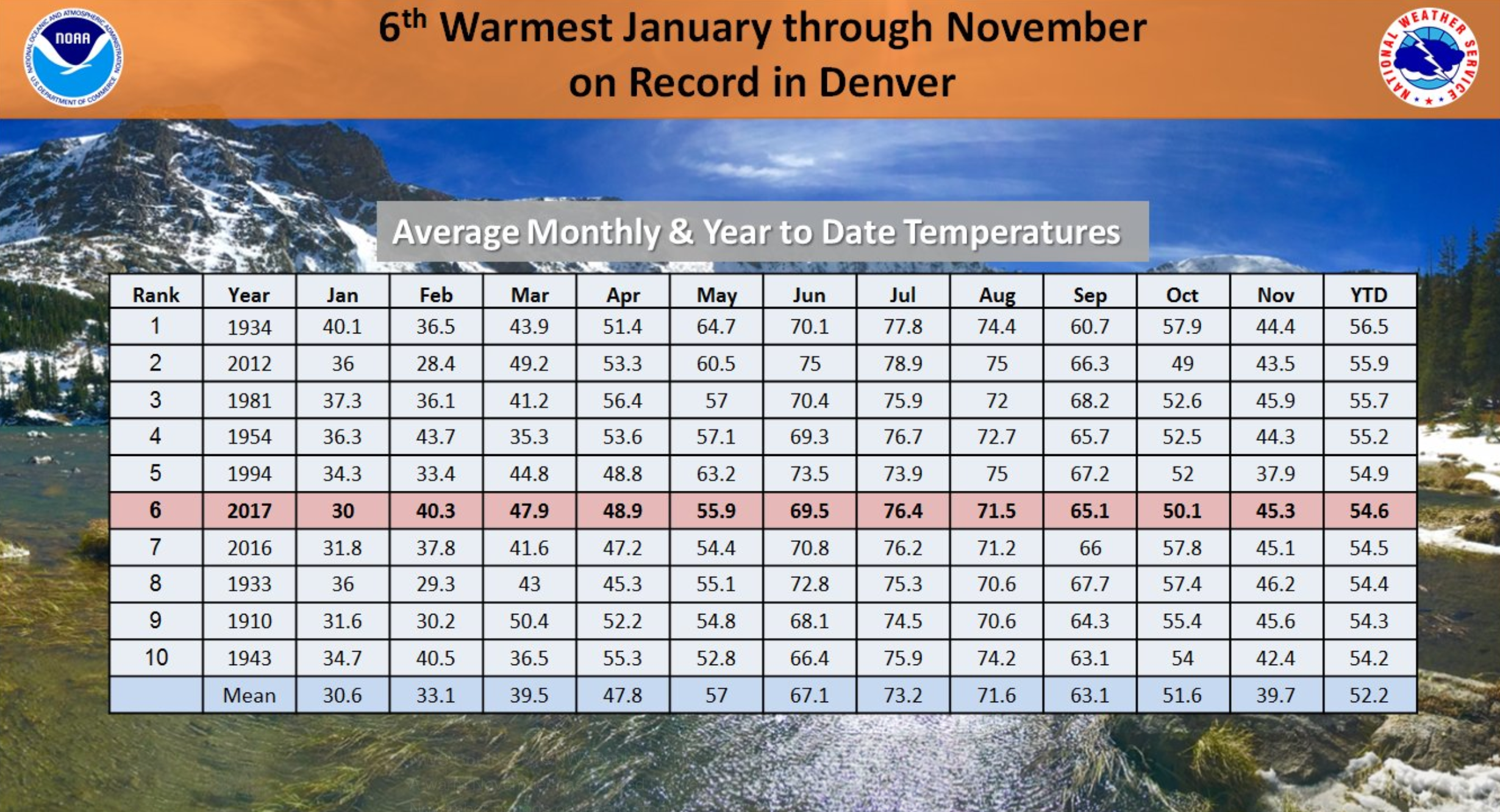
November 2017 ended well above average in the temperature department across Colorado, and bumped us in to sixth place for warmest January through November periods on record – just nudging out 2016 for that spot:
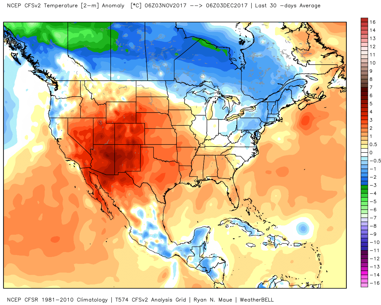
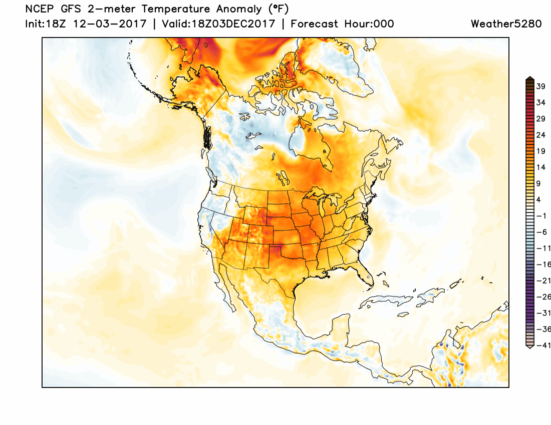
It was warm across most of the country, in fact, with just a few areas across the northern tier and New England experiencing temperatures below average:
Another week, another unimpressive cold front
As we head into the first full week of December we'll again see another cold front move through to knock back the record and near-record highs we saw across the region this weekend. But, just like we've seen for the last month or two, this front won't do much more than knock those temperatures back, with very little snow expected across the state once again.
MOS guidance shows highs dropping into the 40s through at least mid week, with overnight lows down to where they should be for this time of year in the upper teens and low 20s.
While certainly a big change from the weather we've experienced in recent days, hardly an extreme "event" for this time of year (puts us closer to normal for highs), and at this point appears to be a mostly dry one for the Front Range urban corridor as well. The primary impact we'll see aside from the cooler temperatures will be some gusty winds overnight tonight and Monday.
In the animation below you'll see all those warm reds over the central states being replaced with blues/whites, indicating the shift to more seasonal or even colder than average temperatures to begin this week:
So where's the snow?
Well, at the moment it's locked up to the north of Colorado, and moving forward it may be visiting the eastern U.S. as strong ridging builds into the west.
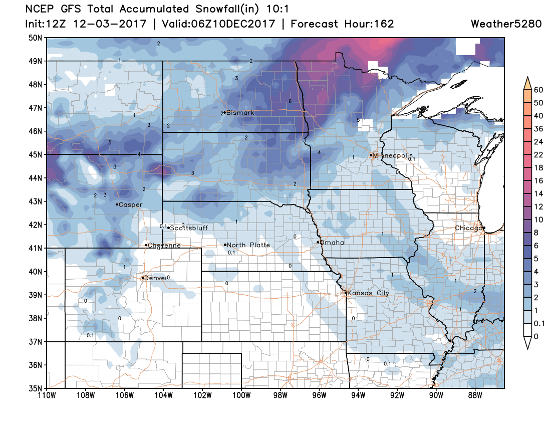
The 12z GFS shows this, with good snows across Wyoming and northern plains through the end of the week, but just light snowfall expected in our mountains with perhaps a drifting snow shower or two racing across the plains later this week. If you're looking for snow at lower elevations, the patter is just not favorable for that – and, if you're hoping for some sweet pow in the high country, this system swinging through tonight will leave a lot to be desired.
Cold in the east as the west warms up
As this next system swing through our region it'll kick of a pretty wintry period across the eastern United States as ridging dominates the western half of the country.
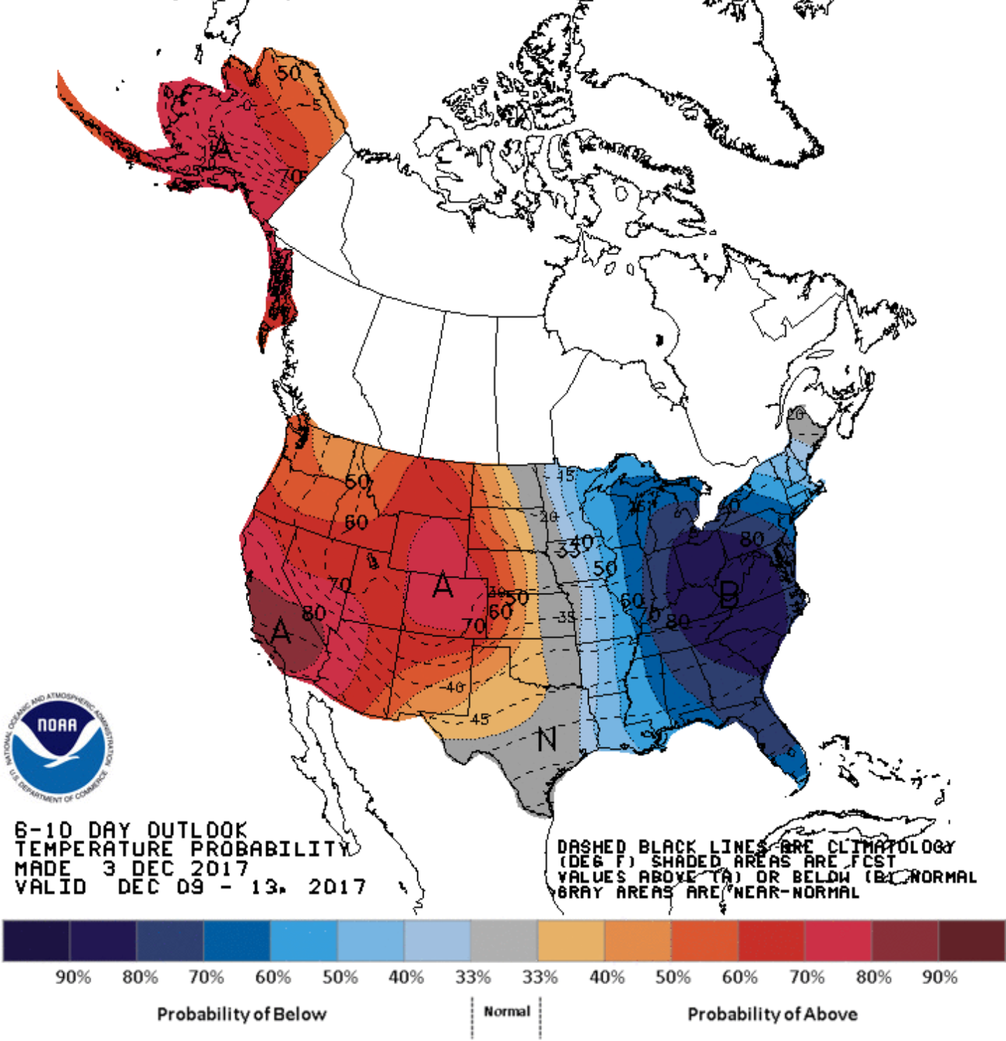
The pattern through the middle of the month will be one that perhaps will occasionally mean eastern Colorado gets clipped by some cold, but for the most part all indications are we'll remain warmer than average – and likely drier than average – for the next 10 days+.
In the east, they'll at least see some pretty good cold settle in, though details in who sees any wintry precip remains to be seen. Hard to argue with this 6 - 10 day outlook from NOAA today: