Another Round of Ill-Timed Snow Could Slow Friday PM Commute

Three themes for this winter:
- No snow, where's all the snow, why won't it snow?
- Another week, another freezing drizzle event ("It doesn't do that here!")
- Remarkable banded snowfall events: a pain to forecast, fun to experience, sad (for me) to miss out!
Today was very much number three on that list... with a rather remarkable, relentless snow band delivering some pretty hefty snowfall totals across portions of the metro area.
If you lived in Golden, Wheat Ridge, northwest Denver, or Arvada your afternoon probably went something like this:

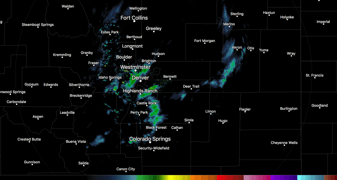
If you lived just about anywhere else, it was more like this:

Our station on the south side of downtown picked up quarter of an inch of snow or so during a brief burst of snow at the tail-end of band number one this afternoon. Meanwhile a few miles west and a few miles north... the afternoon rush turned into quite a mess as band of heavy snowfall parked over the area. From our friends at NWS Boulder and CDOT:
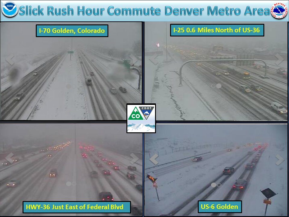
Here's a look at the first band that moved through Golden during the early afternoon hours. It dropped nearly 3" of snow in an hour in Golden... (wow!), but as you can see, was quite isolated in nature. In fact, as reports were coming in of near whiteout conditions under it, there was blue sky showing over downtown. The radar imagery from the time shows not much activity (a little south/east of the city) other than that band itself:
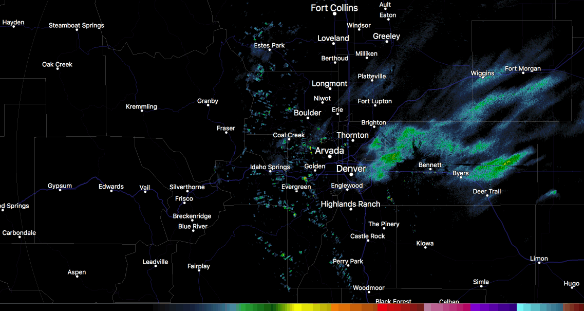
More snow filled in behind the initial push, again focused over the northern/western metro area, leading to some pretty impressive totals in spots. Look how quickly it dissipates this evening after dumping snow in Golden, Wheat Ridge, Arvada... then poof!
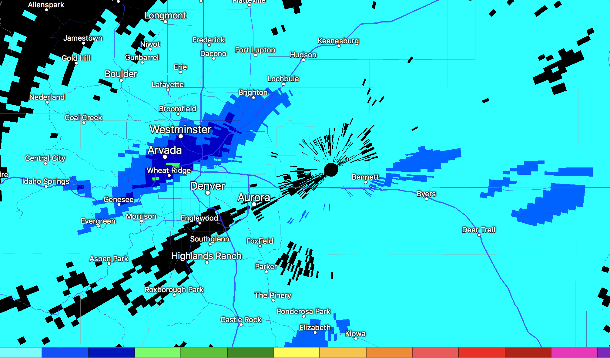
And lastly, to help illustrate this remarkable snow band, here's a look at how much moisture the radar thinks fell (not perfect) this afternoon. The lightest blue covers areas that likely saw a dusting to maybe 1/2" of snow, while the dark blues and greens from Genesee through Wheat Ridge, Arvada, and Westminster indicate estimates of 0.2 - 0.5" of liquid (indicating easily 5 - 6"+ in spots).
The long and the short of it is... fun to see (unless you're driving in it) but no fun at all to predict. We had spots of 1 - 3" in the forecast, but not the 3 - 7" that this band produced.
Friday outlook
There's the potential we do it all over again, with again the northern metro area seeing the greatest probability for banded snowfall.
Hard to say if we'll see anything like today, but high-res models are actually a bit more excited about tomorrow than they were today, so certainly wouldn't rule it out.
In Denver we'll be looking at about a 30% chance of snow (think summer time thunderstorms), while points north Arvada, Boulder, Loveland, Fort Collins will be more in the 40-50% range. Again, as Matt stressed yesterday and we saw today... will be a case of the haves and have-nots: not everyone sees snow on Friday.
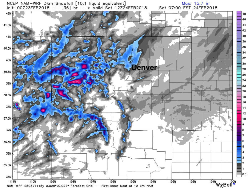
Here's one high-res model showing the potential for a few inches along the urban corridor Friday afternoon/evening. It tends to get a little excited from time to time, but shows the potential:
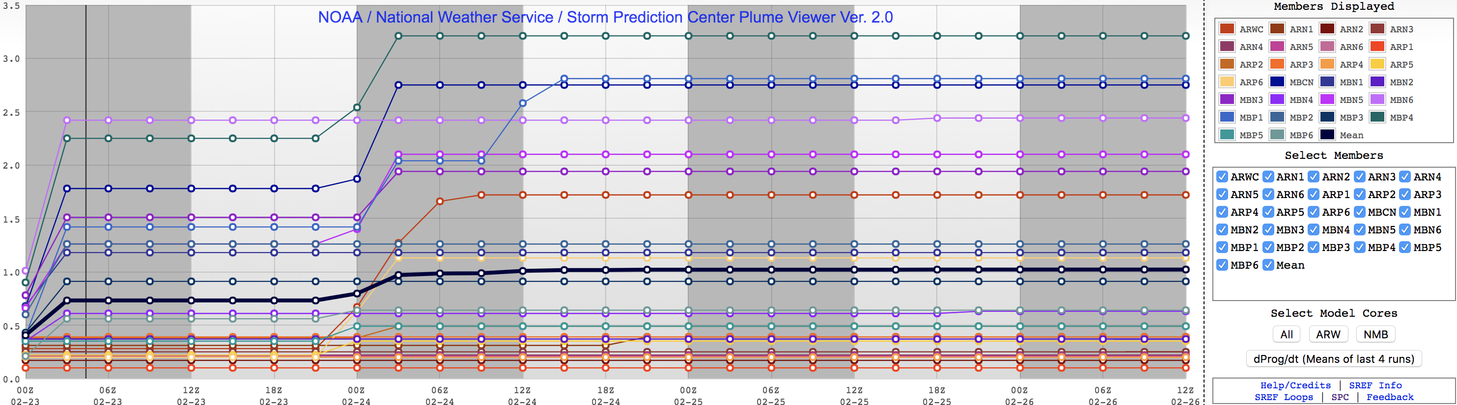
And here's the SREF for Broomfield, showing generally light totals... but a wide spread between members, indicating the band potential:
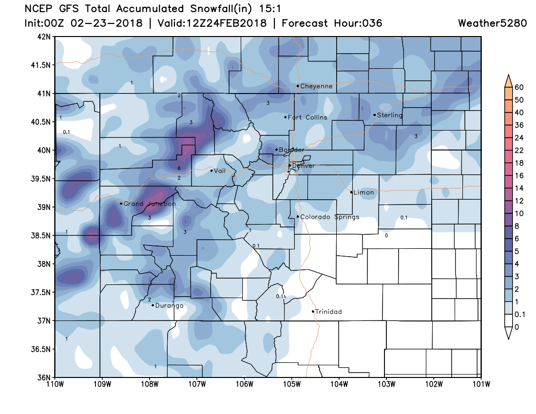
And finally, here's the latest GFS through early Saturday... showing the snowfall potential along the northern urban corridor, but also the snow potential across the far eastern plains that may last into Saturday:
Again, not sure we'll see as mighty of a band tomorrow as we did today, but the potential is there... and couple that with Friday traffic, and it could lead to a tough commute in spots.
Good news is the weekend for now looks sunnier than recent days, though still cool. Highs likely in the 30s and 40s across the metro area both days.