The State of the Atmosphere: Sunday, March 4, 2018

March has roared in like a ... lamb across Colorado, with not much weather to speak of aside from the warm temperatures and periodic wind events.
First, a quick look back at February, which, for a change of pace ended with below average temperatures across eastern Colorado:
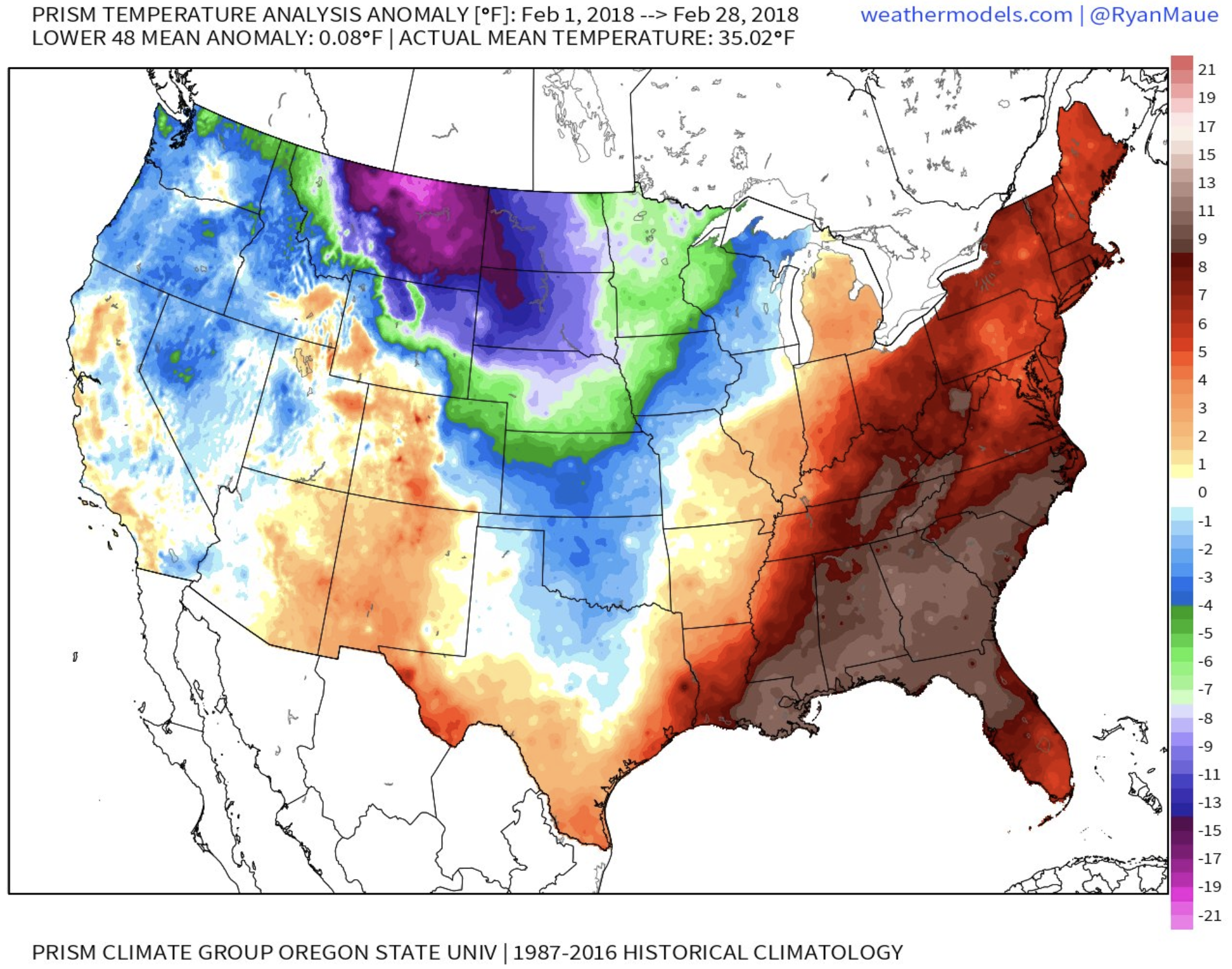
In Denver that equated to temperatures running 2.6°F below average for the month, with the northeast plains running some 5 - 8 degrees below average.
As for snowfall, Denver did pretty okay, especially when considering how the rest of this snowfall season has gone. Officially the city logged 6.2" (7.7" is average for February) of snow during the month, bringing the official season to date snowfall total to 19.4" – well below the 35.1" we see on average to end February.
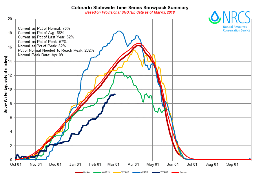
Similarly at a statewide level our snowpack numbers continue to lag, and quite dramatically in some cases. Currently statewide snowpack is at just 70% of average, with basins across southern Colorado reporting just 50 - 55% of average snowpack. While still another month or so before peak snowpack (on average) for the mountains, it'd take a heck of a March to make up deficits up there, which we aren't likely to do.
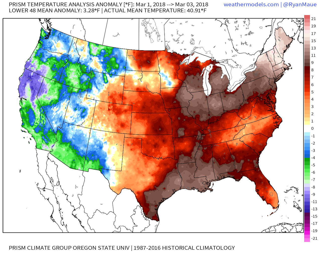
So, while February was cooler than average... the start of March has been quite warm, with temperatures well above average through the first three days of the month across Colorado:
While temperatures will be warm again today, we are looking at a cool down to accompany the wind to start the work week, but unfortunately that won't equate to much in the way of moisture east of the mountains.
The week ahead
The big story today through Monday night along the Front Range and urban corridor will be the wind and heightened fire danger. A Red Flag Warning goes into effect this evening, and a Fire Weather Watch will be in place for Monday with those gusty winds, low humidities, and otherwise favorable conditions for fire growth.
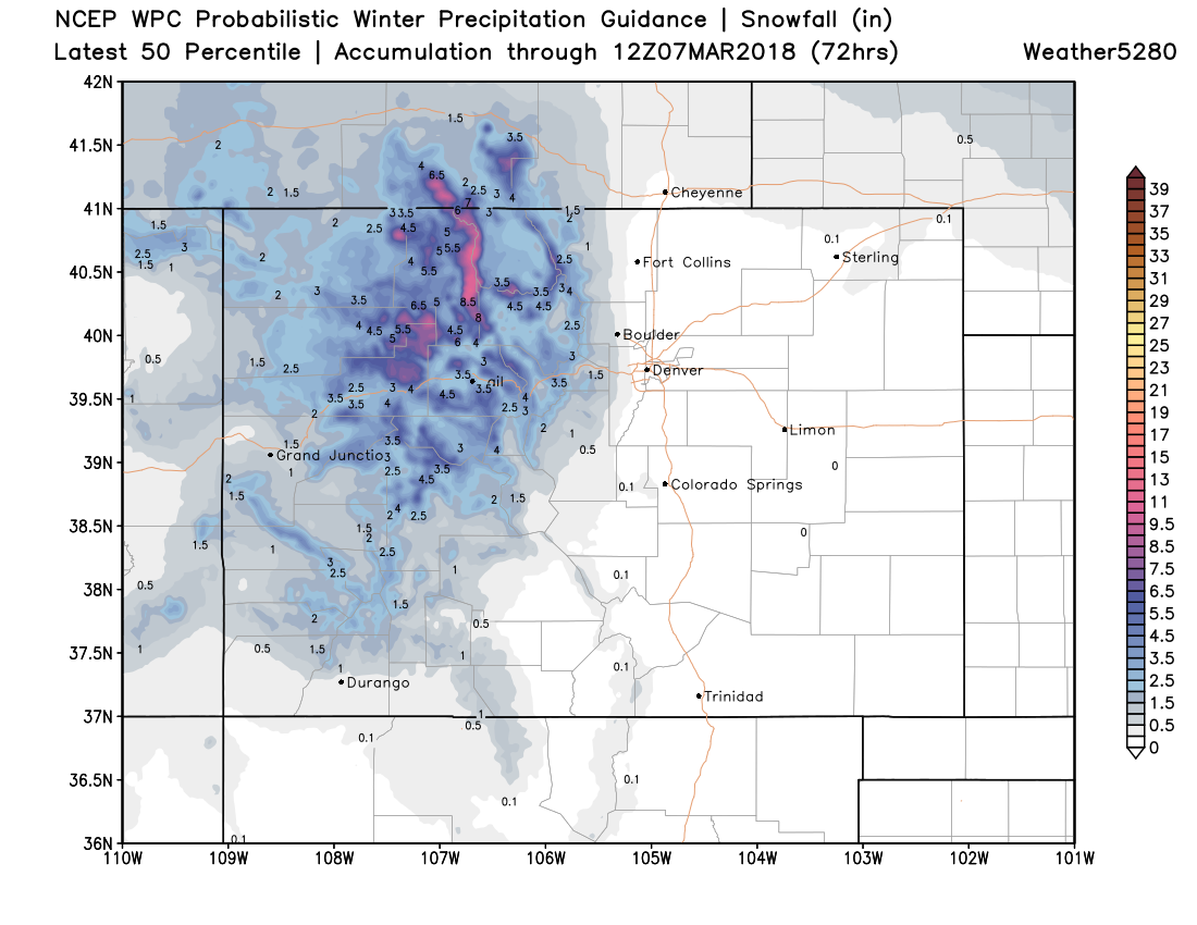
Temperatures will cool into the 40s Monday with that wind, but stay mostly dry east of the mountains. Up high we'll see a Winter Weather Advisory go into effect this afternoon for the northern and central mountains, with generally 3 - 7" of snow expected (locally higher amounts), and likely some tough travel conditions at times along the I-70 corridor as well. Expected snowfall through Tuesday will look like this across Colorado:
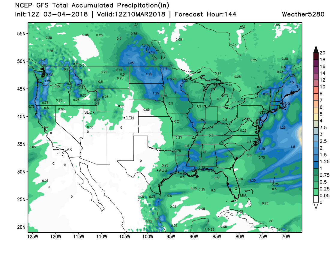
The theme for the remainder of the week across the urban corridor will be a warming trend. Windy conditions will stick with us through Tuesday, but should gradually lessen. Highs will climb back into the 50s for Wednesday and 60s for Thursday. At this time no moisture is in the forecast for the eastern plains through the work week, with the latest GFS showing dry conditions through Friday:
By next weekend we see models diverge a bit in how they handle the next weather-maker set to fly through the intermountain west. We see the EURO trying to bring a bit more of the energy through our area as compared to the GFS... but, not all that convincingly so. While this is likely our next "best" chance for snow along the urban corridor, at this time it doesn't look all that great of a chance at all. Something to watch, but the overall pattern favors a pretty quiet one snow-wise into next week.