Wednesday PM Update: Chance of Storms, Snow Showers to End Week

As we covered with our Insiders yesterday a system racing for Colorado right now will bring the chance for convective rain and snow showers northern Colorado Thursday PM and into Friday. The impacts will vary greatly: from no rain or snow, to just rain, to likely pockets of snowfall by Thursday night or early Friday.
The setup doesn't look all that different from what we discussed last night, though overall trend has been to keep this system further north – and likely less impactful for the Denver area. A trough is set to swing through Thursday afternoon and overnight, intensifying as it ejects east/northeast of Colorado early Friday. You can see in the map below the GFS forecast for Thursday night, with a negatively tilted trough digging into western Kansas and Nebraska:
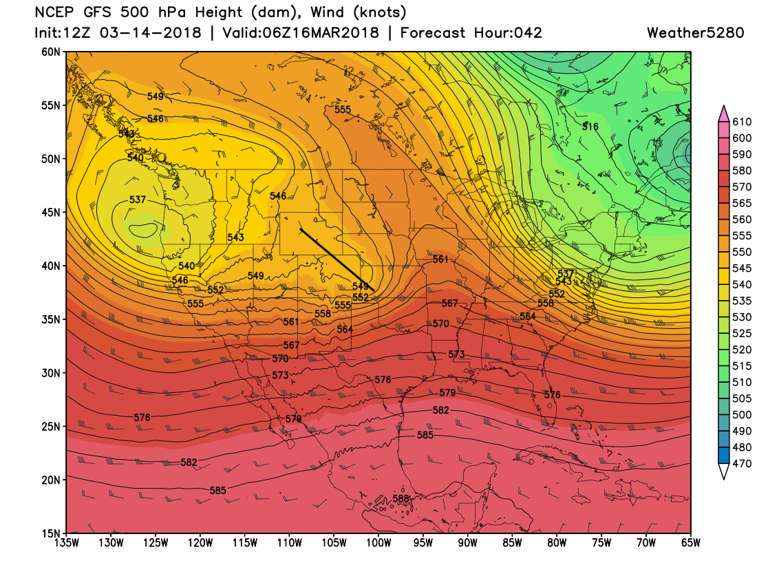
It'll be packing some energy with it, which this time of year can lead to some very dynamic weather across eastern Colorado:
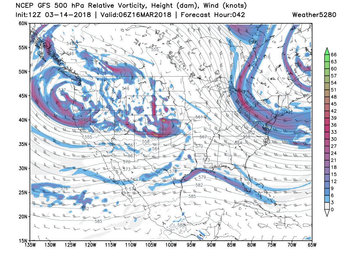
Expect to see storms develop through the afternoon across northeast Colorado, producing what will likely be some of the first thunder of the season for some areas .
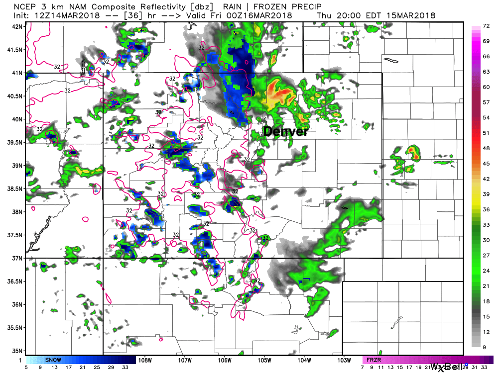
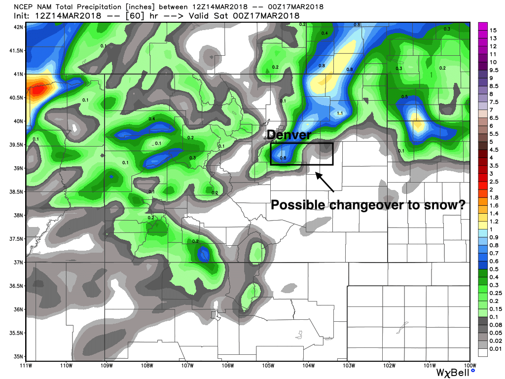
The best chance for this storm activity appears at this point to be north of Denver – though I certainly wouldn't rule out any activity in the city proper. The latest 3km NAM shows storms (some heavy) moving through the northern metro during the afternoon and evening hours Thursday. Note it is all rain with these initial showers/storms at lower elevations, with the blues confined to higher elevations west of I-25:
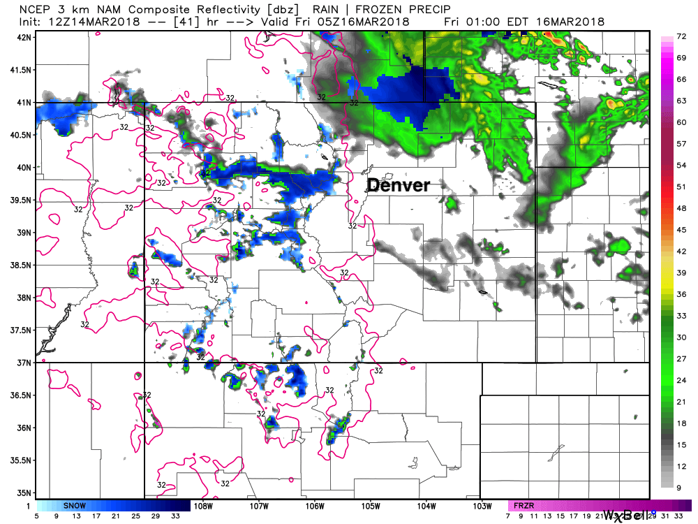
By Thursday night we see some snow mixing in down low... but this particular model has pulled most of that moisture well north of the greater Denver area by that time:
Other models differ slightly in the eventual track of that low... a few miles further south and we're likely to see more activity focused across the Palmer Divide as well. The 12km NAM, for example, pulls the best activity east of I-25, and with dynamic cooling shows the potential for snow across portions of the Palmer Divide Thursday night:
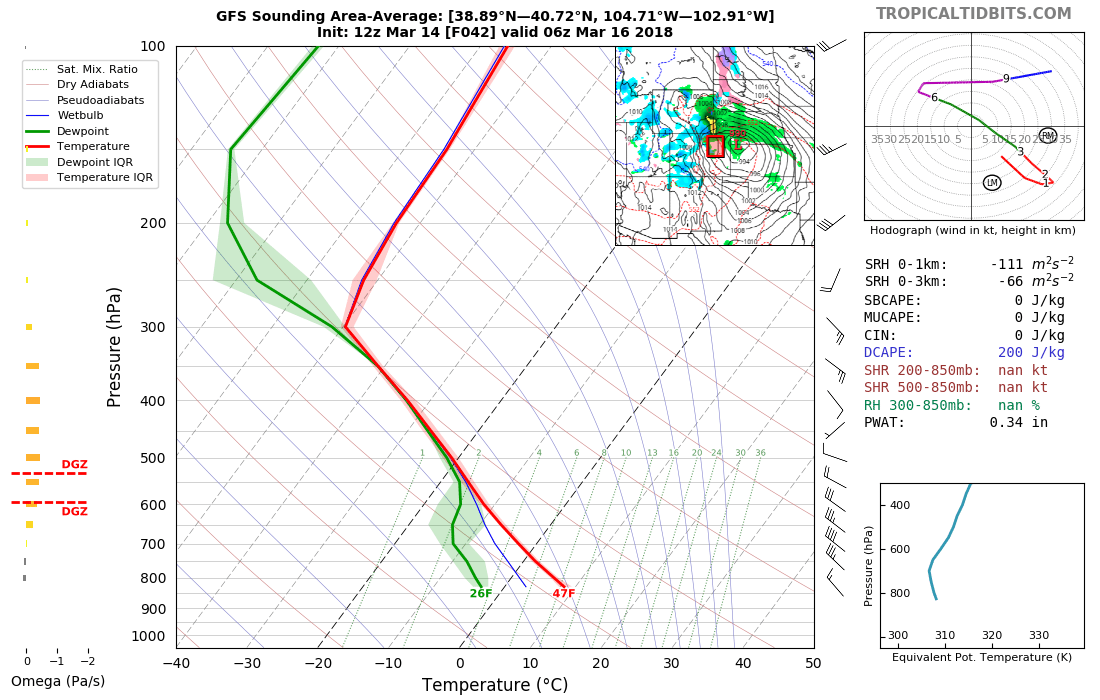
As for snow in and along the northern I-25 urban corridor? It doesn't look all that likely at this time as temperatures look too warm. Might we see some snow mixing in early Friday to any shower activity that remains? Absolutely. Will it amount to much? Not likely. MOS guidance shows surface temperatures bottoming out in the mid 30s Thursday night, with a column (below) not all that conducive for snow. We should rebound into the 50s by Friday afternoon, so not a cold system by any means.
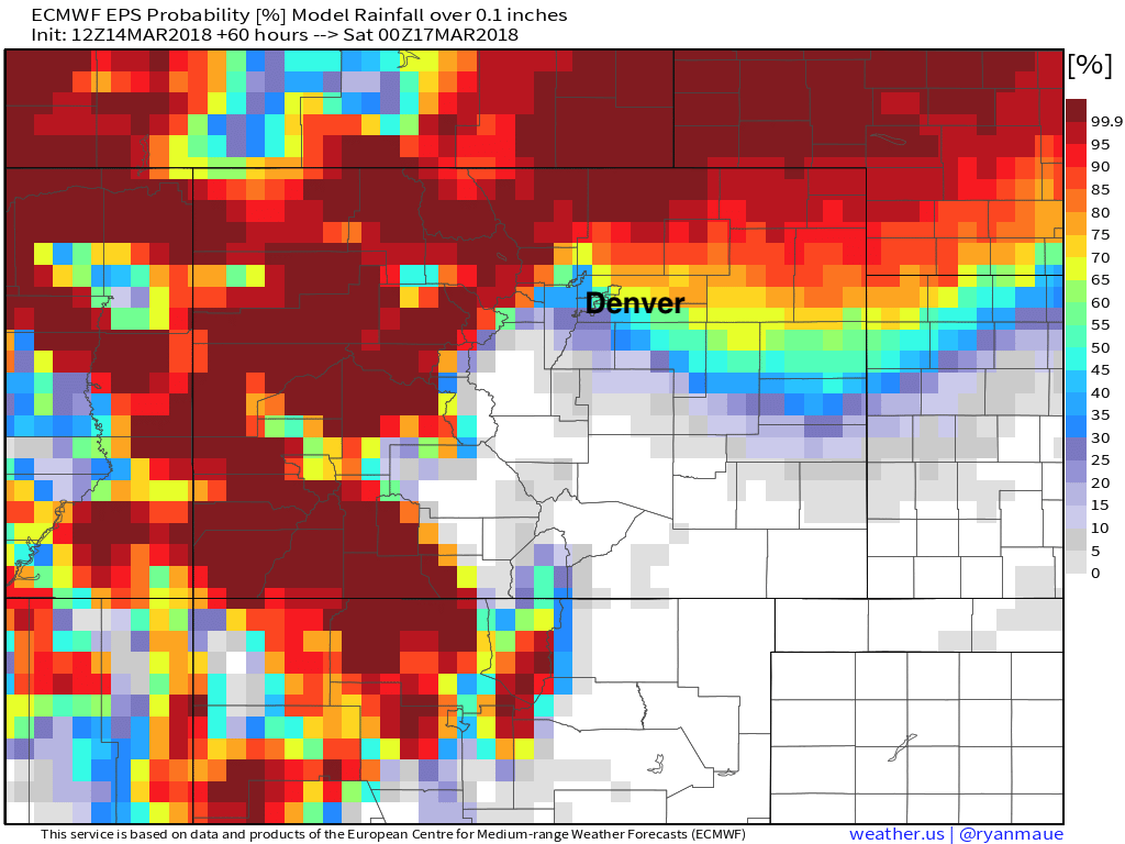
And finally, if we look at the latest EURO ensemble probabilities... we see pretty good odds that northern Colorado sees some moisture Thursday/Friday (probability of >0.1" of liquid):
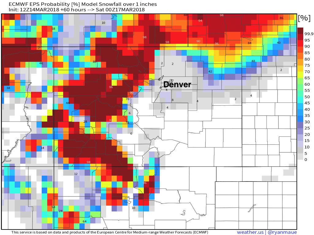
But pretty low probabilities at seeing accumulating snow (probability of >1" of snow):
In short... fun little system getting set to move through, but certainly no epic March snow on the way for most of us. The mountains will see some snow (thank goodness!) and we'll need to watch a few locations across eastern Colorado as well (Palmer Divide, far northern plains) where enough cooling could lead to a period of snow Thursday night. Otherwise, look for that chance of showers and storms to move in Thursday, and cool us a bit for Friday. Again, not everyone will see the rain... but don't be caught off guard if you do!