Modeling Shows a Chilly Rockies' Home Opener, and Possibly Wet

Matt Makens is a member of Colorado's Own Channel 2's Pinpoint Weather Team
There is a storm system that will have an impact on the Rockies' home opener on Friday.
This is a cold front that will be diving in from Wyoming and Nebraska during the day Friday. Right now, it is a very close call on temperatures across the city during the game Friday afternoon.
Let's look at the data.
First, here's a look at noon Friday, showing temperatures in the 50s across the city:
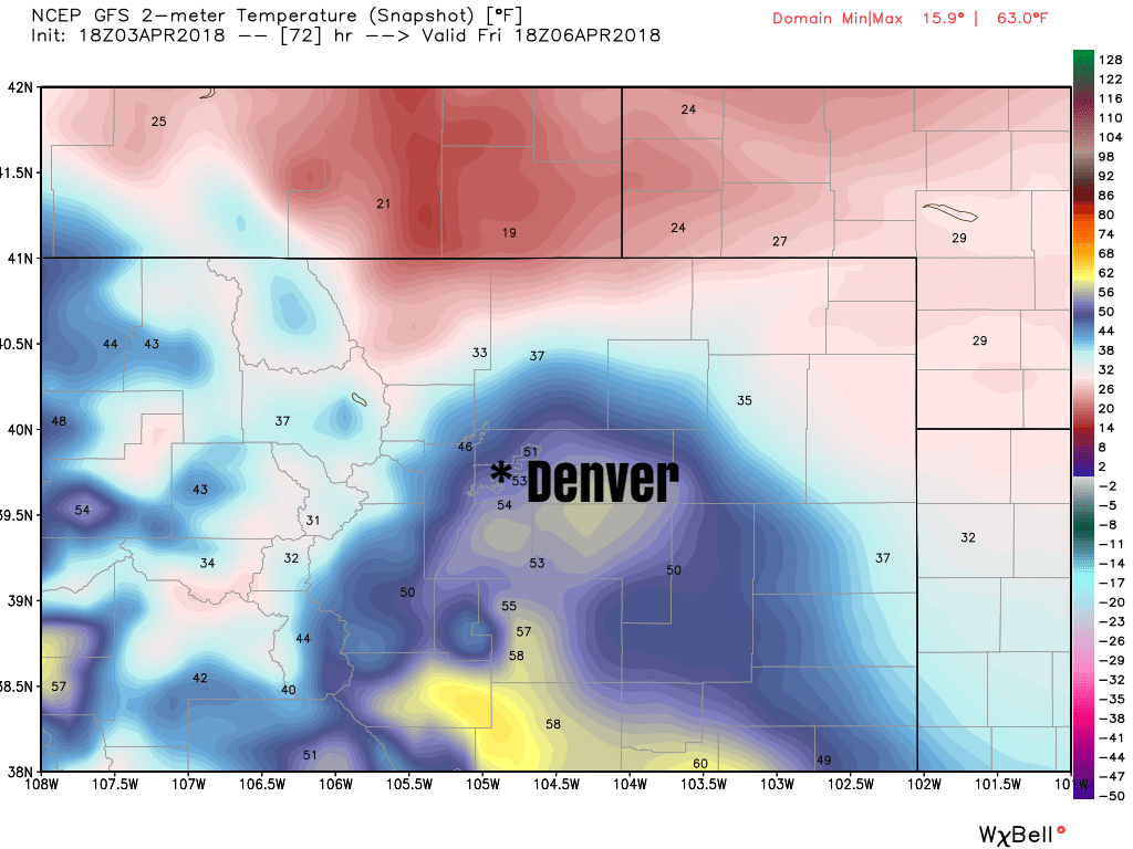
Ah, but look to the north near the Wyoming and Nebraska borders and you see the cold air in the teens and 20s. This is a cold front that will be moving into the metro area, and over Coors Field, during the game.
Look at 6 pm, when temperatures are now in the 20s across the greater metro area:
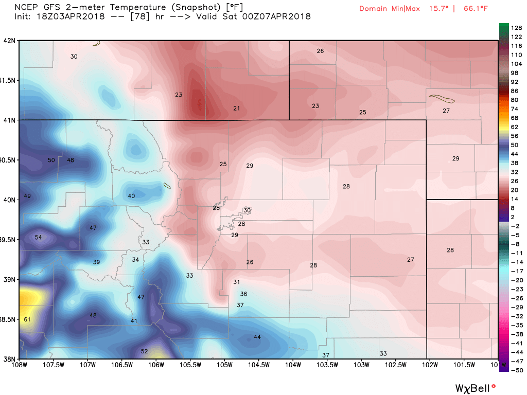
Summarily, that's a drop of some 20 degrees during the afternoon and therefore during the game.
Obviously, you'll need some warmer gear for Friday's game with temperatures falling quickly into the 30s and upper 20s by dinner time.
Rain and Snow
You'll want to have wet weather gear packed just in case of rain and snow.
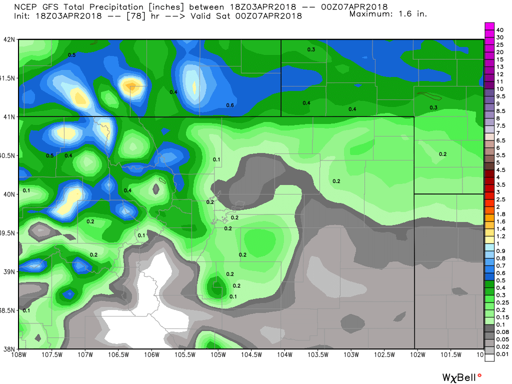
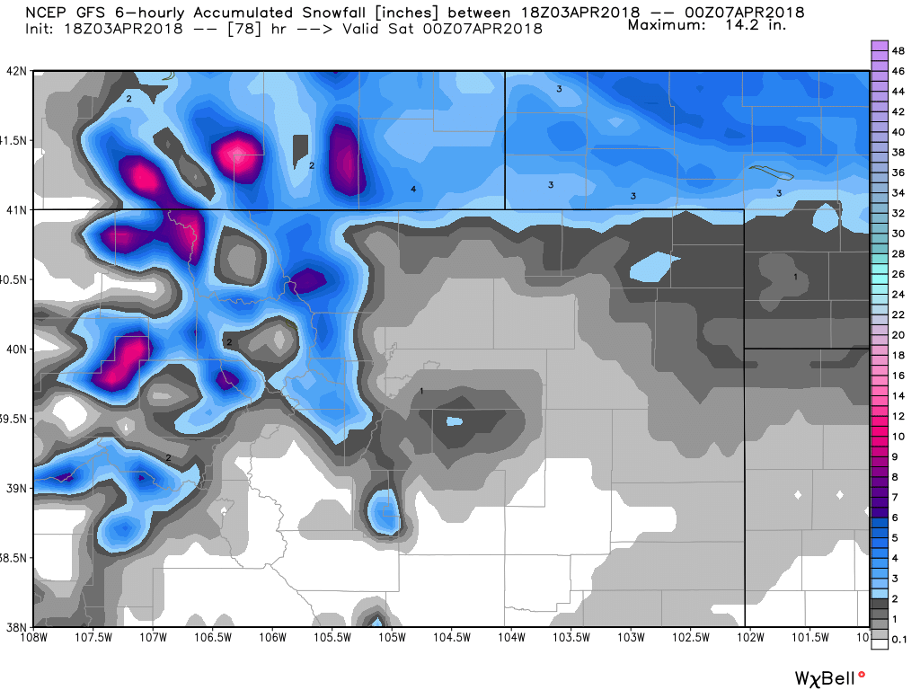
The top image here is total precipitation showing 0 to 0.2" of water. Some of that may be in the form of snowfall, which would result in the totals you see in the second image, not much at all.
What Could Change
Right now, there is a 60 percent chance of rain and snow Friday.
That 60 percent implies some uncertainty and that the weather maker coming in may stay just outside of the metro area, and if it does we will be drier and warmer than this forecast.
For now, plan your go-bag with Rockies warmer gear and a rain shell and we can improve that outlook if we can as the system gets closer.
For the weekend, I see another system moving across the area and, to me, I see cool and possibly wet weather as being a part of the entire series, particularly Saturday's game.
Here's a look at three models across the top, the American (GFS), the European, and the Canadian models. Across the bottom is their ensemble forecast(a family of variations). In all cases, there is very little middle atmosphere energy coming through Friday with the cold front. The laminar flow (parallel lines you see) doesn't hold much energy.
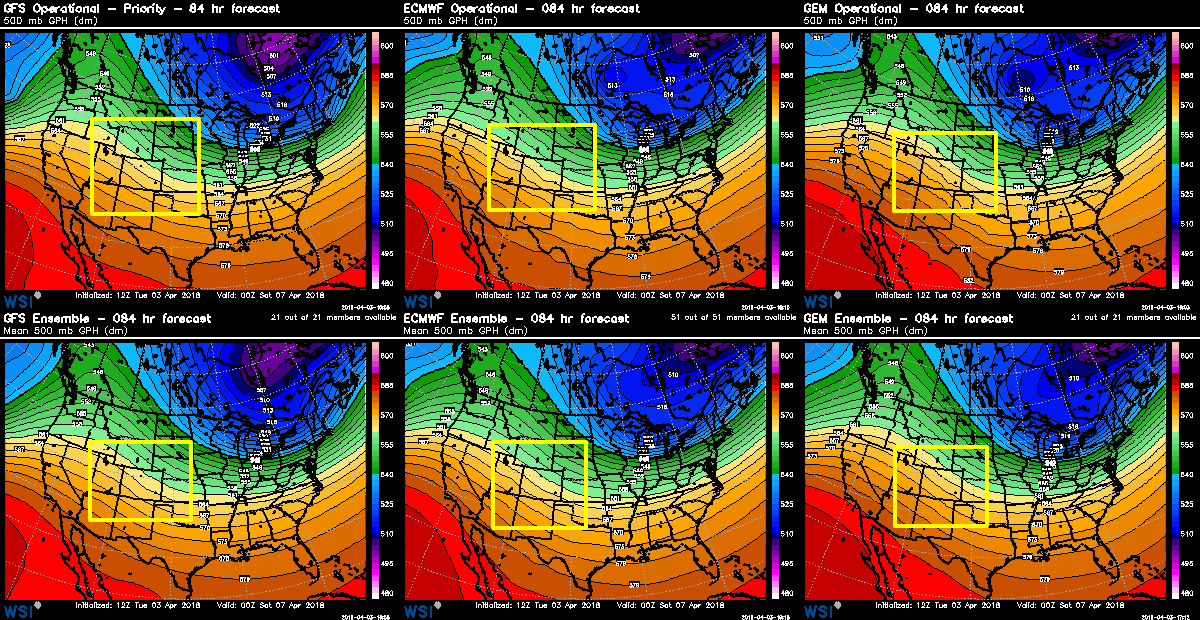
That implies a chance that the system could come through drier, and possibly the cold air can't move as far into the area as it is currently projected to.
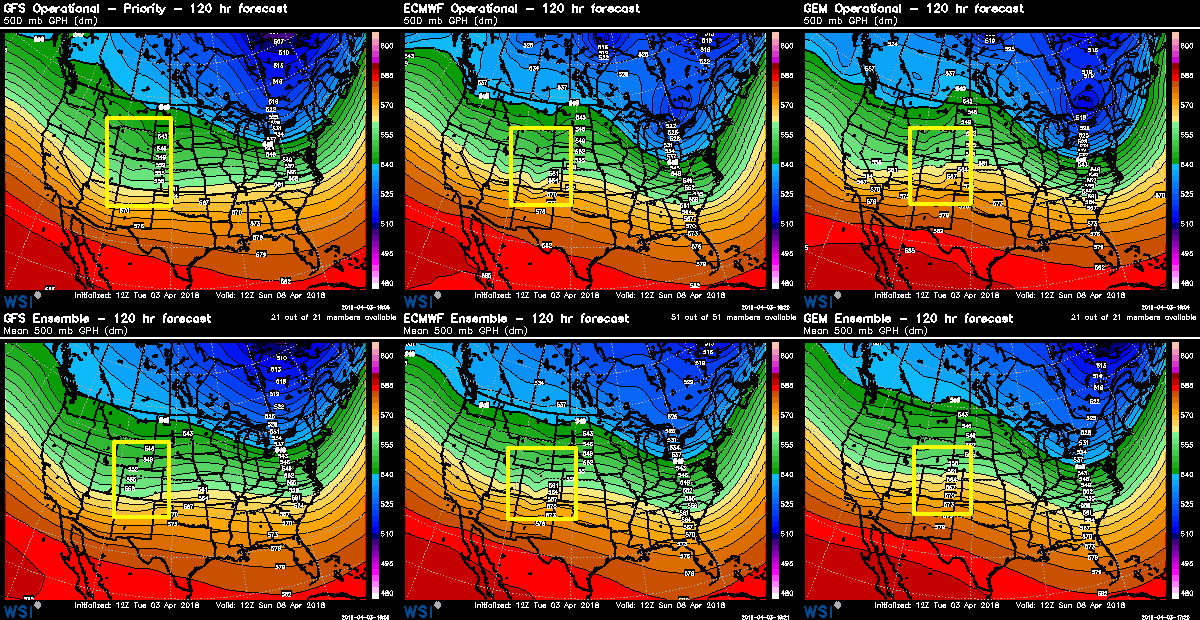
However, Sunday morning there is a short-wave trough (the ripple over Colorado and the region shown here in all windows) that implies to me a continued chance of wet and cool weather this weekend for the entire home opening weekend.
Bottom line, this year's home opening game and weekend will be unsettled.
If anything, I do anticipate the models' temperature and rain/snow forecast changing as we get closer to the game. Meteorologically I could see the coldest air missing us east. My gut suggests the cold air may arrive earlier than forecast and make the entire day Friday a 'wash'. My gut is thinking back to previous cold fronts this season.
Lots to watch in the modeling. I want you to be prepared for a cold home opening series and let's be pleasantly surprised should it be warmer and drier; even if that is a bit of a stretch.