Friday Fridge-cast

Matt Makens is a member of Colorado's Own Channel 2's Pinpoint Weather Team
I should have listened to my gut in Tuesday's post. Data at that time was showing the colder air to arrive later Friday versus the morning as 'my gut' assessed at the bottom of that post. Friday's cold weather will arrive throughout the morning, and there's a chance of rain/snow (mostly snow) coming also.
Temperatures
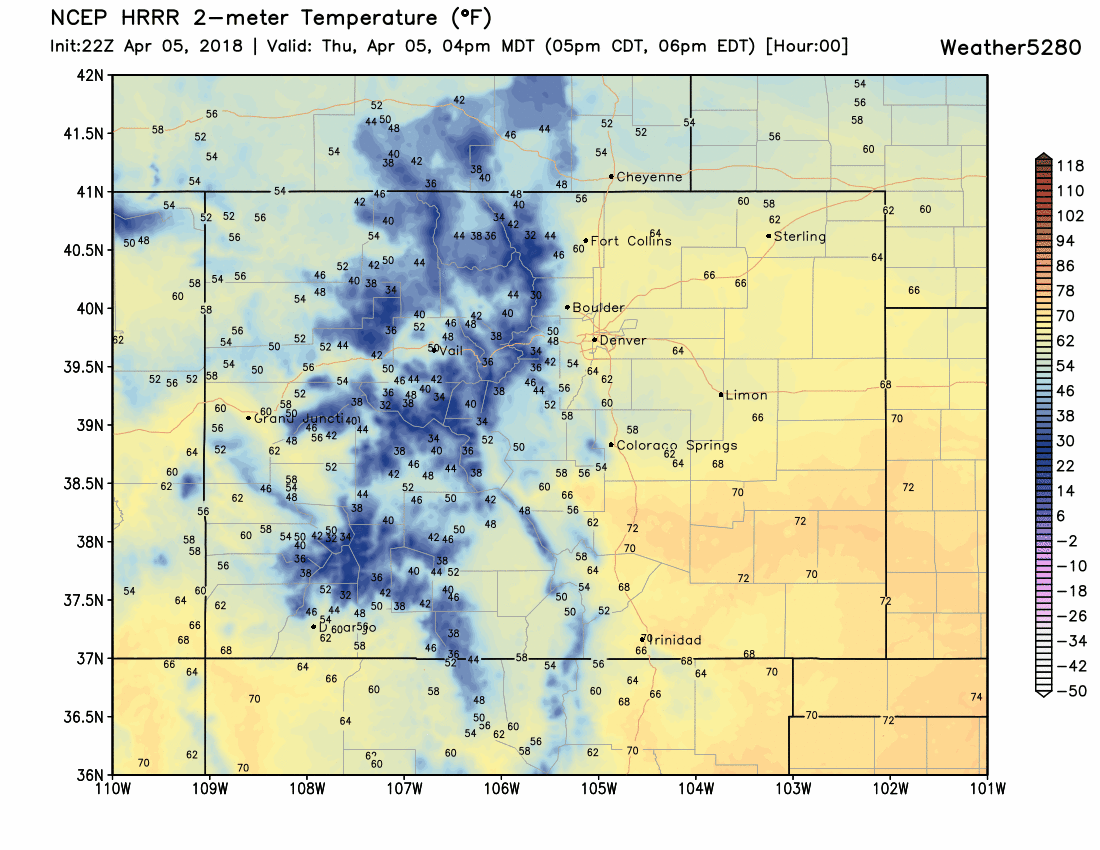
Watch as the cold air spills in by mid-morning for most areas in the greater metro area. Cold arrives first for Fort Collins and Greeley and then Denver and then Castle Rock.
It may be easier to decipher Denver's temperatures here, which basically show a drop from 7 am throughout the rest of the day:
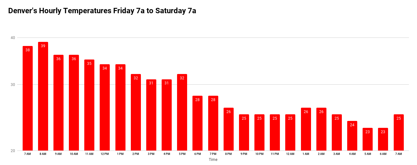
Considering there will be strong wind gusts of 30 to 40 mph with the arrival of the cold air there will be a much colder wind chill temperature for the afternoon; you'll feel 20s.
Rain/Snow
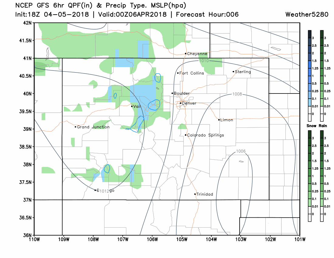
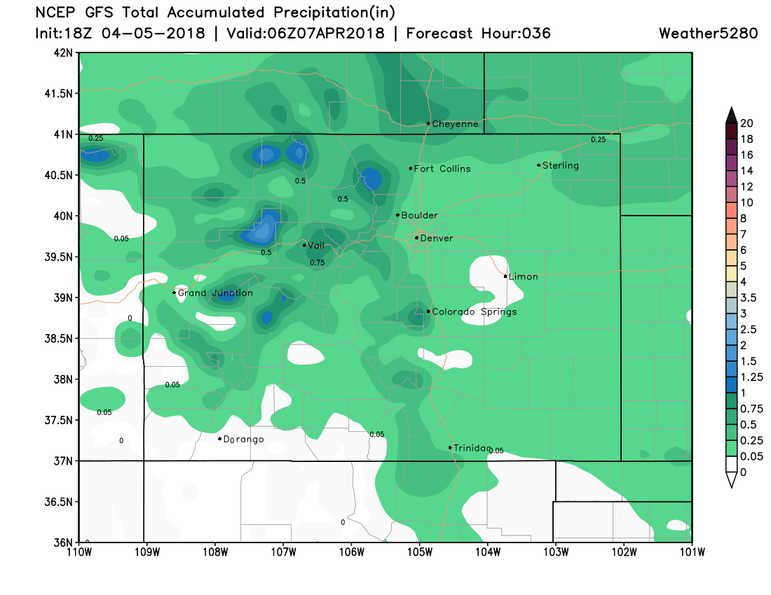
With the surge of colder temperatures will come a mix of rain and snow initially and then a snow chance. Here's a quick look at how the precipitation will move through:
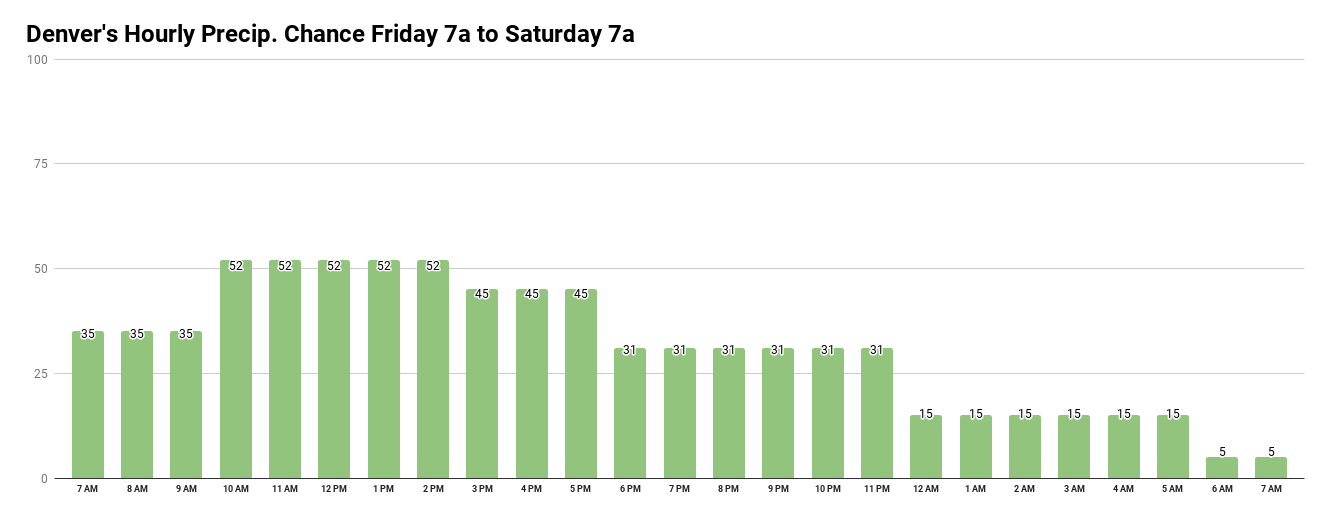
As temperatures drop, rain then snow may drop. Here's an hourly timeline of the chances for Denver, and note that the chance is near 50% so that implies not all areas will have rain/snow.
As far as totals, the total precipitation is on top showing a mostly 0.1 to 0.2" potential. Snowfall is the bottom image showing just a low amount.
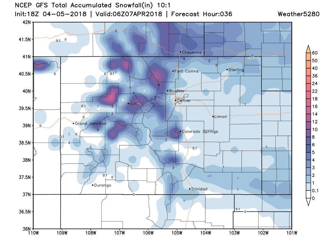
Bottom line: The greater metro area will have areas of rain and snow with beneficial moisture, however snowfall totals will likely be within the range of 0 to 2 inches. Higher totals are possible for NoCo (Fort Collins?) and the foothills/mountains.
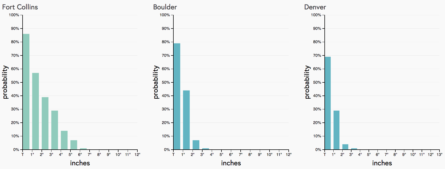
Our snowfall gambler charts for the northern Front Range reflect this as well – good odds at seeing a coating, Fort Collins with the greatest odds as seeing more:
Icy Travel
Sadly, even a low amount of water on the roadways may freeze very quickly considering the quickly dropping temperatures. If you have any form of precipitation along your route, consider that what appears wet may actually be black ice.
The Weekend
This particular system will attempt to clear this weekend meaning warmer temperatures, 50s, but there is a ripple in the middle atmosphere to cruise through later in the weekend. That will mean an ongoing chance for rain/snow across the state.