Tracking Lower Elevation Rain, Higher Elevation Snow, and a Few Severe Storms Today Through Thursday

The forecast remains on track to be a bit unsettled over the coming days. Models continue to vary on where the heaviest precipitation will fall, but the continued area of favorability is the northern I-25 urban corridor, Front Range mountains, and northeast plains.
This will be a much milder system than recent events, which means most of the significant snowfall potential ends up well west of the metro area and immediate foothills. A Winter Storm Watch is in effect for Rocky Mountain National Park and the Medicine Bow Range where 8 - 14" of snow will be possible Wednesday through Thursday, with locally 20"+ possible.
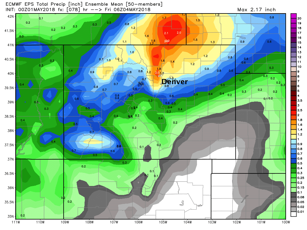
A look at the latest EURO ensemble mean forecast for rain (top) and snow (bottom) shows the northern bias for precipitation as the low tracks over the state Wednesday.
As you can see, it's sniffing out a bit of snow for the foothills/western Palmer Divide, but it shouldn't amount to much if we do see snow mix in Wednesday night. MOS guidance has lows near 40 in Denver Wednesday night and mid 30s across the Palmer, so roads should remain in pretty good condition... but certainly don't be caught of guard is some snow manages to mix in at higher elevations surrounding Denver.
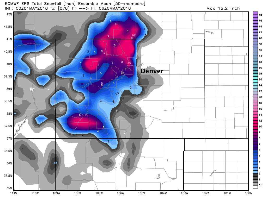
The images above are mean forecasts from 50 ensemble members, so the resolution isn't great. It shows the potential, but in reality totals will vary greatly across the region – with heavier showers delivering more rain for some than others even over very short distances.
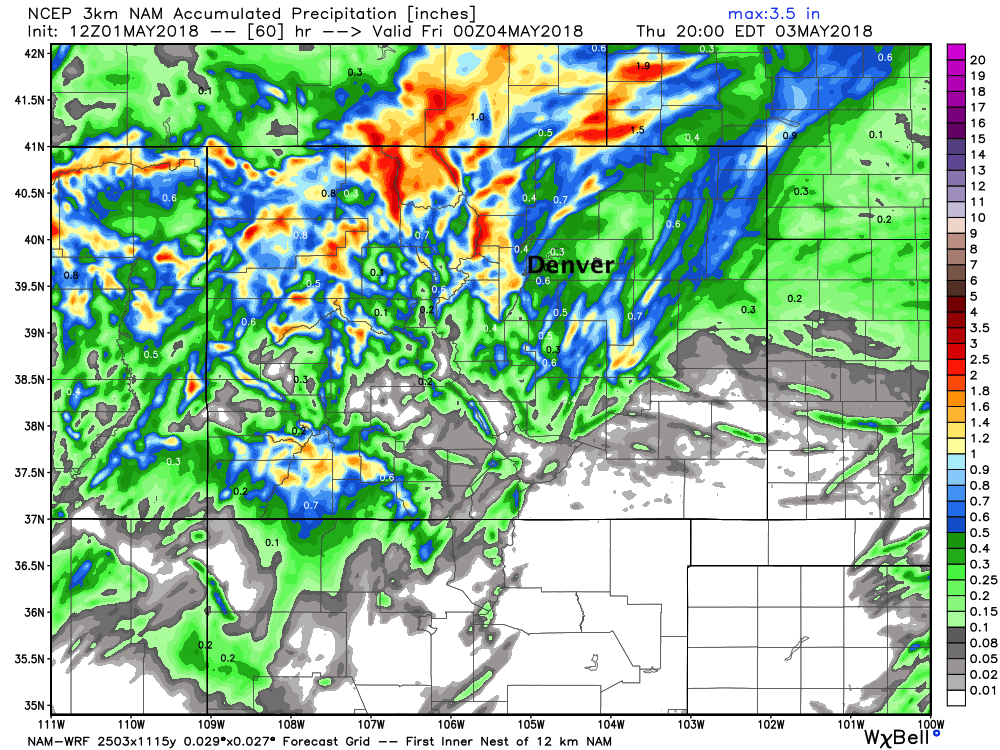
The 3km NAM from this morning shows this (though not to be taken literally with placements). Note quite a bit of heavy precipitation tucked up along the Front Range west of Denver/Fort Collins with more sporadic totals over the northeast plains. Haves and have nots – but clearly unsettled, with good potential for some nice moisture for many locales on the way:
Forecast
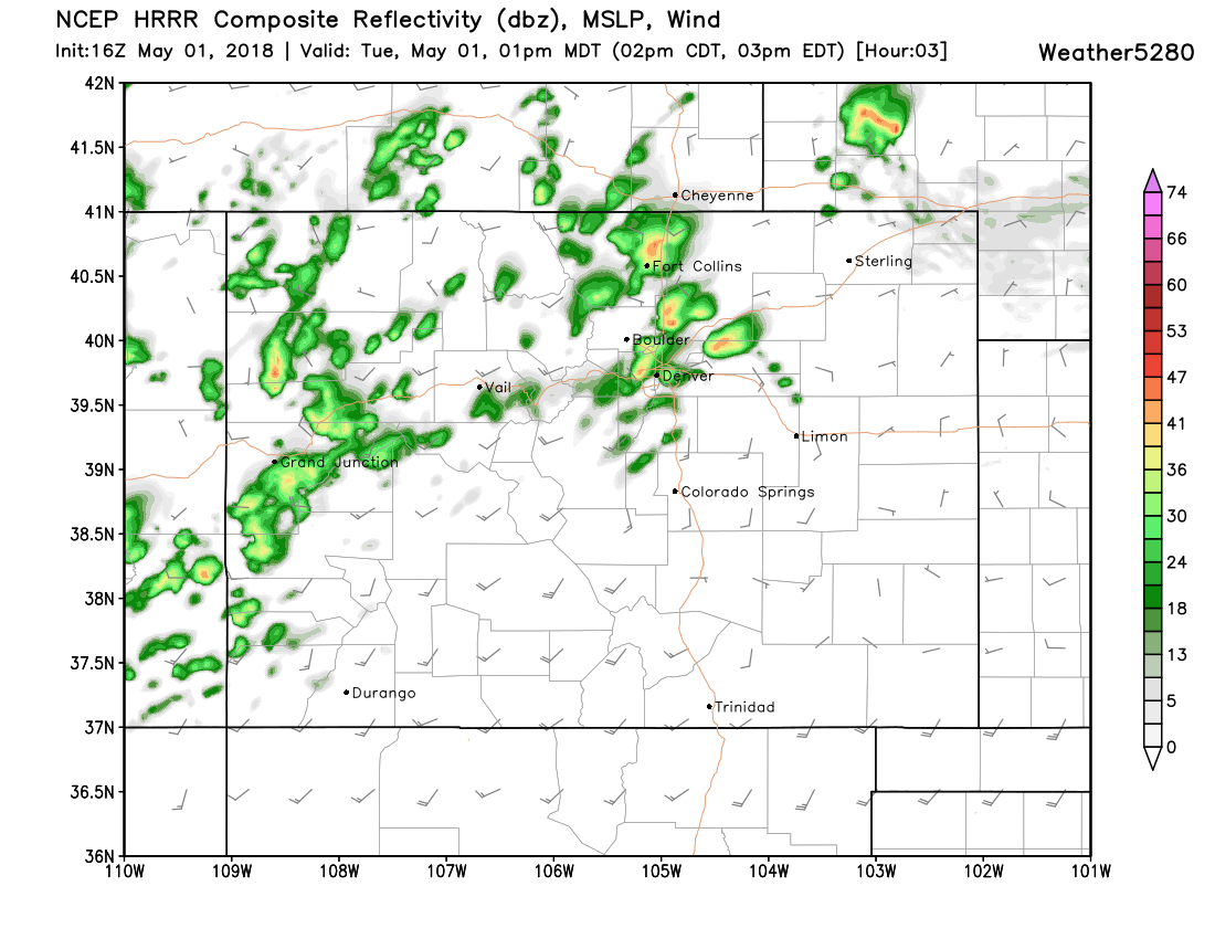
Look for showers and storms to develop early this afternoon, mainly north of the Denver area. A few storms may be severe, with an isolated tornado possible, as well as damaging wind and hail. The SPC has issued a Marginal risk for severe storms across northeast Colorado today, with the worst of the severe weather anticipated to be east of Colorado:
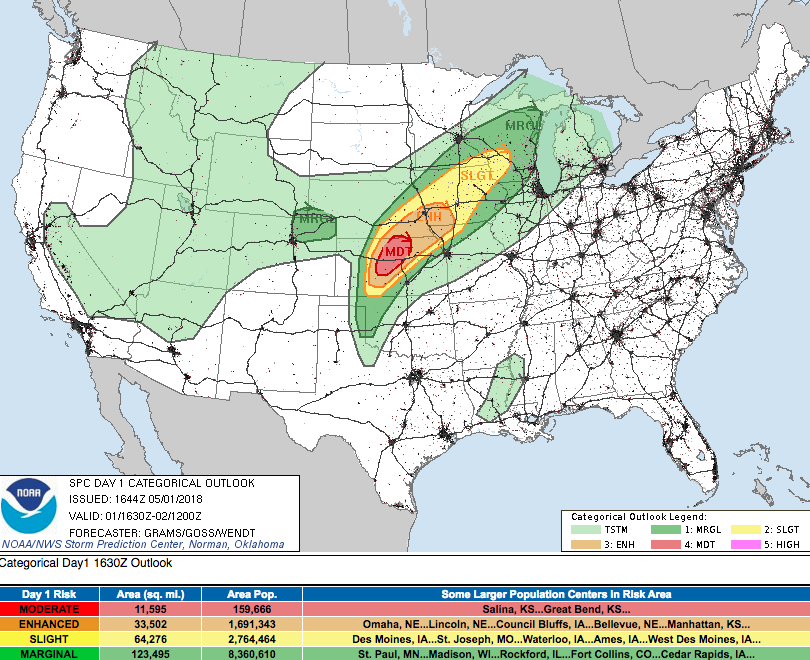
So, not a huge risk for storms to become severe today, but noteworthy if only because we haven't seen much severe weather around here in some time. It's that time of year when we need to start paying attention to the threat of severe storms across the plains, and remember that... when thunder roars, go indoors!
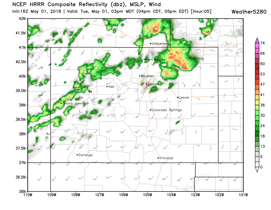
The latest HRRR shows storms developing around 1pm across the metro area, then quickly moving northeast through mid afternoon:
We'll see about a 40% chance of showers and storms from the Denver metro area north/northeast this afternoon, with those chances increasing tomorrow to 60 - 80% chances as Wednesday looks to be the most unsettled day of the week.
Temperatures will be in the mid to upper 50s both Wednesday and Thursday with those storm chances, with the chance for showers and storms decreasing everywhere by Thursday evening.
Friday still looks dry, with highs returning to the low 70s in Denver.