Flash Flood Watch Issued for Northeast Colorado

Still tracking wet weather for your Friday and Saturday across much of northeast Colorado. Rain will be heavy at times from Friday afternoon through Saturday evening across the Front Range foothills, northern urban corridor, and northeast plains. The National Weather Service in Boulder has issued a Flash Flood Watch for these areas from 3pm today through Saturday (green shading below):
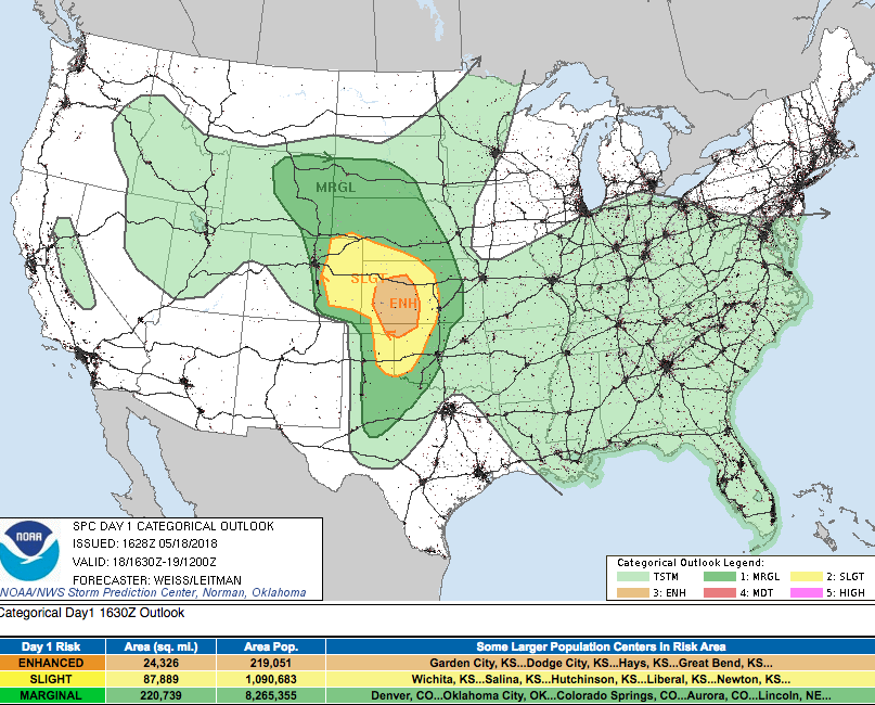
While the severe threat we discussed yesterday (hail, damaging wind) looks less impressive today than it did yesterday, storms that do develop today will be capable of producing severe weather – especially initial development. Later in the day flash flooding becomes the primary concern, as models continue to forecast areas of heavy rainfall. The latest SPC outlook continues to show much of eastern Colorado under a Slight Risk for severe storms – note, however, that this has shifted slightly further east than the map we showed yesterday:
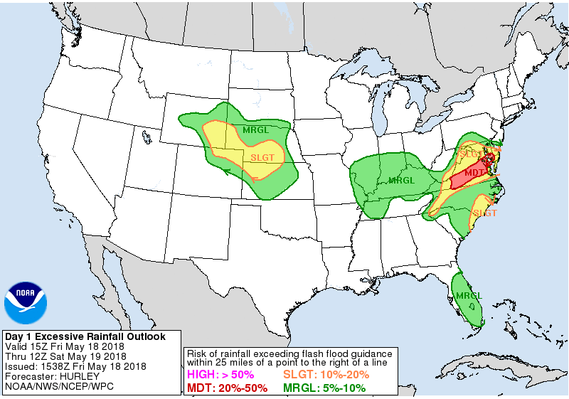
Here is the excessive rainfall outlook for today:
And tomorrow:
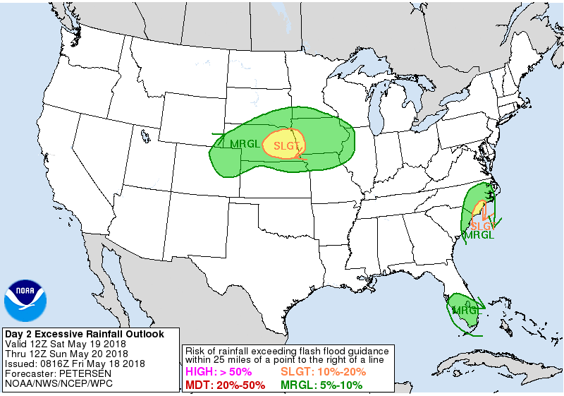
Certainly a bias for the northern extent of the Flash Flood Watch issued above.
So how much rain can we expect? Well, the Watch issued by the NWS discusses potential for 3 - 5" in some spots, which is certainly not unreasonable. Not everyone in the Watch will see that kind of rain, but the potential exists. This is especially true for areas north and northeast of Denver, but not limited to.
On Weather5280 Insider: ENSO Status and Summer Outlook
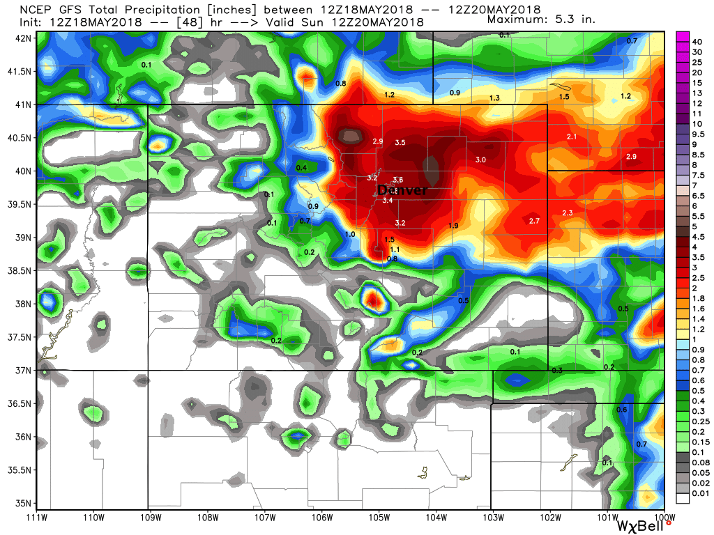
The GFS is most bullish for a greater area, with 3"+ across the region through Saturday:
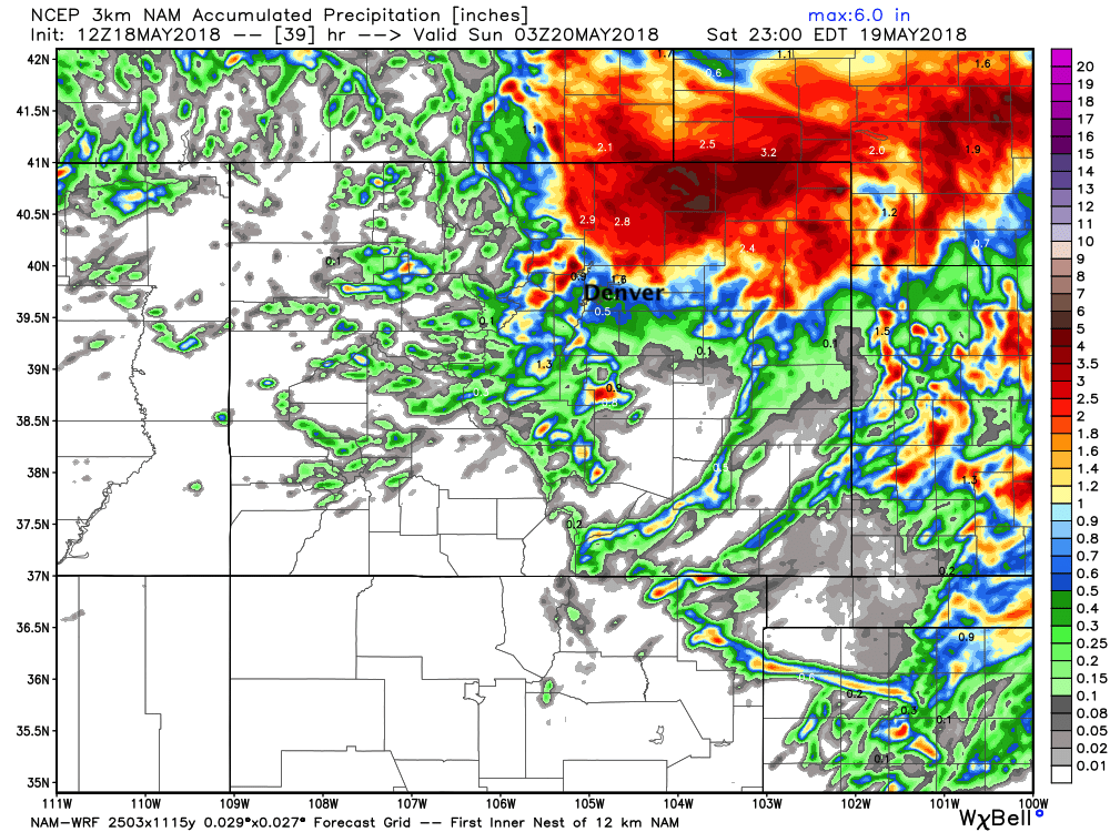
The latest 3km NAM shows that bullseye north of Denver, with only pockets of heavier rainfall for us:
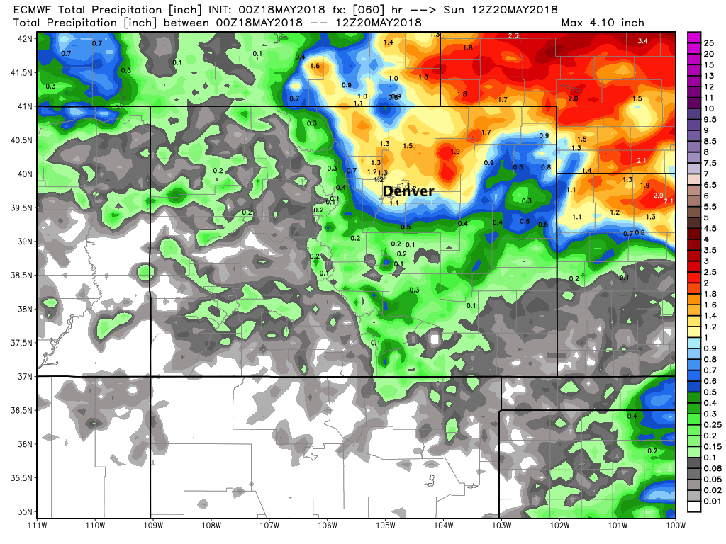
While last night's EURO shows about an inch to two inches across the region:
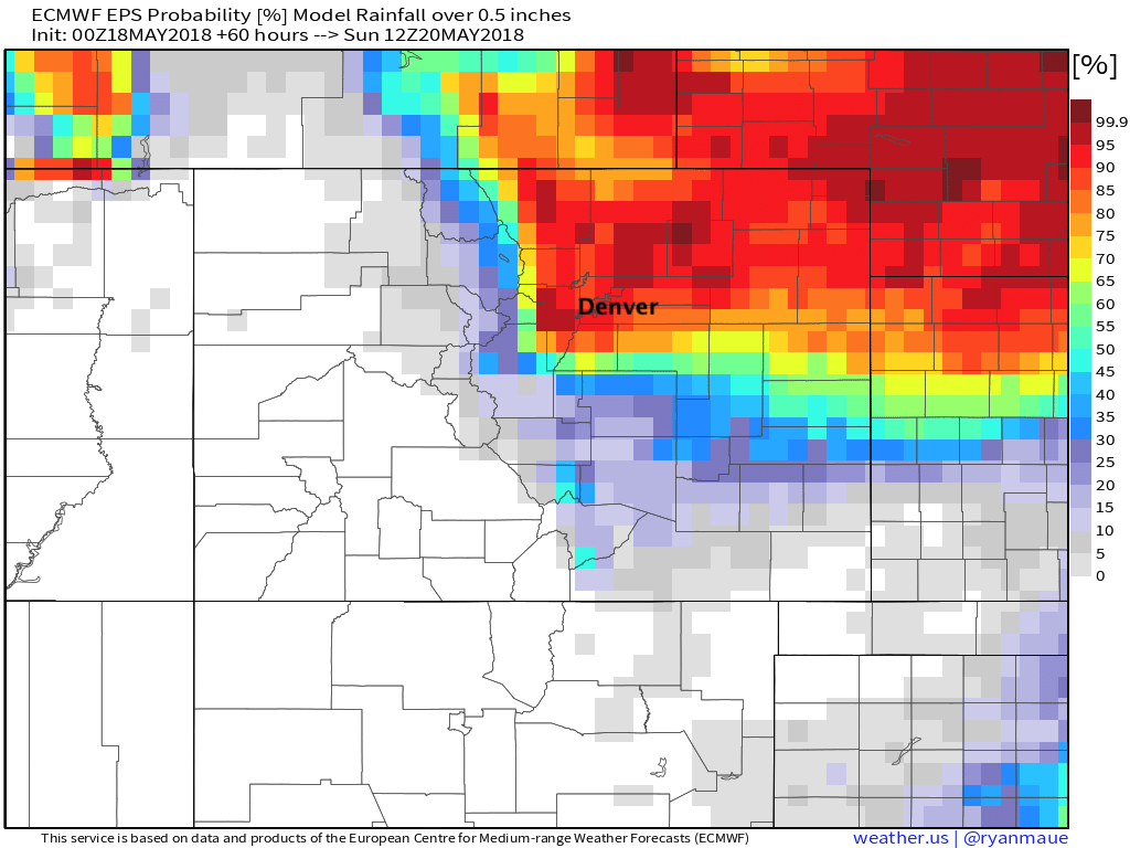
The EURO ensemble also is on the less bullish side... though shows good odds at >0.5" of rain through Saturday:
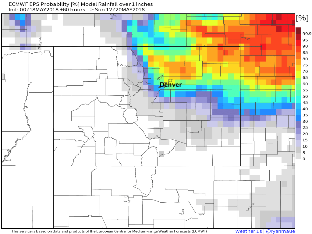
And best odds for more than one inch of rain (liquid) showing up just north of Denver:
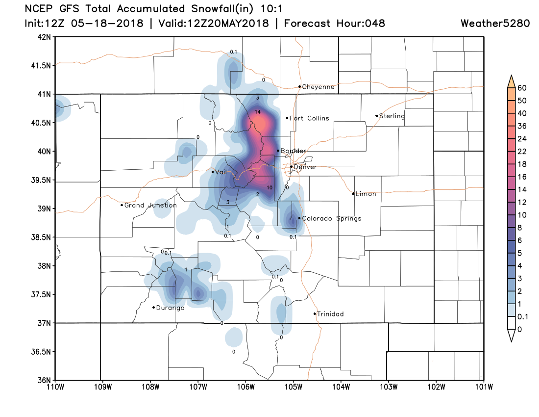
And finally, some great late season snow on the way for the Front Range mountains. 8 - 18" of snow will be possible for elevations greater than 9,500 feet through Saturday, with likely some snow accumulation at elevations lower than this as well for some higher foothill communities.