The State of the Atmosphere: Sunday, June 3, 2018

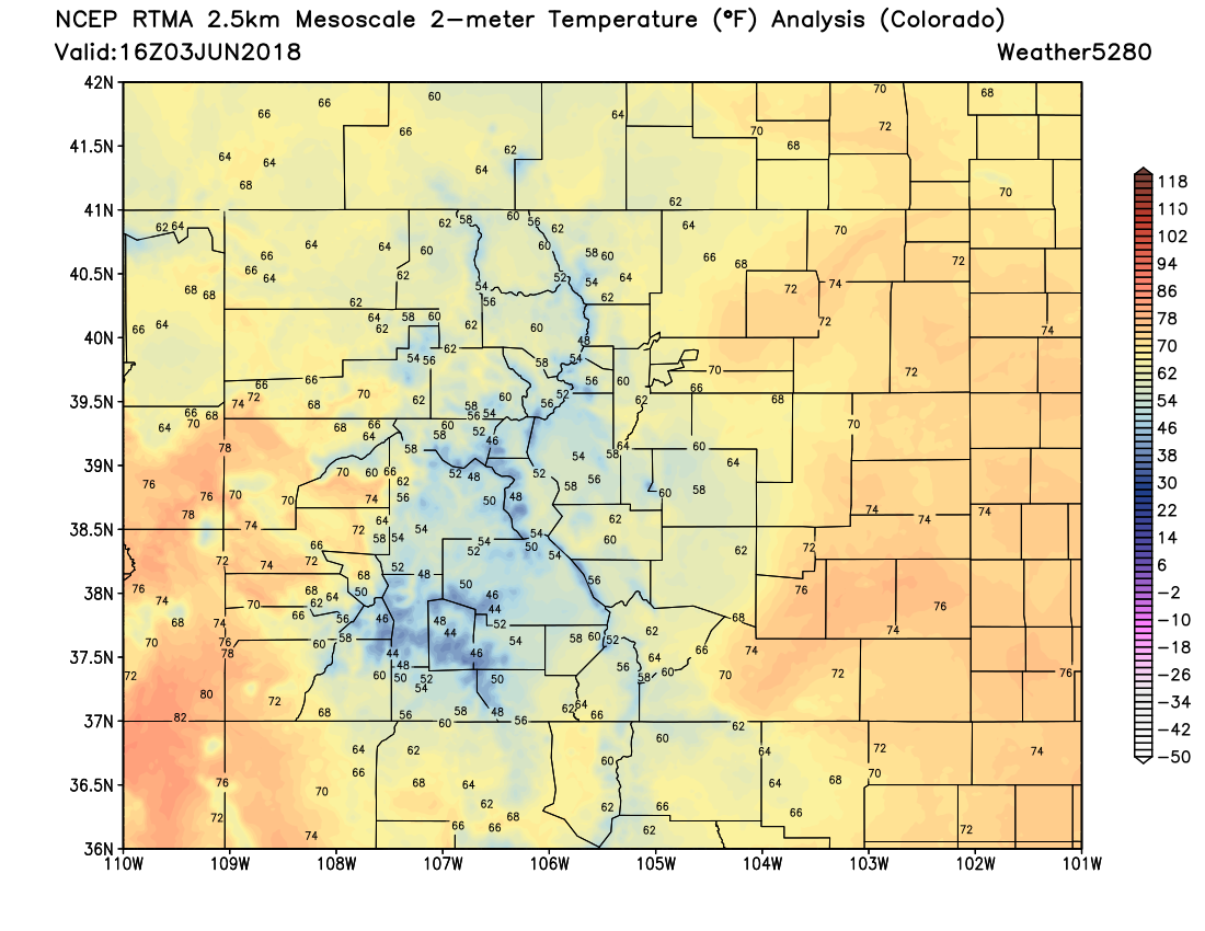
A beautiful early June day across northeast Colorado today before the heat returns for the week ahead. Late morning temperatures in the upper 60s and low 70s across the region on the way to highs in the upper 70s and low 80s later this afternoon.
By Monday we see temperatures climb about 10 degrees into the low 90s for highs. We should stay in the 90s for highs in Denver through the end of the week, with likely little storm potential along the northern urban corridor as well.
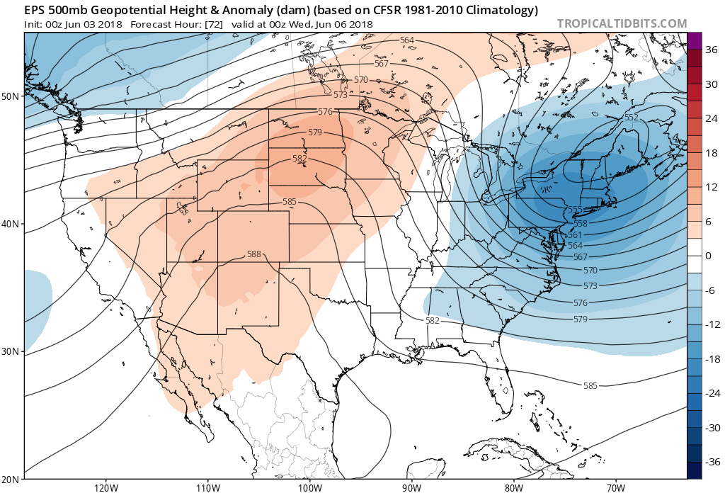
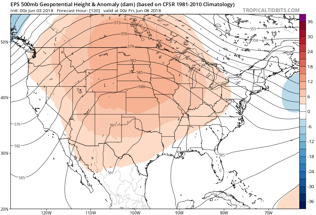
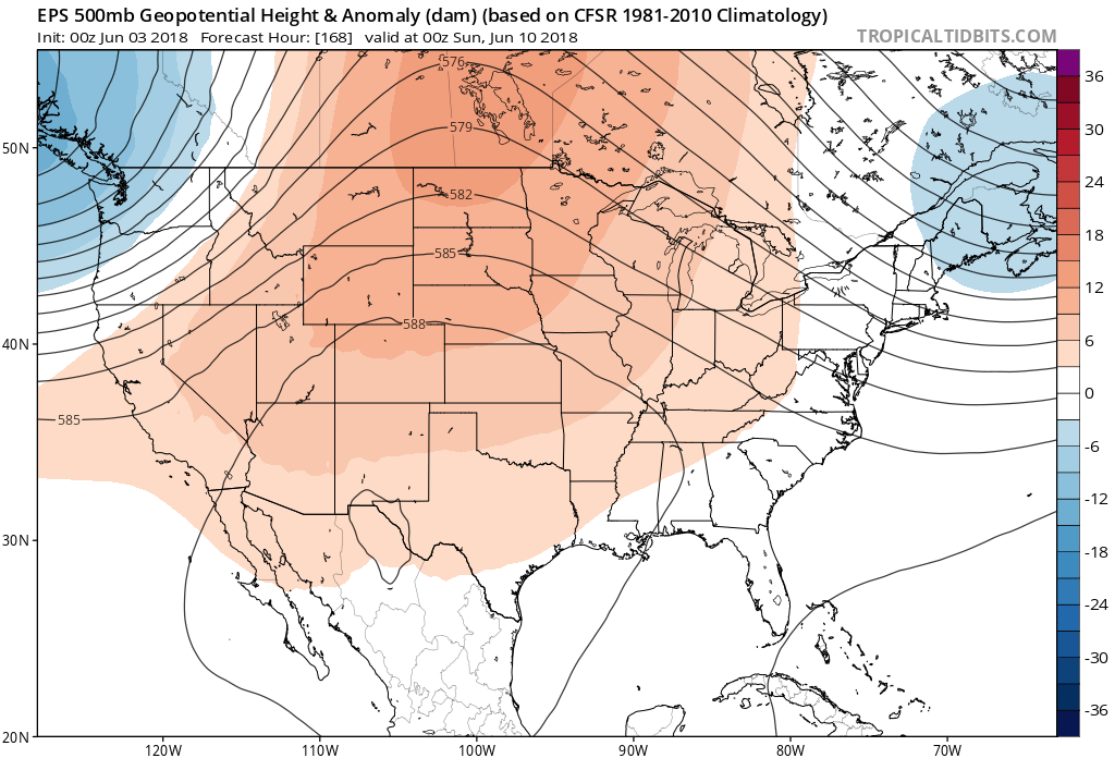
The overall pattern continues to be a ridgy one –– with ridging pretty well established over the region into next weekend, and perhaps beyond:
Tuesday 500mb forecast:
Thursday 500mb forecast:
Saturday 500mb forecast:
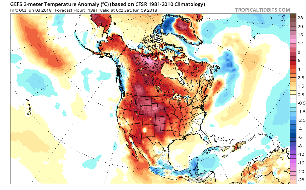
All this equates to a period of very warm weather across much of the country, including Colorado. We'll see temperatures oscillate between low 90s and mid 90s for highs this week depending on the day. The warmest days right now look to be Tuesday and Friday, but again... it'll be a matter of a few degrees between the warmer days and cooler days over the next seven. A look at the GEFS forecast temperature departure from averages for this coming Friday shows most of the country (especially the high plains) running well above average for this time of year:
A a nutshell... not all that exciting of a week on the way when it comes to weather. With the dry conditions we see across much of the state, occasional afternoon storms (lightning), and heat – expect fire danger to remain elevated across much of the region as we head into June. While smoke from nearby fires haven't been much of an issue along the Front Range thus far, we certainly could see that change, with at the very least some hazy afternoons on the way as well.
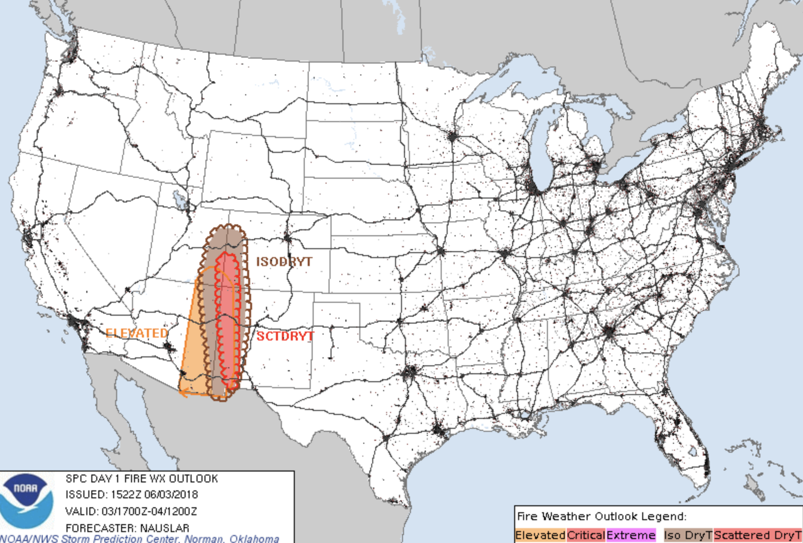
Even with some moisture trying to nose its way into southern Colorado today, evacuations remain in effect for the 416 Fire near Durango as it is now just 10% contained. The latest fire weather out look shows conditions across southwest Colorado remain favorable for fire development today... and likely will remain so through much of the week – likely spreading northeast as well. PLEASE pay attention to local burning restrictions.
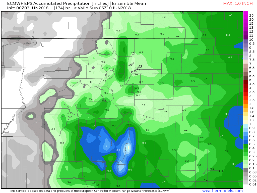
As for storm chances... again, not looking like a great week to bet on storms, but can't rule an isolated storm popping up across the plains on most days. In Denver look for those chances to hover in the 10 - 20% chance range each day, with perhaps some 30% chances showing up well east of the metro area from time to time. A very broad look from the EURO ensemble mean shows we likely won't be completely dry this week across the region... but certainly not an overwhelmingly wet look either. I suspect most areas east of the mountains stay mostly dry through the work week, unless we can break the cap a few afternoons and with that see some brief storms drift off the mountains and cruise east.