The State of the Atmosphere: Monday, December 17th, 2018

Well, if your Christmas wish was for another month of below average snowfall in Denver, you may be in luck (and shame on you! 🙃), but it ain't over till it's over as they say.
We are watching a trend toward a cooler, and perhaps more wintry end to the month... but aren't overly convinced just yet that it'll equate to much east of the mountains. We're still lacking the teleconnection support we'd like to see aligned with some of the model's more bullish snow and cold scenarios we're seeing come down the wire.
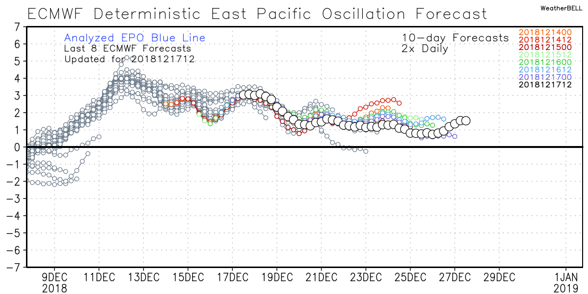
As we wrote about for our Insiders last week, one of our top analog years (2014) did turn cold to end the month, and delivered several inches of snow to Denver on Christmas day. Looking back at 2014 we see clear cold teleconnections that favored the late-month pattern shift, one of those being a dip negative from the EPO. If we look at the current EPO forecast, we see it remaining positive for the next 10 days:
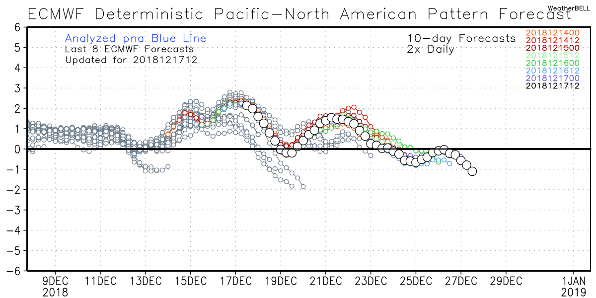
The PNA too has been positive, though models are trying to step it negative as we head into the final days of the month. Not a whole lot of comfort looking back at previous forecasts (grays) and seeing several attempts by the model to take the PNA negative have failed this month:
Neither of the above forecasts scream pattern change, at least not over the next 10 days. The question is, are they right?
Most of our analogs suggest the cold will start to push once more, perhaps as soon as the last days of December, but certainly as we head into January. Unfortunately that may ultimately favor areas east of our area, but at least initially we may be able to sneak out some wintry weather, as we saw for instance in 2014. As we head deeper into the month of January, the action may shift east, so perhaps this is our (albeit narrow) window for some snow on the way?
This week
This week remains rather mild and uneventful across the region, and really for much of the nation. We really don't see anything of concern in the forecast through Friday for Denver, with highs each afternoon well above average.
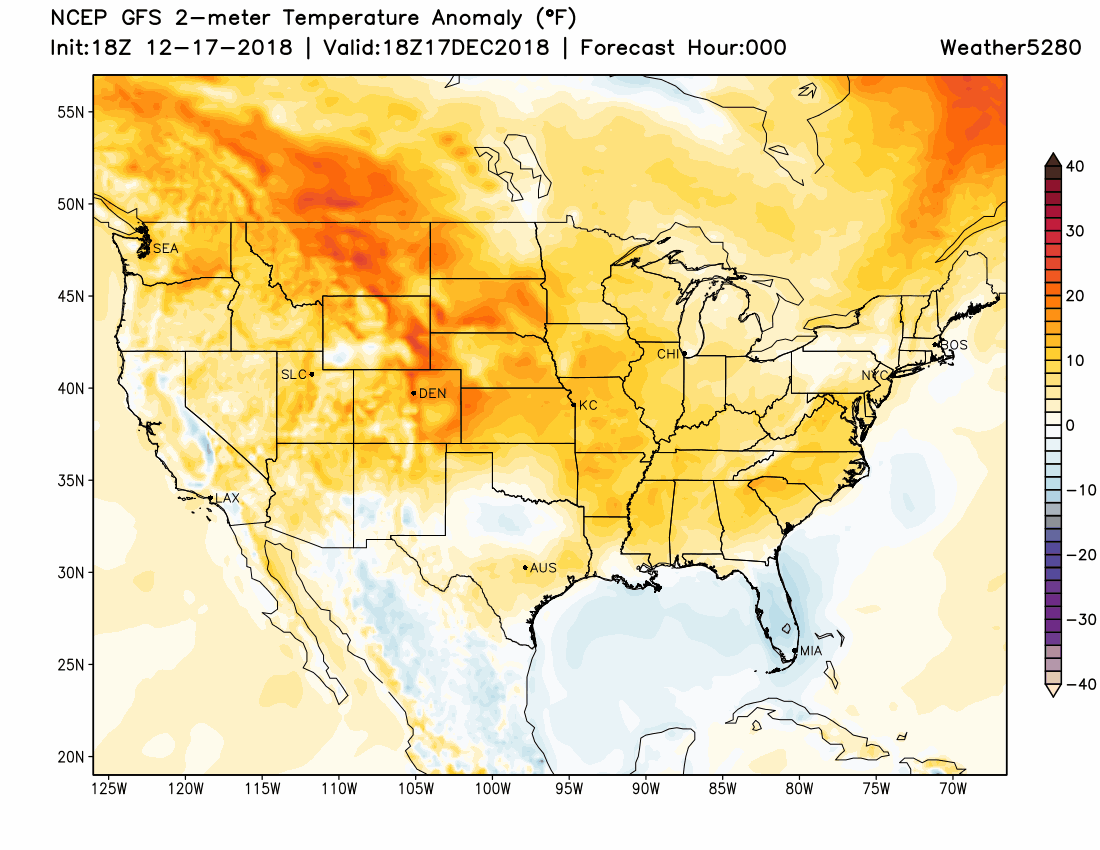
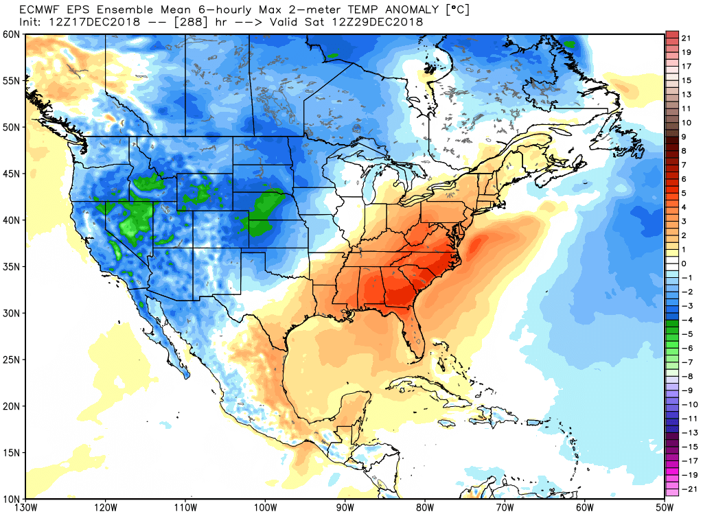
A look at temperature anomalies through next Saturday show most of the CONUS experiencing temperatures well above average, with perhaps a bit of a cold front for next Saturday sneaking down the Front Range and delivering a quick change to our weather, if brief:
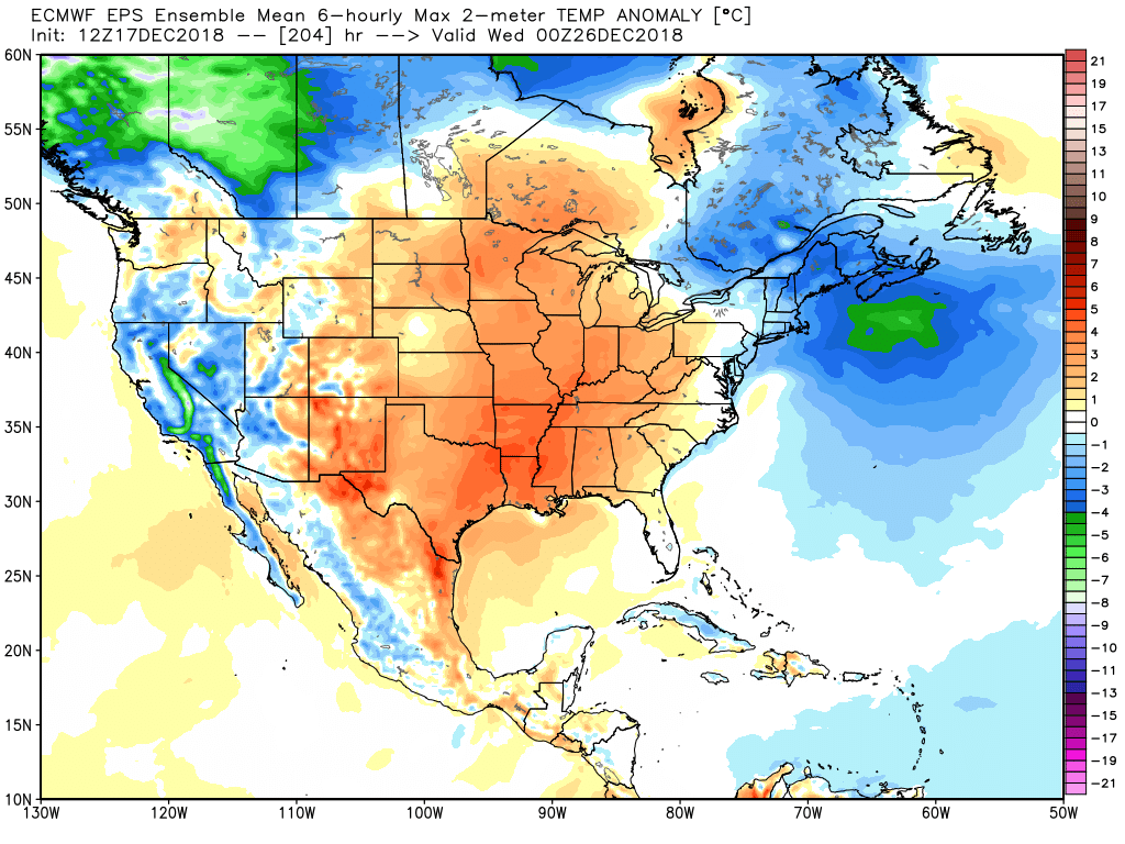
For the later days, we start to need to pay a bit more attention. As it stands today, it looks like we might be between systems across eastern Colorado for Christmas. We'll see something push through this weekend, then perhaps again Christmas night or the following day, but for now (it's a long ways off) we're looking to be under the influence of the ridge, with mild temperatures across the area. Here's the latest EURO ensemble forecast for temperatures anomalies the evening of the 25th:
With perhaps a cooling trend between Christmas and New Years?
Again, let's focus on the rather uneventful weather we have on tap for this week, and wait a few days before getting too married to any given solution for the last 5 to 8 days of the month or so.
The latest EURO doesn't have zero odds for snow across northeast Colorado next weekend (though close to it), but we should see some decent snow from time to time from midweek through the weekend across the northern mountains at the very least:
For Christmas week, the forecast is a bit more of a crapshoot. I'd argue confidence in any scenario is quite low, including those mild temperatures for the 25th in the forecast map above. After this stint of mild, zonal weather across the U.S., it does look like that starts to break down next week, which can sometimes make things interesting around here. Time will tell.