Wednesday PM Update: Warming Trend to End The Week
Well, not a blockbuster, but nice snow and a good ol' fashioned arctic chill to go along with it.
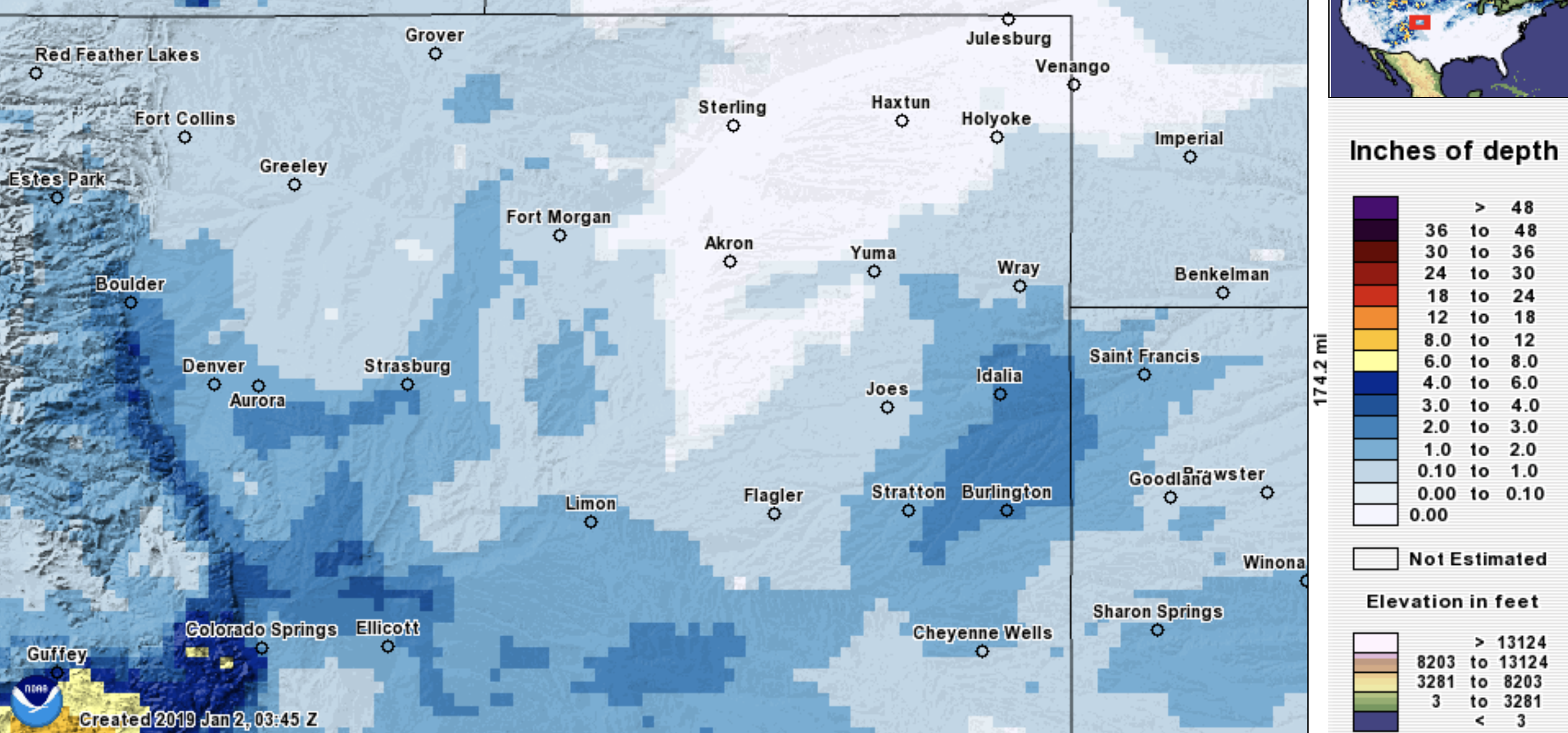
We picked up 2.3" of snow at our station in Denver with a forecast of 2 - 5". Verified, but just barely.
Snow totals across the region ranged from 1 - 4", with no real "boom" totals coming in. We knew it'd be hard for this setup to over-perform, but we did have hopes it would do a bit better in spots.
Denver International Airport picked up just 0.5 inches of snow –– which was enough to end the (measurable) snowless December for Denver, but in a rather unremarkable way.
As we look to the remainder of the week, warming and drying is what we see. After lows near zero Tuesday morning and this morning, highs by Friday near 60 will feel like Spring.
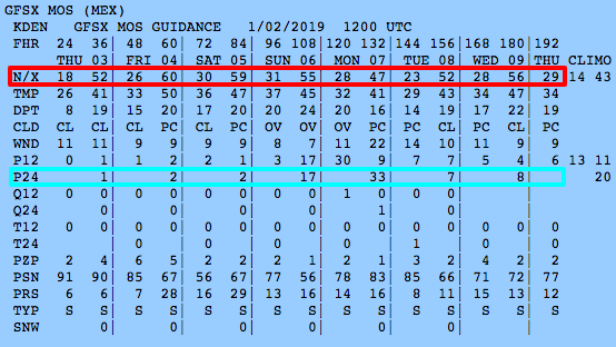
Just a quick look at MOS for Denver indicates that warming trend (boxed in red).
This warmer pattern does continue beyond the MOS range, too. Here is the 6 to 10-day outlook for temperatures indicating much warmer than average conditions:
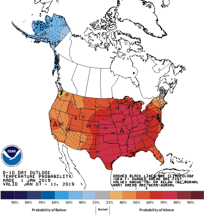
The next best chance to see some precipitation will be Sunday into Monday (chances boxed in blue).
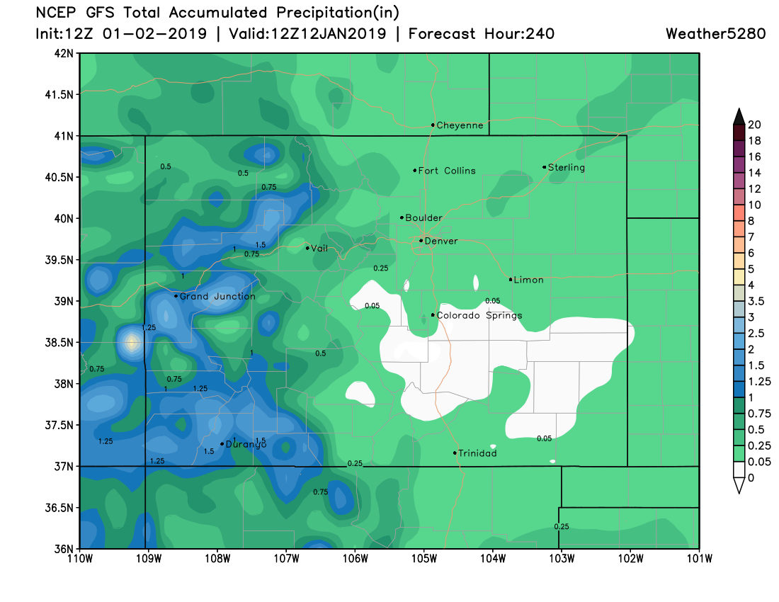
You can take a quick and dirty look at one model output for total precipitation during the next 10 days and we have some indication for a little bit of moisture at least, and continued chances for mountain snow (always a plus!):
We'll have something for the Insiders on the moisture outlook soon, and will update the public side of things later in the week based on how those precipitation chances for Sunday and Monday change.