The State of the Atmosphere: Sunday, January 6th, 2019
Happy New Year!
The last State of the Atmosphere (SOTA) included details on the last snow of 2018 that was the only measurable snowfall event for the city for the month. With the 0.5" on the 31st, December was the 3rd least snowy on record since 1882 for Denver.
We'd like to recap the entire area's year, but we'll post a 2018 review once the government shutdown is behind us and we can access NCDC data again - preliminary data shows a dry and warm year for the state, unsurprisingly. Until the official data is released, know that Denver had its 6th driest and 20th warmest year.
Unlike the average of 2018, 2019 certainly started off on a very cold note. Denver had its first sub-zero temperatures in almost a year during this past week but also felt a steady warm-up into the 60s by the end of the same week. The warm pattern certainly returned, and the dry pattern that's associated with it.
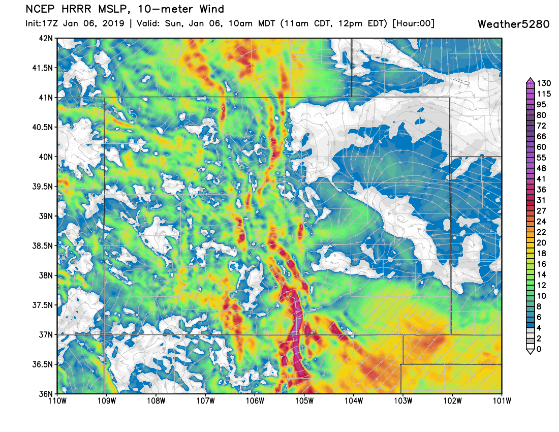
The metro areas remained dry this weekend despite areas of snowfall in the mountains. The cloud cover streaming over the plains is almost all that the mountains could send. Almost? Wind is on the way via a strong jet stream disrupted by the Continental Divide.
Wind alerts have been posted for many areas of the Front Range and foothills:
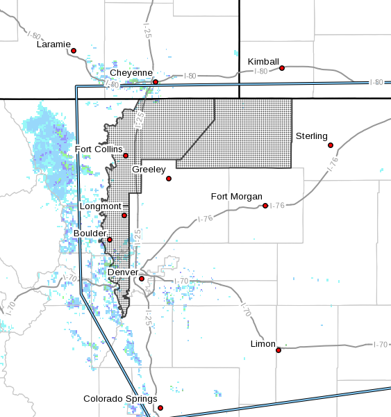
The National Weather Service in Denver has issued a High Wind Watch, which is in effect from late tonight through Monday evening.
- WINDS...West 30 to 45 mph with gusts up to 60 mph.
- TIMING...Late tonight through Monday evening.
- IMPACTS...High profile vehicles will be susceptible to dangerous cross winds. Areas of blowing dust will be possible with visibilities reduced to one mile or less. Possible power outages caused by downed power lines.
 Get the latest wind forecast here
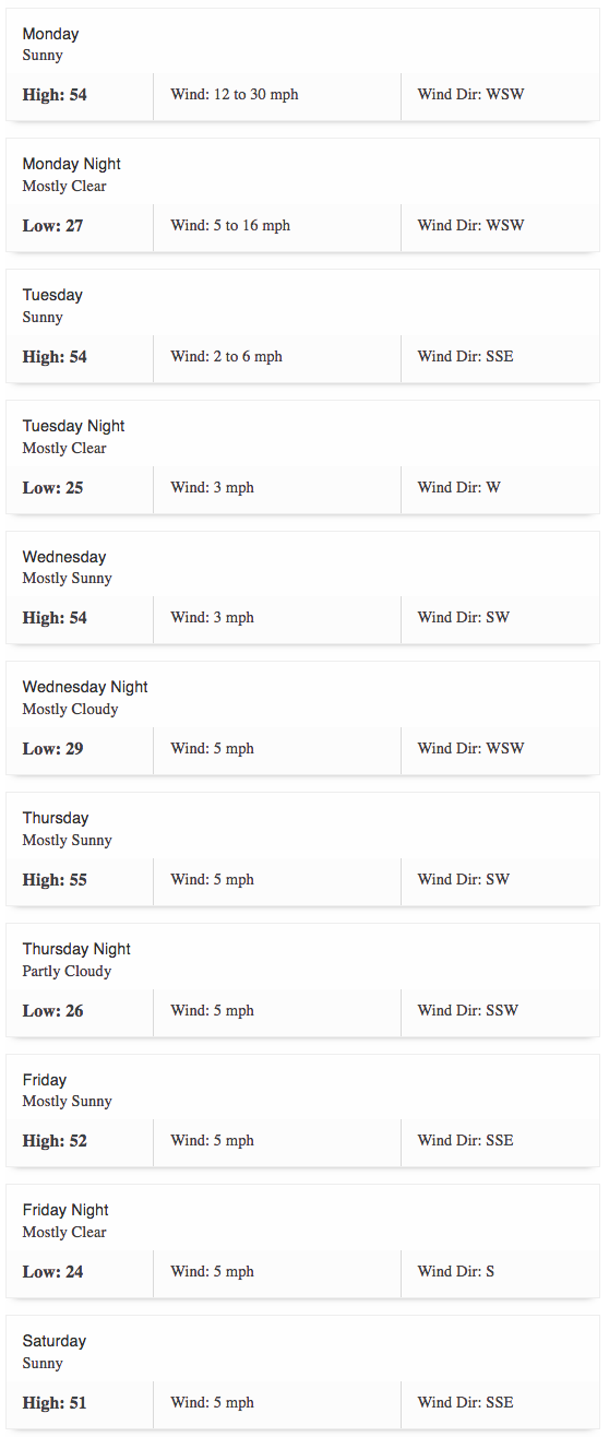
Following this wind is a bit of a temperature drop, however we do remain above average this week. Here's the forecast for Denver:
The warmer than average trend continues for quite awhile, and it isn't only us. Here's an animation showing areas of warmer than and cooler than average temperatures for the next 10 days.
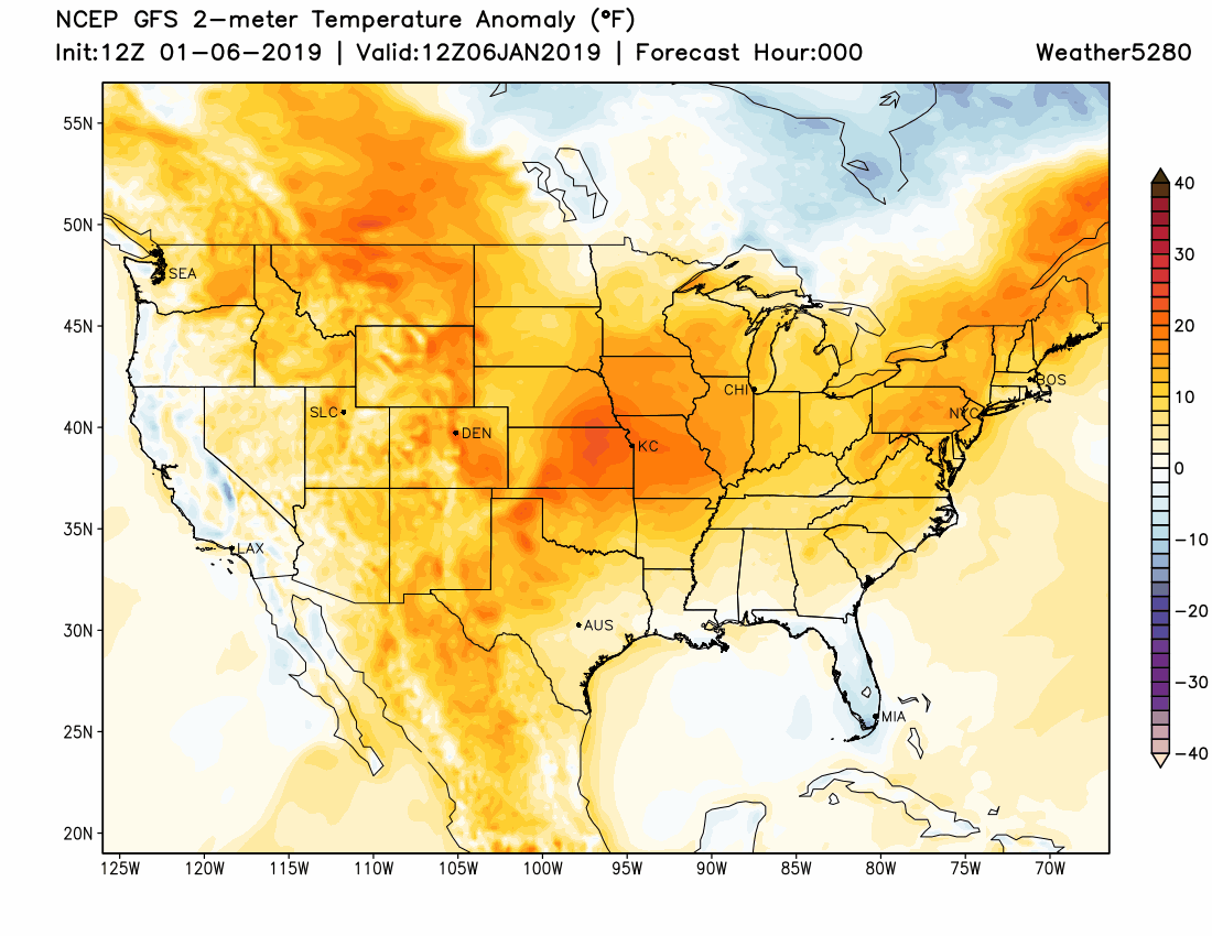
It's interesting to watch very cold air develop and hit the eastern US, meanwhile warm conditions remain across the west.
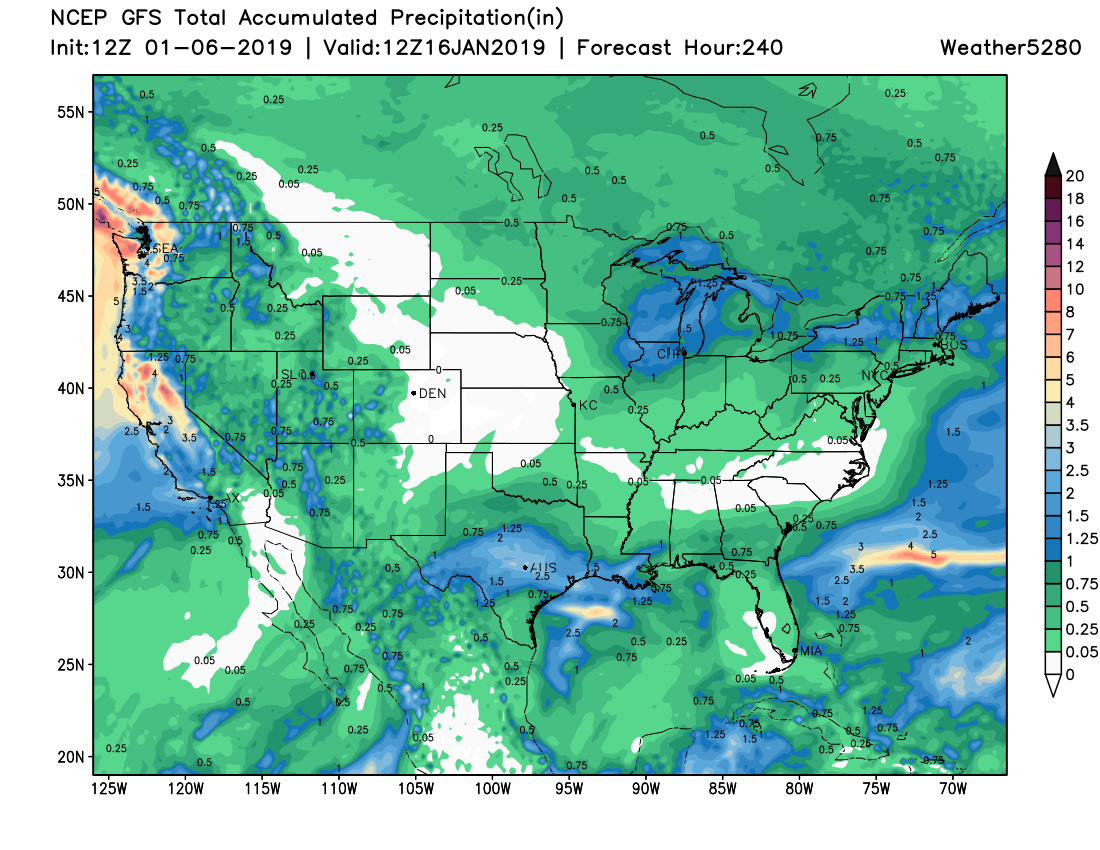
For the curious, here's a look at the total precipitation expected during that timeframe too.

That is a dismal picture for the eastern slope of the Rockies, isn't it? Well, outside of low chances of snowfall, Denver and the metro areas are likely to stay mostly dry for the next 10 days. Occasionally there will appear a couple of systems that may change that precipitation outlook, perhaps one this Friday and Saturday, but that signal is quite weak – clearly – since it isn't consistently shown in the modeling.
Saturday we addressed the longterm outlook with our PRO Subscibers in their drought update. Bottom line there and here, mostly dry through the month.
It appears as though at least the first half of January isn't too far off the pattern we had in December.