El Niño Has Reestablished and Might Stick Around For Awhile

The weather we have experienced for the past several weeks lines up very well with what we thought winter would be like... a more active finish than start and middle. During the past 60 days, areas along the Palmer Divide / I-70 Corridor have benefited the most –– running well above average for precipitation during this time:
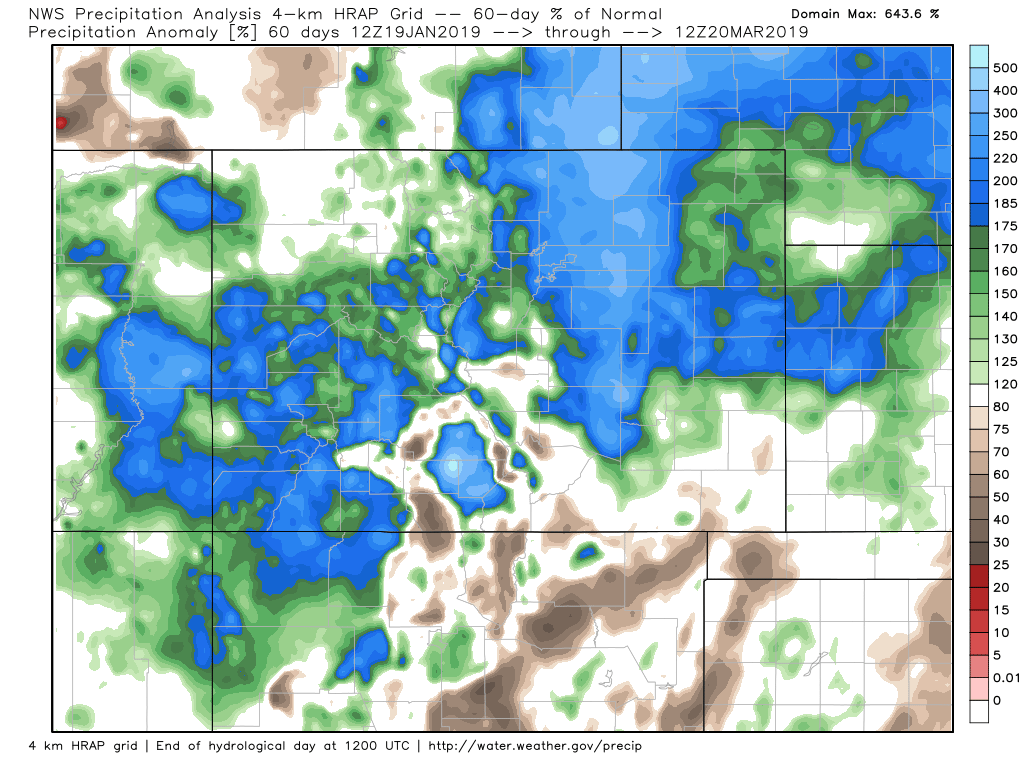
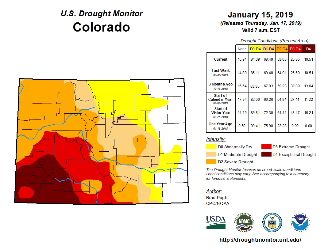
Most areas of Colorado have received at least average moisture, with a few small exceptions. Mountain areas have also been doing well, especially the parched San Juans and Sangre de Cristo mountains. That means the drought has been easing too. Here's a comparison from the past two months.
January 15th, 2019
March 21st, 2019
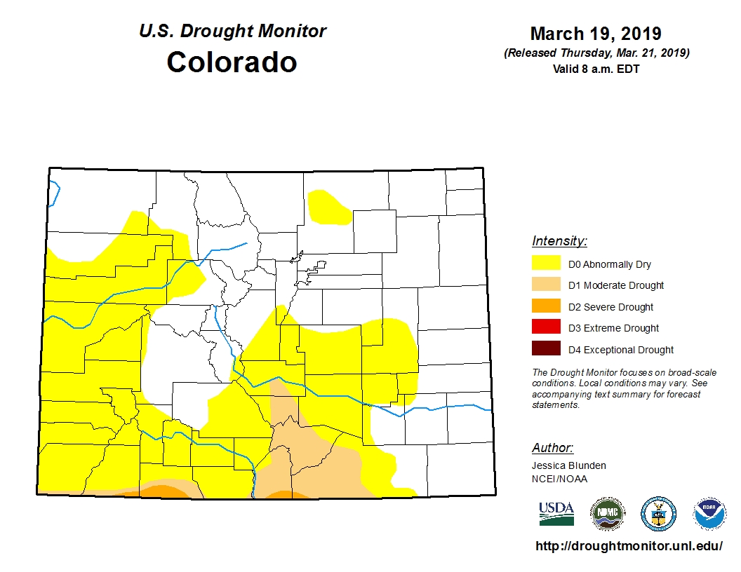
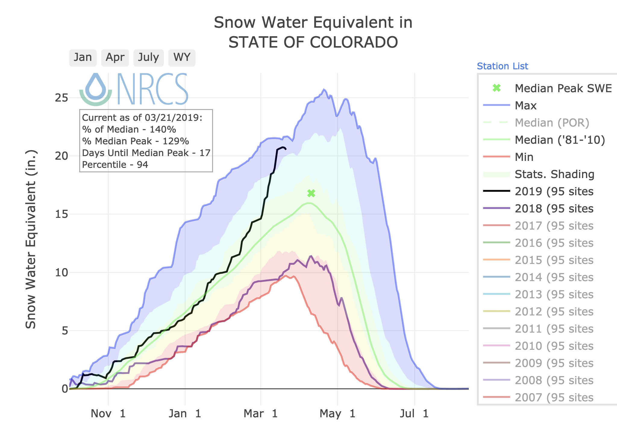
Notice how much the drought has been reduced! What a difference a pattern change can make. Take a look at the current snow water equivalent (SWE) chart for Colorado. The black line is this water year, which is now running some 140% of the longterm median, and is ranked in the 94 percentile for this time of year! Amazing. Peak snowpack comes during the first week of April, and with a few more systems to push through the state we should only add to the snowpack in spots until then:
So, where do we go from here? Let's start by looking at the sea surface temperature anomalies, and what El Niño is up to these days.
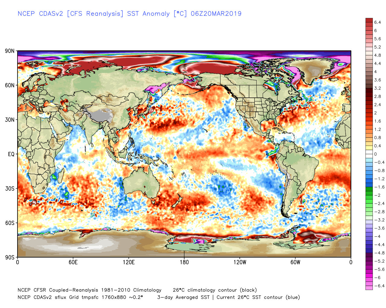
The map above shows warmer than average ocean temperatures across much of the Central and Eastern Pacific Ocean. That warmth is consistent with the ongoing weak El Niño. The two maps below show sea surface temperature anomaly changes during the past few weeks and ocean temperature anomaly changes beneath the surface.
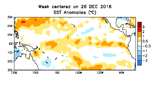
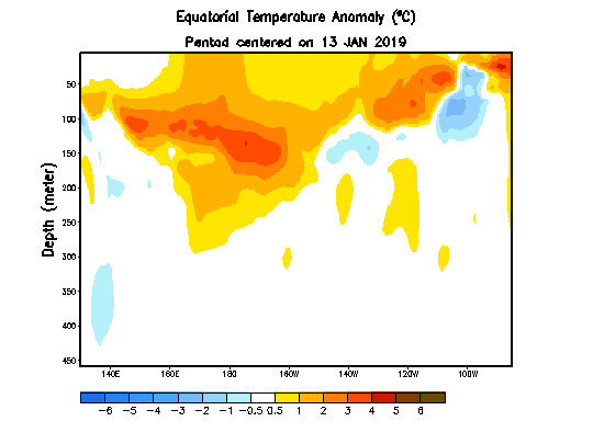
The change both at the surface and beneath the surface has been pretty stark, during the past several weeks. This has also allowed the weak El Niño to couple with the atmosphere. What does that mean? Well, when the ocean and atmosphere couple during an El Niño event, the impact of that event is more pronounced and impactful. The fact the the Southern Oscillation Index has been steadily getting more and more negative, is a clear sign of this coupling.
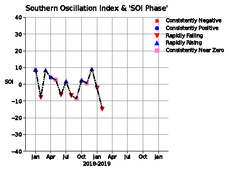
Before late January, this El Niño event was behaving more like a La Niña event, and the neutral to positive SOI is a good indicator as to why. The ocean and atmosphere were not communicating with each other. That changed dramatically in February.
So, is this reestablished El Niño going to last? Given how much warm water is present in the Pacific ENSO region at the surface and below, I would say it certainly has a shot of sticking, and perhaps even intensifying. Models show somewhat the same thinking but aren't terribly reliable during the spring at predicting such. For now, here is what they say:
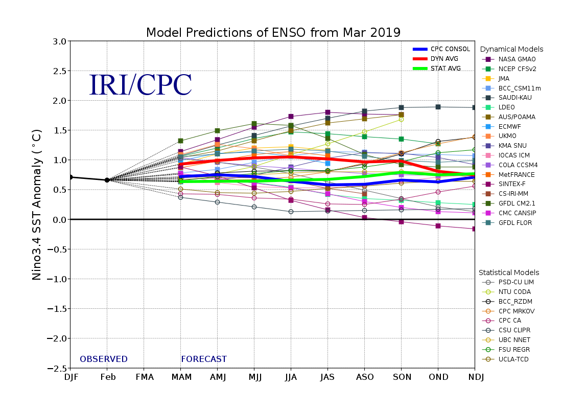
Notice that most of the models not only maintain current strength for awhile, but some intensify this event through the rest of 2019. While the jury is still out on exactly what will happen, we are certainly watching this trend closely for what could be a potentially significant El Niño event later this year.
Are you looking for how this may impact the spring forecast and beyond? We will be posting our official spring/early summer outlook next week for our Insiders. Stay tuned!