The State of the Atmosphere: Sunday, July 21, 2019

A spectacular end to the week's heat yesterday for many, as heavy rain moved off the mountains Saturday afternoon delivering soaking storms to communities up and down the urban corridor.
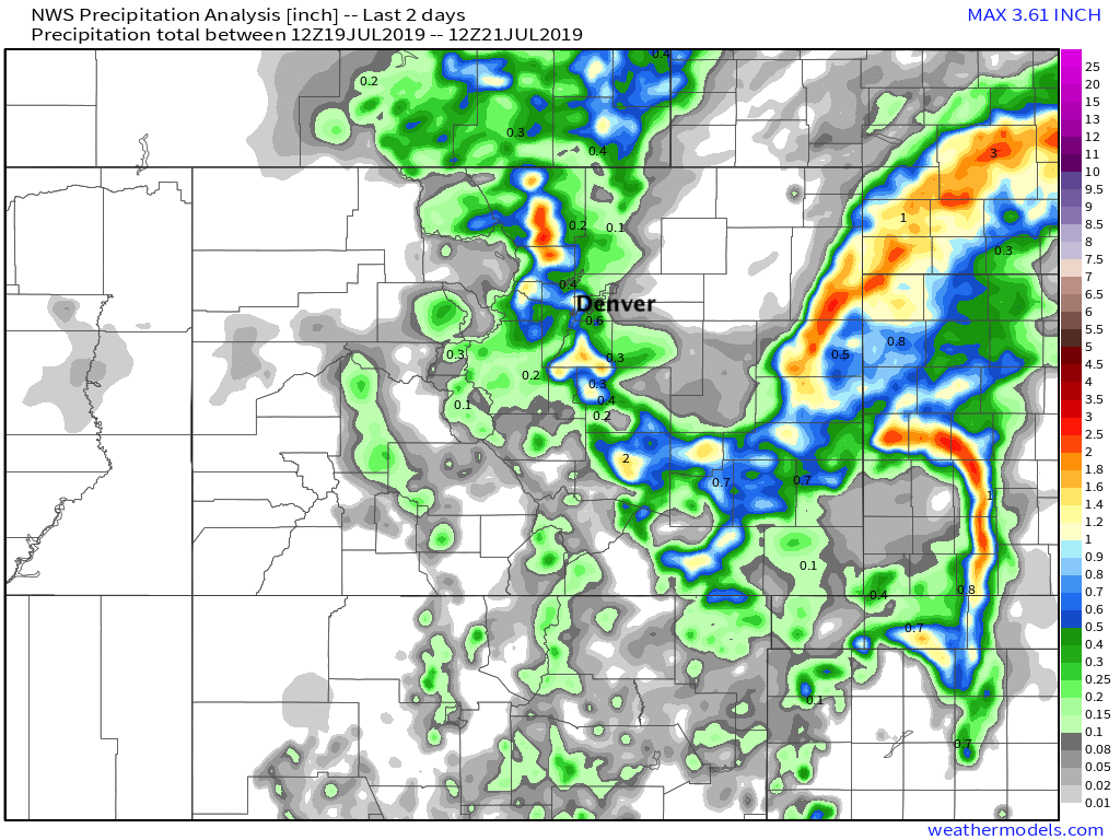
Our station, now located six miles west of downtown Denver, picked up 1.72" of rain on Saturday with a high of just 85°F. As you can see in the 24-hour precipitation total map below, we were not alone –– many areas saw upwards of 1" of rain from the storms yesterday:
It was a hot week across eastern Colorado, and really, much of the country on the whole. Denver hit 101°F on Friday, tying the record of 101°F for the date set back in 2005.
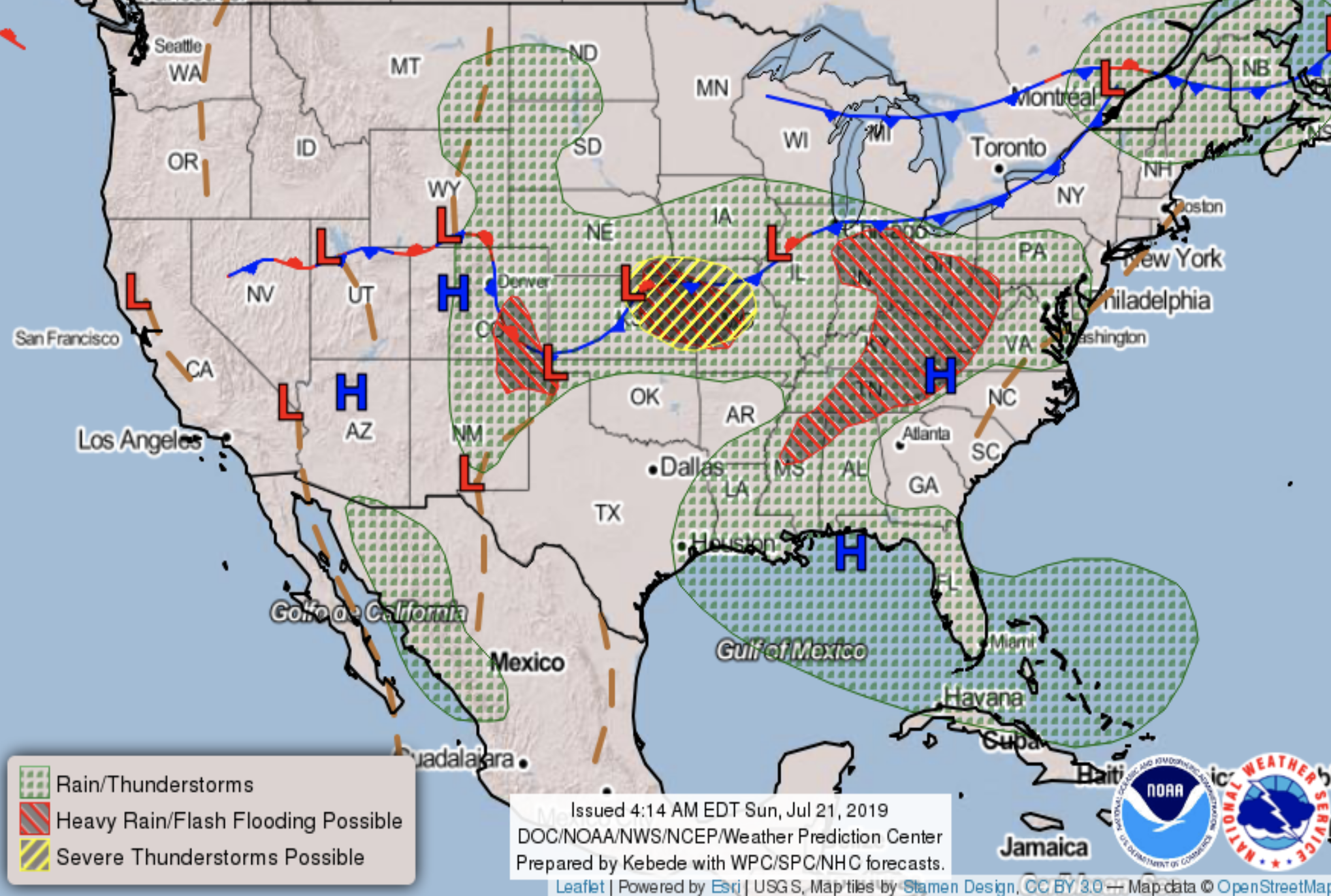
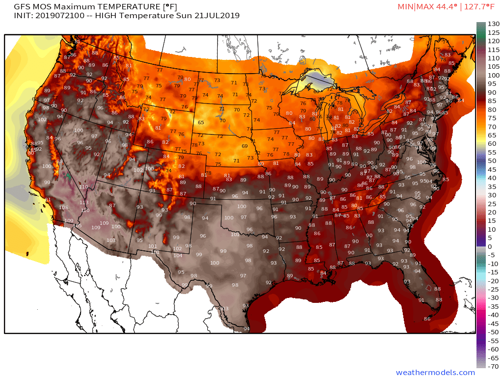
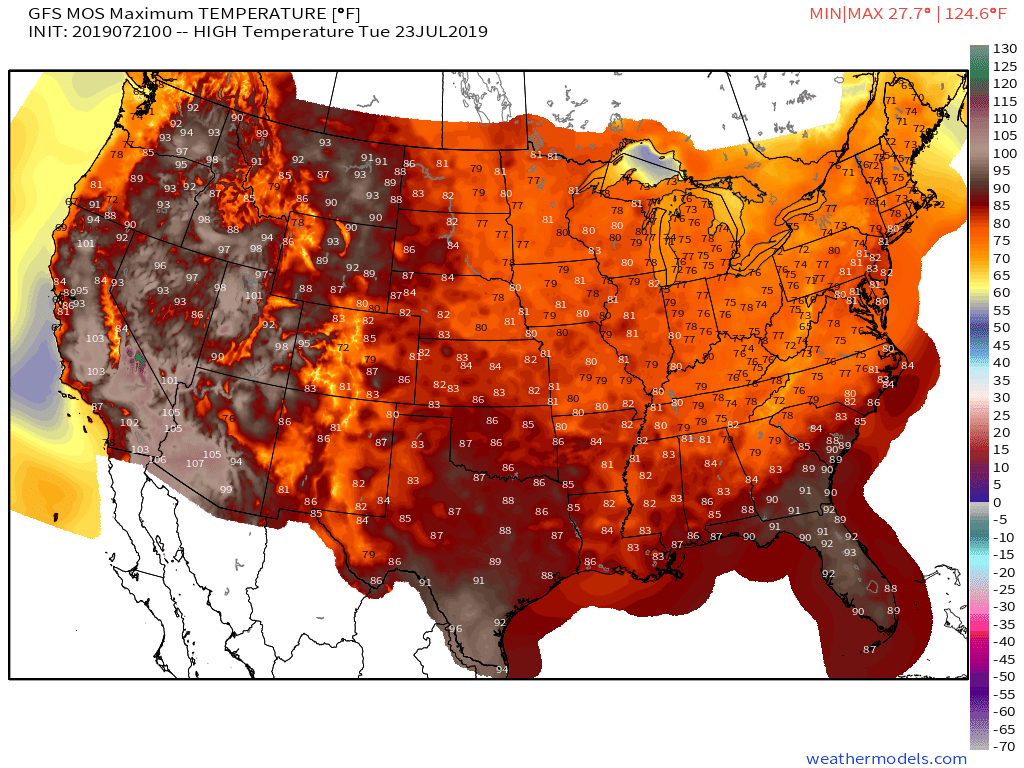
Today will be another hot one across the South and East, though not all that bad for Northeast Colorado and the High Plains:
By Tuesday we see the heat locked in across the Western United States, with a relatively cooler period ahead for the eastern two-thirds:
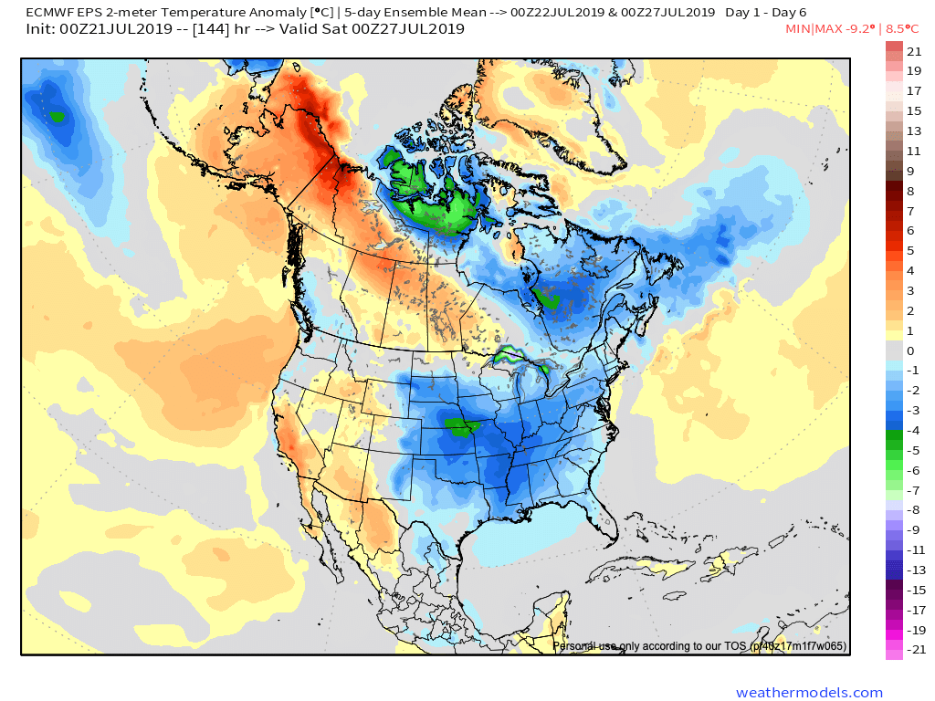
For Eastern Colorado, the last week of the month will feature temperatures near average to below average for the most part. This with a better chance of storms most days than we saw the week prior.
For Denver, this means highs in the 80s most afternoons (perhaps low to mid-90s for Wednesday), but altogether a much more manageable week in the temperature department expected.
The European model is certainly on board with this; it forecasts temperatures to run below average across the middle of the country over the next five days, including across most of Eastern Colorado:
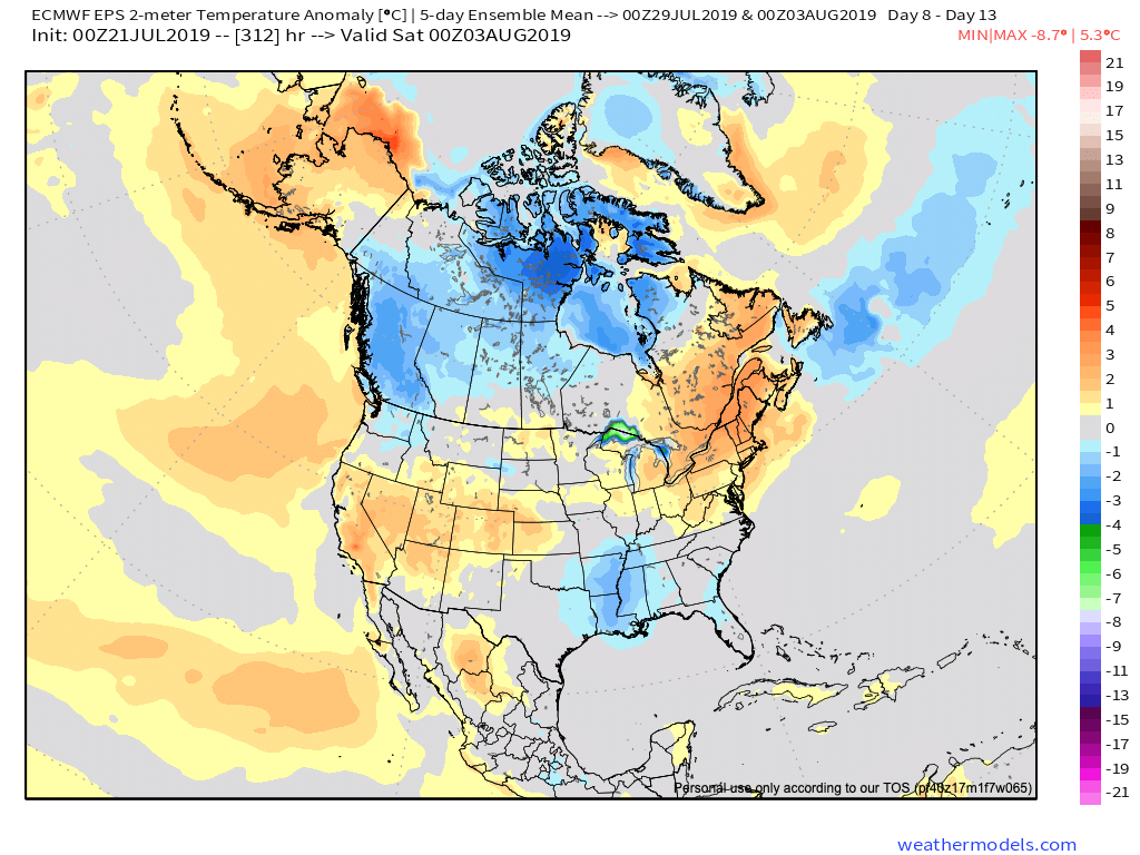
The same map for the first week of August, however, shows the heat returning once more, with the latest outlook from the Euro showing above-average temperatures for Colorado to start August:
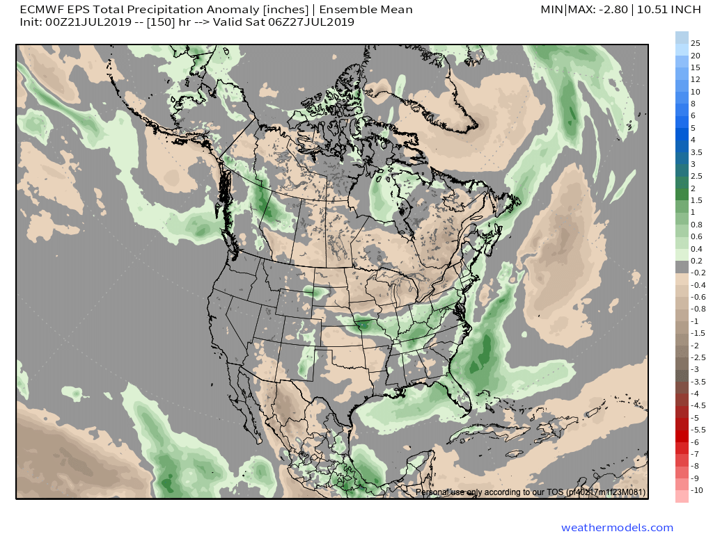
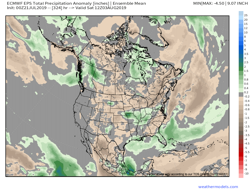
For precipitation, look for average to above-average rainfall for Eastern Colorado this week before drying out again to start August. No, this isn't the monsoon as this year has yet to develop the circulation pattern necessary to bring tropical moisture (evident in above-average precipitation from Mexico into the US) into the region.
The Euro shows the best chances for above-average moisture over the next five days to fall across Southeast Colorado and the northern Front Range mountains, with near-average moisture expected most elsewhere:
When we add to this the following week, we see a clear dry signal return:
For the Denver area, look for storm chances to be in the 50 to 70% chance range today - these rain chances run later through the evening - and a 30 to 40% range Monday through Wednesday.
The latest HRRR shows storms developing over the foothills this afternoon and gradually pushing east over the urban corridor and into this plains this evening. The severe risk is lower than yesterday, but not negligible either. Heavy rain and hail are the primary risks associated with today's storms: