The State of the Atmosphere: Sunday, October 13, 2019

The upcoming work week looks much, much quieter than the weather rollercoaster we experienced last week. Temperatures will be quite mild each afternoon, with Tuesday currently looking like the coolest day of the week across Northeast Colorado.
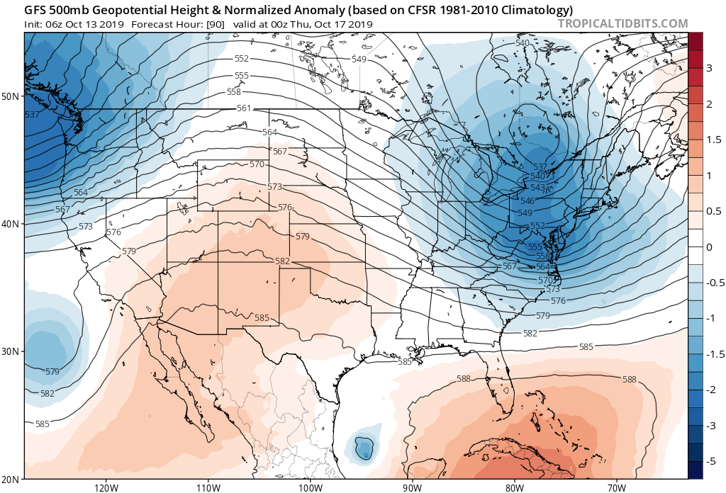
Here's a look at the 500mb pattern last Thursday when we see the snow and cold move through the region:
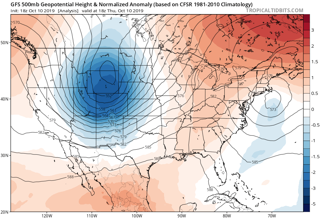
Today that system has moved into the Great Lakes, and we see between it and a trailing (weaker) system that will move through Monday night. This one doesn't look to deliver much in the way of moisture (or cold air for that matter), but will knock highs down about 10 to 15 degrees Tuesday from highs in the low 70s on Monday in Denver.
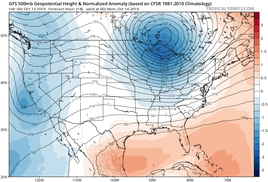
Tuesday you can see some blues(potential instability) moving overhead, but as compared to last week's system not much to see here:
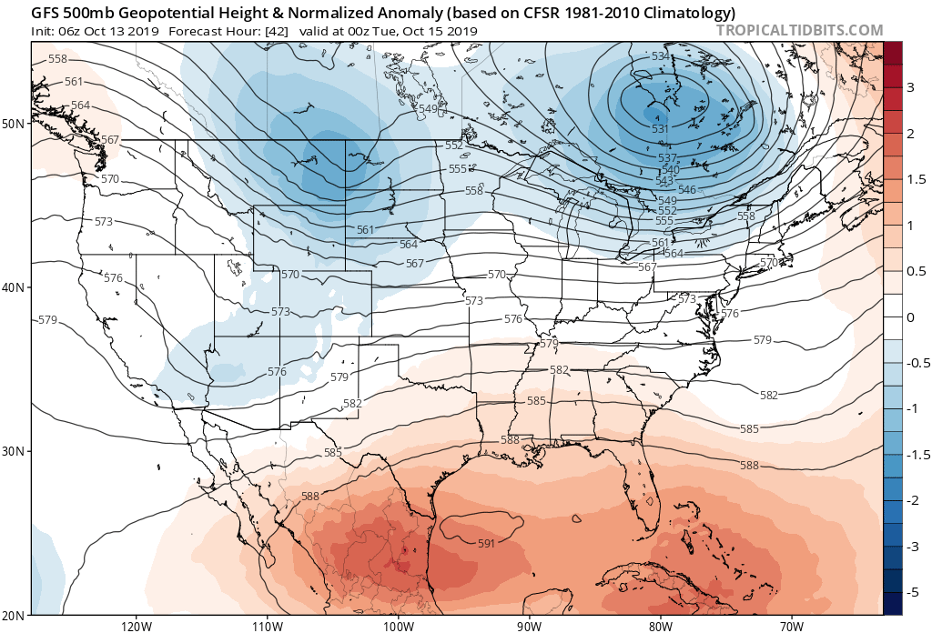
And finally, ridging moves overhead for Wednesday and Thursday bringing with it some very warm fall temperatures to Eastern Colorado:
The average high for the week in Denver is in the mid 60s, so most days through Friday look to be either near average or above, with highs potentially pushing 80°F by Thursday before cooling off a bit on Friday.
With highs in the 60s and 70s this week, and lows in the 30s and 40s, we don't expect any records of either variety to be broken through Friday.
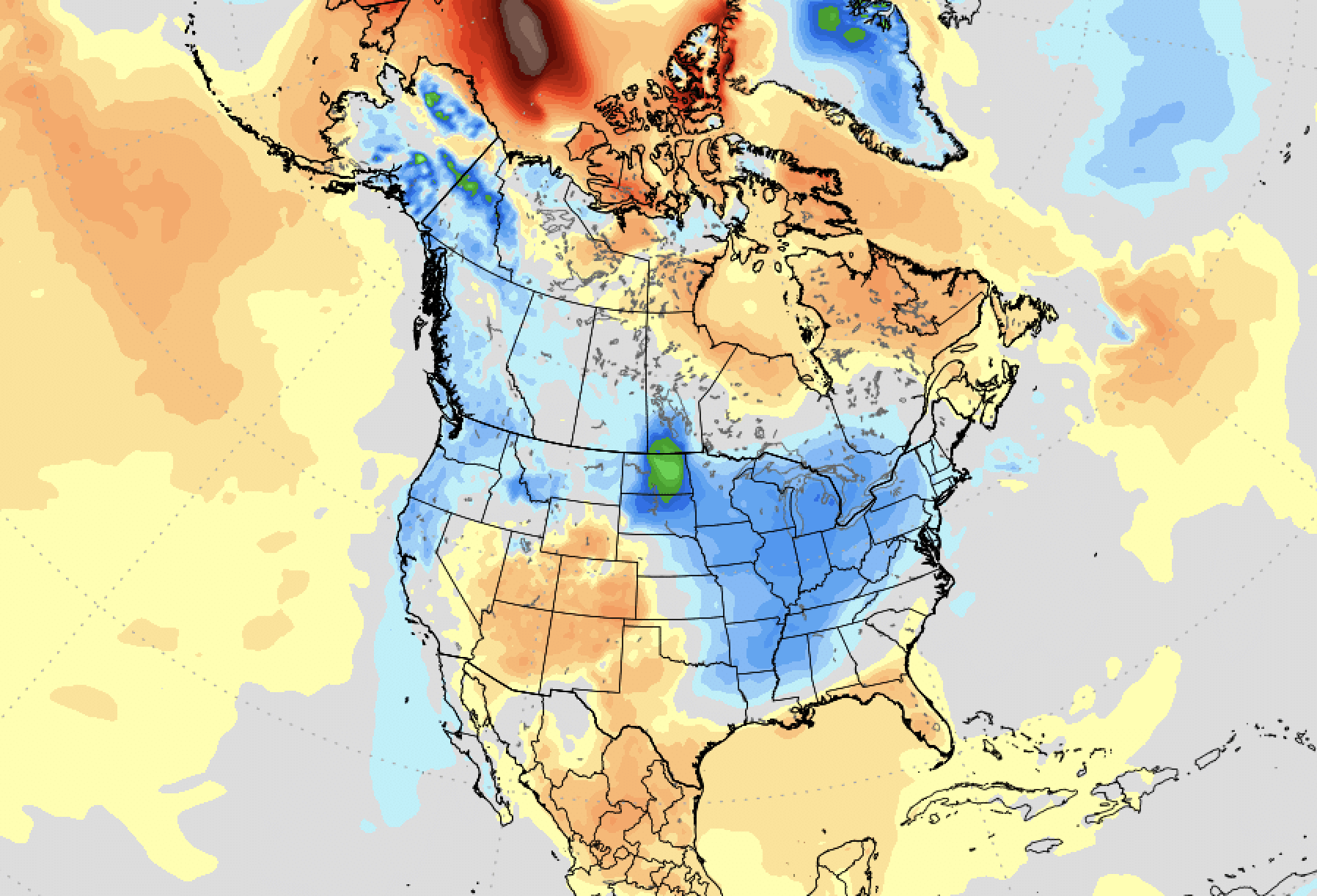
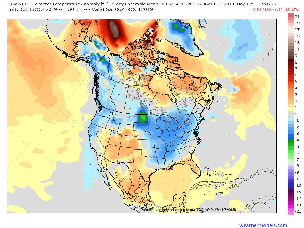
A look at the 5-day temperature anomaly forecast from the European model shows temperatures are likely to be above average for the period on the whole for the Four Corners states, with the cold air this week end up across the Northwest and Eastern United States:
By next weekend models start to diverge –– not only with themselves, but also between updates. We see a large system move into the Pacific Northwest late in the week, with a small feature out in front of it helping to cool us down Friday and Saturday. As it organizes over the Northern Rockies its eventual track will but what we'll be looking to solve over the coming days.
The modeling has been all over the place, laterally, and with that the variety of solutions for Colorado have ranged from a big early season snowstorm late next weekend to breezy but dry depending on the model and model run.
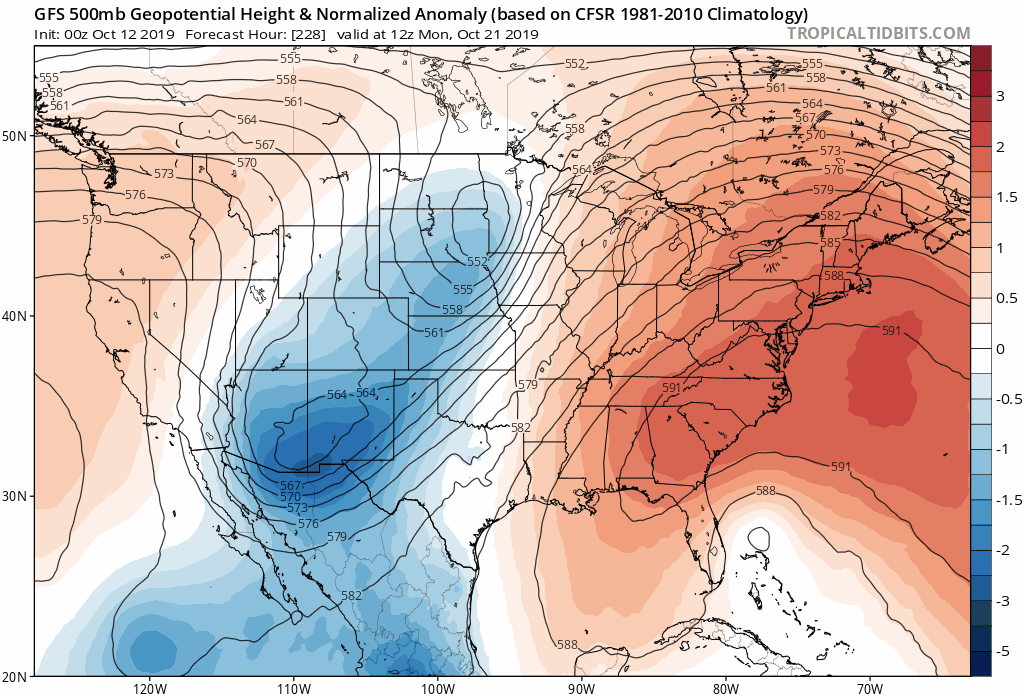
Take a look at the GFS 500mb forecast below. This is the last six model runs all valid for early next Monday morning. We see in some cases it swings the entire system through quickly. Another run splits the trough, some of the energy north, some south. And then this morning's run shows a strong cutoff low moving right through the "sweet spot" of eastern Colorado if you're in the mood for snow:
And no, it's not the just the GFS either.
Here's the Euro forecast for Sunday afternoon from its run last night:
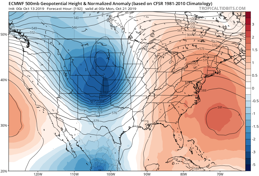
vs its forecast for the following Monday morning from its run yesterday:
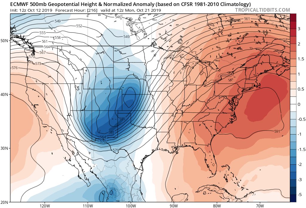
Both show a low that would have impacts on the state, but its run yesterday morning is notably further south with the track of the low, and would have greater impacts across the region.
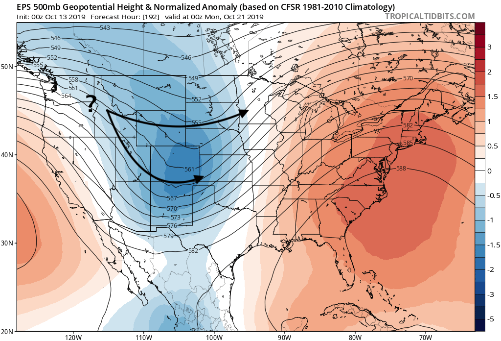
If we look at the ensemble mean, we see it shows a trough moving through next Sunday and Monday, but it's open and fairly progressive, indicating there's a lot of variety in the solutions. The question will be –– does it stay north and provide us with just a glancing blow late next weekend? Or does it dive southwest on approach, strengthen, and deliver a more impactful storm to Northern and Eastern Colorado to round out next weekend.
Of course we'll be tracking the latest all week here and on Weather5820 Insider. For now, enjoy some beautiful fall weather this week, and stay tuned!