GFS continues to paint widespread heavy snow across Northern Colorado on Friday, other data is less convincing

We continue to watch the forecast for Thursday night and Friday as our next system will bring snow first to the high country, then to the plains to end the week.
For the metro areas and plains this is a tricky setup, as we're likely to see banded snowfall deliver several inches in some locations and next to nothing a few miles down the road.
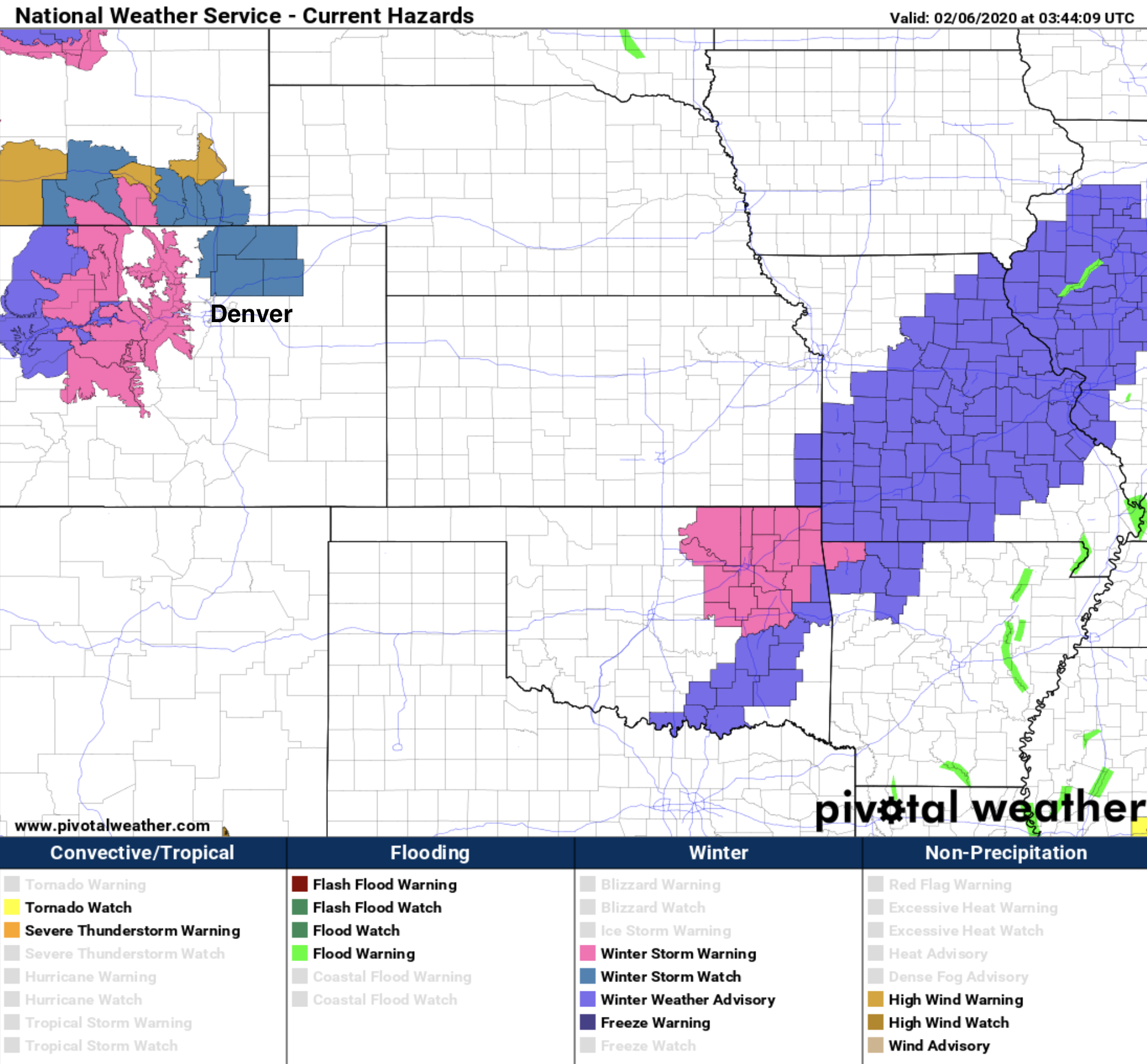
The National Weather Service has issued a Winter Storm Watch for areas north of Denver (including Loveland, Fort Collins, and Greeley) as this is the area favored to see this banded snowfall develop. Note that Denver is not in the watch area as of this posting Wednesday evening.

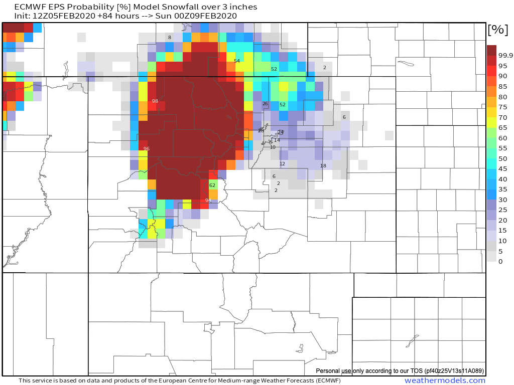
That said, confidence is low in the storm overall. The latest European ensemble forecast shows probabilities highest for 3" of snow or more in the watch area, but even those probabilities aren't all that high.
The GFS continues to go bananas, painting six to over twelve inches from Denver north through Fort Collins. Also, you can see how it tries to catch the bands of heavier snowfall that will extend from northwest to southeast across the region.
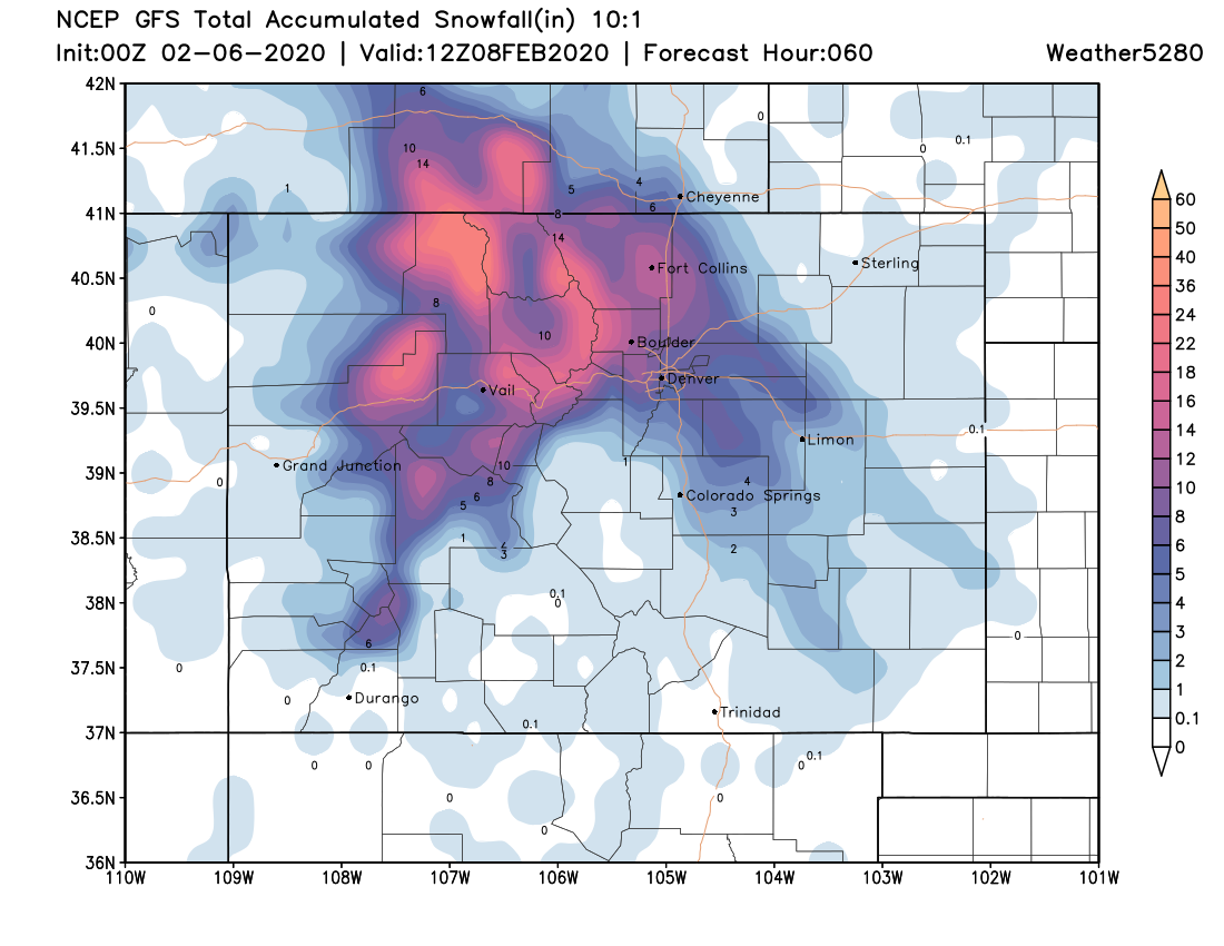
We think the coverage and likely totals are overdone by the GFS. Can these setups deliver a foot of snow? Sure -- but most other data isn't supporting that at this time, and such high totals likely wouldn't be so widespread.
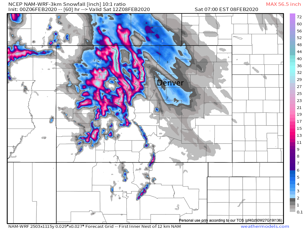
Take a look at how dramatically different the NAM looks:
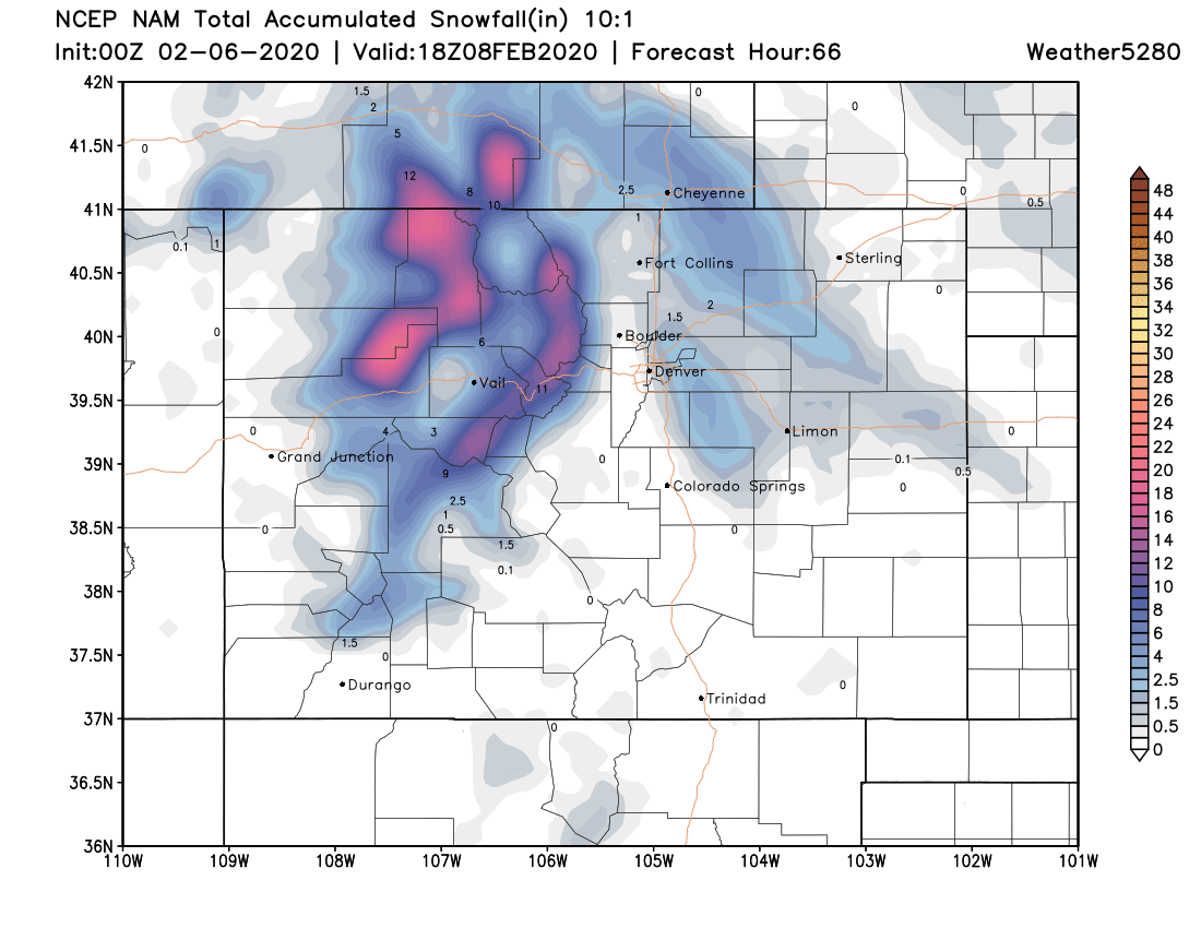
The highest-res NAM looks similar to the 12km gridded version, showing nicely the banded snowfall expected with this setup. It has a few pockets of 6"+ near Fort Collins, but not widespread.
For the Denver area hit-and-miss, but a signal that some of us could see several inches of snow, while others will be left out of this one. You'll also notice that both NAM products have heavier banded snowfall south/southeast of Denver –– meaning the Palmer Divide, like areas up north, may end up being the place to watch.
The disclaimer here is, and it is an important one: These types of events are VERY difficult to forecast. Narrow but high intensity snow bands will often times give us no clue where they will form until they do. So, the best thing to do is stay very current with the forecast and prepare accordingly. This is especially true if you live on the Palmer Divide, or along the northern Front Range.
The Watch makes sense up north with greater potential there, but how this eventually pans out just isn't clear yet.
What is clear, is that while not an impossibility... the GFS is a big outlier at this time.
More tomorrow.