Snow falling across Eastern Colorado, but marginal temperatures and February sun to dampen impacts

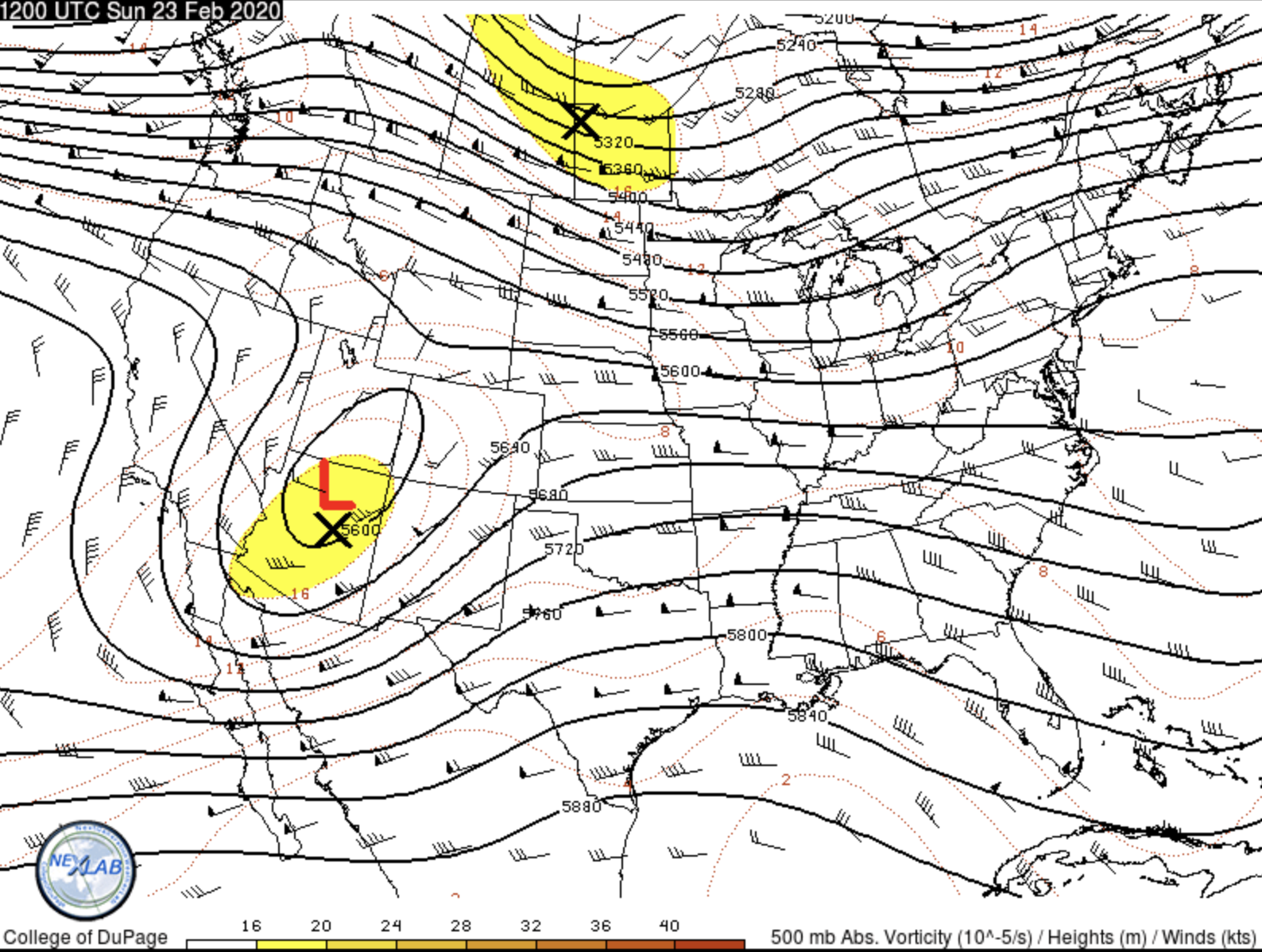
Everything's running about on schedule this morning as our upper level low begins its trek east across Southern Colorado, and our surface low establishes itself across Southeast Colorado through the afternoon.
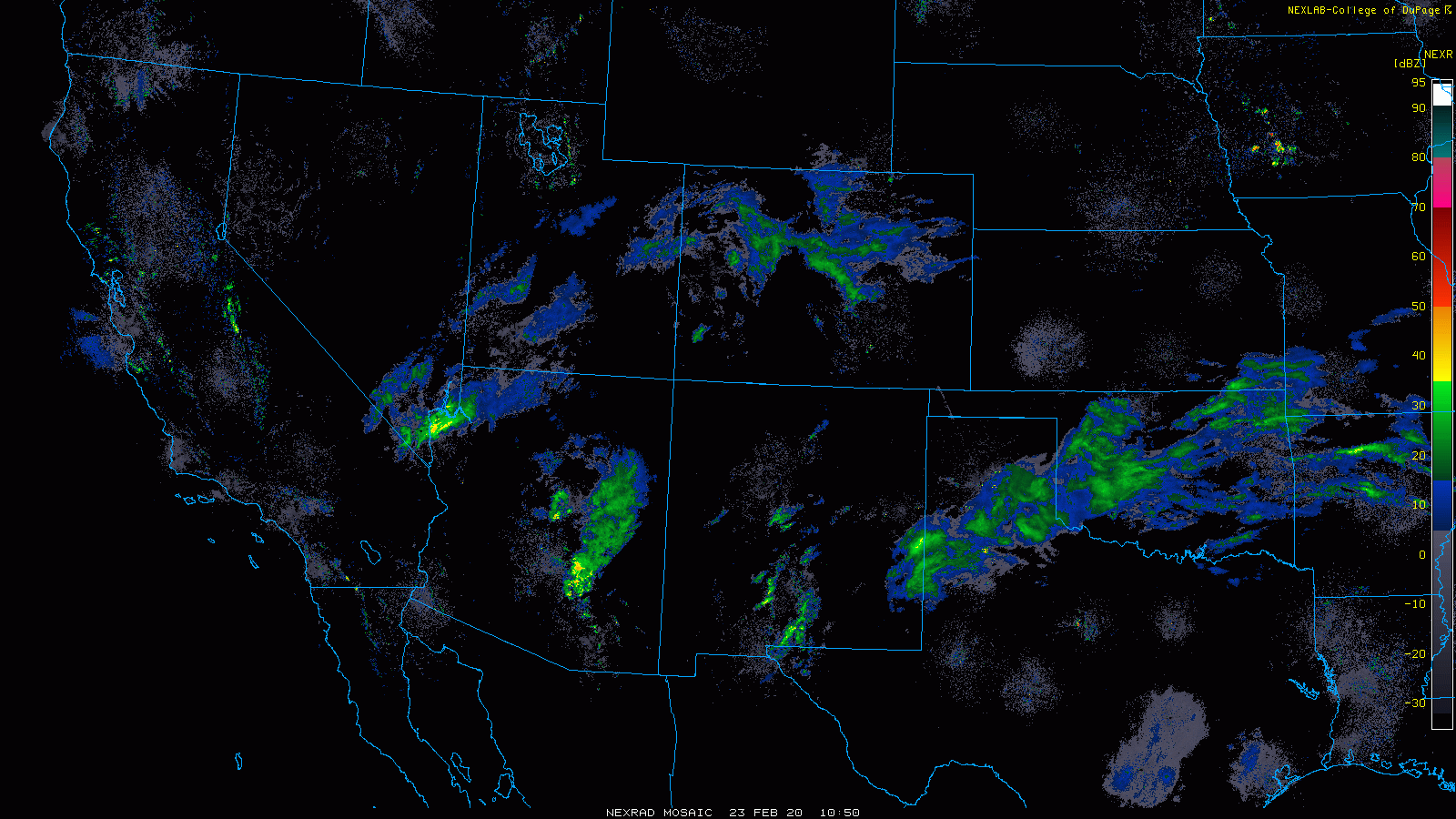
A look at radar this morning shows moisture pushing into East-Central and Northeast Colorado, with pockets of heavy snow across the Colorado Springs region, Palmer Divide, and greater Denver metro area. The bright greens in the animation below indicate the heaver precipitation rates.
Temperatures just aren't all that cold. In west Denver we're sitting at 33°F as of 9am. These (relatively) mild temperatures and the higher sun angle here in late February will likely keep accumulations at a minimum for many locations today. Already the coating to 1/2" we saw from this morning's heavier snow burst has largely melted.
As we discussed yesterday, this system is likely to end up well short of what another storm with a very similar track might produce. This is due to a number of contributing factors, but temperatures (well) into the 30s and daytime snow sure isn't helping.
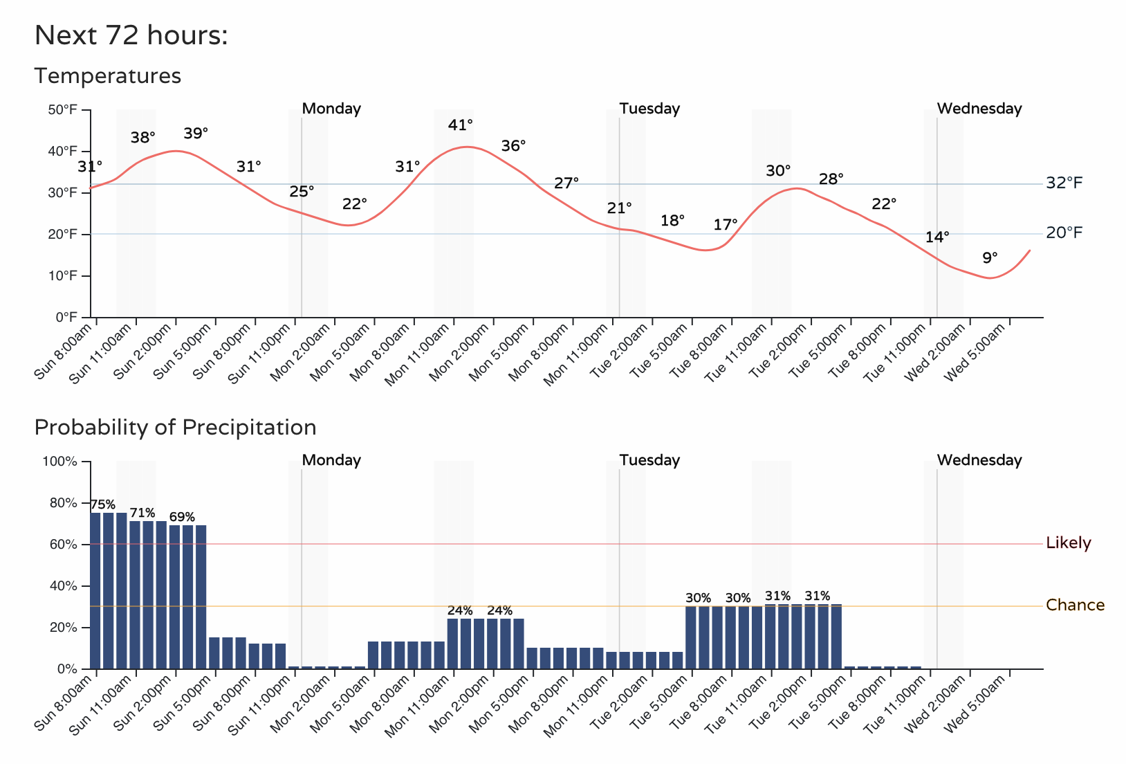
Here's a look at the latest hourly forecast for the Denver area:
With all that said, best way to qualify this system is likely as a "bust". For Denver and points north it probably technically won't be (we had a Trace for our low-end forecast), but still... not exactly one to write home about.
According to the latest high-res HRRR model, the real bust may be across portions of the Palmer Divide, where we may struggle in many locations to meet the low-end forecast range. This includes Colorado Springs if we are to believe this model:
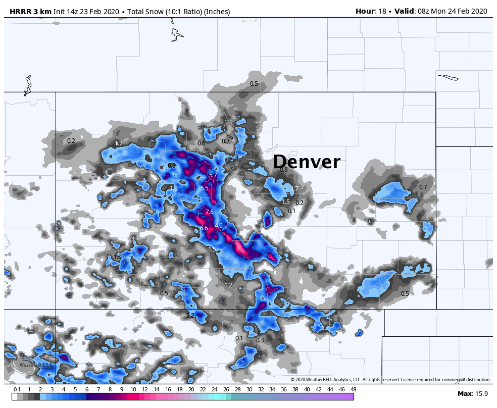
Not only does it not show a lot of accumulation for the Palmer Divide and Colorado Springs area, but it also dry slots a large portion of this region, with most of the moisture confined to the western portions of the Palmer and then across far eastern Colorado:
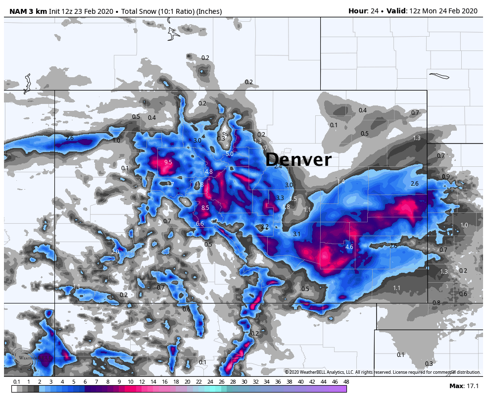
The high-res NAM remains far snowier, but given our temperature issues this is likely overdone. Still, a mix of the two models would suggest areas south of Denver could still have some snow to contend with through the remainder of the day, and at least pockets of poor visibility and snowpacked roads as the day progresses.
What's consistent across all models is that northern Colorado won't see much snow. Even this morning as some heavier bands of snow extend well north of Denver (not well captured by the high-res models), we expect most of these to be relatively short-lived, and thus the impacts overall on the low side.
Let us know how things shake out at your house! We're still tracking another wave set to drop out of the Northern Rockies following this system, but at this time it looks like it won't do much around here other than keep us chilly and unsettled to start the work week. As you saw in the timeline above, we'll see about a 20 to 30% chance of snow showers in the forecast both Monday and Tuesday before milder and quieter weather returns to the forecast for the remainder of the week.
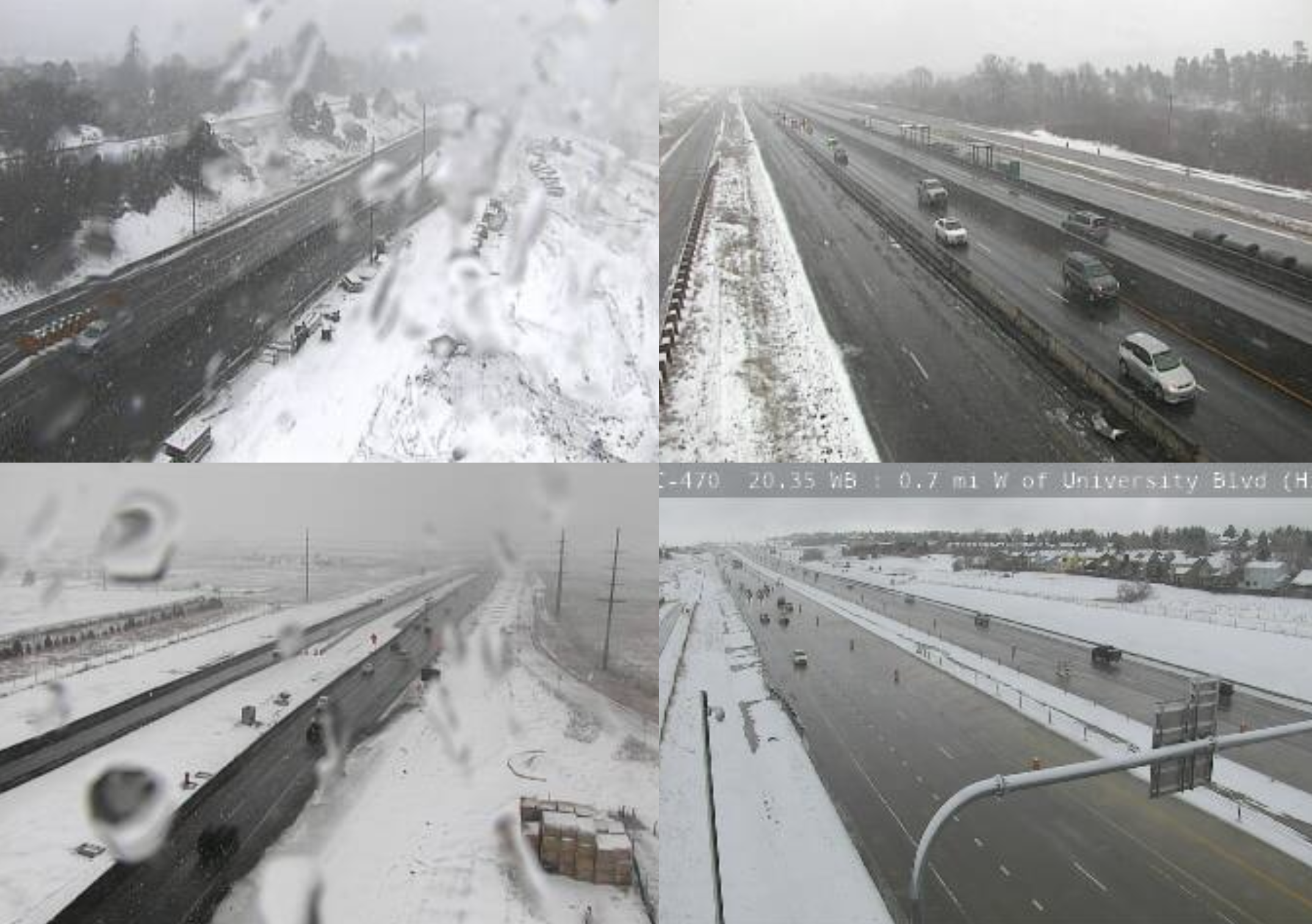
We'll leave you with a look at some snowy scenes across the southern metro area and Palmer Divide! Roads are holding up just fine so far, but another snowy, soggy, chilly February day across the region in what has been a very snowy month!