Snow squalls shut down parts of Colorado, more wind and snow on the way Tuesday

Snow squall warnings were issued across much of Colorado Monday morning as powerful, short-lived areas of intense snowfall and strong winds raced across the state.
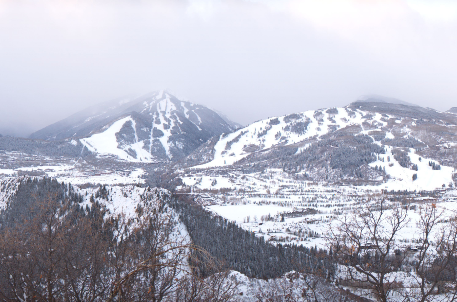
In Aspen, an incredible example of how quick these squalls move in, and just how heavy the snowfall can become in a matter of moments. The Aspen Roundshot cam captured the impressive snow squall that moved through just before 8am in stunning images:
7am

7:50am

8:30am

9:10am

This was the scene across much of the high country this morning, though these squalls were just confined to the hills. We saw snow squall warnings for Fort Collins and point east and southeast of the city, as well as for Colorado Springs this morning (this was the same squall that moved through Aspen a short time earlier). Across Eastern Colorado the snow didn't amount to much, but as the snow moved through the strong winds and near-zero visibility made for a tough commute in spots.
While snow showers continue across parts of the state this afternoon, all snow squall warnings have been canceled. We are also seeing resorts reopening lifts and buses, many of which had to close earlier today due to strong winds.
More wind and snow Tuesday
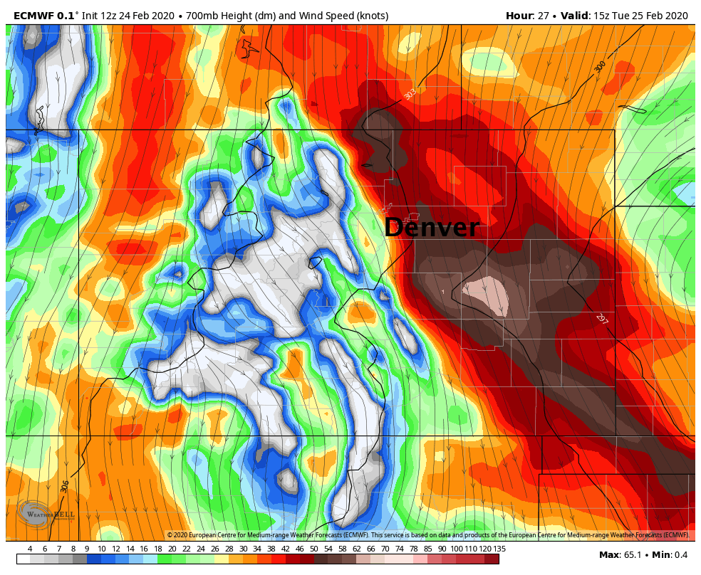
We aren't quite done with the snow or wind across the state. Late tonight and Tuesday will again feature some strong winds. The winds will be especially strong across parts of Eastern Colorado, with data indicating sustained winds to 40 mph across the Palmer Divide on Tuesday, and gusts to 60 mph across the far Eastern Plains.
The wind across the Plains will be rather persistent. The worst of that wind is expected to take place during the morning hours. The map below shows the strongest of the winds around 8am in reds/browns, with El Paso and Lincoln Counties likely seeing gusts in excess of 55 mph:

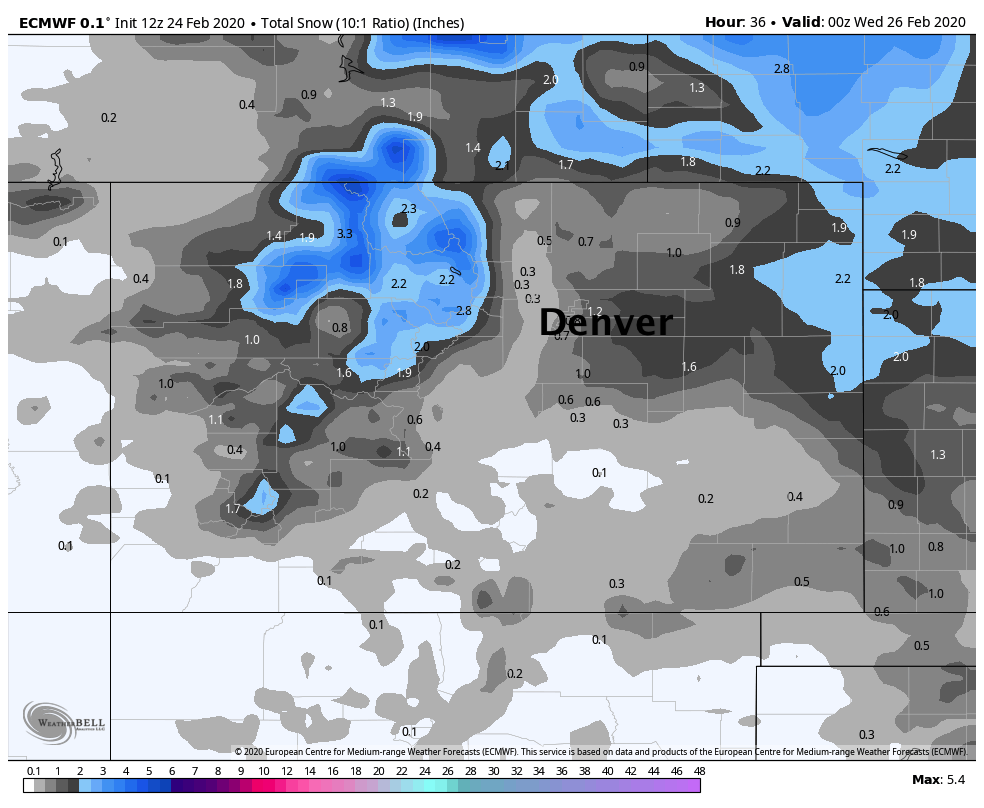
Snow totals may not be all that impressive, and not everyone will see that snow. Still, a dusting to 3" will be possible close to the urban corridor, with up to 4" possible for the far Eastern Plains. For the far Eastern Plains a Winter Weather Advisory is in effect from 5am Tuesday to 5pm Tuesday. Again, for those that do see some snow, when combined with the cold and wind will –– this make for a rather raw and unpleasant Tuesday.
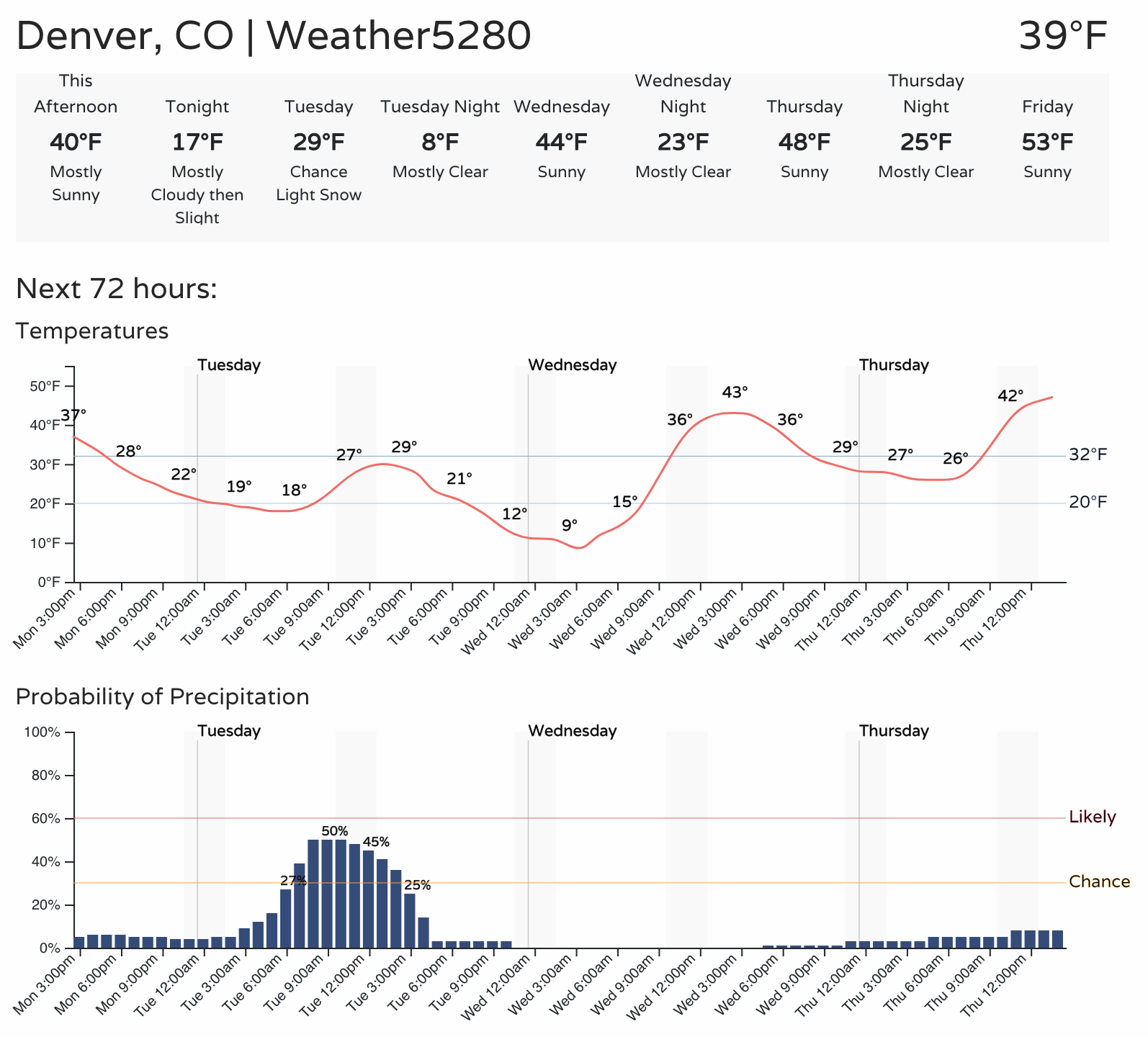
For Denver this will equate to about a 50% chance of snow showers on Tuesday. For Fort Collins we're looking at about a 40% chance, and Colorado Springs a 30% chance. Temperatures will be chilly too, with highs topping out in the upper 20s to near freezing across Northeast and East-Central Colorado on Tuesday. Accumulation across the cities is expected to be on the low side (if at all), but brief heavy snow showers cannot be ruled out.

The Euro model shows some accumulation will be possible, mainly east of the urban corridor and across the Palmer Divide. Again, not huge totals, but when factored with the cold and wind... we could see some impacts in spots. These totals are considering a snow/liquid ratio of 10:1, with the cold air these totals could be a bit higher than indicated in this map.

Conditions improve across the state as we head into the middle of the week, with our next system set to arrive late in the weekend.
