Snowfall totals as storm departs, and warming up for the remainder of the week!

The biggest issue with yesterday's forecast is the band of heaviest snowfall ended up about 30 miles south of where we thought the highest probability of its occurrence would be. Otherwise, things went about as expected –– timing and totals were spot on.
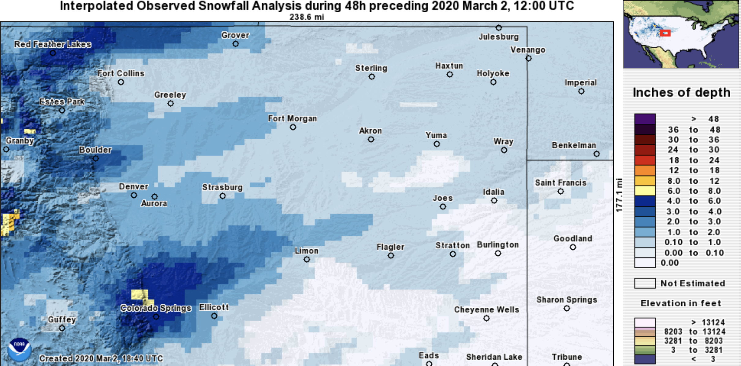
The heaviest snow band was indeed able to produce totals of 4 - 7" as we expected it would, it just ended up over the south side of the Palmer Divide and Colorado Springs metro area instead of up north. Where we didn't see the more persistent heavier snow, our 1 - 4" range worked just fine, with a few areas seeing even less than that.
Our station ended up with 1.75", located in Denver West. Stapleton picked up 1.5" of snow, and Denver International Airport (official Denver tally) came in under an inch.
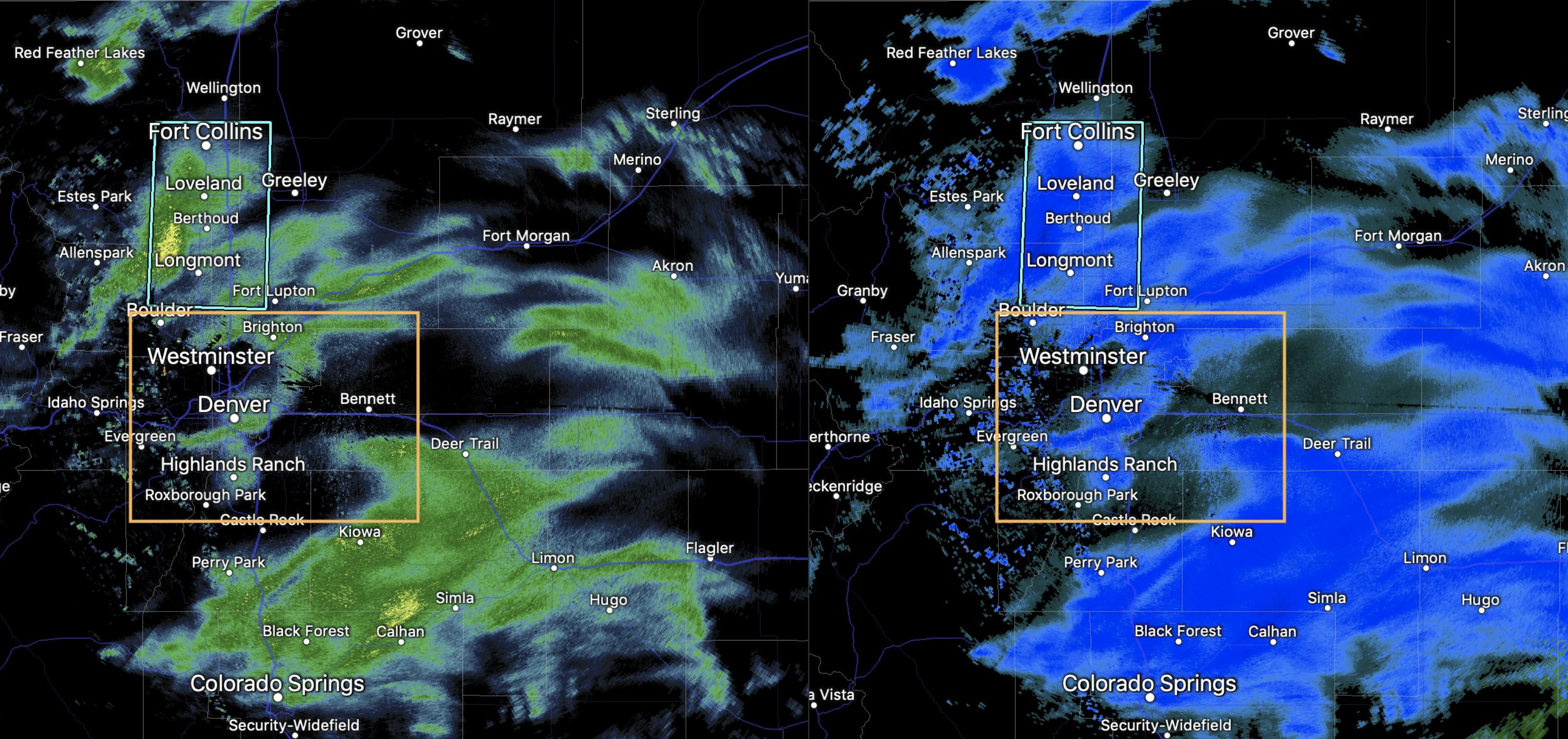
While we see brief heavy snow in Denver, and even a Snow Squall Warning up north of the city, you can see how the heaviest bands of snow largely evaded our yellow box of where to watch for those heavier totals. The short term, high-resolution models did pick up on this through the course of the day Sunday, but well after our update in the morning. Here's the radar from around 9:30 pm last night, with the approximate zone we had targeted for the best "boom" potential:
Latest interpolated snowfall totals this morning show where the heaviest snow ended up –– a few miles south of our zone, with a couple of nice bands up north as well:
Warming up!
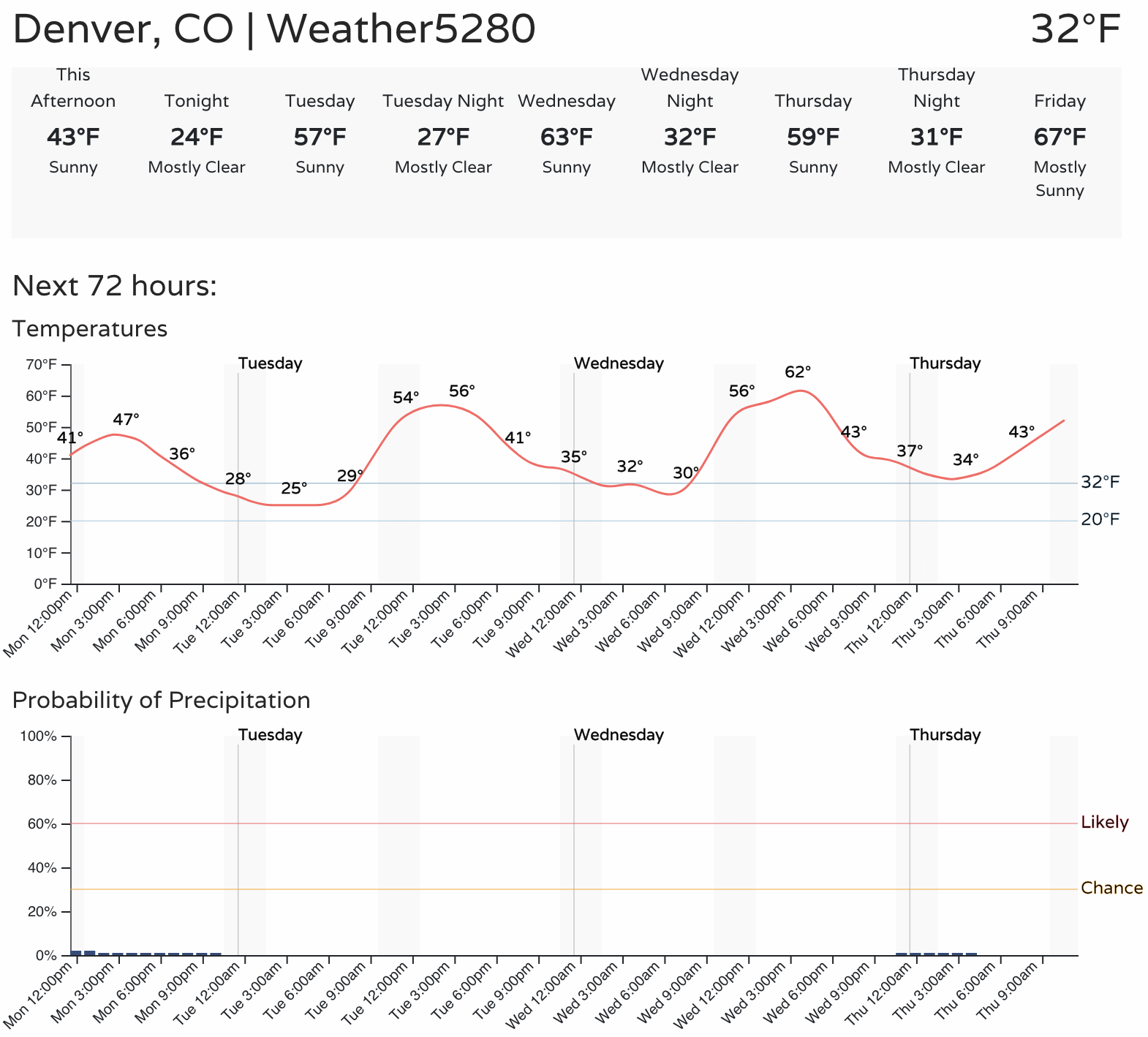
While March is Denver's snowiest month on average, and while it did snow last night... no, the start of March largely won't be picking up where February left off. Instead, we see a good warming trend for the remainder of the week, with several afternoons forecast to be well into the 60s over the next seven days for Denver.
A look at the latest forecast shows temperatures topping out in the mid-40s today, mid-50s on Tuesday, and climbing into the low 60s for Wednesday. It could be that we'll be approaching the 70-degree mark by Friday afternoon and a brief cool down on Thursday:
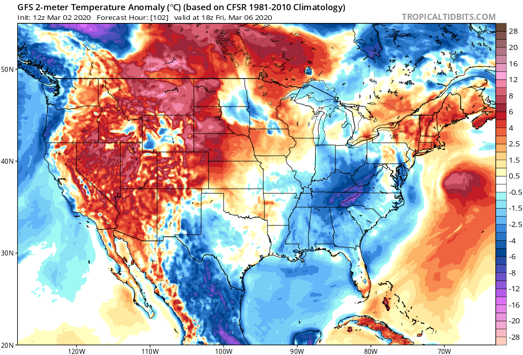
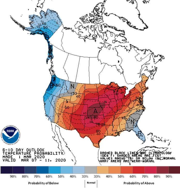
The mild weather will spill into next week as well, with temperatures overall expected to run warmer than average across a good portion of the country days 6 - 11:
Enjoy the warmup; it's been a while. We'll keep an eye on the skies and see if we see any signs of a perfect March storm as we head deeper into the month.