The State of the Atmosphere: Sunday, March 8th, 2020

The warmth that has come with March will continue for much of the workweek, and as far as moisture, we are watching for the potential for some to arrive late in the week.
For the first week of March, temperatures were warmer than average other than on the first. The first is also the only recorded precipitation for the week, and that was only 0.03" at Denver International Airport where official records are kept.
The warmer and drier pattern of March is clearly different than what the area had in February. A few days ago Becky Bolinger posted some really interesting stats about the February snow. In case you missed it: How February snows have helped shape Colorado's 2019 - 2020 snow season.
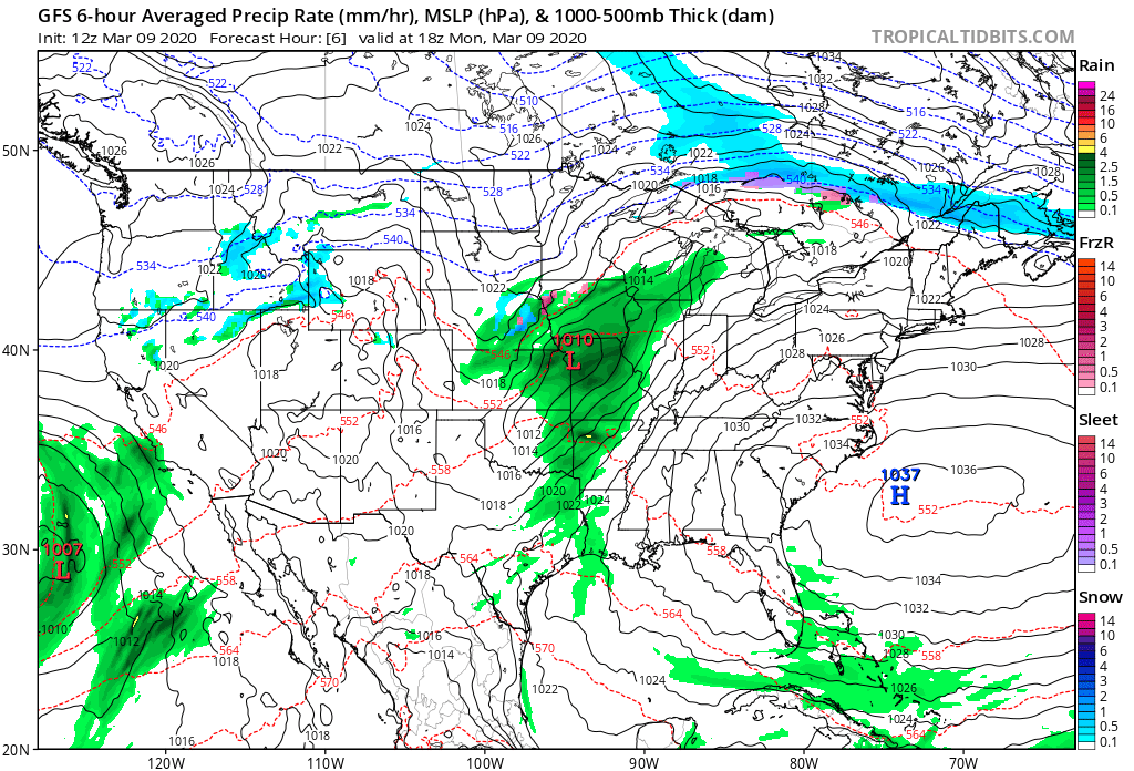
Sunday and Monday may have some areas of rain and snow for the metro locations (we discussed this in Saturday's forecast discussion), but it is later in the week before we see a stronger system that will be more interesting to watch play out and that's what we will focus on in this SOTA.
Later this week we will be watching the storm system shown here, a low that develops from southern California toward New Mexico before passing through Colorado as a trough.
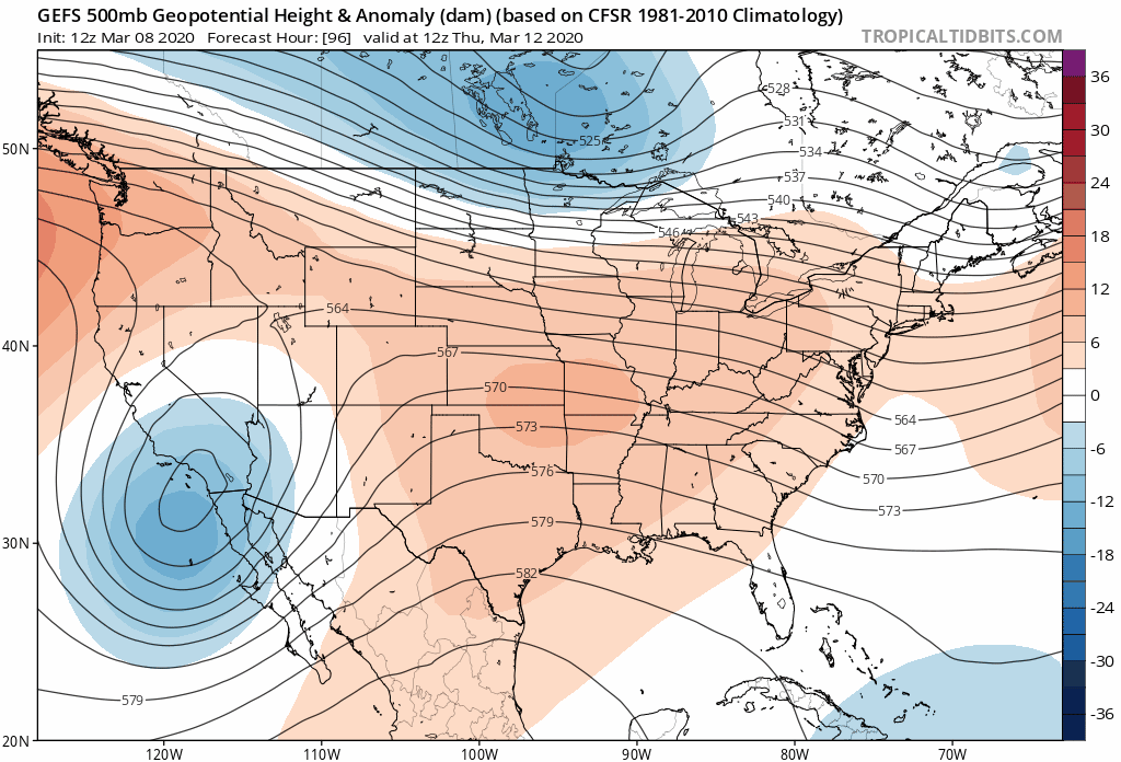
That system is depicted differently in models, differences are in the strength and position. There had been some timing differences but those appear to have become more consistent as of this post.
Friday will be the day to see that system slide overhead, lingering into Saturday (yes, that's the St Patty's Parade in Denver...ahem).
This system will be carrying tropical moisture with it and where it ultimately treks it will spread some valuable moisture.
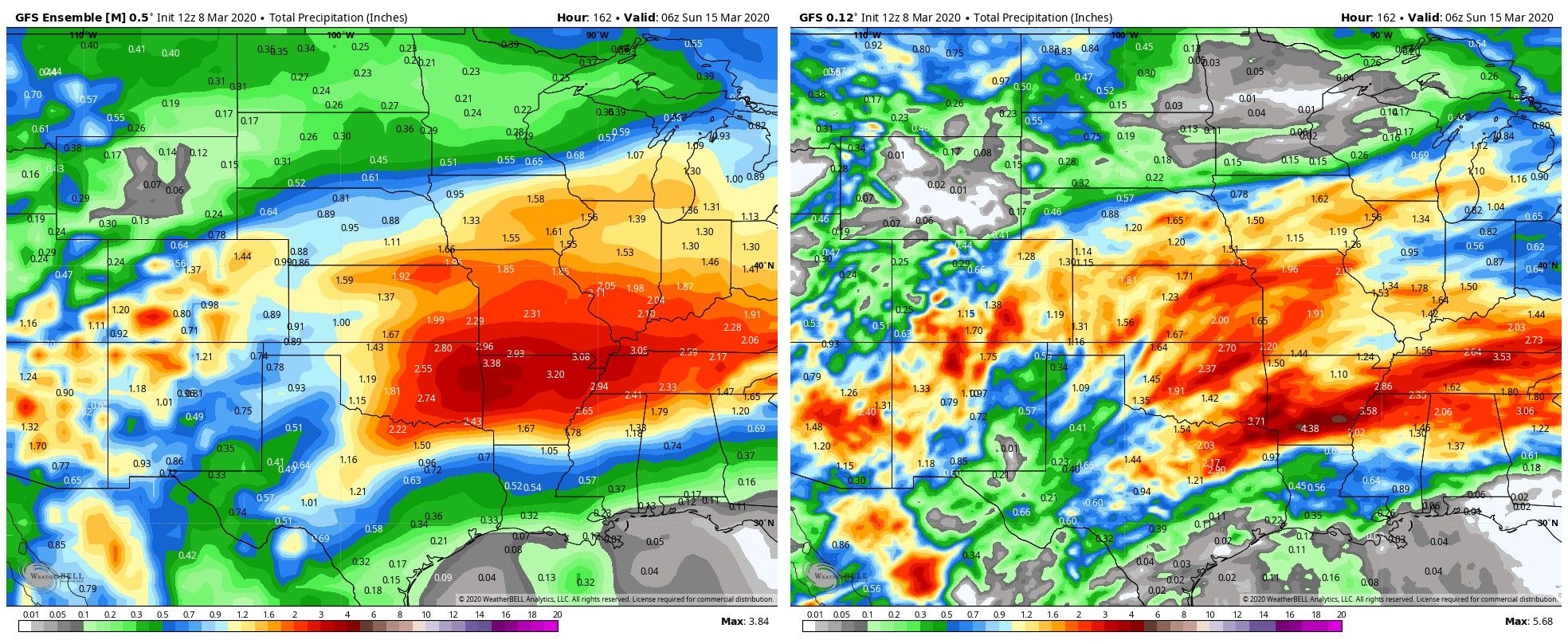
For an example in the current inconsistency per location and strength, let us look at two global models and their ensembles for the total precipitation.
First, the American GFS:
Second, the ECMWF:
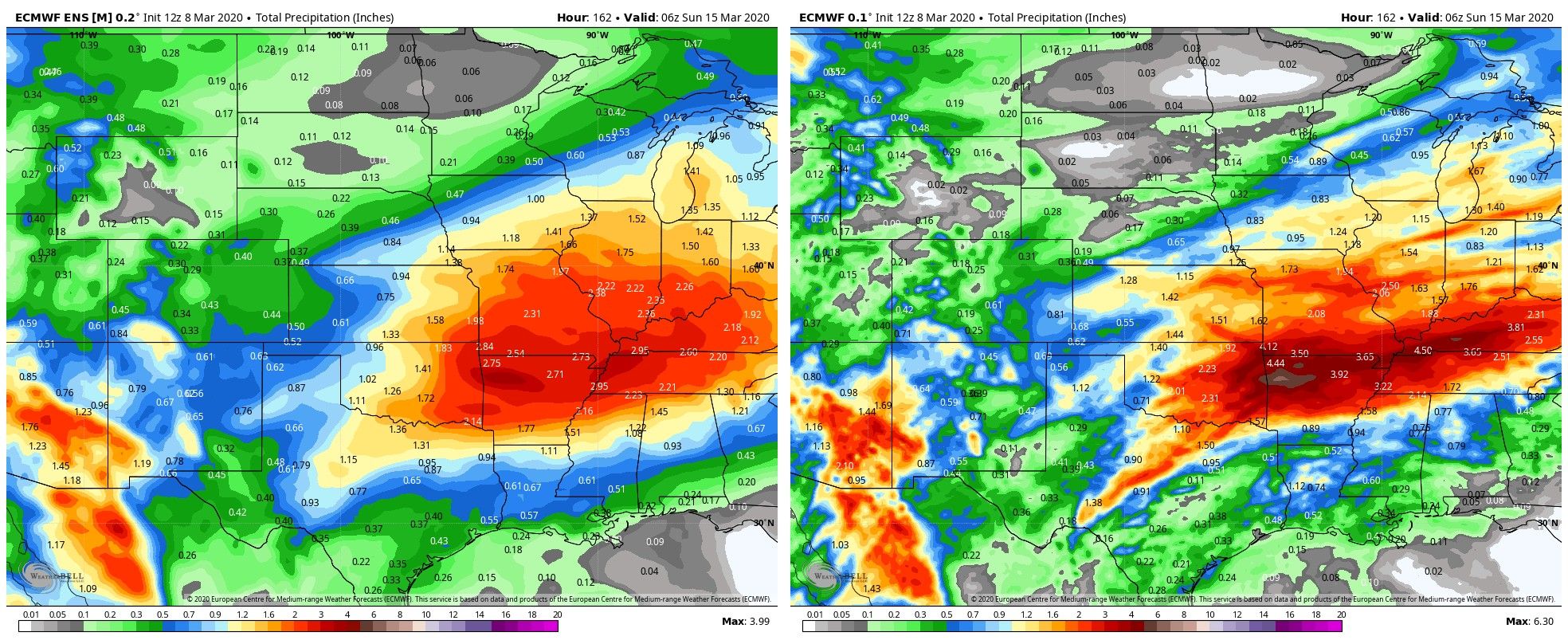
Note how wildly different the precipitation totals are for Colorado between the two model systems. Yet, there is a more consistent message that folks to the south and east of Colorado will have quite a lot of water headed their way.
So, between the two which is the better-looking solution? We are currently in an ocean-atmosphere teleconnection pattern driven by the region in the northern Pacific that is in a negative phase. That will favor a more southern impact, ala that ECMWF model. In March, Colorado typically needs that teleconnection to swing from a negative to positive phase (or at least trend less negative than it currently is) to bring moisture here. We aren't currently anticipating such a change. The current PNA forecast is quite negative through the next 10 days from the European model:
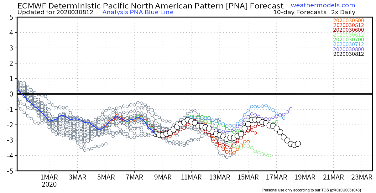
Second, analogous years have also favored the ECMWF solution. Similar weather patterns have spread the heaviest precipitation south and east of Colorado more often than bringing the heavier stuff to Colorado.
Both solutions remain on the table, however, the probabilities favor a southern storm impact. With that said, we still have valuable moisture coming to Colorado later this week, and unless we see a change in the trend overall, and perhaps a more favorable teleconnection outlook, the greatest benefactor for that moisture will be Southern Colorado. The extent of that benefit in ultimate rain/snow totals is to be determined.
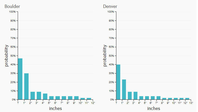
For Denver and Boulder, we continue to see a wide range in possible impacts, for example, the amount of snow shows quite a spread in our Insider access Gamblers Data. This data will offer a clearer picture as we get closer and that storm track becomes more reliably forecast.
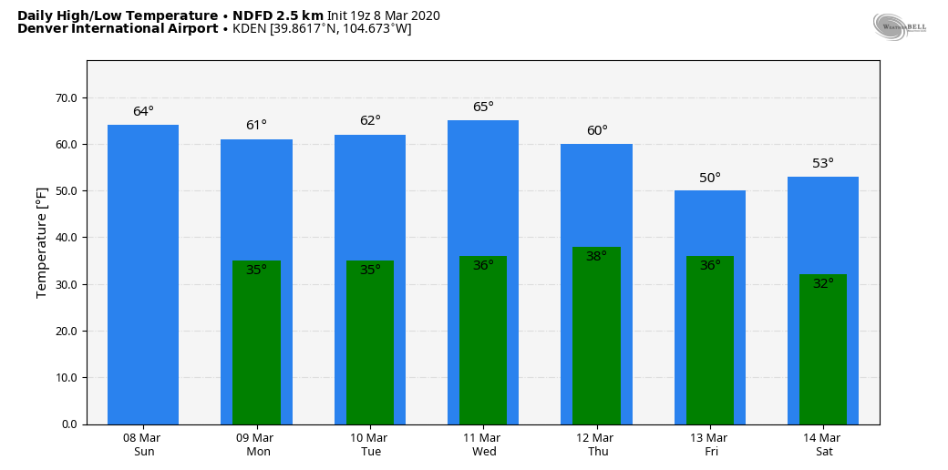
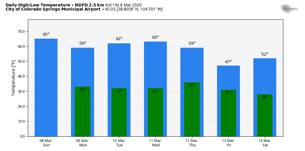
We haven't talked much about temperatures for the coming week as there isn't a big deviation from the warmer than average conditions so far in March.
Here are daily highs and lows for a few locations up and down the Front Range.
The ultimate storm track is to be seen, obviously, and we will post more on this system in the days to come.
Impacts will vary in total precipitation, as discussed, and possible temperature impacts that will be larger than shown here as we see exactly where this system is headed. So, put Friday on your 'radar' as a possible impact day.
Weather5280 articles of interest this week:
How February snows have helped shape Colorado's 2019 - 2020 snow season
La Niña potential later this year
Outlook for March 2020, a bias toward warmer and drier weather for Eastern Colorado