Thursday AM update: Rain and snow across much of Colorado on Friday, won't amount to much for the Denver area

As we've discussed both in our SOTA this week and midweek Insider update, tomorrow brings our next chance of rain and snow to the state, with some slushy accumulation possible for some across Eastern Colorado.
While it does look like we'll see snow on Friday (perhaps some rain too) in Denver, the chance it accumulates looks low. Tonight some freezing drizzle could work to put some ice down on raised surfaces for your morning commute, so something to watch. For snow, perhaps we see some accumulation on colder surfaces depending on how heavy it comes down on Friday, but air temperatures will be quite mild and the best chance for precipitation comes during the daytime hours.
Down south that could be a bit different, where temperatures will run a few degrees cooler an we may see a bit longer snowfall duration. Still, the mild (relative) temperatures will likely limit totals across the Colorado Springs area as well.
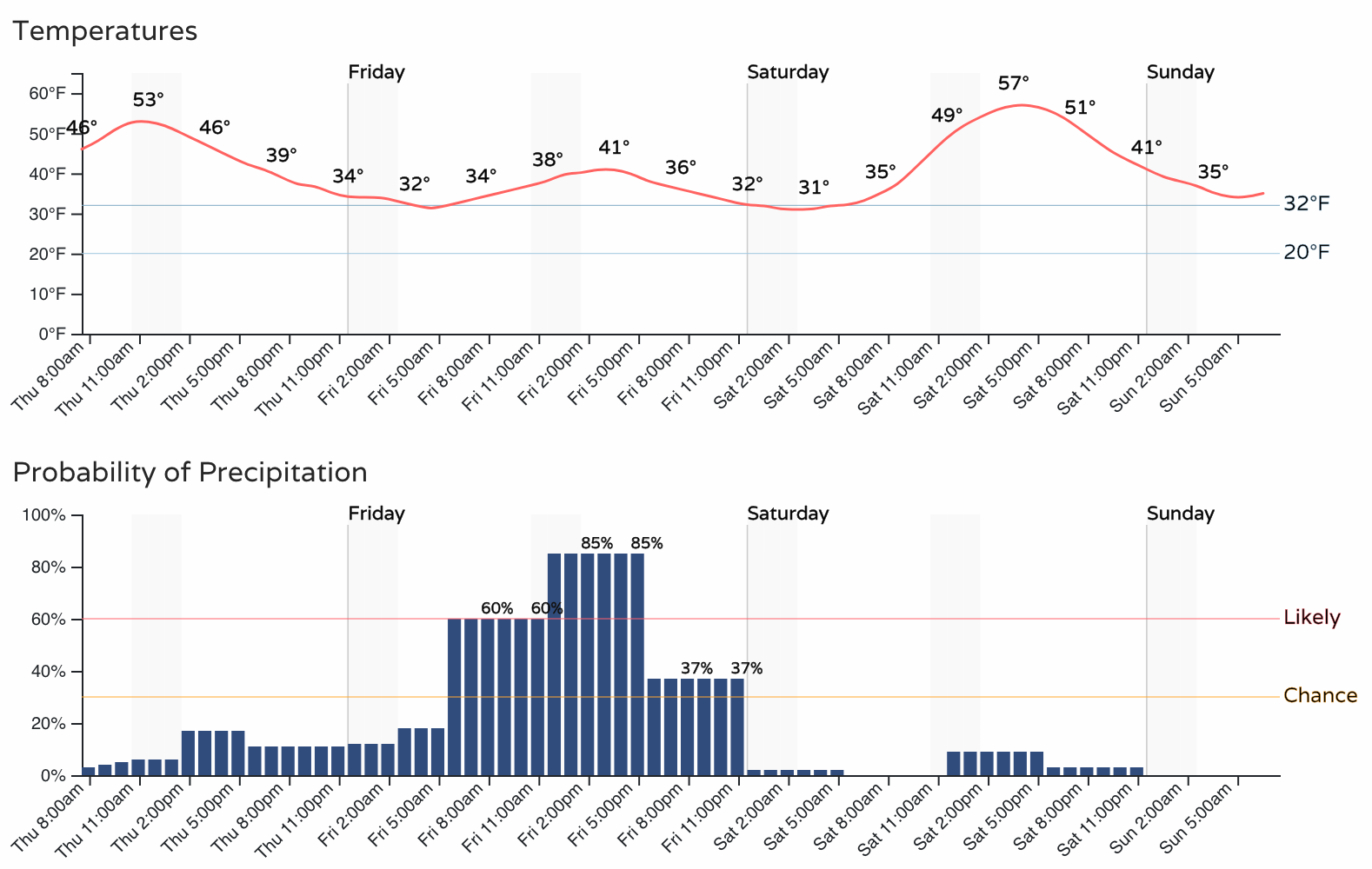
If we look at the hourly outlook for Denver we see temperatures in the upper 30s and low 40s during the best chance of precipitation on Friday:
While Colorado Springs sees both a better chance of precipitation overall, and temperatures about 5 to 8 degrees colder:
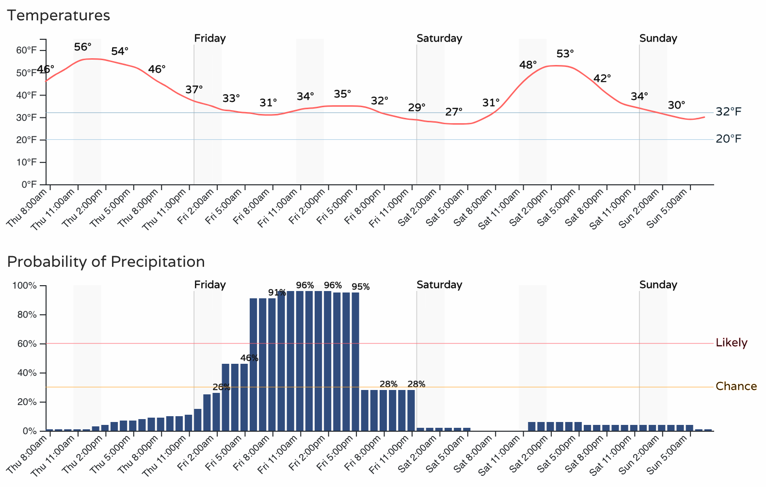
Still, not all that cold. If most of this comes through during the day and does not spill into the evening hours the impacts on the roads should be minimal for most locales. IF snow lingers into the evening hours we could see some icing/slush on the roadways Friday evening in some areas.
As for how much snow? Hard to say given the temperature issues. For the Denver/Boulder/Fort Collins area we are thinking little to no accumulation. If we see some it would likely be in the form of slush on some grassy areas and cars. Again, most models keep us 1) too warm, and 2) drier than most other areas of the state on Friday.
For Colorado Springs a Trace to 4" seems possible. The high side if we can cool enough/things spill into the evening, the low side if the bulk of this comes through midday. This includes all of El Paso county running along the south side of the Palmer Divide.
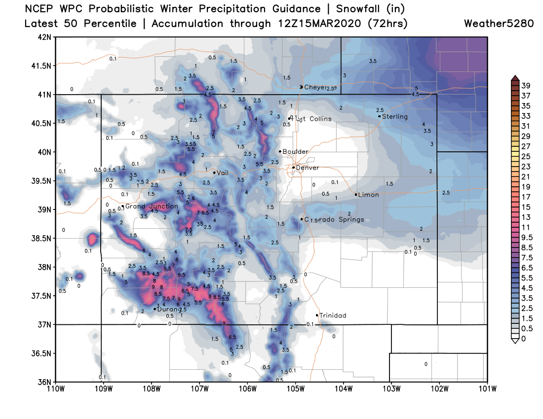
Finally, a Winter Storm Watch is in effect for southwest Nebraska. You can see in the map below some heavy totals will be possible here. Some of that may spill into far Northeast Colorado, so if your travel plans take you northeast along I-76 then to I-80 across Nebraska plan on winter travel conditions or delay your trip until Sunday. The Watch goes into effect Friday evening and continues through the day Saturday.
Below is a good idea of the snowfall potential Friday and Saturday. A great round of snow on the way for the Southwest mountains, and they need it!

The system exists the urban corridor Friday night and we'll see a quick recovery to those temperatures. Saturday's highs will be back in near 60F for Denver, with the mid 60s possible by Monday!