
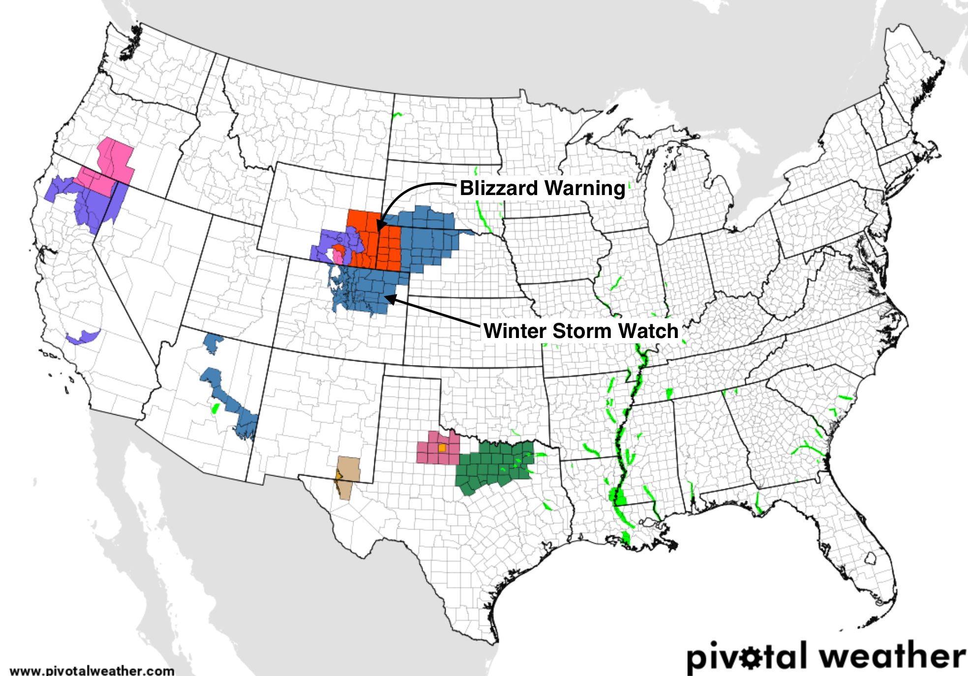
Winter Storm Watch posted for Northeast Colorado: Forecast update

We continue to track a weather maker due to impact our weather Wednesday evening through Thursday night. It's likely that we'll see both rain and snow with this event, along with gusty winds and reduced visibility at times across Northeast and East-Central Colorado.
In anticipation of rain changing to snow on Thursday, the National Weather Service has issued a Winter Storm Watch for Northeast Colorado, where several inches will be possible –– especially at elevations west of I-25, and across the south/southeast Denver metro area.
The Watch goes into effect Thursday morning and expires late Thursday night. It includes the cities of Castle Rock, Denver, Boulder, Loveland, Fort Collins, Greeley, Sterling, and Limon.
From the NWS:
- WHERE...Portions of east central, north central and northeast
Colorado.
- WHEN...From Thursday morning through late Thursday night.
- IMPACTS...Plan on slippery road conditions. Patchy blowing
snow could significantly reduce visibility. The hazardous
conditions could impact the evening commute.
While most of us may in fact not be commuting Thursday evening, this is when the heaviest snow may be falling, along with those gusty winds. If you must travel Thursday, plan on adverse conditions, and better yet, in case you needed another reason... stay home!
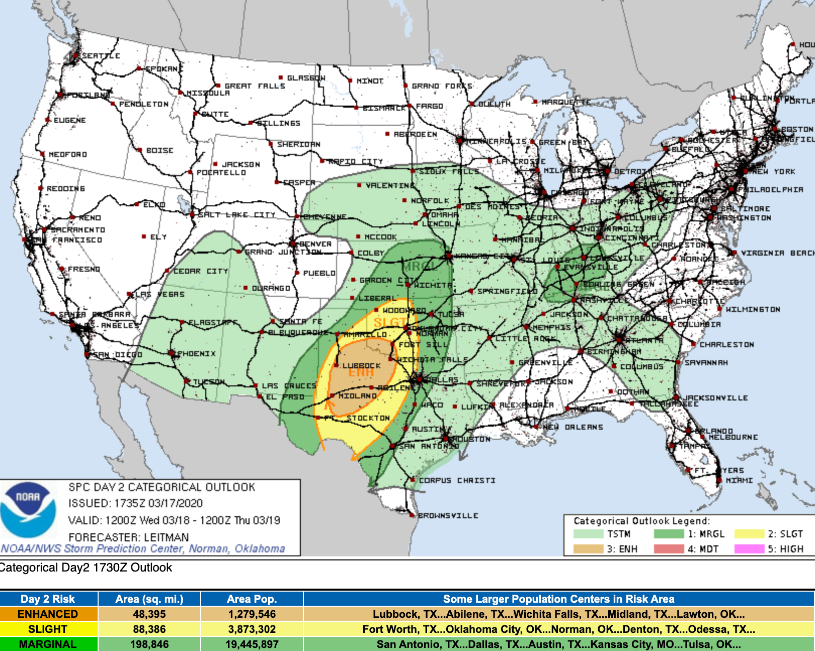
Severe side
To the southeast we'll see severe weather as this system moves through over the coming days. Tomorrow there will be an enhanced threat of severe storms across Central Texas:
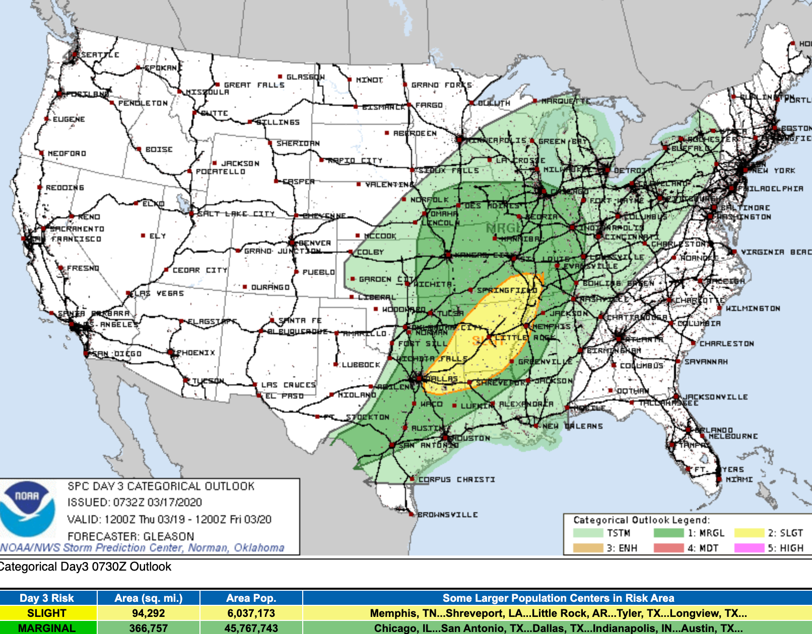
On Thursday that threat slides east:
Soggy storm
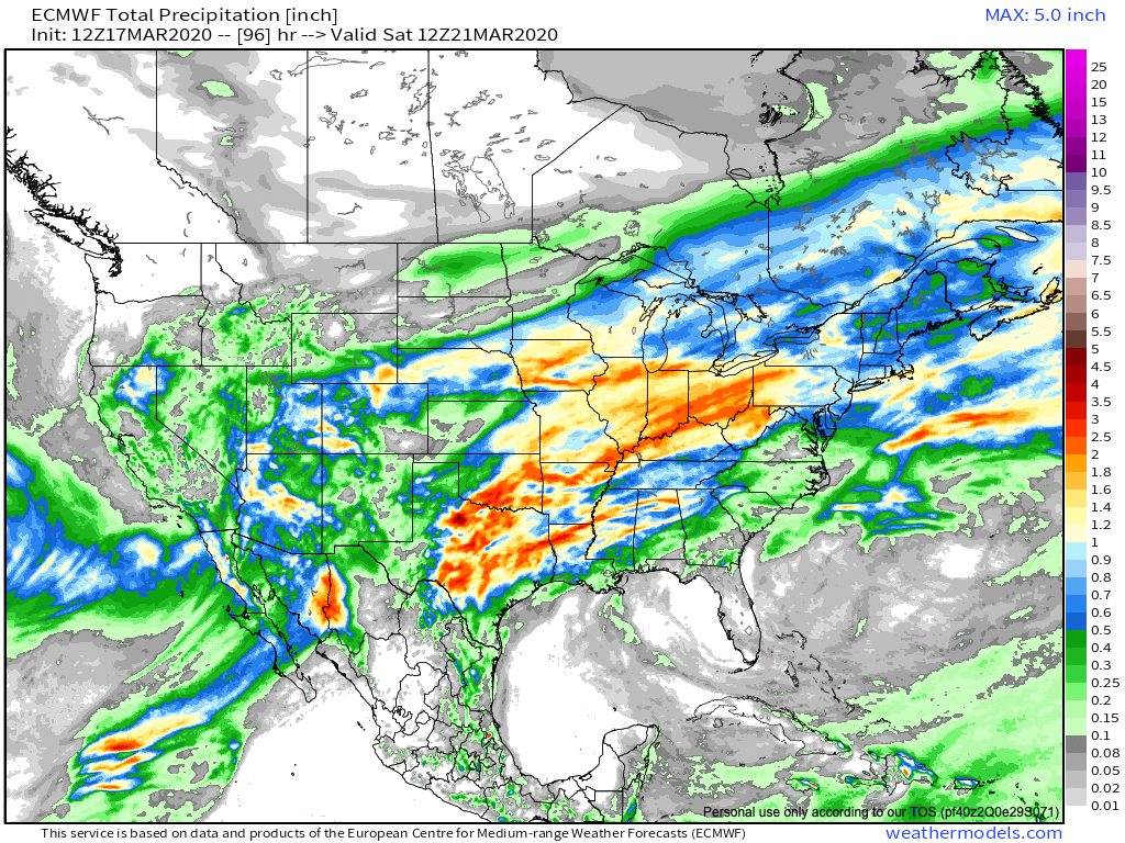
While QPF totals for our area have come down a bit from yesterday, deep upslope could mean some pretty good liquid totals for the Front Range.
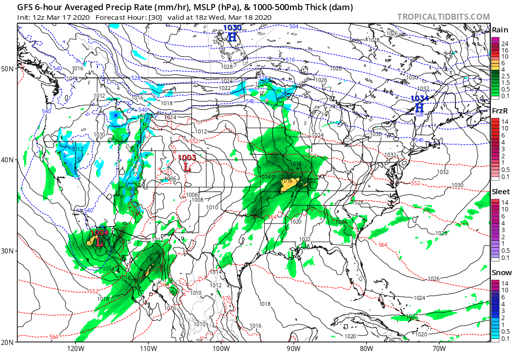
This system will pull a lot of moisture through Texas and the Central Plains as well, with a notable dry slot for Southeast Colorado in the latest guidance. Much of central Texas will see a lot of water in the coming days, in addition to the severe threat.
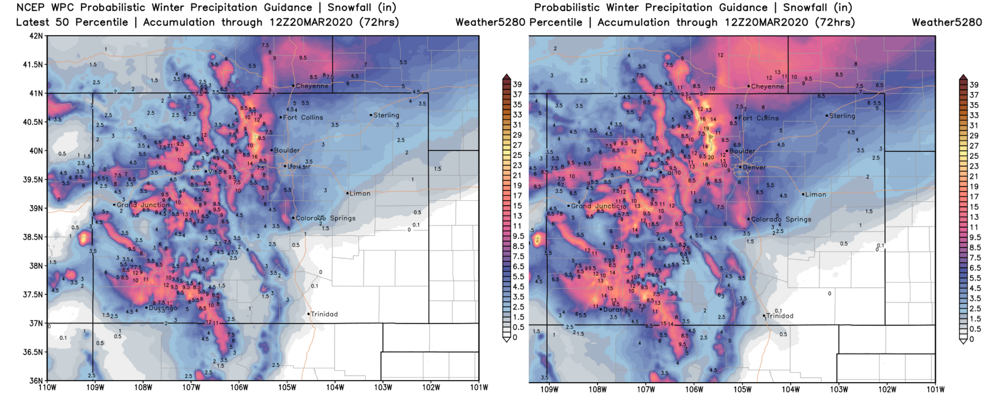
How much snow?
The Watch calls for 3 - 7" for the greater Denver metro area. We don't see much issue with this. Still some time for things to change –– with important items to watch:
- When will changeover to snow occur?
- How fast will this move east?
- Will central states "rob" our moisture?
- Does track wobble (north or south)
As for opening bids? Somewhere between the following seems pretty good. Lower end (warmer and or drier) we see 1 - 3" across the Plains, with 2 - 6" for areas along/west of I-25. If things line up right we add 3 - 4" to both of those ranges. For its part, the trusty European mean currently has 6 - 7" of snow for the entire urban corridor.
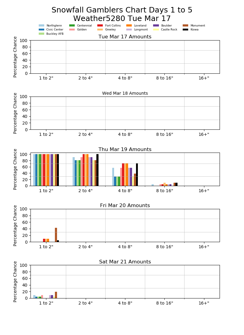
As for our gamblers, greatest odds across the board remain in the 2 - 4" range, though still a pretty good signal for some 4 - 8" totals as well, with a "boom" possible, but far less likely:
What about wind?
As of right now, the strongest wind with this storm will be between 6 AM and 4 PM. Gusts over 40 mph look pretty likely, and will possibly lead to blizzard conditions for those that see the better snow. Areas along the Palmer Divide and along the I-70 Corridor immediately east of Denver seem to be most at risk for this scenario. Still quite a bit to pin down though, so stay tuned...