End of week storm will bring another round of rain and snow to Colorado

After another mild afternoon Thursday, a cool down and a chance of rain and snow return to the forecast for Northeast Colorado to end the week.
While at the moment it doesn't look like it'll deliver nearly as much snow to most areas as last week's storm, it's not to be completely written off just yet either.
Most guidance has the heaviest precipitation well east of the urban corridor, with perhaps some sneaky snowfall across the Front Range foothills and Palmer Divide on Friday and Friday night. For the urban corridor, a lower probability for both appreciable moisture and snow at this time, but let's keep an eye on things in case that changes.
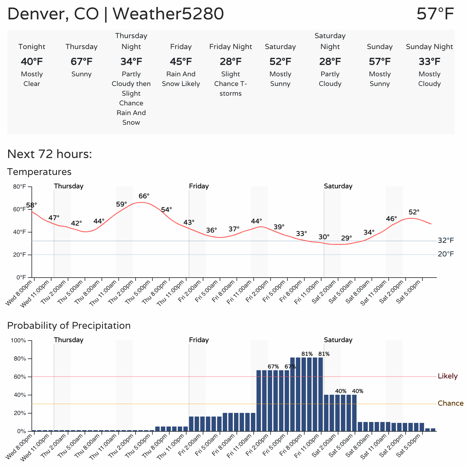
Even if we don't see the heaviest rain or snow, we are likely to see showers from Thursday night through Friday night across the greater Denver area. The hourly planner shows highs topping out in the mid 60s Thursday, followed by highs in the 40s on Friday with that rain and snow:
The European operational and ensemble models are the wettest, with the NAM thus far running much drier overall. The Euro ensemble probabilities did very well with last week's system, so perhaps a good measure to lean on this time around as well.
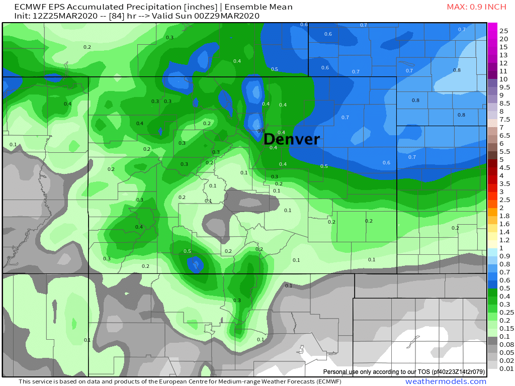
For its mean precipitation forecast we see totals from 0.4 to 0.7" across Northeast Colorado. The heaviest across the northern foothills and Eastern Plains, with a respectable helping for the urban corridor as well. Southern Colorado again is on the drier side of this storm.
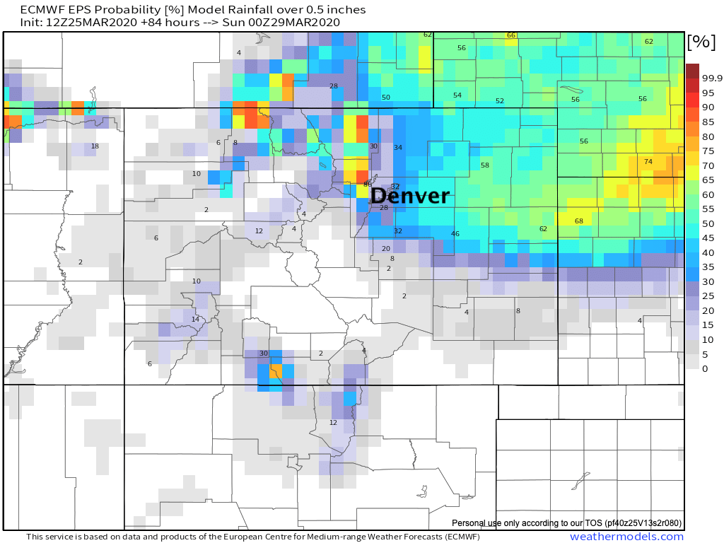
If we look at the probability of seeing more the a half inch of liquid, you can see again those odds are greatest for the foothills and Eastern Plains, but lower along the urban corridor:
And finally, probabilities for 3" of snow or more –– greatest at elevations west and south of Denver, but also extending east of Denver where we could see a period of heavy snow Friday evening and overnight into Saturday as this system intensifies east of Colorado.
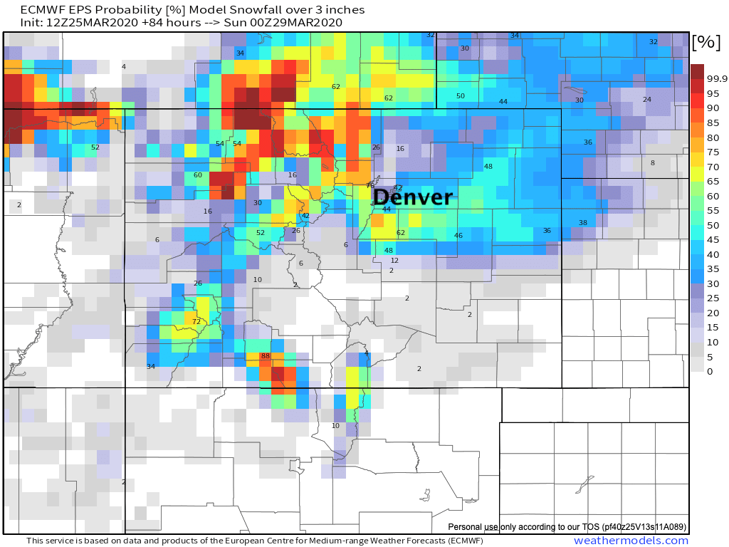
The Euro is most pronounced with this idea, and with that has some of the greater snow totals for all of Northeast Colorado as compared to other models. It's got the bullseye of the heaviest snowfall east of Denver Friday afternoon and night with much less for the urban corridor. We'll need to monitor exactly how this system will track, as a shift in speed or location of the low will change where we see that heavier snow develop.
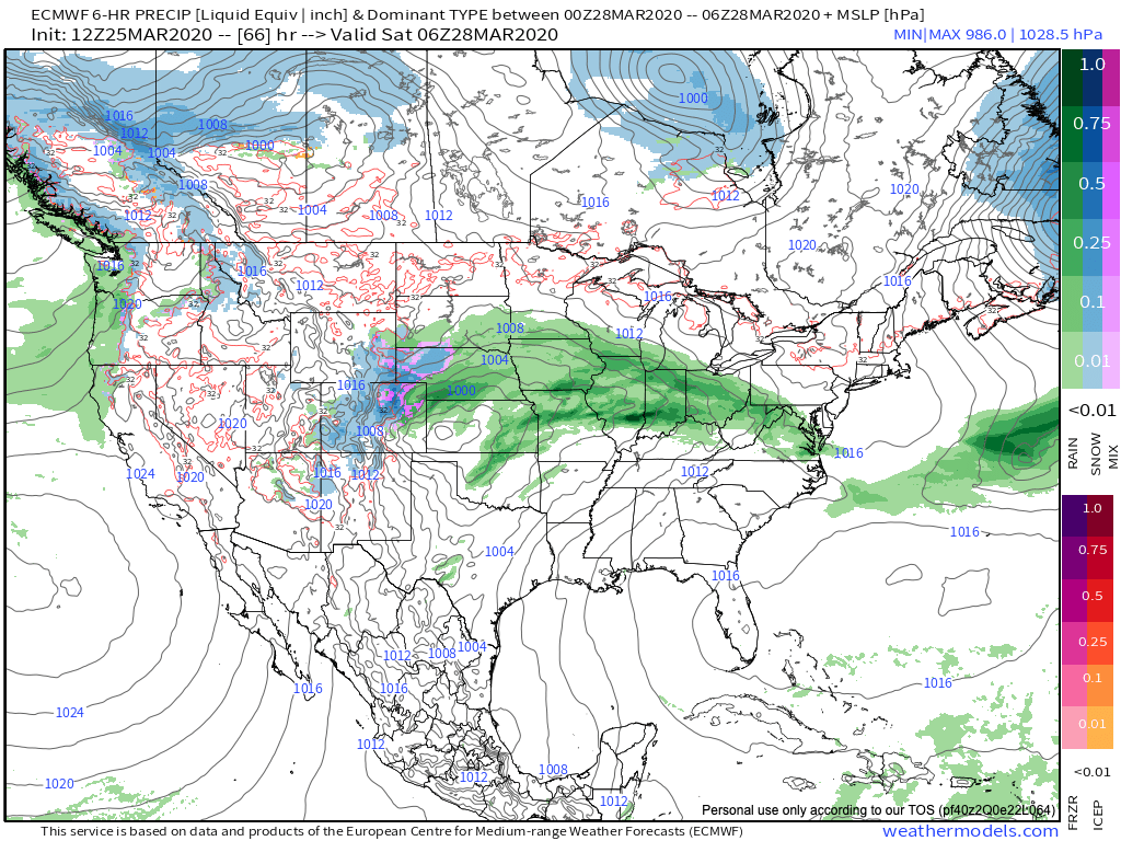
Here's the latest European outlook for midnight Friday, showing some heavy rain and snow across the state, with mixed precipitation at lower elevations as well.
Finally, here are our gamblers. If the cities see some snow it'll be a heavy wet snow once more, and will favor raised surfaces such as cars and grass. Should the heavier snow back up a bit we could see a bit more of an impactful event, but not the highest probability scenario at this time, clearly.
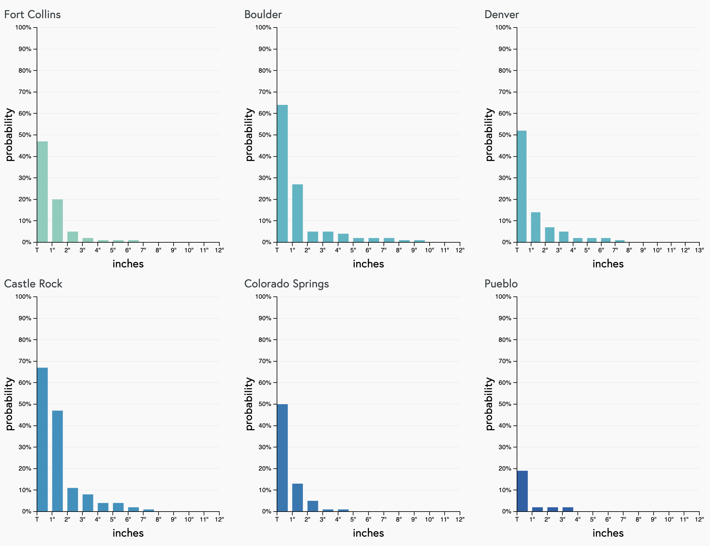
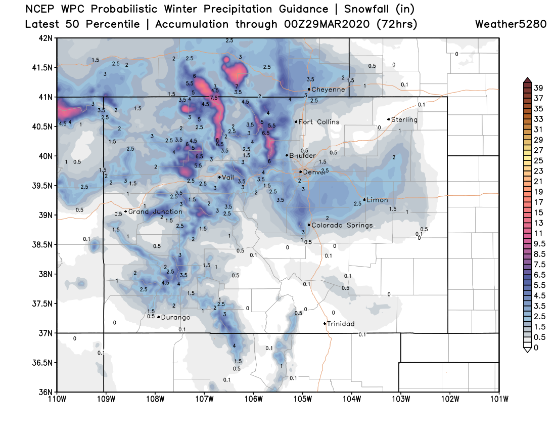
For now the map below is a good starting point, especially when considering any melting and compaction we're likely to see. If the Euro is right, the totals east/southeast of Denver will be greater than indicated here:
Beyond what rain and snow we see, wind will also be a significant issue –– especially late Friday night through Saturday. Gusts over 45 mph will be likely, mainly across the Eastern Plains. IF the wet snow can materialize and last long enough east of Denver, blowing snow and poor visibility could be an issue early Saturday morning. Again, this would essentially impact I-70 and I-76 east of Denver if it materializes.
Most of us will be watching this one from our living rooms. If your responsibilities take you out and about Friday be mindful of the changing weather. We'll continue to track this system, and offer and update tomorrow on what if any accumulation we think the cities will see.
Be well.