Wednesday evening brief: Time for a reset on this weekend's storm?

I wanted to jump on this evening and offer some quick thoughts on this weekend's storm as we're now about two days out from when we should see precipitation increase in earnest across the region, and it feels like we need to reset just a little.
So please, take a deep breath, (this is reminder for myself too, by the way), and clear your mind a bit of all the noise floating around this week.
We won't go into much technical detail around the system here tonight. That was covered at length this morning and you can find that discussion here. Instead, we'll let the evening data roll in, and plan for another full forecast update around midday Thursday.
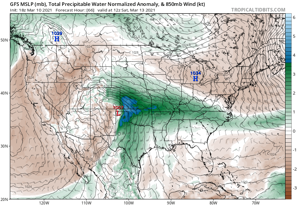
The one thing I'll note from looking over all the data since our update this morning, is that while all the questions we outlined at the end hold true – our biggest concern with regard to high-end snow potential for the greater Denver metro area is that the global models continue to pull the storm north with each consecutive run. IF that trend continues tonight, we'll have to start talking about the real possibility of lower snowfall potential this weekend. We aren't there quite yet, and like we've been saying all week, the track will continue to wobble right up to the end. In fact, the GFS tonight may even be a bit more south again after a day or northerly runs. 🙃
For better or worse the availability of model data has made the build up for these storms only more chaotic than they were even 5 years ago. You can't go 10 minutes without someone sharing an extreme outlier modeled snowfall map for a storm a week out. While I'm not all that interested in policing what people share online, it's really not all that constructive to do, and leaves a lot of folks in the dark about what the actual probabilities and potential is.
While I thought most folks learned from Monday's adventure, where the GFS was forecasting some 50" or so for Denver (making for a beautifully viral Tweet), it seems like there's still a tendency to find the most extreme outlier and share it like it may just happen. May it? I guess so. Is it helpful or probable? I'm not convinced. Today's gem is some 91" some model produced for Estes Park. We seem to be sniffing a bust, so let's go see how models can resolve an extremely uncertain, extreme outlier event and share that with folks just in case we can say – told you so!
This morning we shared a chart of what we feel like are the greatest probabilities for select cities across the region for snowfall totals Friday night through Monday. Let's see how things have shifted tonight:
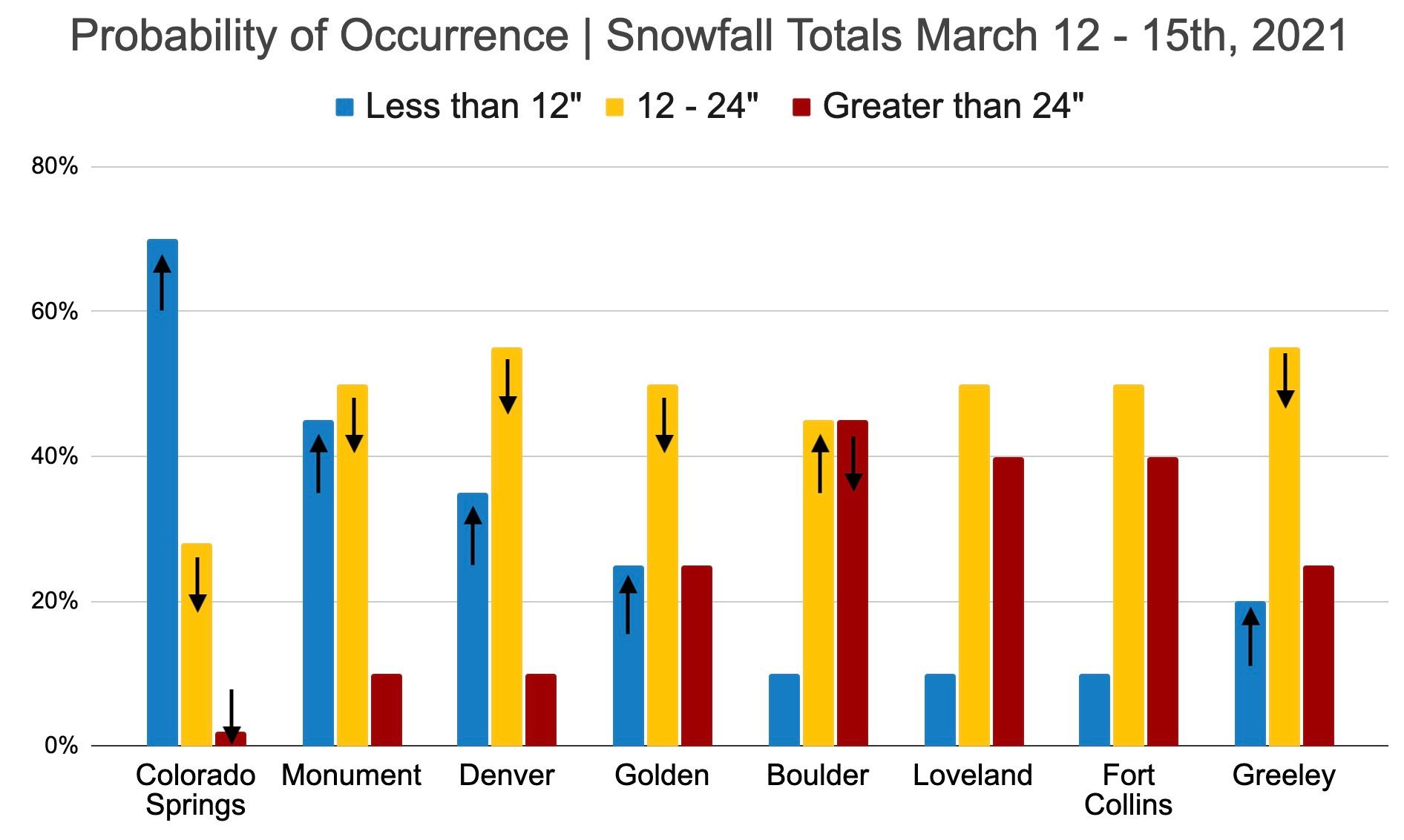
Overall not a huge shift. A slight trend up or down for some sites. We don't tend to react quickly around here, especially as confidence remains low on the ultimate track of this thing, even if we do see some trends in the data today. Generally speaking, we've bumped up lower-end probabilities and down mid-range probabilities for our southern cities to account for the northerly bias in the data today. Boulder saw a bit of a bump down too, but still sitting at even odds for the 12 - 24" range and 2 foot plus. Loveland, Fort Collins, and Greeley we really didn't move at all.
For Denver, that's a 35% chance we won't break a foot this weekend. We managed a foot two weeks ago in town and spent a fraction of the brain cells on that storm. Again, let's take a deep breath and not put the horse in front of the cart with calling for an epic (and frankly historic) storm this weekend. Those are incredibly hard to pull of – everything has to line up perfectly, which is why 1) they don't happen very often, and 2) are called outliers.
Think about this. March is Denver's snowiest on average, yet of the top five largest snowstorms on record for the month, only one has recorded more than 20" of snow in Denver. In fact, since 1881, Denver has only recorded 9 snowstorms where 20" or more of snow fell in the city. Breaking that 20" mark in the city is very tough to do!
Whew.
Finally, we just wanted to acknowledge all of the new visitors to the site this week and thank you for taking the time to read our forecasts and join in on the conversation. We hope that you will continue to reach out in the comments or on social media, as we are more than happy to help answer any questions you may have, and appreciate your feedback and insights. Let's get through the next two days in one piece and see how the weekend pans out.
We'll be watching tonight's data with great interest and hope to bring you a (measured) update in the morning.