Latest snowfall totals as Denver Cyclone delivers heavy snow to the metro area

There was a lot of anxiety from folks last night with the slow start to the snowfall across the northern urban corridor, but in the end our forecast looks like it will work out quite well – even the *boom* snowfall for portions of the east Denver metro area, the potential for which was outlined in a guest post last night.
Most of the snow totals shared below are through 7am this morning. Some areas will add to that total today, with another 1 - 4" inches possible for some locales, but in nearly all cases this wouldn't impact our forecast outcome as the numbers would remain in range. The Winter Storm Warning in place remains in effect through the remainder of the day.
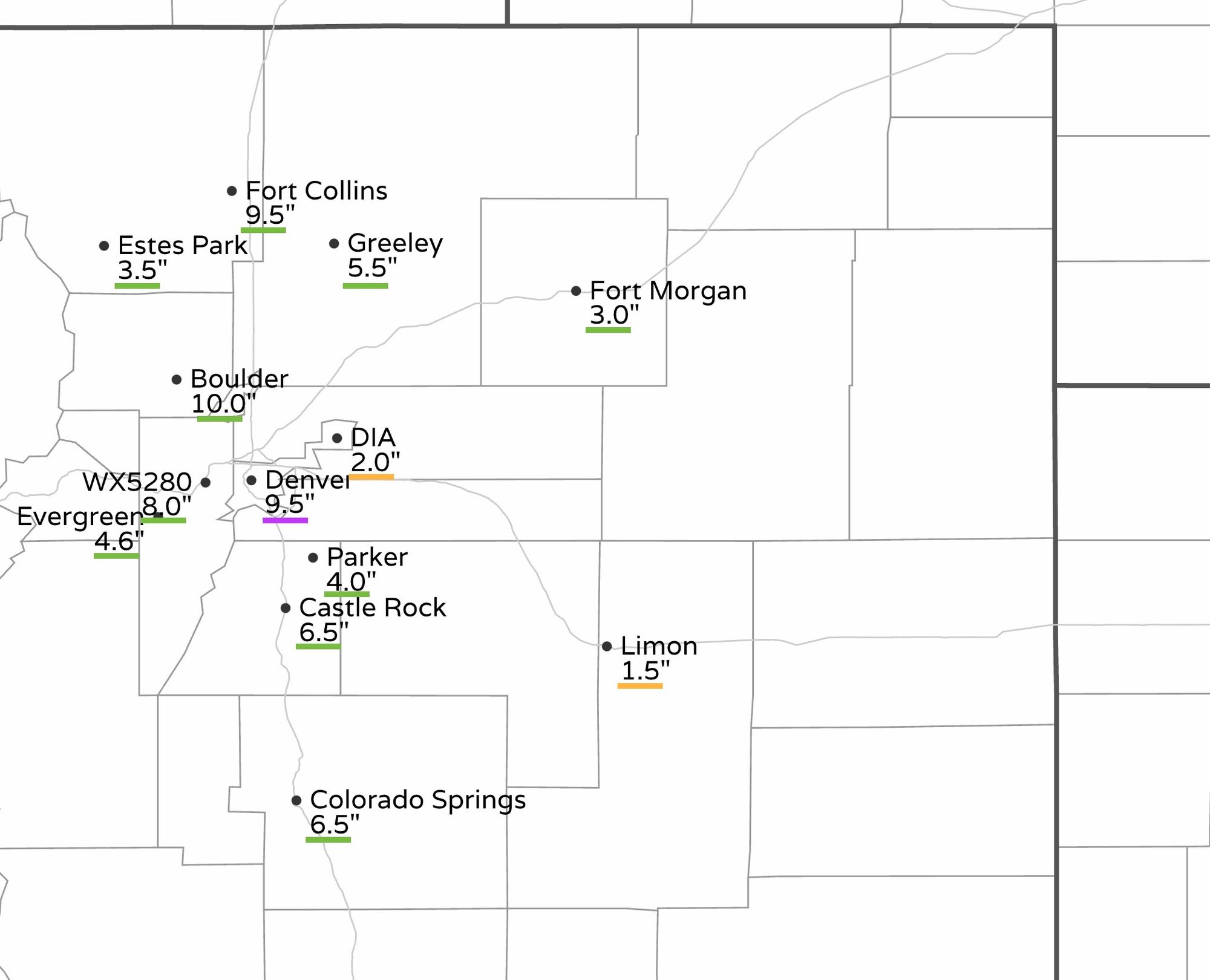
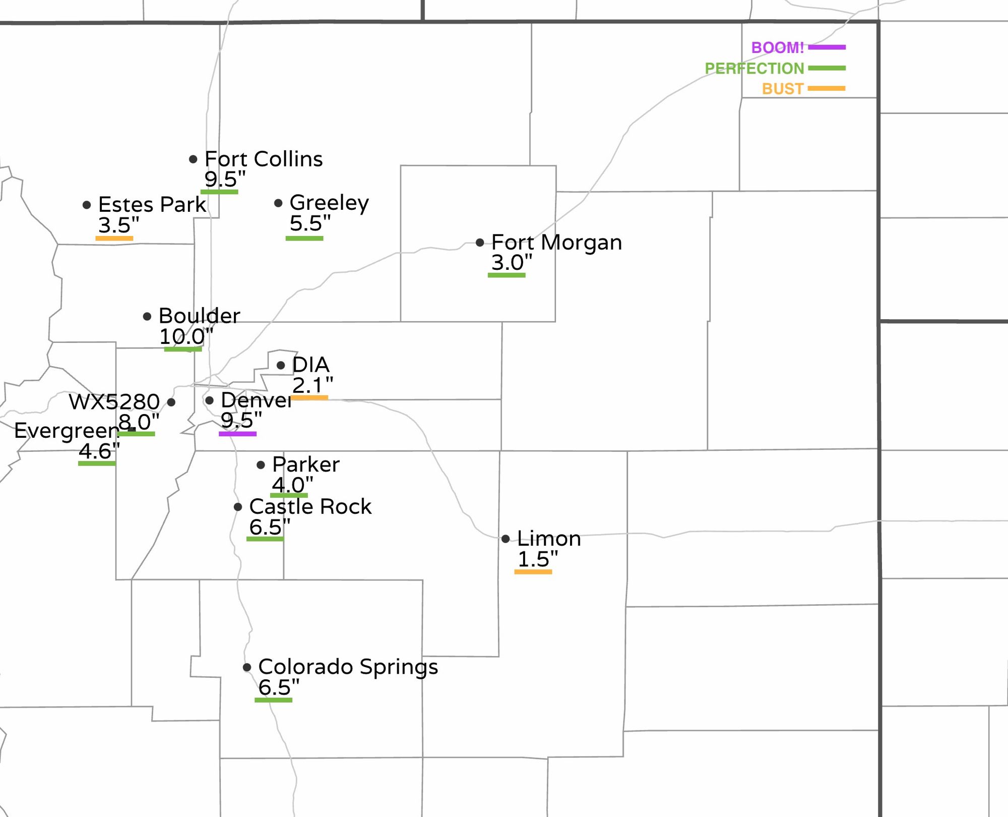
We were a touch too high in a couple of areas, with Estes Park coming in a half inch shy of the 4 - 7" range we had forecast, and Limon just shy of the 2 - 5" forecast range. Officially, Denver only picked up 2.1" of snow from this event, although most of the city saw far more than this. This is because official records are kept at DIA and not in town. We'll mark this as a "bust", though our 4 - 7" and 2 - 5" split the airport, so we probably could have counted this in the W column too, and if we add to this a bit today it could be we end up decisively in range.
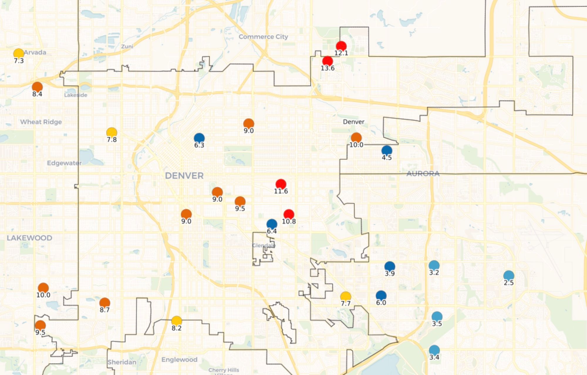
The 9.5" in Denver is from the central city, but some parts of the city saw even more than this overnight. On the east and northeast side 10 to 13" totals were common under the heavy band that moved through after midnight. We had 5 - 10" along and west of I-25 in Denver, and 4 - 7" east. We considered pulling that 5 - 10" line east in last night's update, but held tight. The band delivered, and proved that would have been the right call! Here's a look at totals reported across the city through 7am this morning:
Despite a bit of a curveball with the development of the Denver Cyclone last night, the foothills still managed to get their snow, though we haven't see any crazy boom totals that we might expect with this setup as the heavy snow was quickly pulled east as the wind shift cut into the upslope potential. With that, totals from 10 - 13" were common in the immediate foothills west of town, but further west totals quickly go down – like the 3.5" in Estes Park and Nederland.
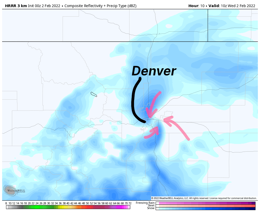
As it turns out, the HRRR did very well with this system, though it's struggled quite a bit this season. Here was the forecast image we shared in last night's post for shortly after midnight:
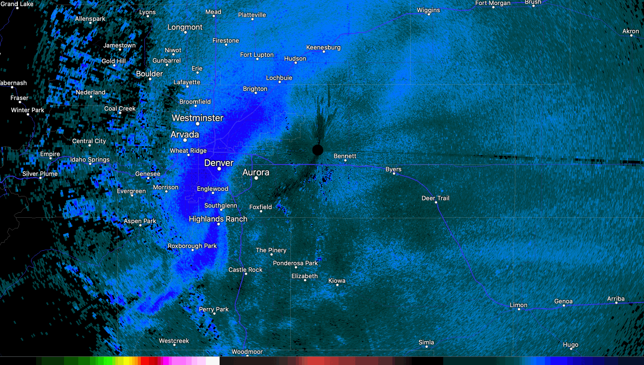
And here's the radar loop from 3am this morning! It's very easy to see the counterclockwise circulation in this loop, the band of heavy snow which produced upwards of 2.0" and hour at times, with snow liquid ratios approaching 30:1 under the band! Pretty cool.
The bulk of the heavy snow is now over, especially for those of us across Northeast Colorado. While we'll see areas of snow continue off and on throughout the day, the main impact now shifts toward the cold.
The HRRR shows a Trace to 3" across the urban corridor through the day, but as you can see the higher totals (blues) are scattered around Denver, with the heaviest snow across the far eastern plains and south-central Colorado:
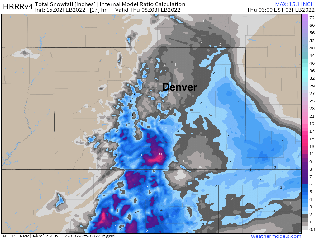
The hourly planner shows a good chance for those snow showers and flurries through the late afternoon, before chances decrease tonight.
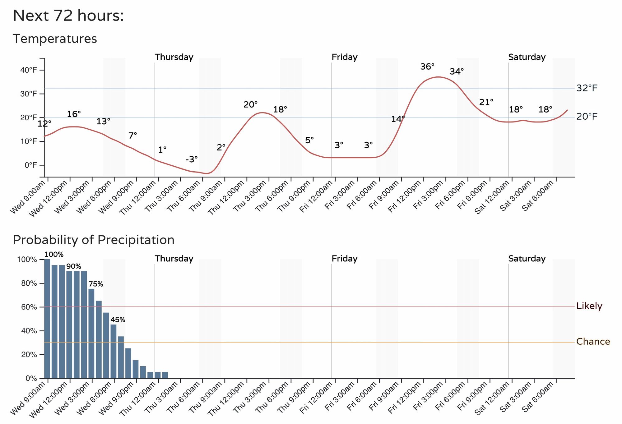
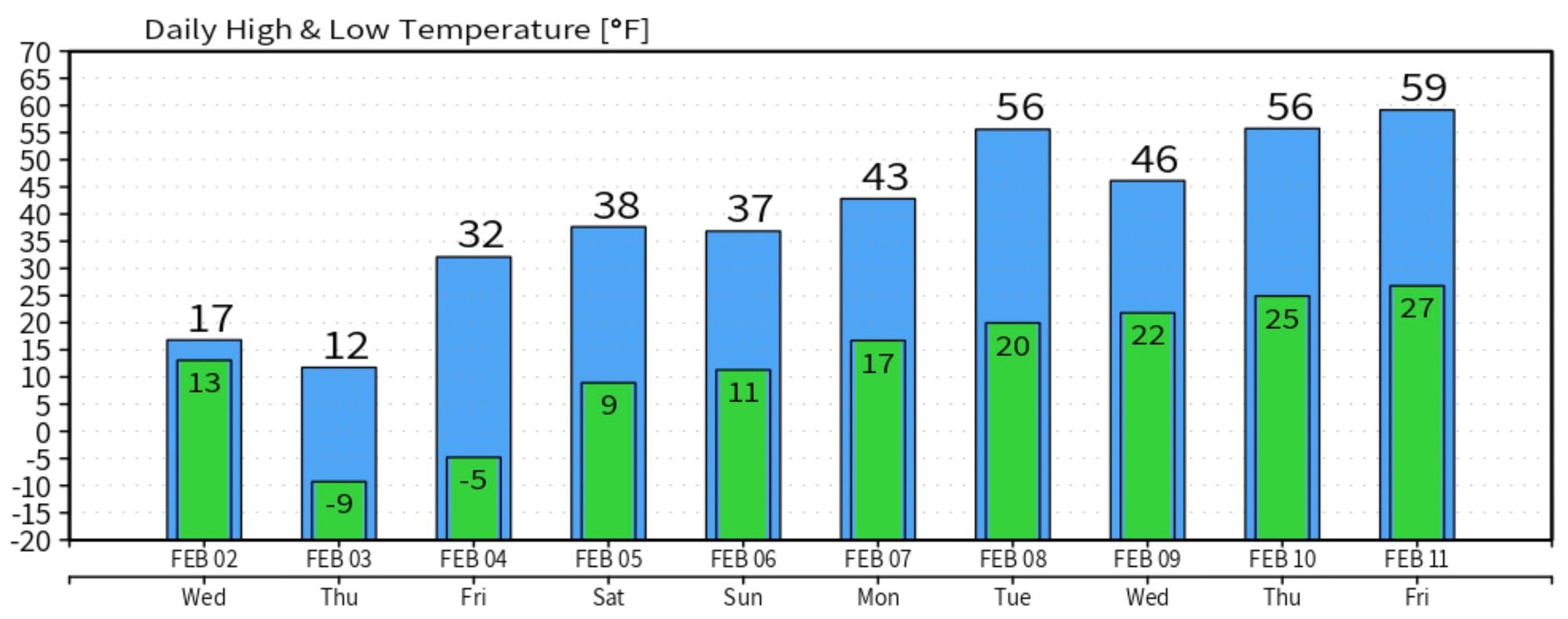
The other thing that'll decrease are the temperatures! Lows tonight will likely dip below zero, after only topping out in the teens for highs this afternoon.
Thursday won't much warmer, with highs around 20F in Denver and overnight lows into Friday in the single digits.
Temperatures will moderate through the weekend, but will be slow to do so. By next week the European shows much milder air back in the forecast, but the northwest flow aloft means we shouldn't sleep on the pattern just yet.