
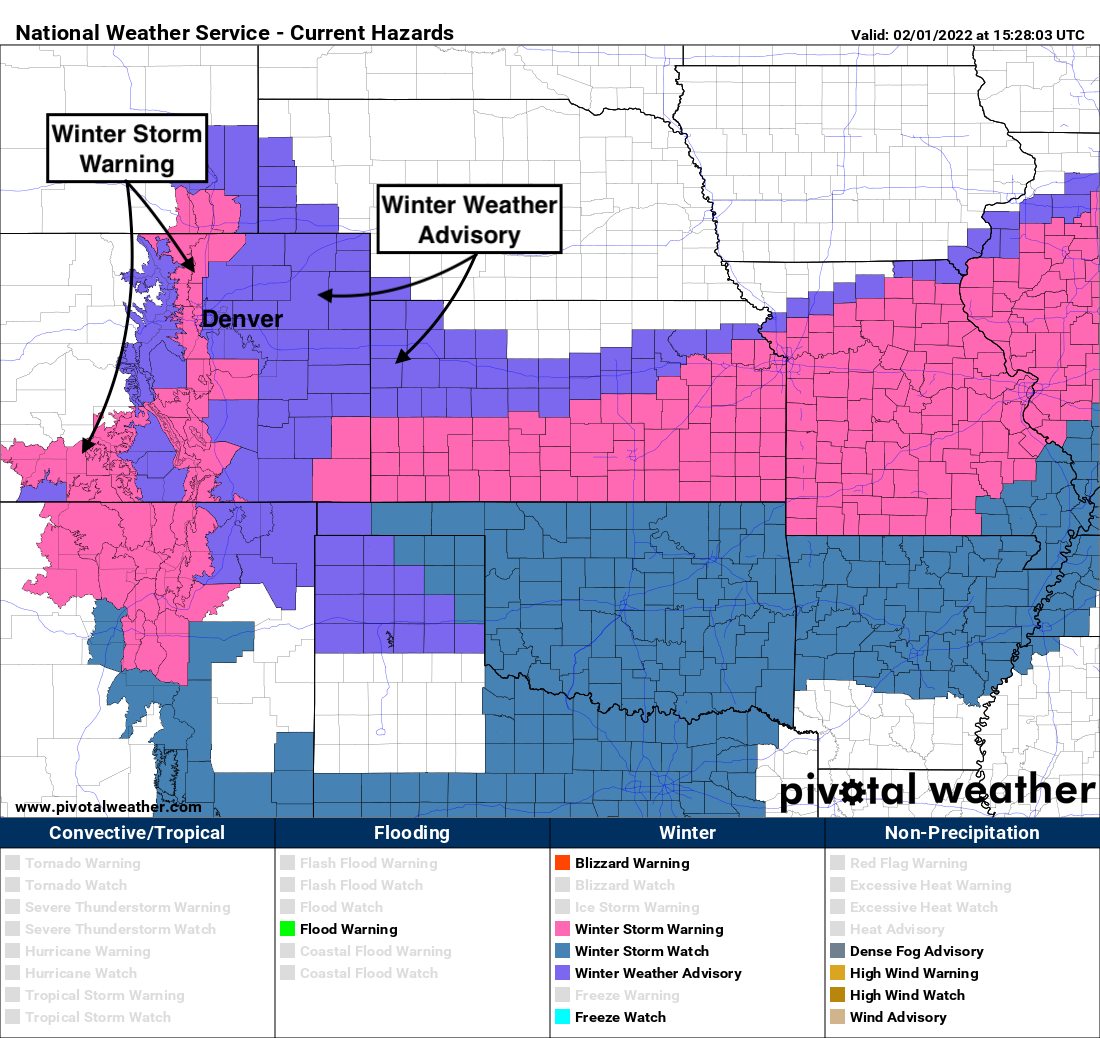
Winter Storm Warnings posted for Fort Collins, Boulder, COS, Advisories in place for Denver and Castle Rock: Latest snowfall forecast

The upslope machine is getting warmed up this morning, and all indications are it'll be running on all cylinders by this evening and into the day Wednesday.
All of eastern Colorado will see snow, as well as sharply colder temperatures, but the greatest totals are expected in and along the Front Range foothills where upslope will be king. As you move along and east of I-25 totals will be lower, but the impacts the same – prepare for winter driving conditions from this afternoon through Wednesday night across the region, with snow already getting going across northern Colorado this morning.
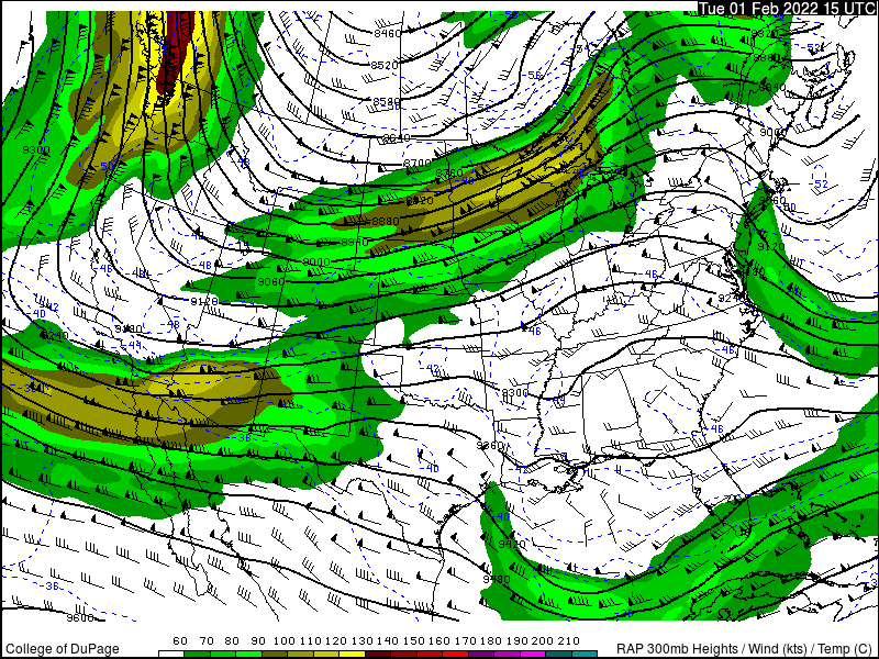
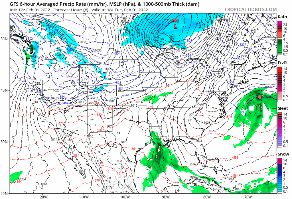
One of the major ingredients in play for this setup is the coupling of the northern and southern jet over Colorado which will help provide plenty of lift for good snow production across the region. We see how the GFS has been handling this over recent days:
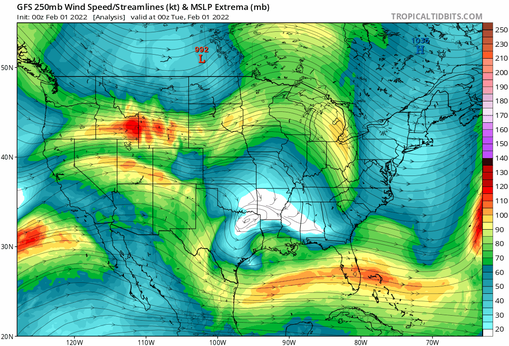
And now that coupling taking place right on time on the current analysis:
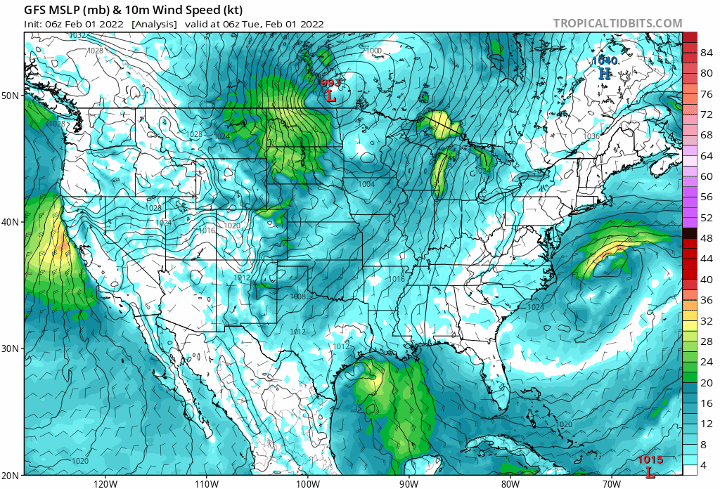
The other key ingredient, which has yet to kick in for most of us, is upslope! Winds near the surface will gradually shift out of the east today, as anticyclonic upslope develops across Northeast Colorado.
While the National Weather Services upgraded some areas to Winter Storm Warnings overnight, this was not the case for Denver. This is largely due to the concern that winds will gradually shift from the east to the southeast, which is not a favored upslope for for those of us just on the north side of the Palmer Divide (but on the flip side is favorable for Colorado Springs snow production!). You'll recall from this week's SOTA this was one of the concerns we had for snow potential in the city proper.
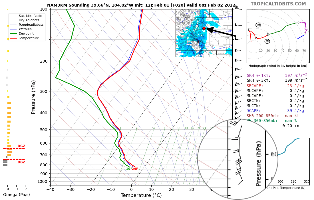
If we look at the 3km NAM model for late tonight... we see it shifts winds out of the south/southeast for Denver and largely kills snow production for portions of the metro/southeast metro for awhile. You can ignore most of what's in the image below, but note the circled area show winds near the surface out of the southeast late tonight. The red dot (and arrow pointing to it) indicates this is centered on Denver:
If we look further north toward Loveland and Fort Collins, we see winds out of the east at the same time, and good upslope snow continuing:
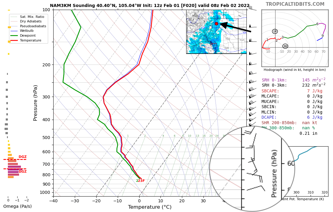
This is not to say we won't manage snow in Denver, but the opportunity for a bust is greater given the potential to lose some of that optimal upslope flow sooner than surrounding areas, and this is especially true for areas east of I-25 and just north of the Palmer Divide.
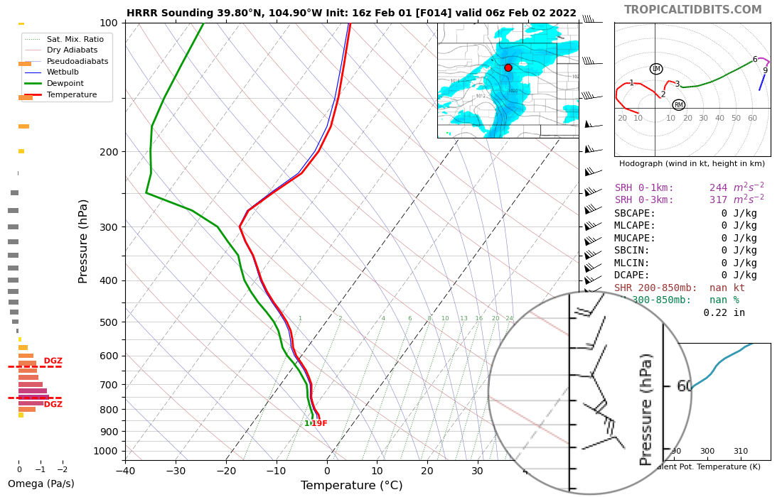
If you're hoping for a boom snow in Denver, however, some models are a bit more promising on that front than others. The HRRR, for example, doesn't shift the wind as southerly tonight, and therefore has much more snow for the Denver area than we see in models like the NAM and GFS. Here's a look at the same time tonight on the HRRR, which looks much better for Denver than the NAM above!
Here's a look at the latest Advisories and Warnings in place by the NWS:
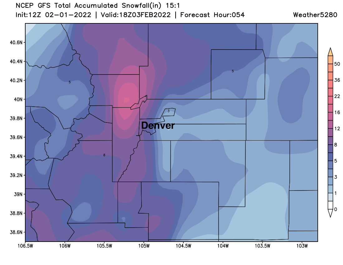
The morning run of the GFS continues to show the heaviest snow favoring cities to the north and west of Denver. Boulder and Fort Collins are likely to do very well with this system, as should Denver's west side. You'll note a bit of a snow whole east/southeast of Denver due to those southeasterly winds we anticipate, with heavier snowfall again focused on the south side of the Palmer in the Colorado Springs vicinity:
Given this, the trends in the modeling overnight weren't all that surprising. Taking a look at the SREF plumes we see the following numbers and trends from yesterday's runs:
- Fort Collins: 14.25" ↑
- Greeley: 8.0" ↑
- Broomfield: 13.0" ↑
- DIA: 5.5" (steady)
- Centennial: 8.0" (steady)
- Elizabeth: 8.0" (steady)
- Colorado Springs: 10" (steady)
It's hard to argue much with these numbers... and with that we've adjusted our map slightly from yesterday's forecast to reflect greater confidence in higher totals for Boulder and Fort Collins, leaving Denver mostly unchanged, and extending the 5 - 10" range slightly around Colorado Springs. It's likely some areas in the 8 - 12" zone will see more than 12" of snow, but probabilistically this range is the greater confidence even given the potential to over perform.
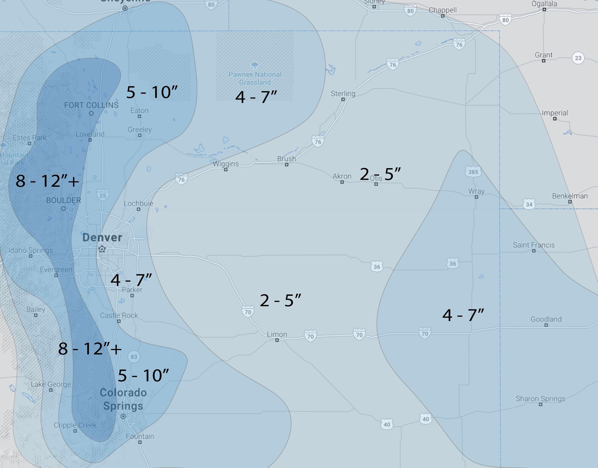
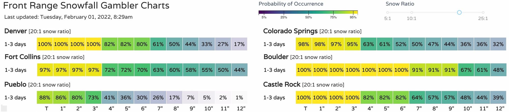
So, greatest boom potential? Boulder, Loveland, Fort Collins and even Colorado Springs. Greatest bust potential? Denver, Castle Rock, Parker.
Interestingly enough, our snowfall gamblers might have greater confidence in Denver's snow potential than we do 🙃. Boulder is the clear winner in these probability charts, with the high-end potential intriguing for Fort Collins:
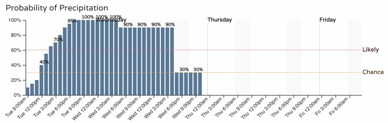
As for timing... Look for snow to continue to grow in coverage across the mountains, foothills, and northern Colorado this morning into the early afternoon. As saturation occurs, snow will continue to grow in coverage and extend south into Denver by the evening rush if not before. Snow will continue off and on through much of the day Wednesday before coming to an end Wednesday night across southern Colorado.
The hourly planner shows snow chances quickly increasing by midday today, and extending through much of the day Wednesday.
Fort Collins:
Denver:
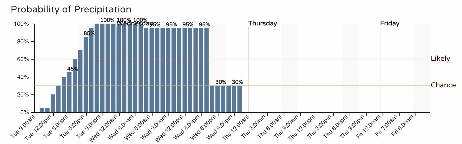
The Tuesday evening commute and Wednesday morning commute are most likely to be most severely impacted, but with the cold in place and likely lingering snow showers and flurries, Wednesday evening could remain slow.
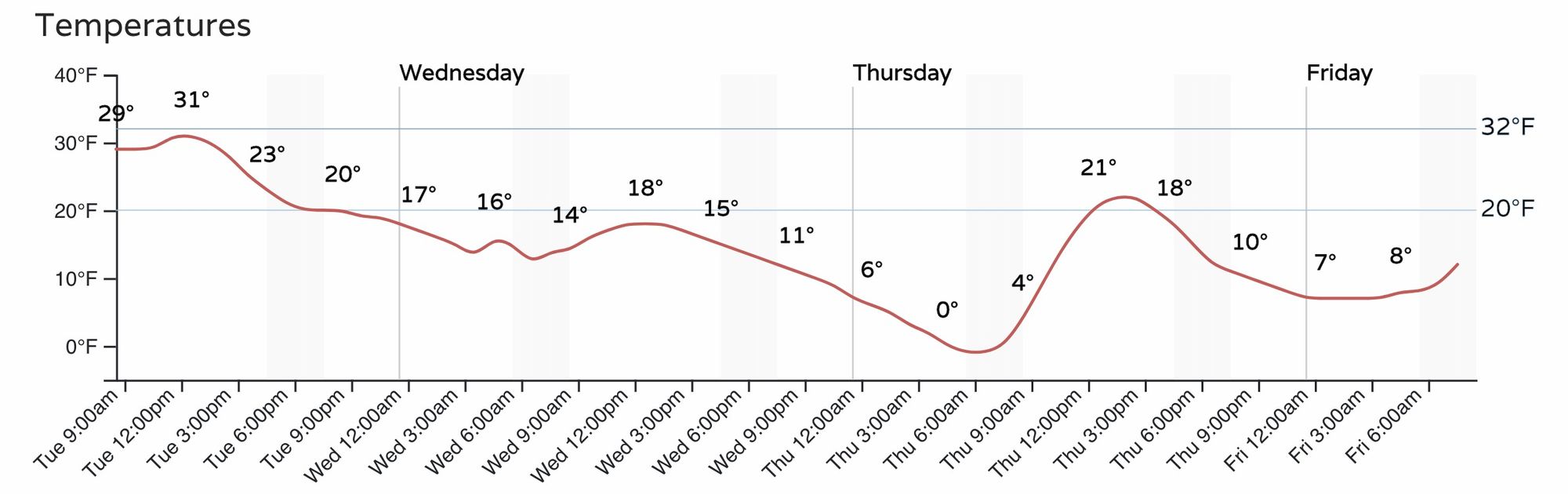
Temperatures... will be COLD! Not to be lost in the messaging here, but along with the potential for several inches of snow will be the bitter cold temperatures we'll be contending with as well. "Highs" on Wednesday will be in the teens, with many areas dipping below zero Thursday morning as the snow clears. Thursday won't be a whole lot better, with highs only in the low 20s for Denver, before temperatures moderate a bit to end the week.
A lot to watch with this setup, but overall looks like a fun system incoming. As always there will be some haves and have nots, but plenty of upside for snow for many locations given the ingredients in place.
Big things to watch as things get underway...
- What do winds do around Denver, do we lose upslope flow for a time tonight?
- What surprises will jet play, meaning where might we see a heavy band of jet-induced snow set up aka boom snowfall totals!
- How high will snowfall ratios be, as this will be key for high-end totals
We'll be watching things today and offer updates if/as needed! As always, keep us posted as to snow (boom or bust!) at your place, and stay safe and warm.