
Snowfall totals as storm clears, cold lingers through Tuesday

What a great storm, if for no other reason than the 10 - 20" of snow that fell over the East Troublesome and Cameron Peak fires. Rarely does it seem a storm is able to deliver when we are in such need – but this one did, even if less moisture content than you might expect from an October storm.
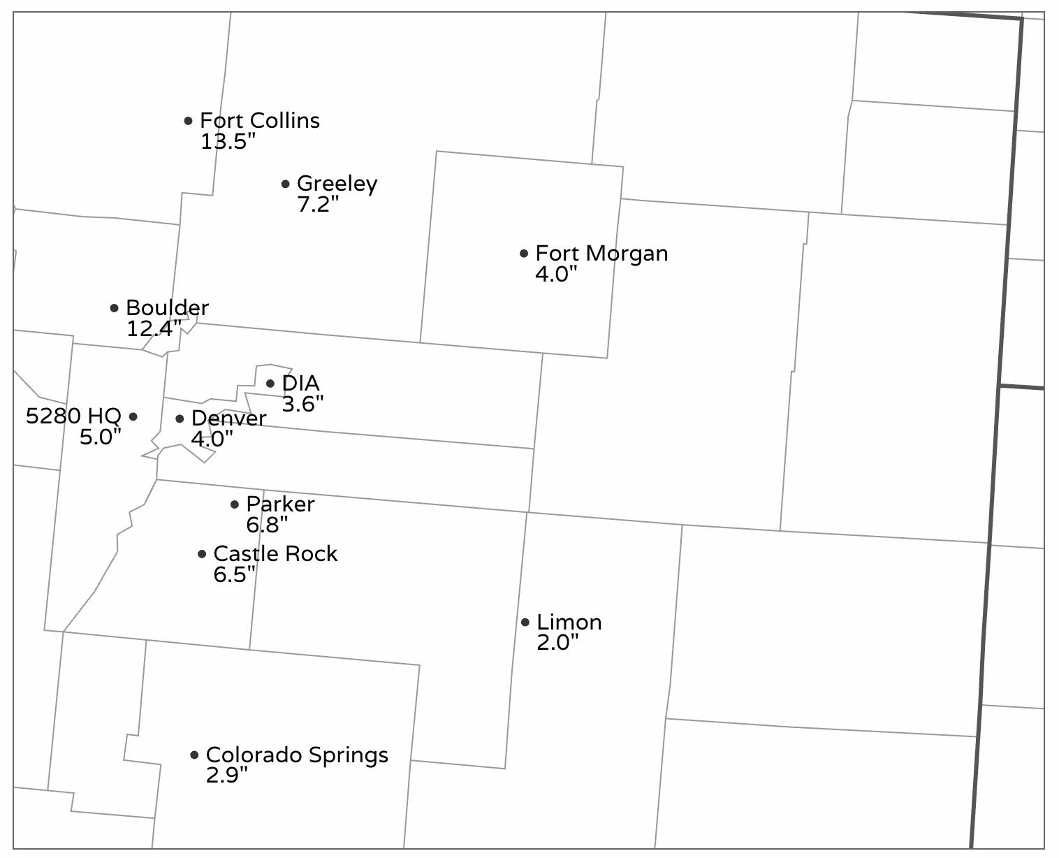
Along the urban corridor those north of Denver did best with snow totals this round, and this should come as no surprise. Boulder and Fort Collins both reported a foot of snow or more, with 12.4" of snow officially in Boulder, and 10 - 14" of snow in Fort Collins (heavier totals west). We had both cities in our 5 - 10" range, with locally 8 - 14", and the forecast was well couched that a persistent snow band up north was the most likely scenario.
It took some time, but the band finally moved through the Denver area Sunday evening and got most locations to our low-end forecast if not a bit better. We ended up with 5.0" on Denver's west side (5 - 10" forecast), with downtown and DIA receiving 4.0" and 3.6" respectively. The forecast for Denver was 4 - 8", so pretty good given bust potential south of I-70.
Here are a few other totals from across the region:
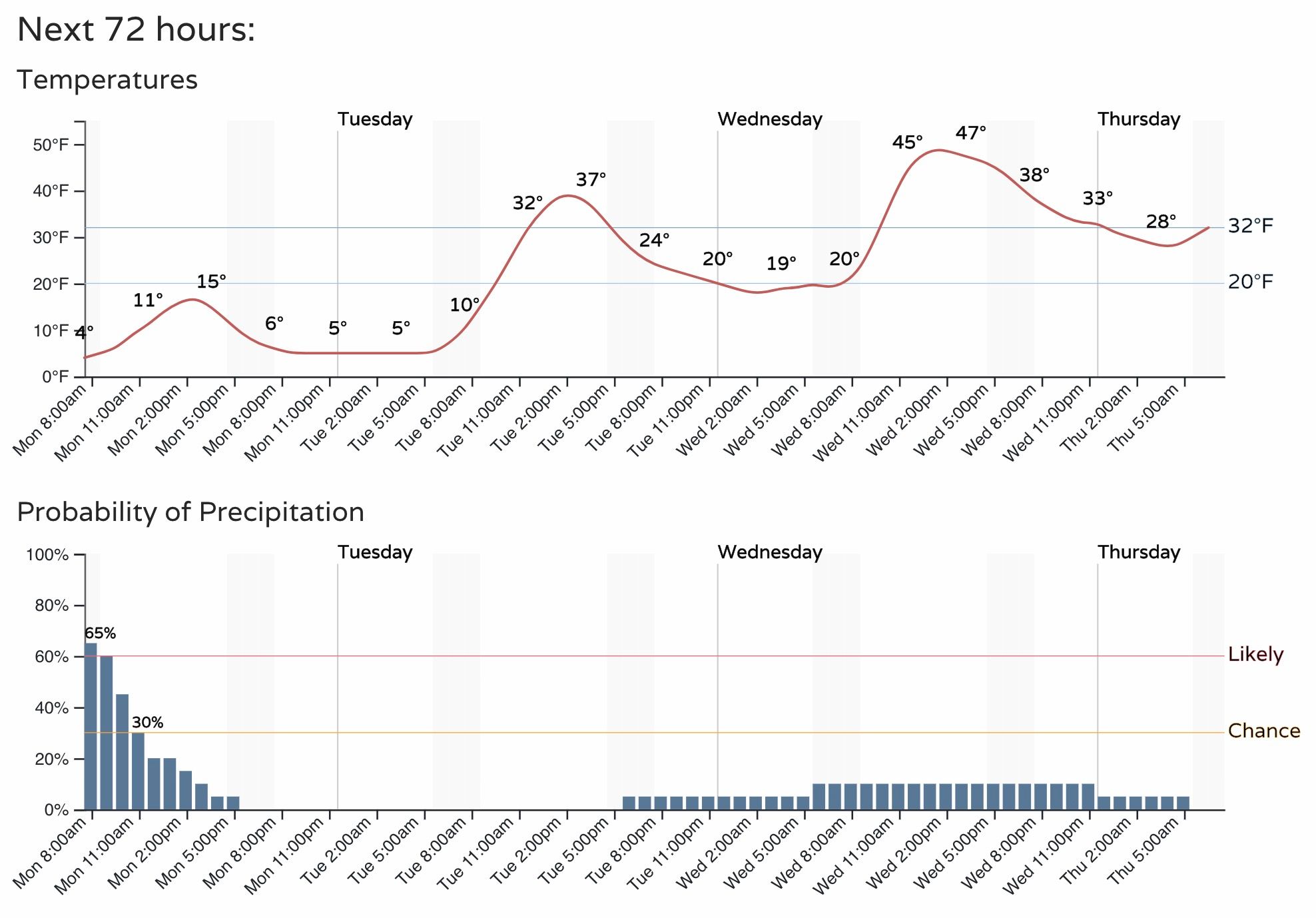
We're still seeing some light snow from time to time this morning, but the measurable snow is done. Now the story will be the lingering cold, with teens for highs today and another night of single digit record lows tonight.
Here is the hourly planner for Denver, slowly warming through the remainder of the week. By Friday highs in Denver should be back in the low to mid 60s.
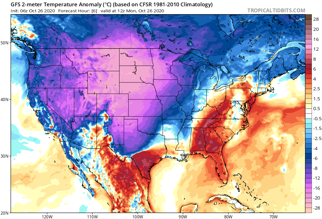
The record cold isn't confined to Northeast Colorado. A look at temperature anomalies this morning shows much of the West and High Plains experiencing temperatures WELL below average for the date:
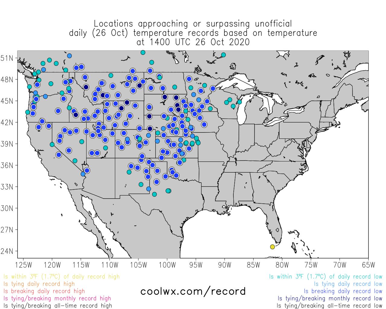
With daily and monthly record lows falling all over the place this morning!
Stay warm, and enjoy the snow.