The State of the Atmosphere: Sunday, November 8th, 2020

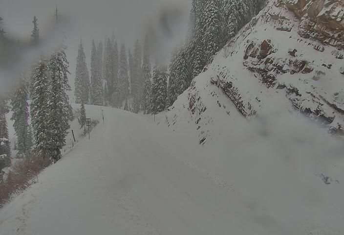
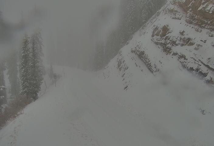
As we discussed in our last update, the weather system that has brought wind and isolated showers to the Front Range and Eastern Colorado last night and today has delivered some big time snow to the mountains of Southwest Colorado.
The heavier snow we saw overnight, and the showers we're seeing across Eastern Colorado will come to an end this morning, before another round of snow arrives (mainly for the mountains) late tonight and Monday.
For the plains, this all equates to more wind today with cooler temperatures but still on the mild side for this time of year. Denver's forecast high of 58cF is just about average for this time of year, which goes to show just how remarkably warm the start of the month has been (the city is running more than 15°F above average through the first week of the month!).
With the ongoing wind, and mostly dry conditions across the Plains, look for many of us to be under a Red Flag Warning from mid morning through Sunday evening. Gusts to 35mph and humidity levels in the teens will mean fire conditions will be elevated through the day today.
Next system arrives tonight
The next round of snow for the high country, and eventually the chance for rain and snow across Eastern Colorado, arrives tonight.
The animation below takes us from late tonight through Tuesday evening. You can track the snow increasing across Southwest Colorado tonight, eventually spreading into the northern and central mountains, before some rain and snow showers push east across the plains Monday into Tuesday:
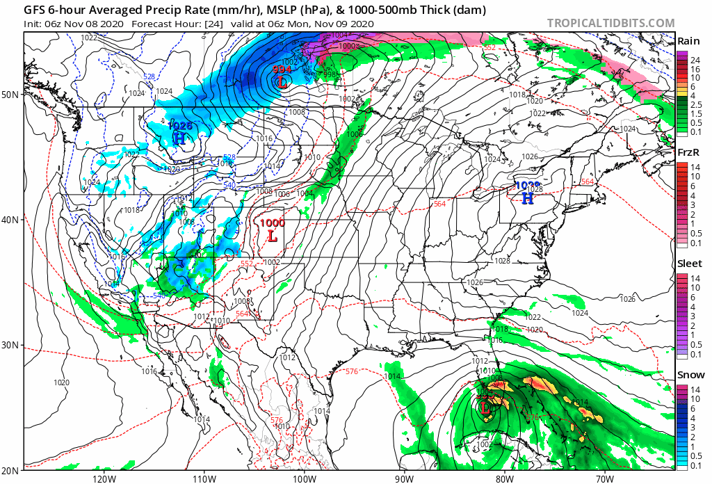
For the I-25 corridor this next system won't do all that much either – at least when it comes to rain and snow. Some showers, yes, and perhaps some spotty accumulation, but really a chilly change to our weather will be the bigger story.
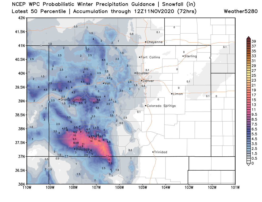
For the southwest mountains, additional snowfall totals in excess of a foot will be possible, with some nice accumulating snow expected for our central mountains as well. Below is a look at the latest 50th percentile snowfall forecast through Tuesday night. Again, much more of a mountain event than anything of substance for Eastern Colorado:
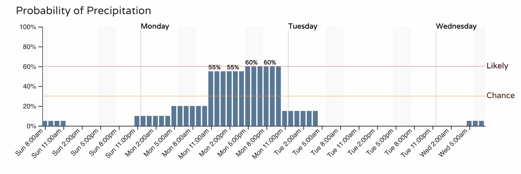
The timeline for Denver shows an increased chance of snow (perhaps some rain mixed in as well early on) by mid morning Monday, with the greatest chance we see some of those snow showers coming between noon and 11pm. Again, for most of us snow accumulation won't be an issue, but a Trace to 2" is not off the table, especially across the western suburbs and Palmer Divide.
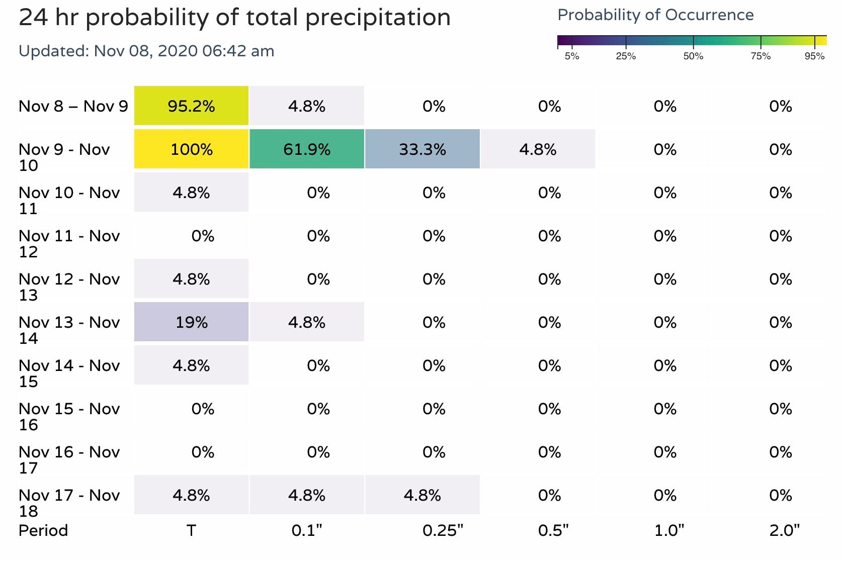
Your precipitation outlook for Denver over the next 10 days:
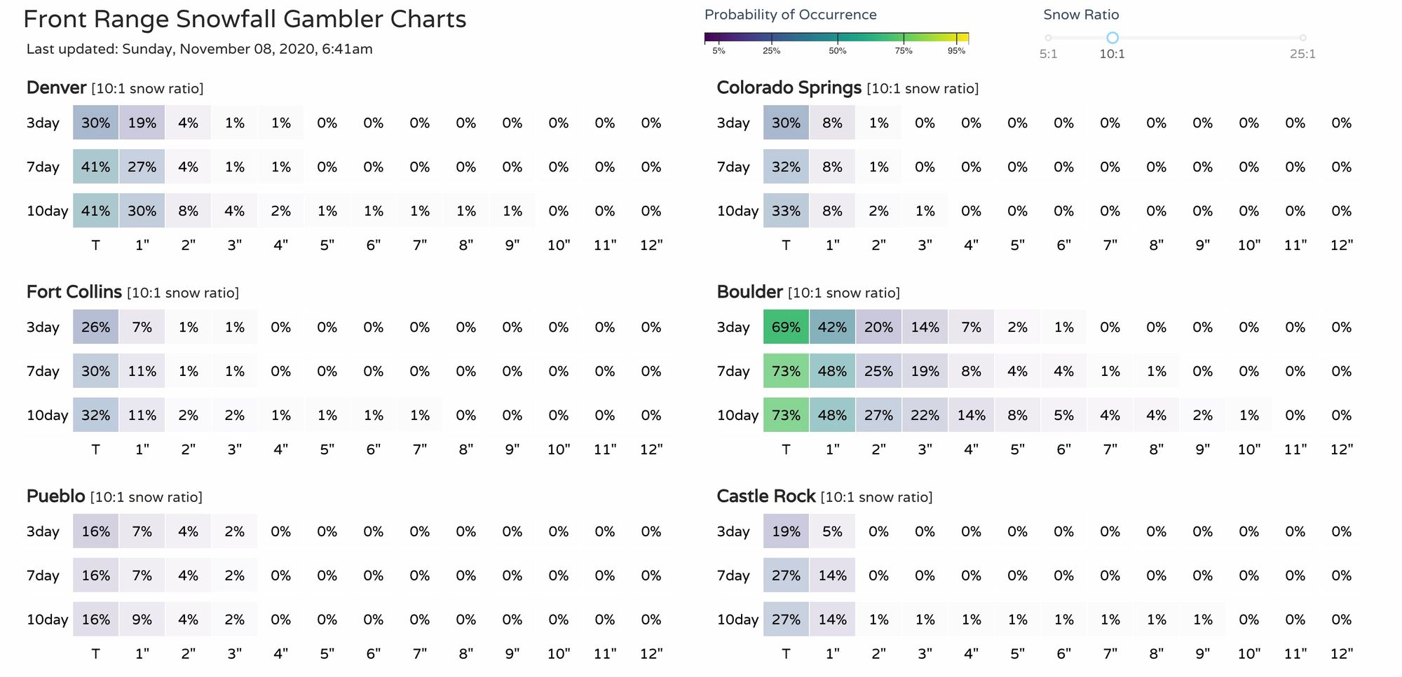
And finally, the latest snowfall gambler charts (Hey, Boulder!). As you can see, some snow incoming, but odds on a boom is not looking great...
A chillier week ahead
After the record-setting heat we've seen to start the month, the next week will feel much more like November across the state. Highs in the 40s are expected for Denver Monday through Thursday, before a bit of a warming trend returns for next weekend.
Monday looks to be the chilliest day of the week as tonight's system moves through. This means highs near freezing for Cheyenne, in the upper 30s to near 40°F for Denver, and 40s and 50s across Southeast and East-central Colorado.
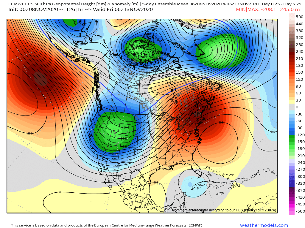
This is all thanks to the 500mb pattern we showed you last week that will be driving the weather extremes across the CONUS this week. Troughing in the means across the Western United States (cooler and unsettled weather), with a large ridge in place across the Northeast (warmer and drier).
We'll keep an eye on the rain/snow chances headed our way on Monday and update as needed. For now looks like plan on those chilly temperatures and occasional showers, but not looking like a big snow event for us this time.