The State of the Atmosphere: Sunday, January 24th, 2021

Well, we are quickly approaching the end of the first month of 2021, and if you were hoping the year would turn things around in the snow department, you can probably pile this on to the list of disappointments to start the year! I say probably, as we do still have a chance for some snow this week, but odds of anything significant across Northeast Colorado look low.
Officially Denver has recorded just 1.9" of snow so far this month, well below the longterm average of 6.5" for January. It's possible we'll add to that before month's end, but it does not appear likely that we'll climb back to average or better at this time. Season to date isn't all that great either, with just 18.9" so far at the airport, well short of the 27.0" we see on average through the end of January.
Atmospheric River
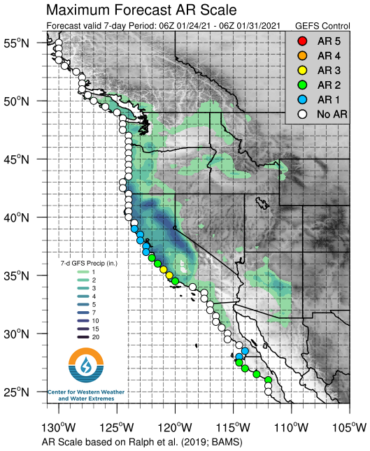
As we've covered quite a bit on the Insider side, an "atmospheric river" event is forecast to bring big time rain and snow to California here in the final days of January. Tracking the latest AR Scale Forecast from the Center for Western Weather and Water Extremes shows latest guidance suggesting a midrange event for portions of California this week, with models forecasting upwards of 5" of precipitation (and FEET of snow) for much of the northern and central portions of the state this week.
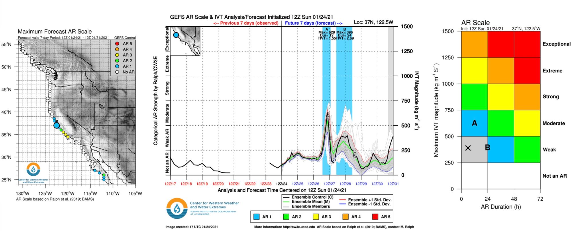
Here's another look at the outlook, showing where in the outlook the greatest impacts are expected along the West Coast. If you're interested in learning more about how these impact forecasts are created, you can find more information and a video here.
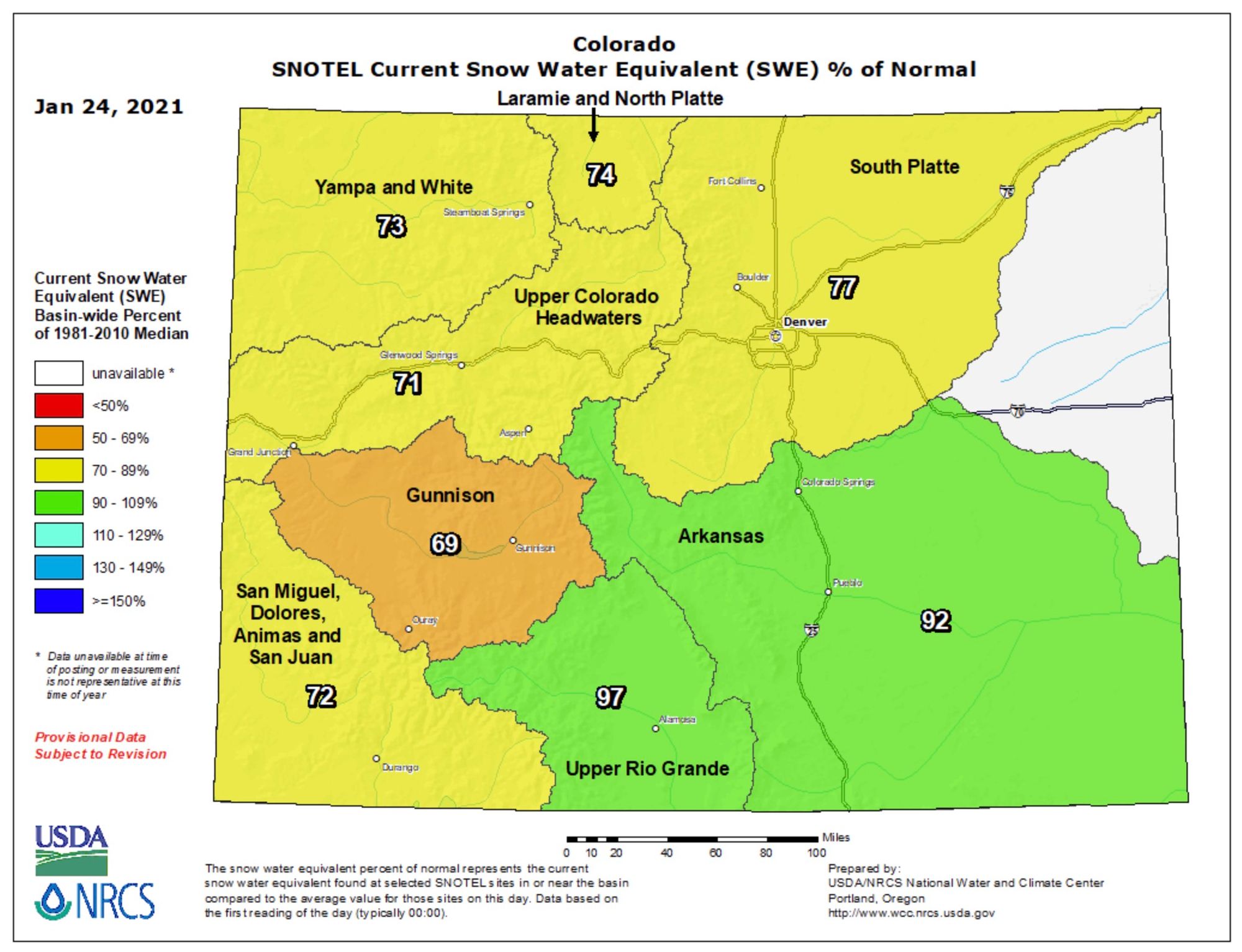
How much of that moisture ends up delivering much needed snow for our area? Well, perhaps not as much as we'd like, but it continue to look like some of our mountains will finally see a period of appreciable snow to finish the month – thank goodness. Here's the latest snowpack map for Colorado, showing most basins remain considerably below average at this time:

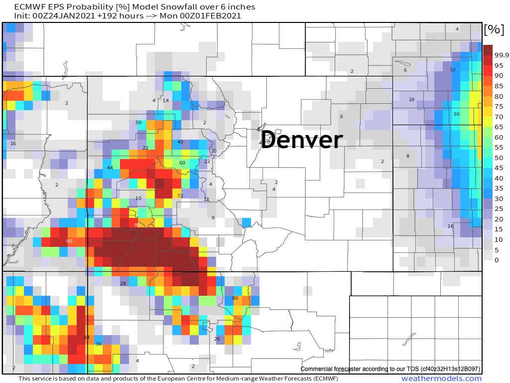
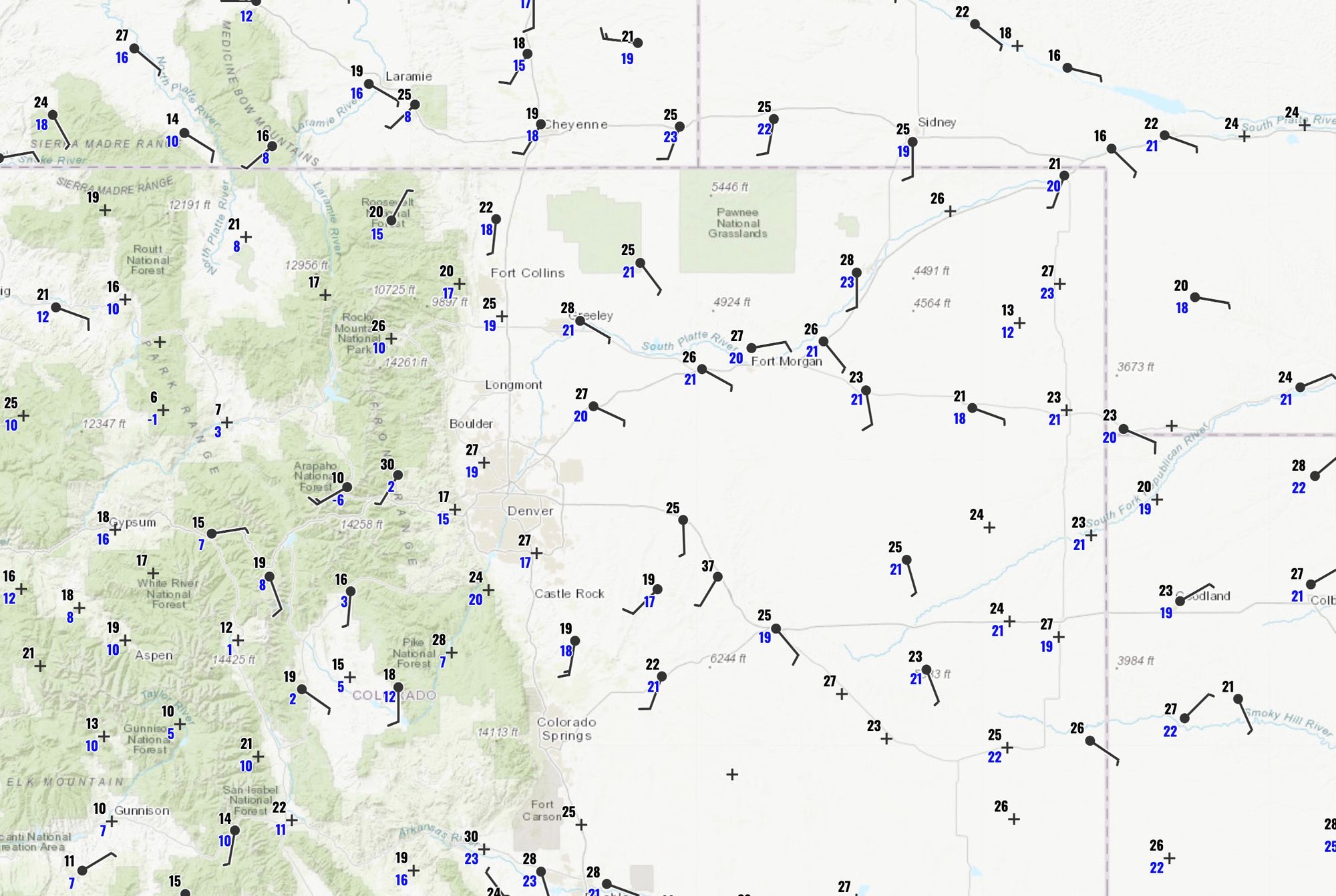
At the same rate, it's not a done deal, especially across the northern half of the state. The mountains across Southwest Colorado and West Central Colorado are most likely to do well in the coming days as several systems move across the state. Further north remains in greater question, as the general trend this weekend has been a more southerly storm track. Below is a look at at the latest probabilities for 6" of snow or more this week from the European ensemble model:
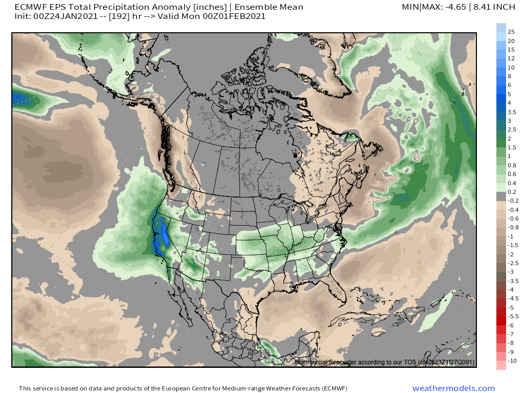
As for precipitation anomalies – well, not surprisingly California is expected to see precipitation totals WELL above average through the end of the month. Those positive anomalies hold true across much of the drought-stricken Southwest United States as well, including areas of Southwest Colorado should the forecast hold. Northern and Eastern Colorado are expected to see near-average precipitation through the final week of the month, which in January isn't all that much.
The week ahead
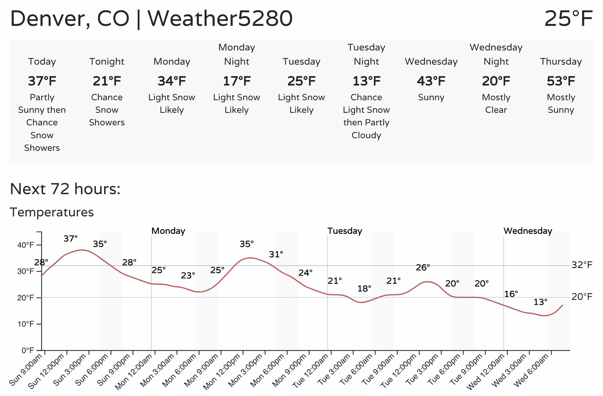
The cooler weather we discussed on Friday has arrived. Temperatures across the region this morning have been largely in the teens and 20s, with highs only expected to climb into the mid 30s or so for many of us Sunday afternoon.
With off and on light snow in the forecast really today through about Tuesday night, we expect afternoon highs today to be about as warm as we'll be until Wednesday or so, with Tuesday forecast to be the chilliest of the next five across the eastern half of the state.
For Denver, the outlook looks more wintry than we may end up being. Yes, it's likely we'll see some light snow at times over the next several days, but the question is – what will it amount to?
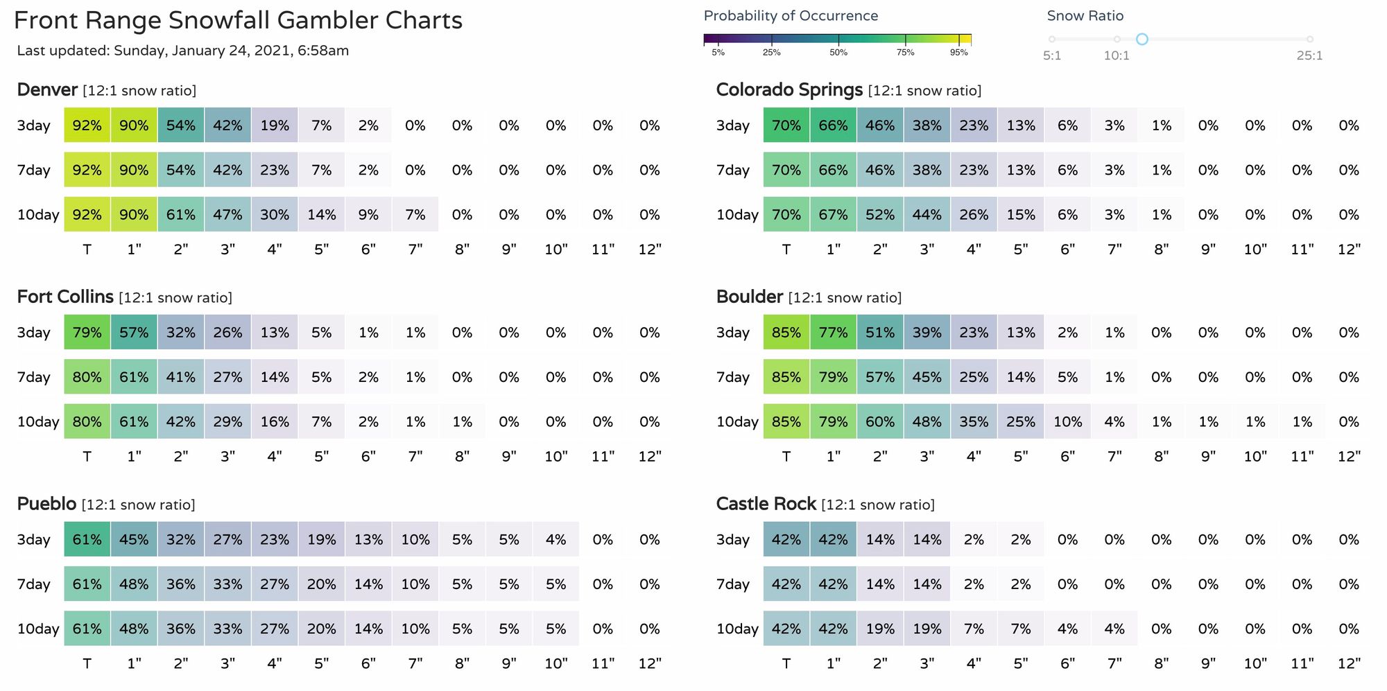
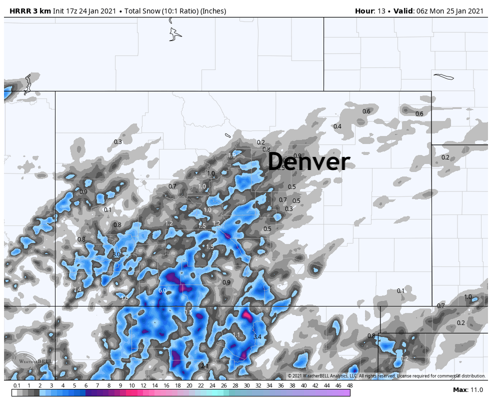
Looking at our gamblers this morning, and they frankly feel too bullish to me. Might we see 3 or 4" over the next few days? Perhaps, but it feels increasingly less likely after looking at the morning data. Most models are much more southerly with their tracks of multiple short waves coming our way in the next three days, which IF that trend continues would mean more snow south and east, and less snow for the northern urban corridor. Still, a dusting to 3" for the I-25 urban corridor looks possible by the time Tuesday evening rolls around, with plenty of ifs ands and buts.
The HRRR has about a dusting to 3/4" this afternoon and tonight as it pulls a few showers off the foothills and over the urban corridor. Some models show similar, some show most if not all the shower activity remaining confined to the hills. We'll see. Not a lot of snow anticipated even if we do see those showers develop later today, but enough to cause some slick spots perhaps, especially if you're headed into the mountains this afternoon and evening.
Another pretty good wave moves through late tonight and Monday morning, but consensus at this time paints the heaviest precipitation over Kansas and Nebraska, with less moisture wrapping around into Eastern Colorado. Still, some does, so how far west will be the question. In this particular model run, a few inches look possible for the Plain, but less so as you get closer to the urban corridor.
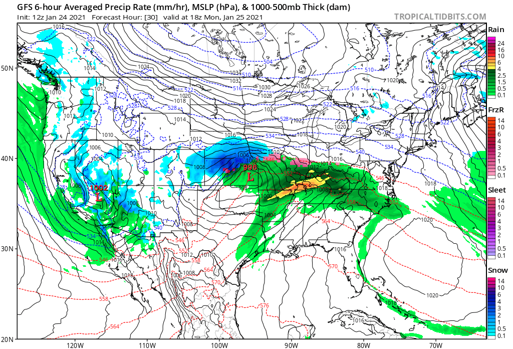
As you can see in the image above, another low waits in the wings southwest of Colorado, and it'll swing through Monday night and Tuesday.
The trend here has been to keep the heaviest snow south of us with this wave as well. Earlier model runs showed a bit more organized surface low developing Tuesday afternoon, with at least a period of light to moderate snow developing along the Front Range. This morning, it's less organized once it gets east of the hills, and has less upslope/more dry air in place for the Denver area.
So, an unsettled couple of days ahead? Check. High uncertainty that it'll equate to measurable snowfall for the urban corridor? Check. A chance we get skipped completely again? Check.
We'll keep an eye on things and pass along updates as needed. For now, best to plan on those chilly temperatures sticking around the next couple of days – and if you see some light snow develop, don't be surprised! If either tomorrow morning or Tuesday start to look at all more organized for our area, we'll pass along updates here.