Sunday brings another round of heavy rainfall to some in the Denver area

Your plans today are, again, subject to a round of storms, just as they were the past two days.
Here's an animation to show the general idea for the progression of storms forecast to develop across Colorado noon Sunday through midnight.
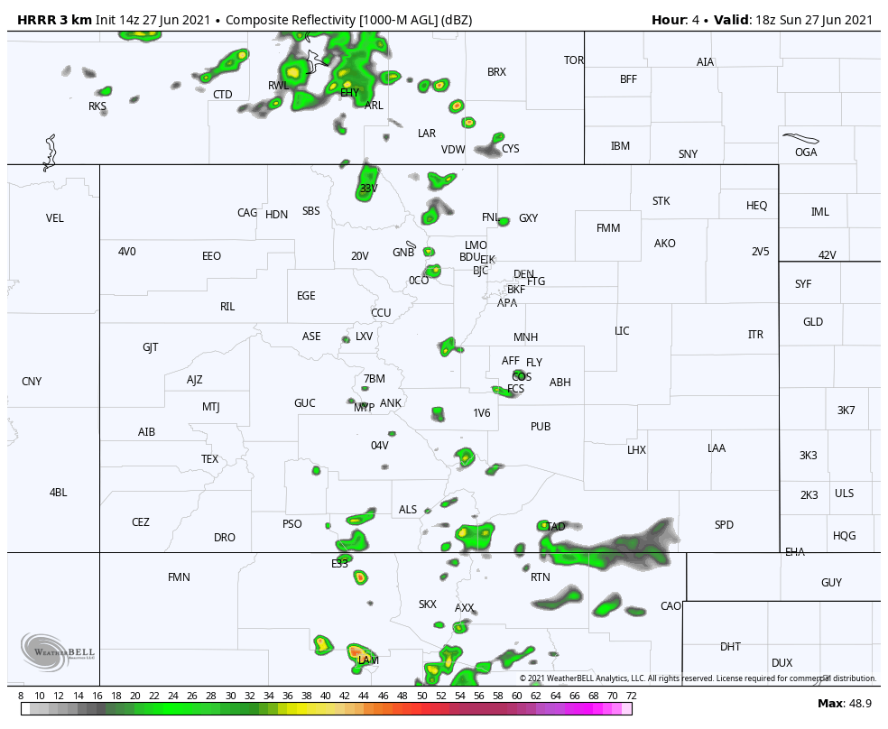
Storms will develop and move from the north to the south/southeast and largely focusing on 2/3rds of the state, leaving the Western Slope the driest.
For a few hourly timelines, let's look from north to south from Fort Collins to Denver to Castle Rock to Colorado Springs.
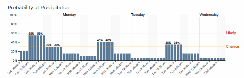
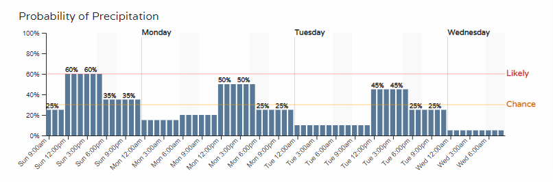
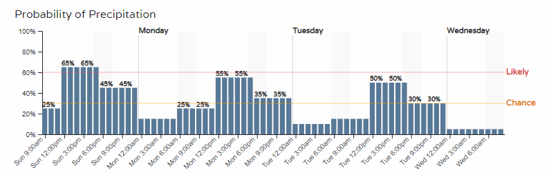
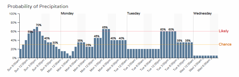
In all cases above, we have a couple days worth of higher rain chances yet to come, including today. Castle Rock and Colorado Springs have a slight edge on the rain chances.
We are likely to see storms from midday to afternoon and evening in the metro areas, with about a 50 to 70% chance of storms for most Front Range cities.
As far as a risk of hail or other damaging weather, there is a chance for some hail and gusty wind but the threat is the lowest it has been in days.
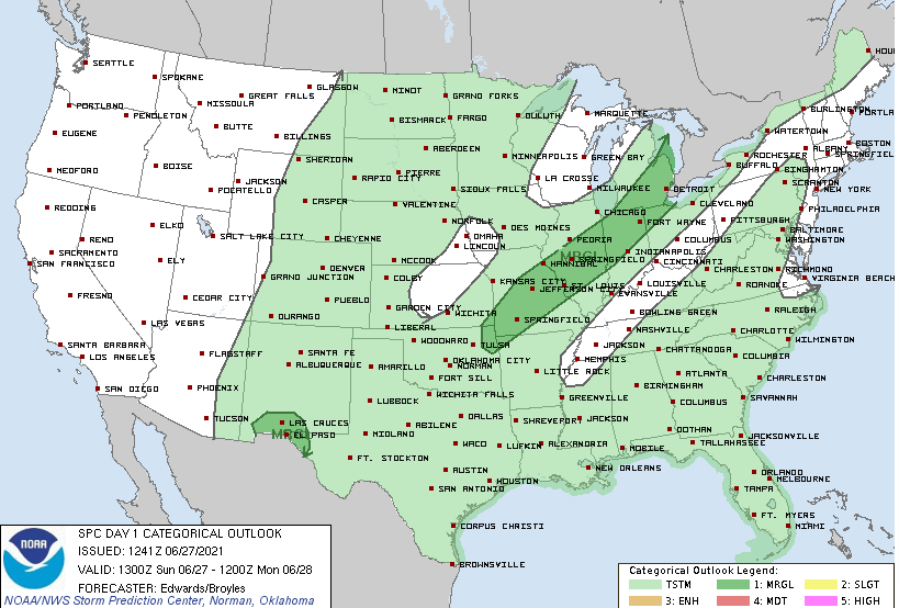
Flooding, again, including flood alerts remain a higher threat than severe thunderstorms.
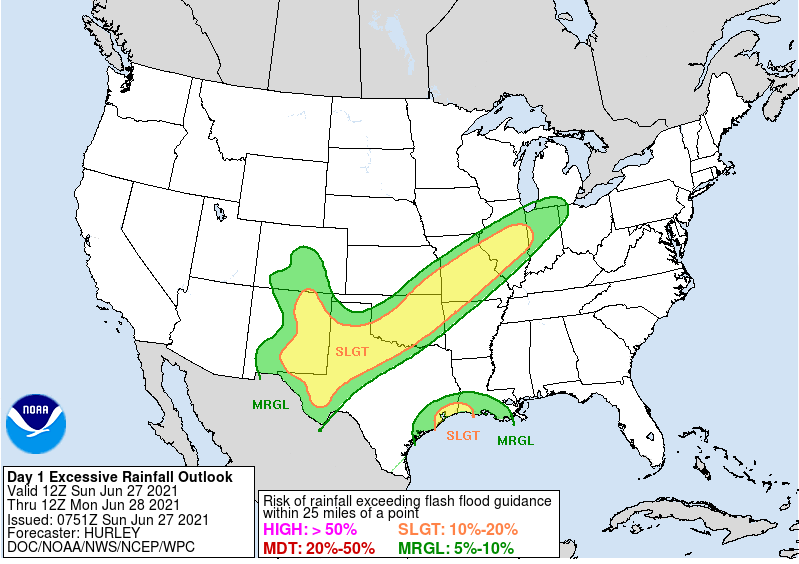
Today the greatest chance for excessive rainfall (risk of rainfall exceeding flash flood guidance with in 25 miles of a point) is greatest to our south:
Have a great Sunday.
In case you missed it, we see a favorable rainfall pattern now but much of June to date turned very dry, and hot, as you know.