The State of the Atmosphere: Sunday, January 16th, 2022

Friday's snow event was a non-event for most areas, but proved quite a challenge for folks trying to escape the to the mountains Friday evening as a heavy (and persistent) band of snow setup west and southwest of Denver. This meant a narrow band of 6"+ snowfall, and incredibly ice conditions on I-70 and 285 heading up the hill out of town.
As one of our readers rightfully pointed out, our forecast update on this system probably should have given more weight to the potential for some the immediate Denver suburbs to see some snow, as the focus of our attention was on the foothill's chance. Our station, located on the east side of Golden in Denver West picked up 2.5" of snow, while just a couple miles east saw little to no accumulation.
You can see the totals below – focused west of Denver, and along the Palmer Divide, with most of the rest of the state seeing little or no snow on Friday!

The animation below shows the band of moderate to heavy snow as it slowly sagged south Friday evening, piling up a fresh coat of snow for Genesee, Evergreen, and points south like Perry Park and Monument.

Even with the rather tight gradient, and narrow nature of the band, several models actually did quite well with this system. Here was the morning snowfall forecast from the 3km NAM on Friday, with a pretty good idea of what ended up occurring Friday evening:

The week ahead
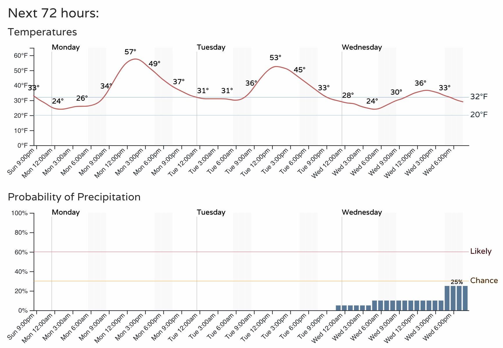
The week ahead starts off mild, and with that if you have a holiday on Monday make plans to get out and enjoy the day! Tuesday will also be on the mild side, before cooler weather arrives midweek. Here is the hourly planner for Denver through Wednesday evening:
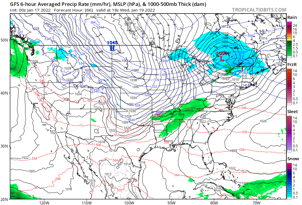
On the precipitation front, Wednesday's cold front may leave quite a bit to be desired across the region, as most guidance is pretty dry with its passage. Still, a chance we'll see some snow showers move through, so we'll keep those in there for now and see how things evolve. The latest GFS, for what its worth, is dry:

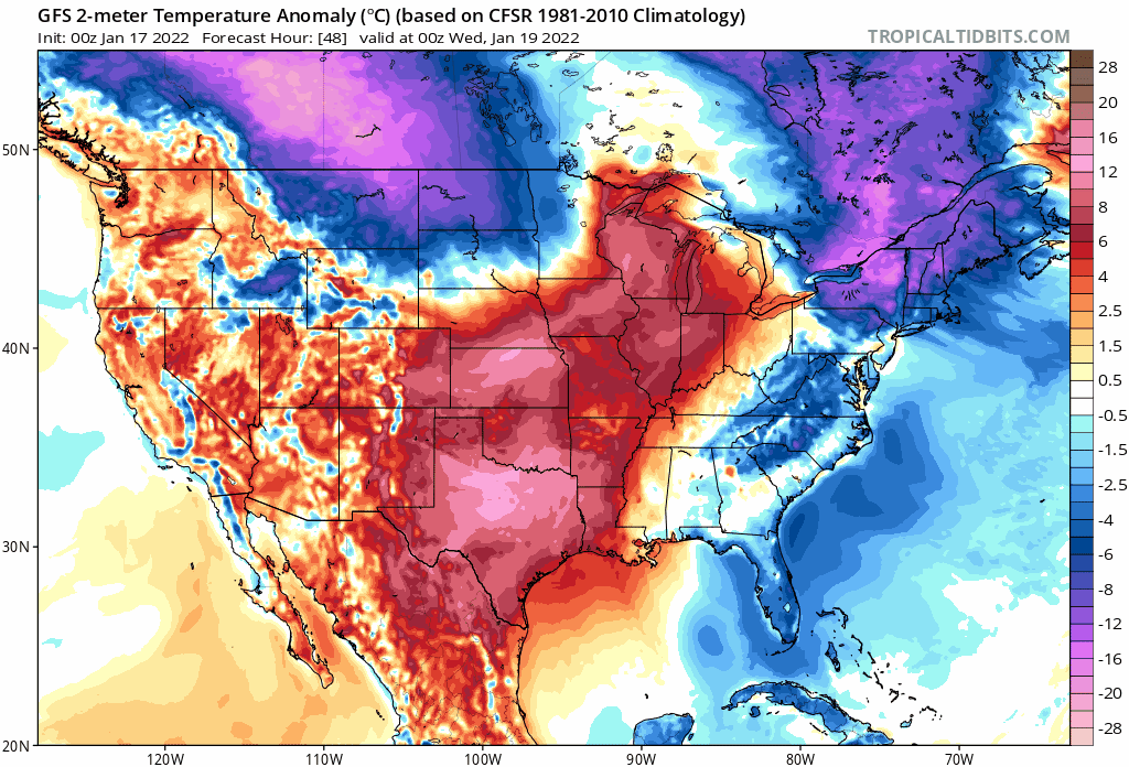
And, while a cool down looks possible if not likely for midweek, the greatest cold anomalies will be east, so the coldest weather could end up favoring the eastern plains of Colorado vs the urban corridor – but the exact placement of the cold air remains to be seen.
What you can see in the animation above, is that the warm air to start the week across the central plains states is replaced by another push of cold air from the north. It'll be transient in nature, with moderating temperatures across Northeast Colorado by the end of the week before another system races through Friday night and Saturday.
As you can see above, the end of week/weekend system may have a bit more moisture to work with, but speed will likely be an issue again. Still, something to watch – and in a generally quiet pattern, it's nice to have a steady stream of maybe snows to keep an eye on.