Colorado weather: Much warmer days ahead, snow for some Christmas weekend

As we climb out of the deep freeze – some history made the past couple of days – we have a sizable warm-up coming through Christmas and into the New Year.
But first, yesterday marked Denver's second coldest day on record, with an average temperature of -15°F on Thursday. Congrats!
🌡️Yesterday, December 22, 2022 marked Denver's second coldest day on record.
— NWS Boulder (@NWSBoulder) December 23, 2022
The daily high was just -6°F, and the low was -24°F, giving us an average daily temperature of only -15°F! #COwx pic.twitter.com/BvCYv2OMuq
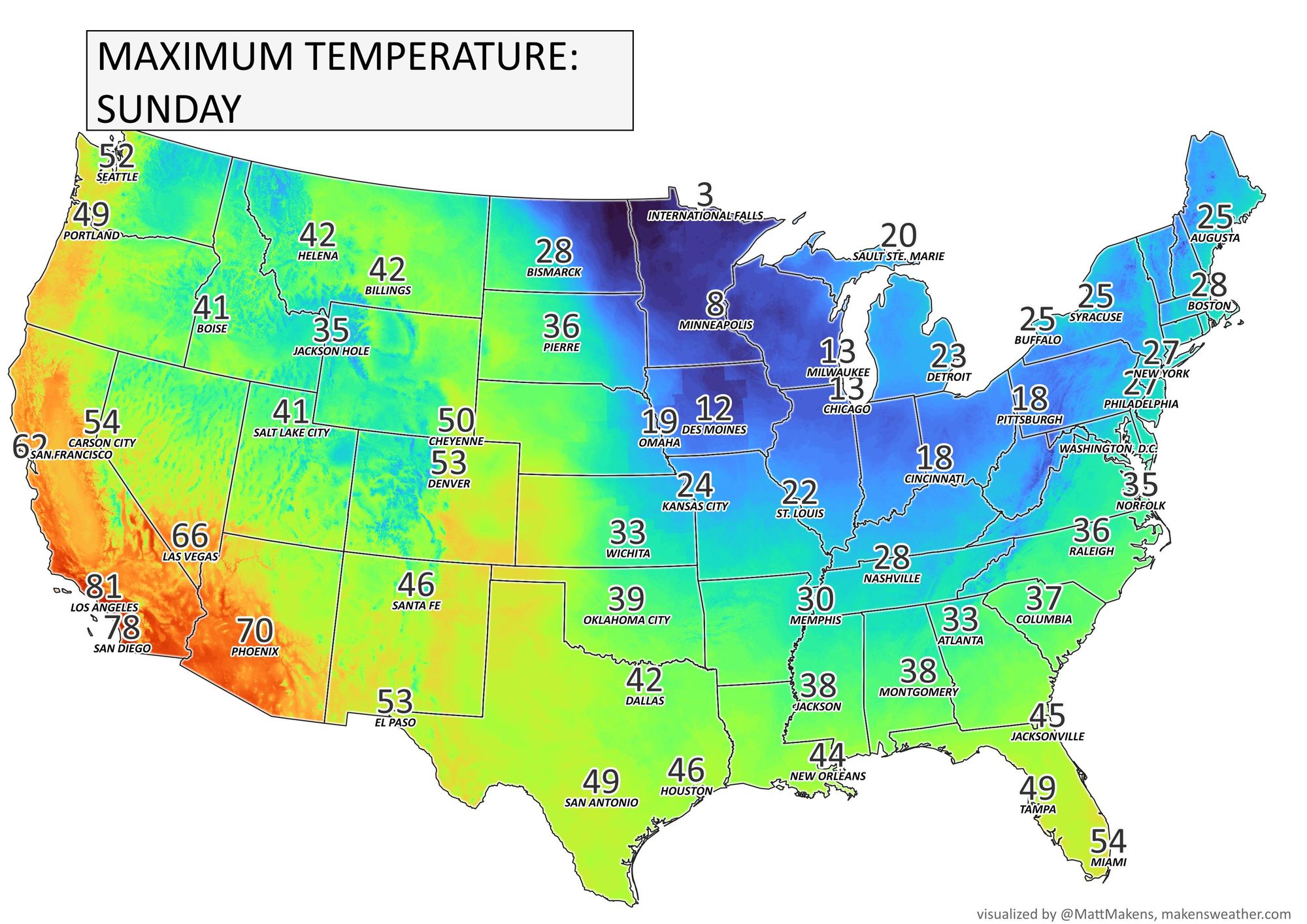
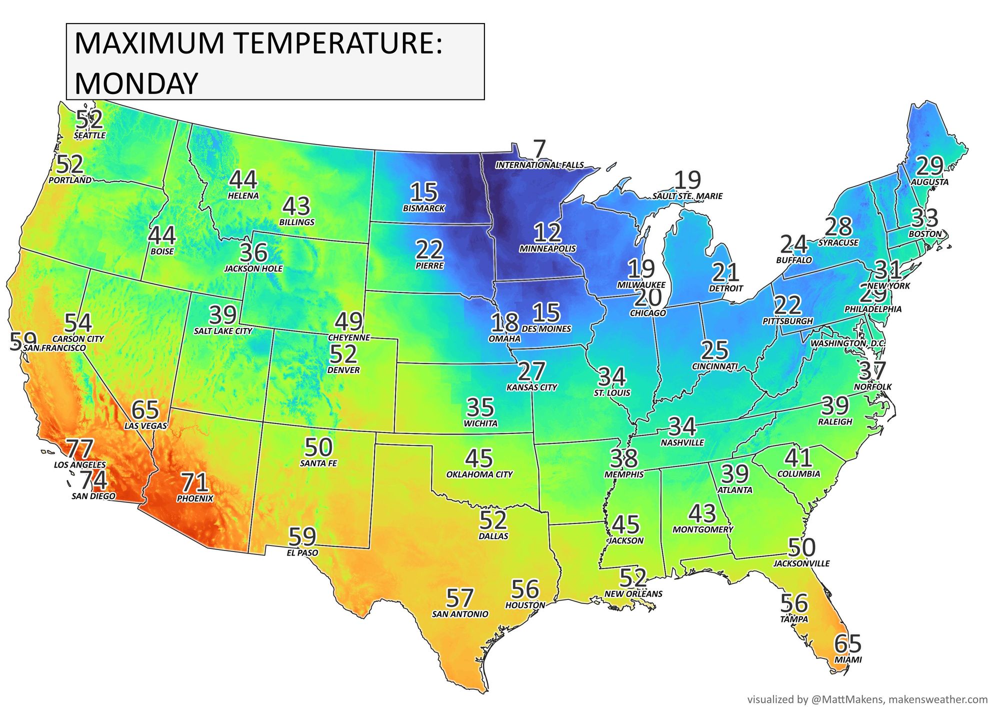
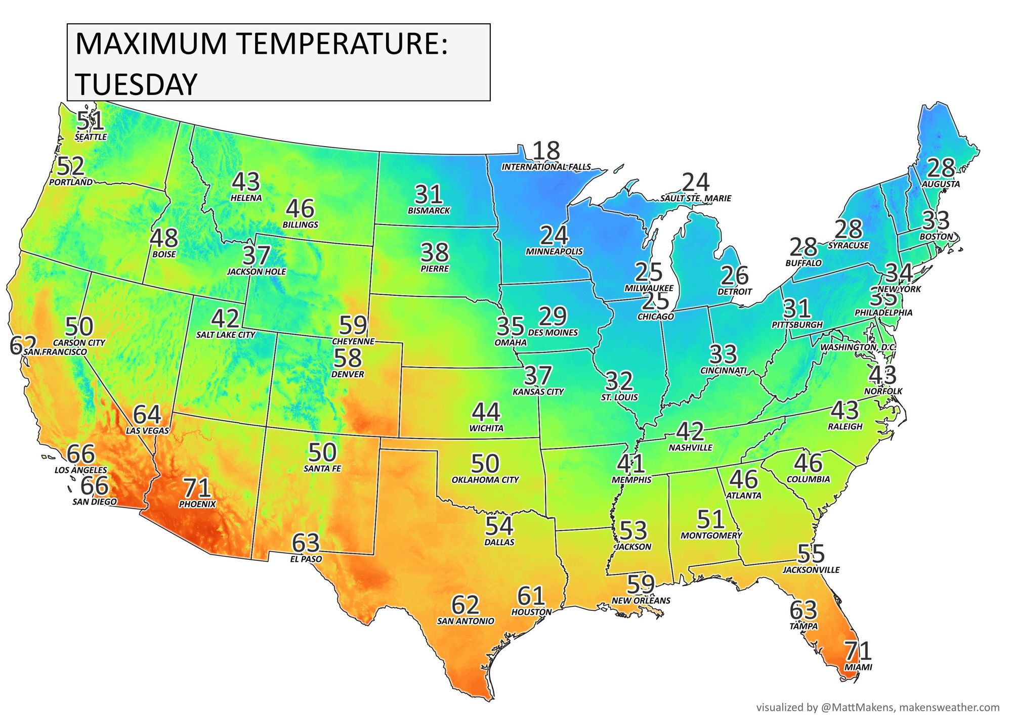
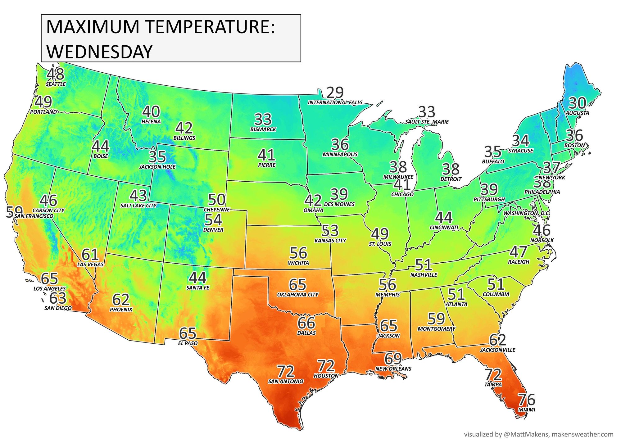
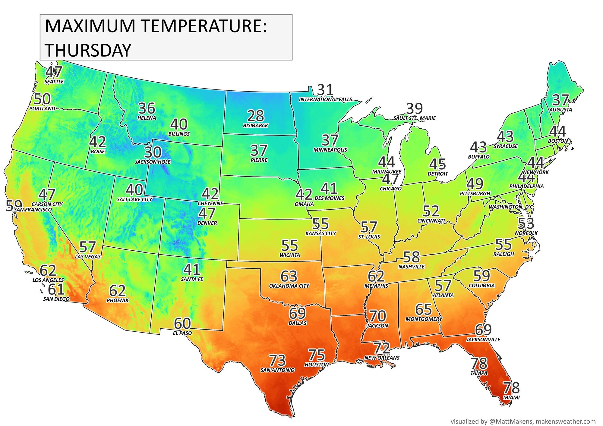
For the state, the warmer temperatures Friday moving into the state from the southwest. We discuss the warm-up from a national standpoint here:
Locally:
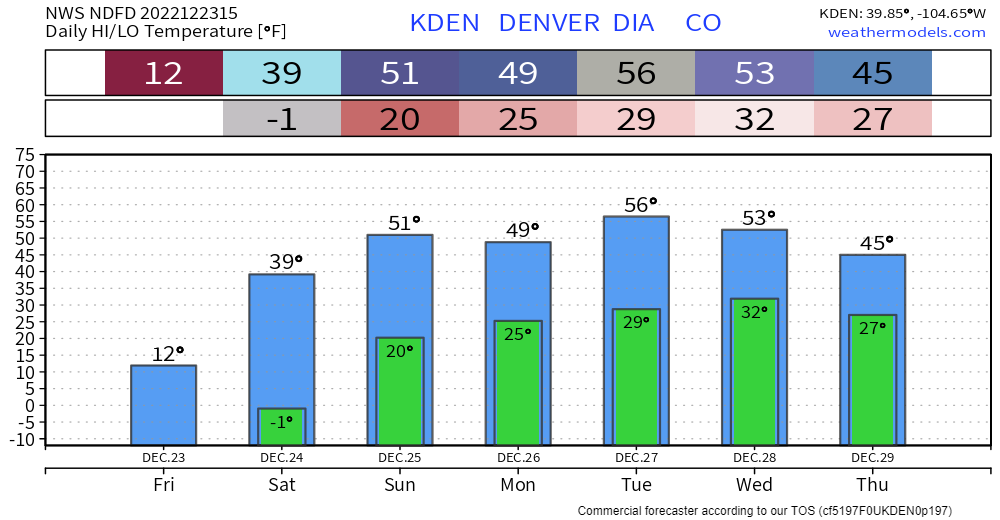
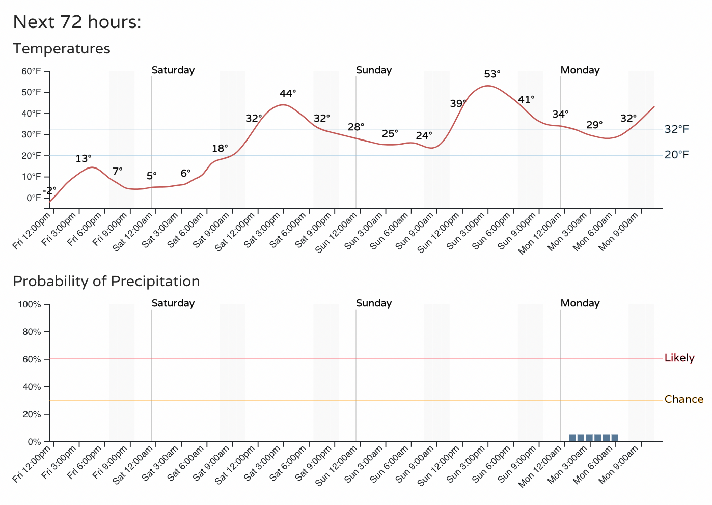
Overall, the week ahead will be relatively warm and mostly dry. Let's take a look at the next three days.
Denver's hourly planner:
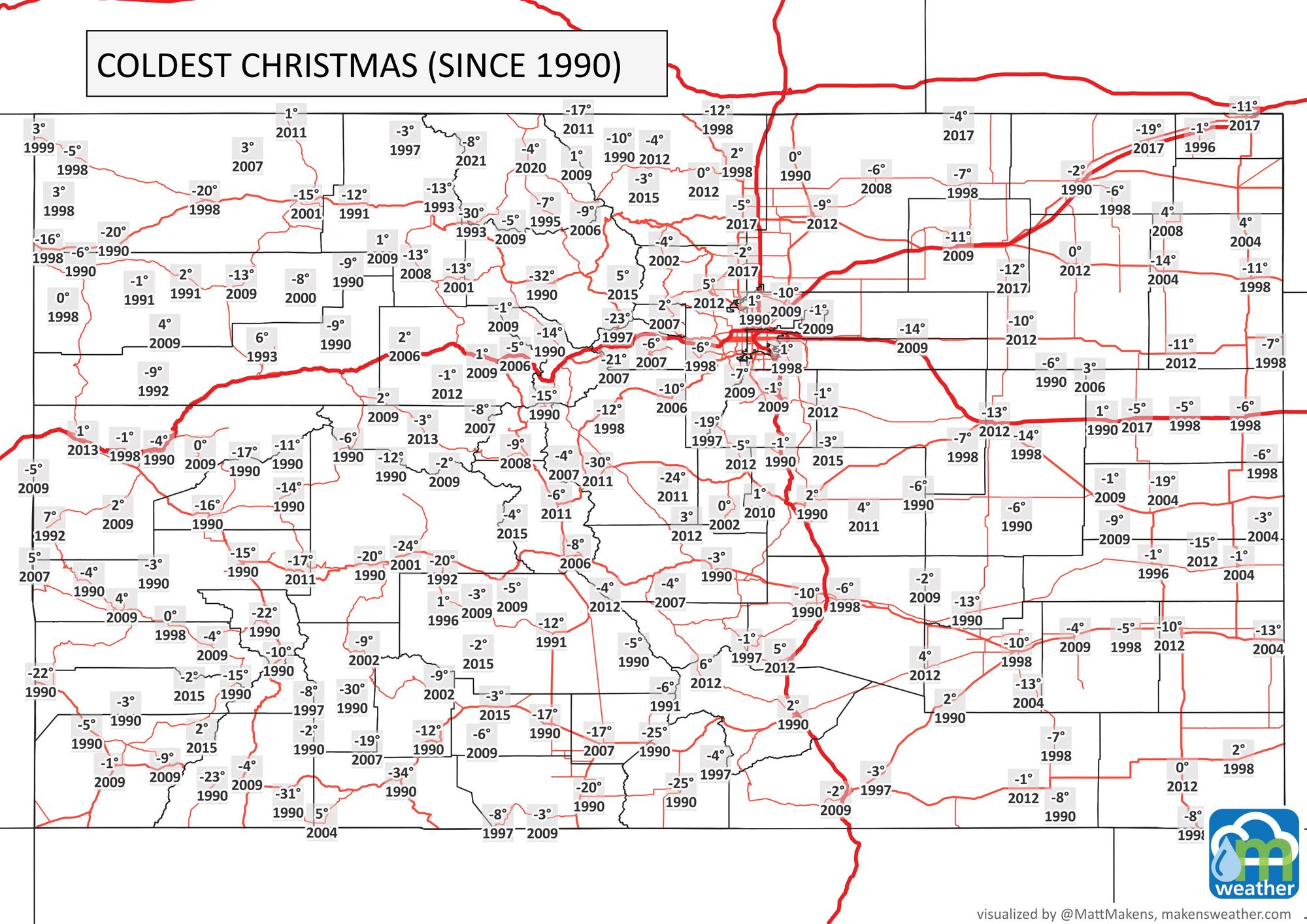
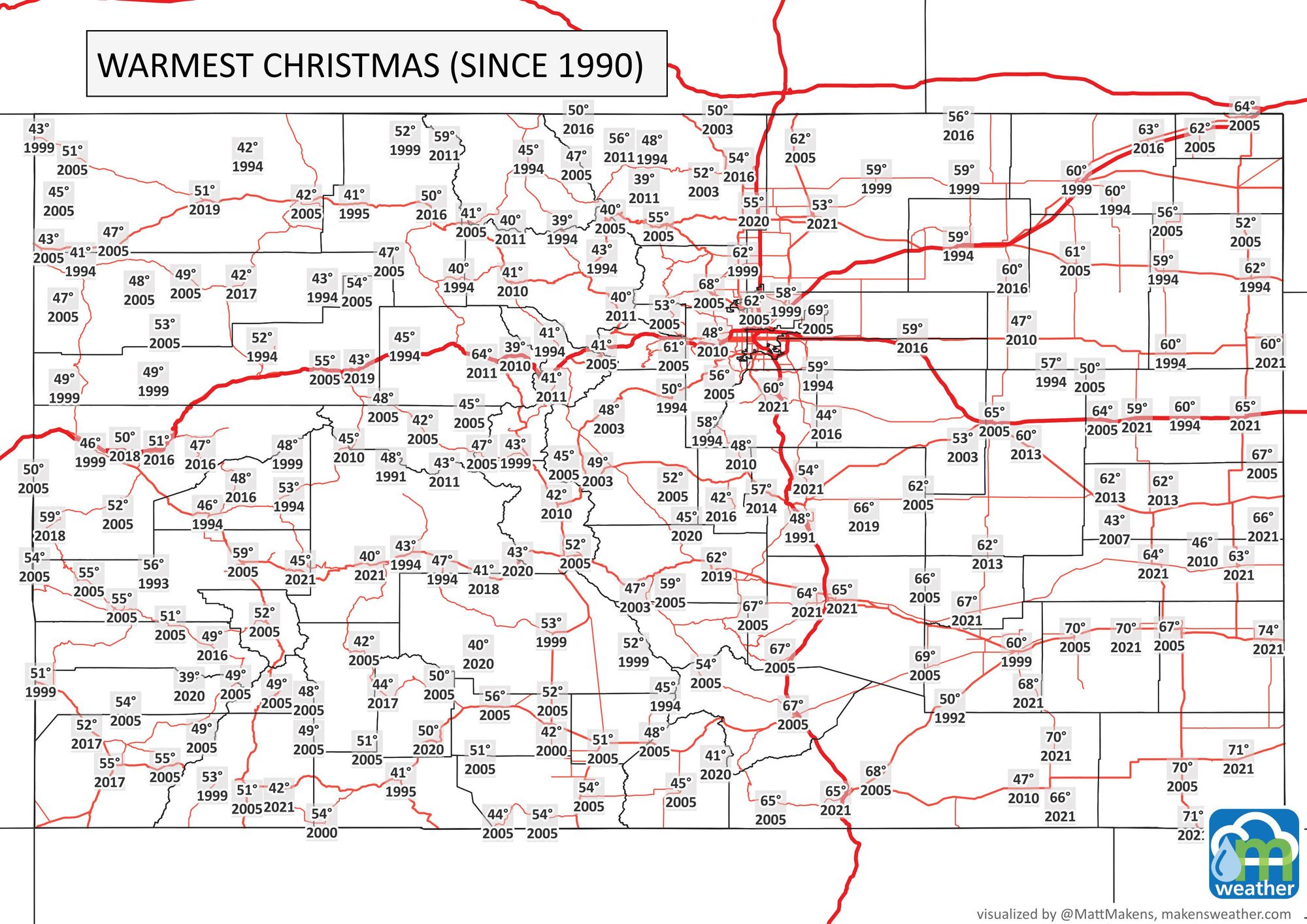
That puts Christmas day into the 50s for the city! Since we are on the subject of Christmas day, here are some stats for Christmas Day for stations since 1990. Shown are coldest, warmest, and snowiest December 25ths.
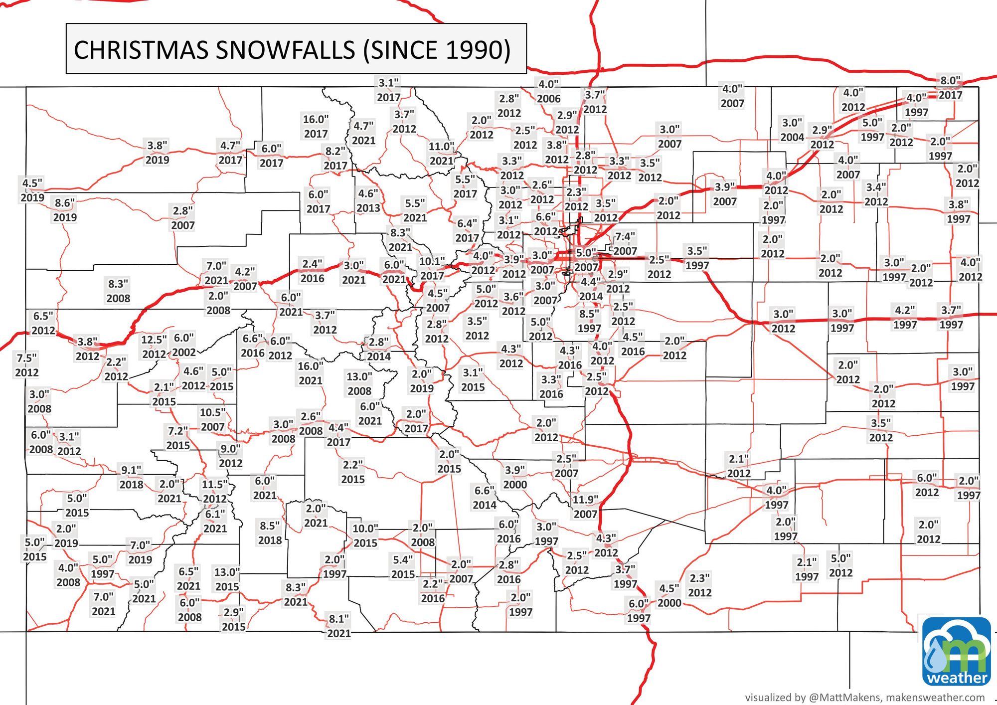
I ended with snowfalls. Do we rival that this year? Not at all likely. Here is the snowfall projection for the next three days.
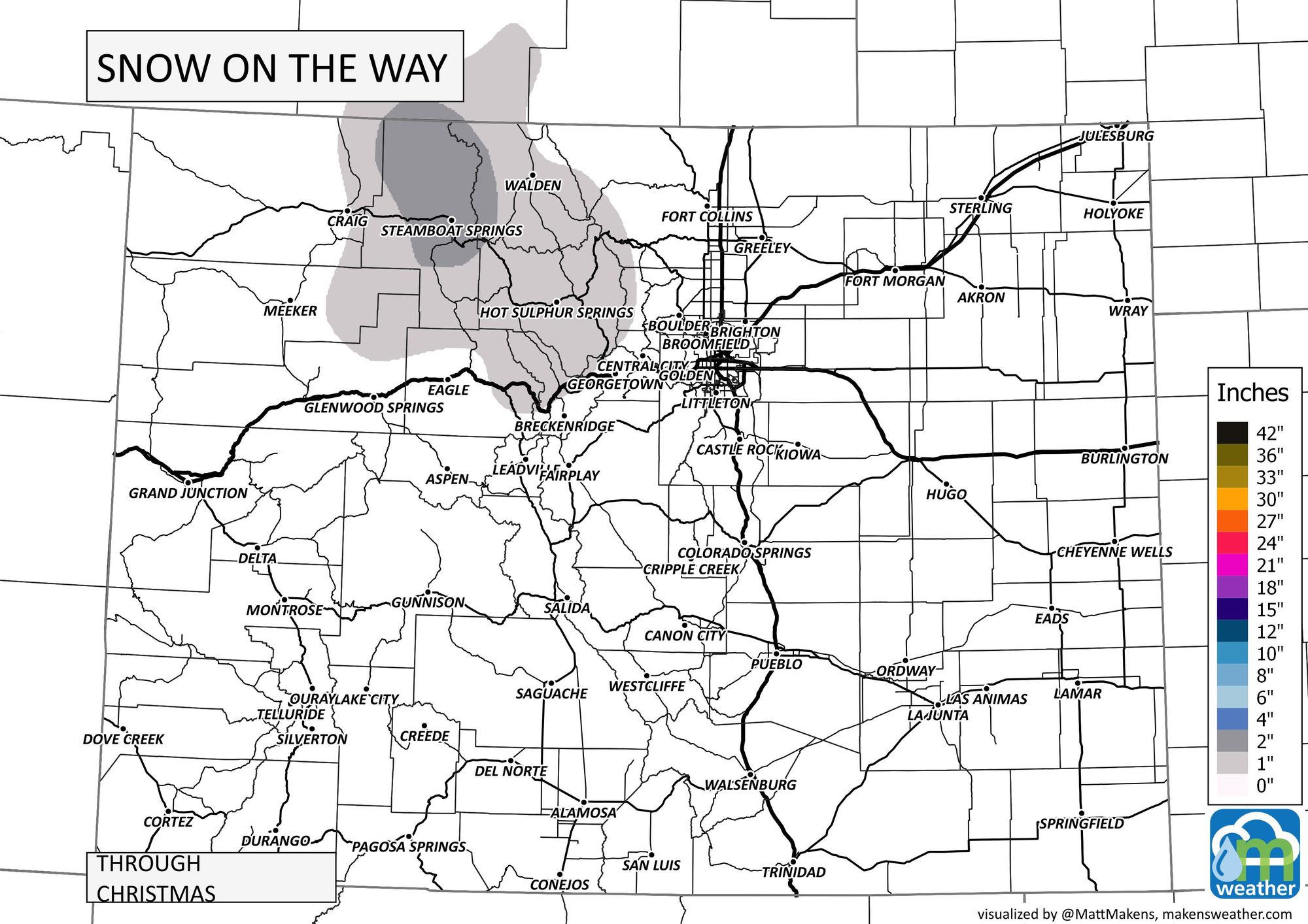
Temperatures remain warm with lower end snowfall chances for next week.
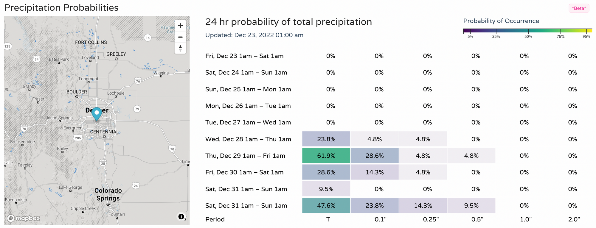
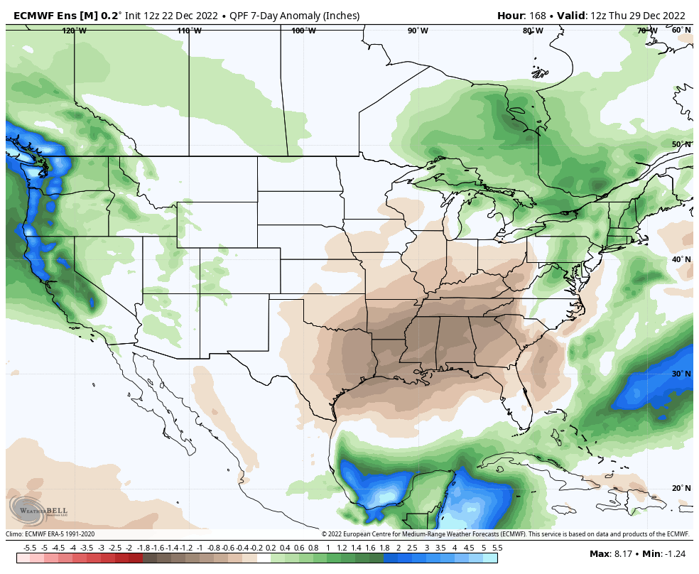
With the warm-up comes a drier outlook for awhile. Shown as the precipitation in terms of above or below normal, we have a neutral outlook for much of Colorado the next week.
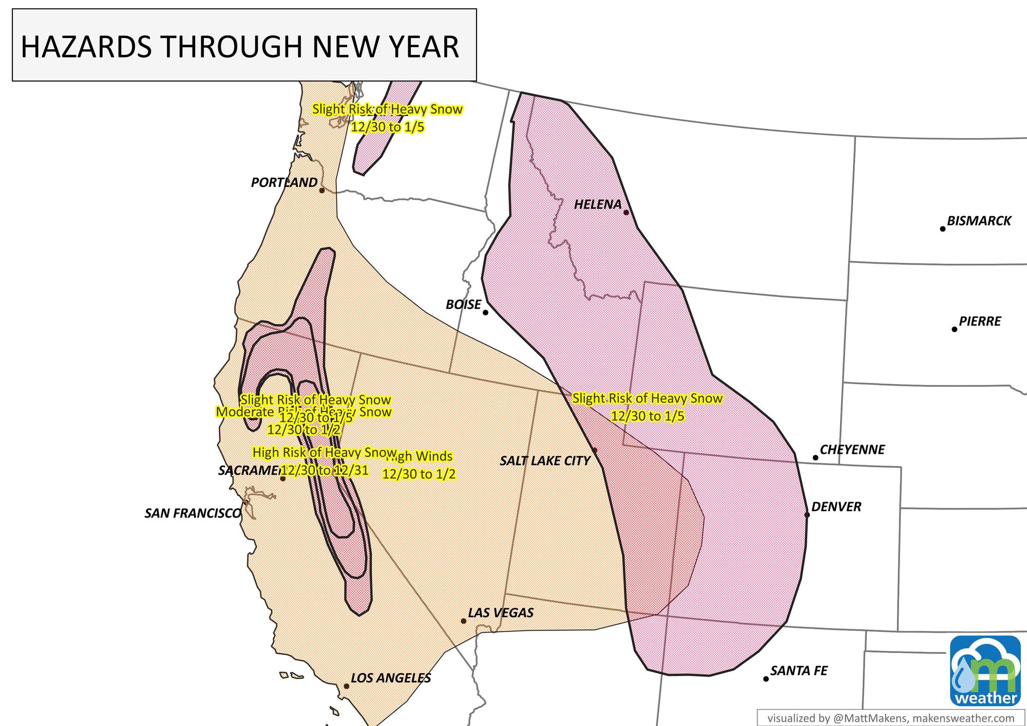
That is until the New Year when there is some potential for heavy snowfall in the mountains - a chance of anyway. From 12/30 to 1/5 there is a slight risk of heavy snowfall throughout the Rockies.
Bottom line, warming temperatures through Christmas and beyond, with not too much snow on the horizon for the week.