
Colorado weather: An active weather week across the region, but will that equate to snow along the Front Range?

Well, not much of storm showing up for later this week in really any of the models today after a couple of days with some impressively snowy runs. As we covered yesterday, the outlook for the coming week remains quite uncertain – with plenty of active weather moving across the country, but hard to say how much of that will impact to the urban corridor.
Let's take a look at what the GFS is showing for weather across the country over the next week (through next Sunday night). Plentiful moisture moving into the West Coast, across the intermountain west and Colorado, then pushing east of our area.
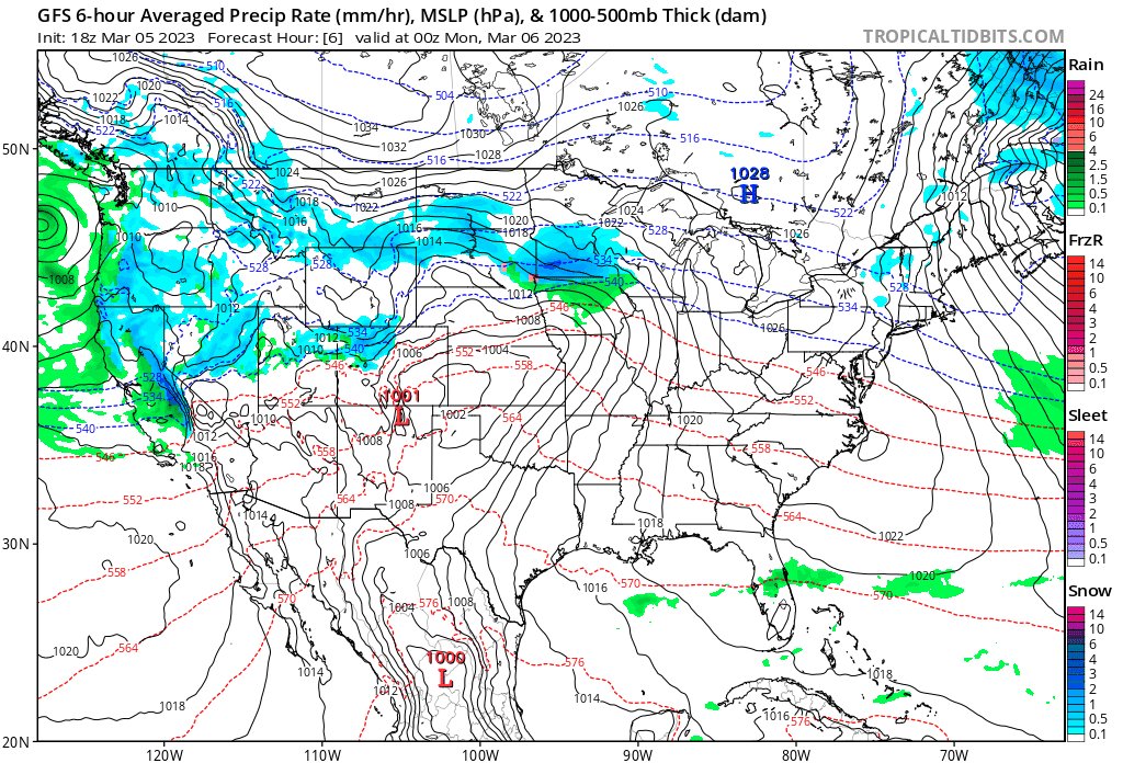
Some of that snow ends up along the Front Range in this animation, but nothing close to what this same model was showing a day or so ago.
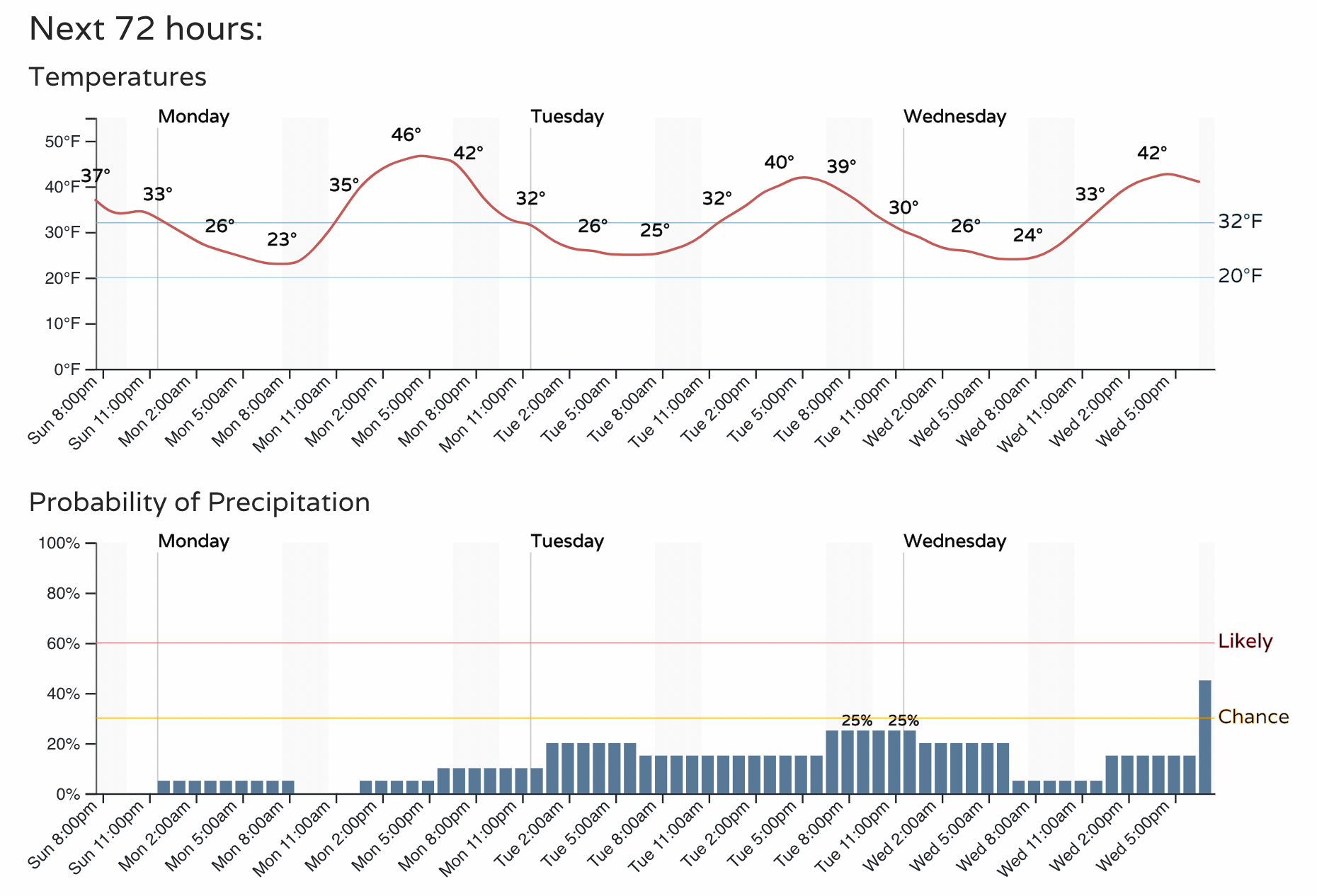
As we start the workweek, plan on the chance of showers (snow, rain, mixed-precip) over the next several days as we are under the influence of this unsettled pattern. Nothing through midweek looks all too significant, but you'll want to be aware of the chance of precipitation and the chillier air on the way:
As for late week... Remember how yesterday the ensembles weren't nearly as bullish on snow as some of the operational models were?
Well, here was the GFS 500mb forecast for Friday afternoon in yesterday's model run. A strong ridge going up across the eastern U.S. and a cutoff low tracking across the Colorado/New Mexico border – a pretty ideal track for snow along the Front Range.
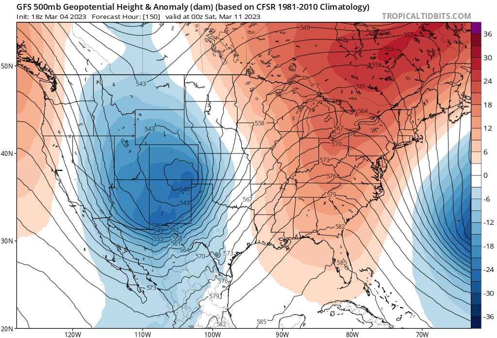
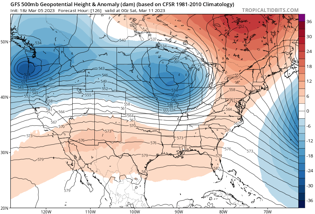
24 hours later that same model today has very little ridging to our east and is very progressive with systems through the week. This means it moves the late week system through very fast and quite far north, and has the same low up over Wisconsin (vs southeast Colorado) by Friday evening, with very little snow for our area.
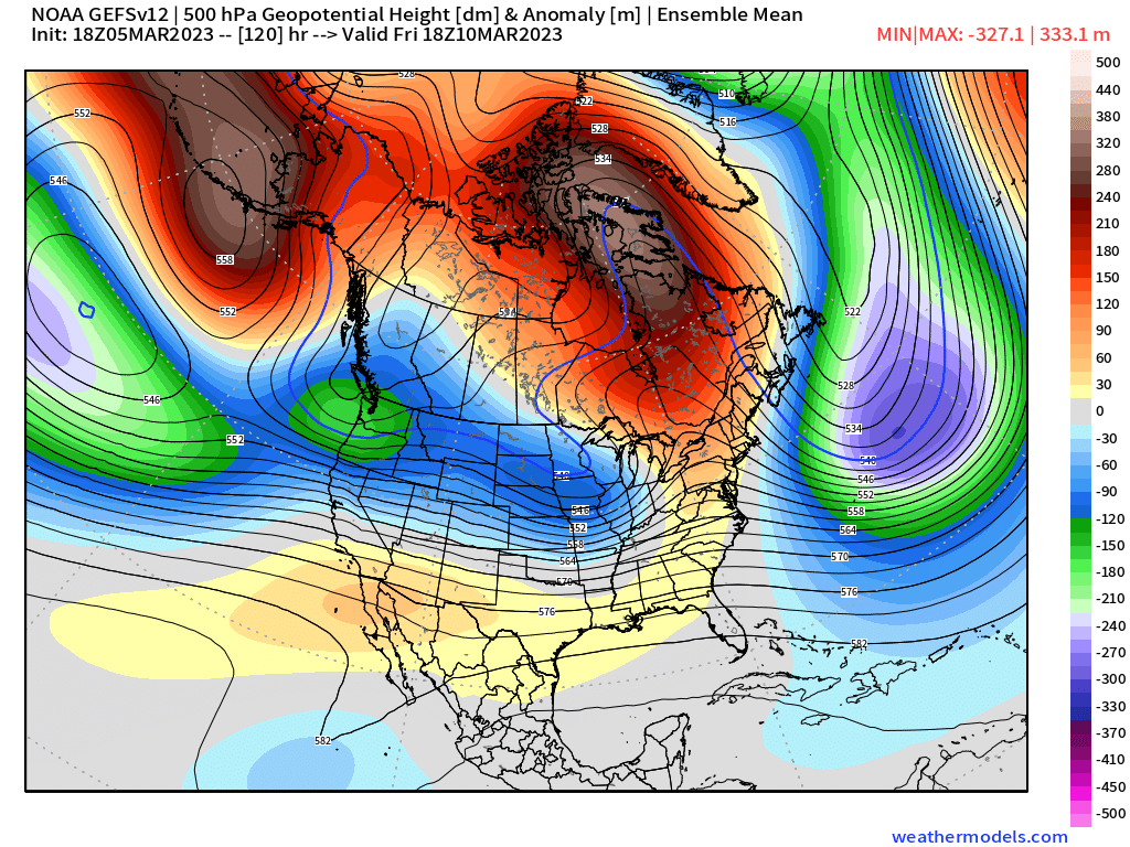
Unfortunately for snow lovers around here the trend in today's data better matches its ensemble. We saw a similar trend from it over the last 24 hours, with an elongated trough across the northern tier – even making it hard to pick out the "system" we're talking about which is well our northeast in the image below:
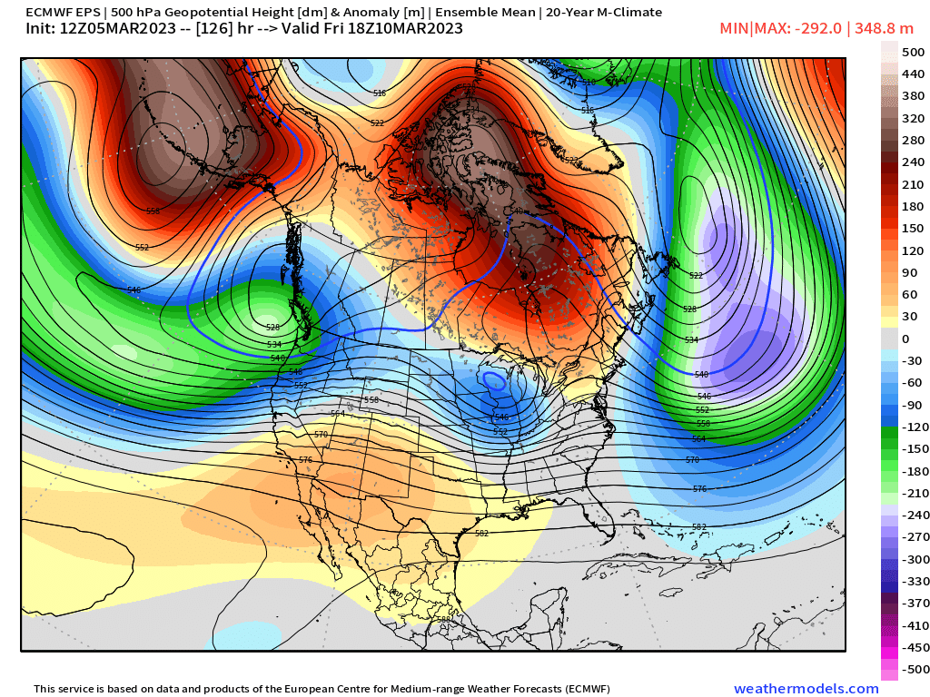
Further, now the European ensemble model has a ridge(!) overhead by late week, with the trough long-gone as well:
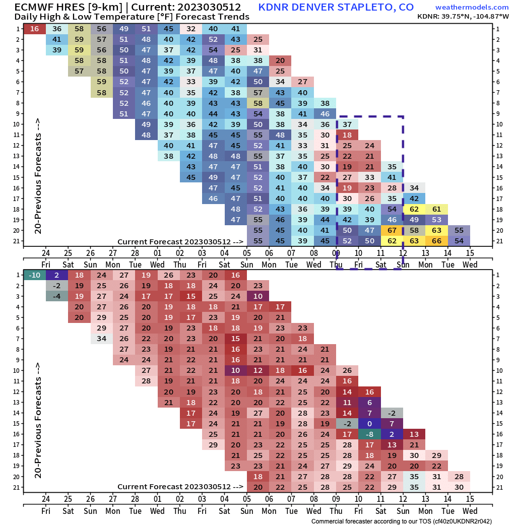
Not surprisingly, the temperature trend has followed a similar trajectory. When the Thursday/Friday timeframe first came into range for the Euro model it had highs in the teens and 20s for Denver, slowly we've seen that warming, with the most recent run (bottom of the checked box) printing highs around 50F for the city!
So, one takeway tonight is that the models are struggling mightily.
We know it's an active pattern for the U.S. We know there is some cold air to tap into. We know potential remains for some snow for our area this week. We also know the odds look considerably lower today for significant snow to occur this week than they did yesterday.
The 5 days ending next Sunday morning will be chilly across the West and northern tier of the U.S., with some of that trying to push into Northeast Colorado as well:
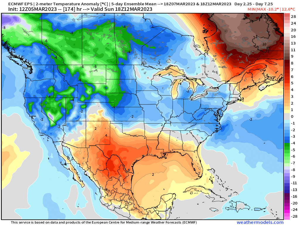
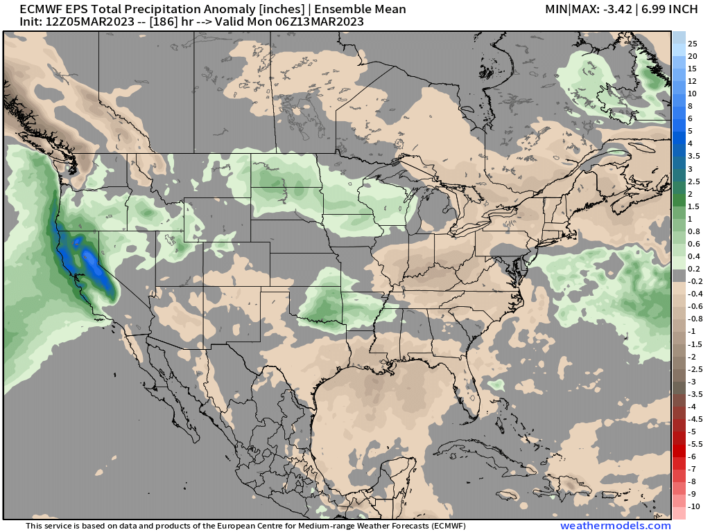
The greatest confidence in above average moisture lines up across California (again!) and the northern high plains, with even a nice signal for Colorado's northern mountains.
I suspect we'll see some more back and forth before things settle on a solution, but for the time being the trend has been a milder and drier one for our area this week, with the bulk of the energy scooting by to our north this week. Let's see how things look tomorrow!