
More mountain snow on the way; snow showers and even some rain in the forecast for Northeast Colorado

A week ago we anticipated a much different end to this week than what looks like will be our reality, at least when it comes to temperatures. We showed this chart the other day, but felt it was worth reiterating.
The top pink box shows what this model had for high temperatures a week ago in Denver for today/tomorrow/Friday, with the bottom box showing the pretty big shift in recent days to the outlook. From teens and 20s for highs, in previous updates - the past several have been much warmer.
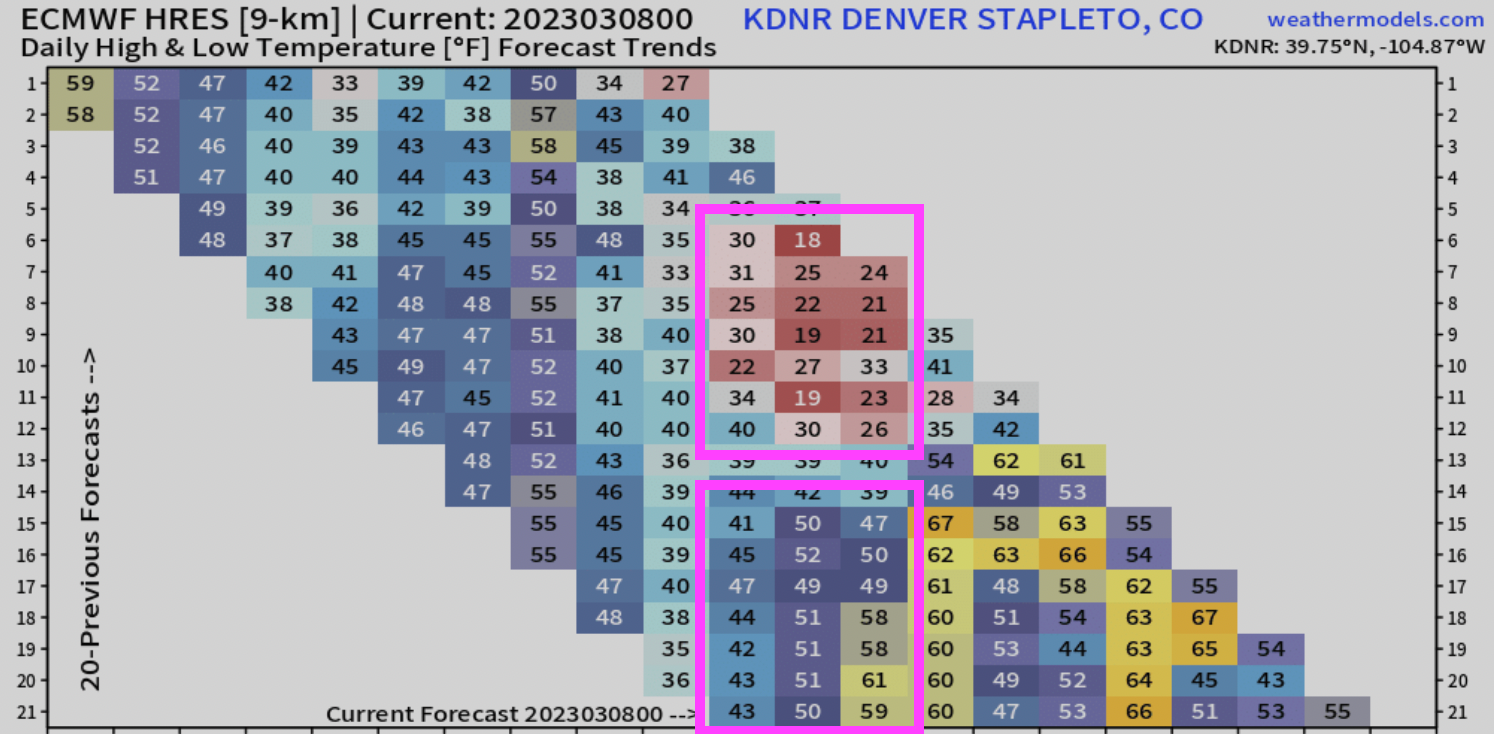
Our forecast now calls for a high for about 40°F today, 50°F on Thursday, and possibly into the low 60s Friday. Not quite the teens and twenties!
So what happened?
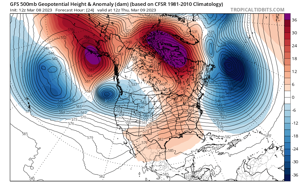
A bit of a similar situation to what we saw with the potential system a few weeks ago. It's still moving across the region, but will stay pretty well north and limit our impacts locally. We've also seen it trend weaker and faster, with a rather robust ridge to our southeast which was really underdone by the models a week ago (though you'll recall Matt talked about that possibility in his March update). The 500mb pattern for tomorrow morning shows that ridge in full control, and our system grazing northern Colorado:
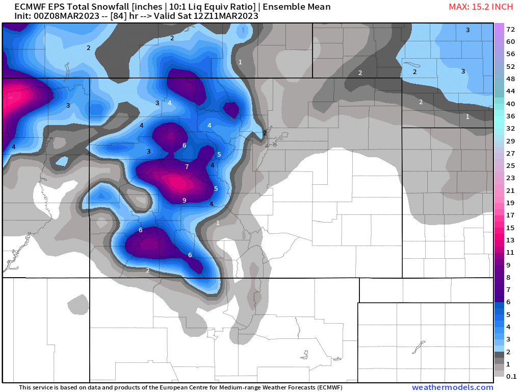
This should equate to some more good mountain snow fall as we end the week and head into the weekend. In fact, a secondary system (the one you see off the coast of Washington/Oregon) in the map above could bring additional mountain snowfall as we head into the weekend for the high country. Across the plains? Precipitation is likely to be limited.
The best chance of snow for the plains as this first system passes looks like it will be early Thursday, with most of the snow potential staying well north/northeast of the Denver area. A look at the latest European ensemble mean snowfall forecast through Saturday morning shows the good snow across the high country, with perhaps a coating to 1" along the northern urban corridor/northeast plains as showers pass through.
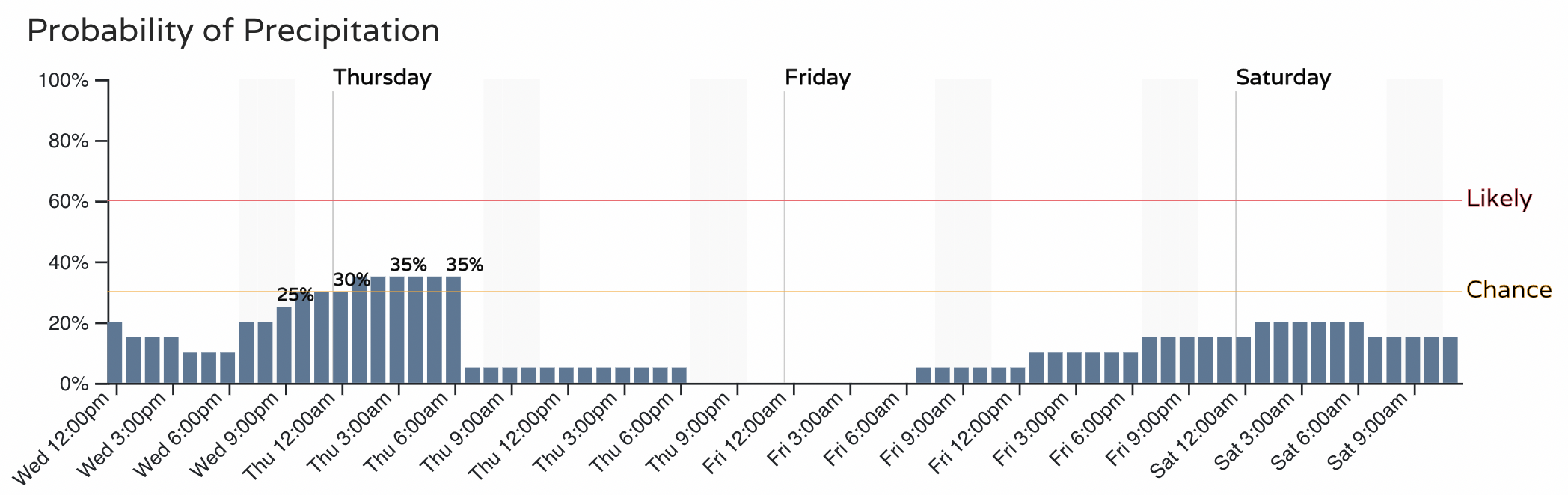
It's pretty hard to be excited about snow chances if you live in Denver:
With a bit better chance of catching a snow shower for areas up around Fort Collins:
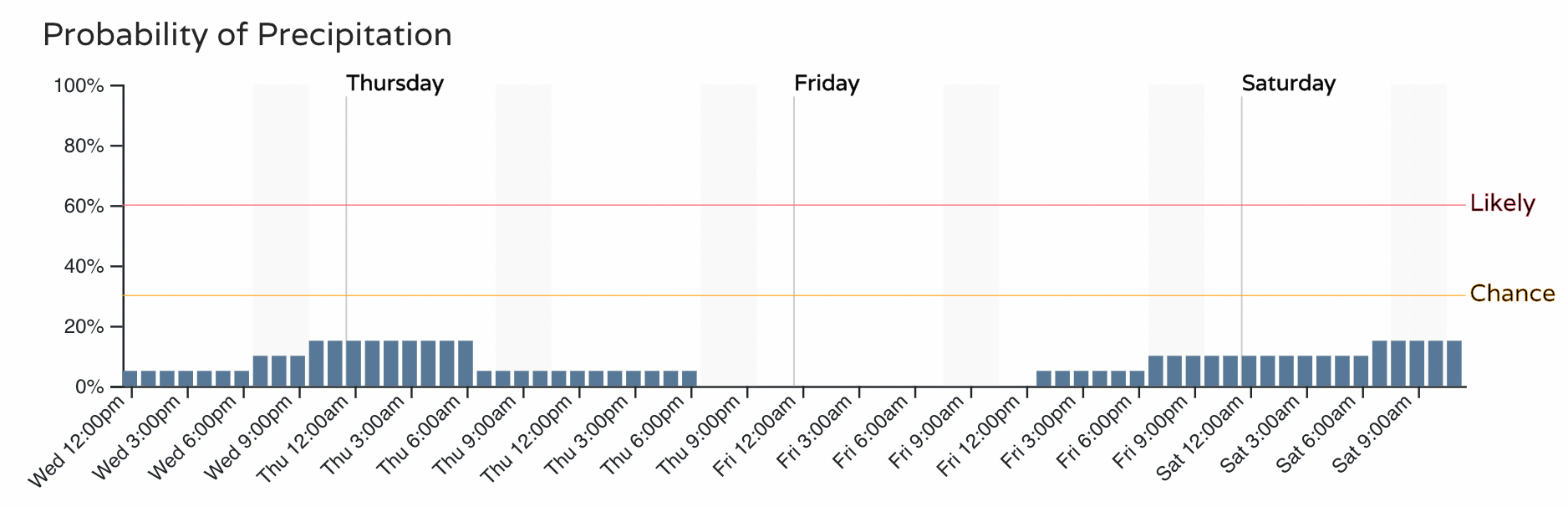
Those precipitation chances Friday into Saturday correspond with some milder air, so for the urban corridor the chance of some rain by the weekend definitely looks like a possibility while more snow moves into the high country.
So, in short, our weather remains unsettled... our mountains continue to see snow... the chance of meaningful snow across the urban corridor over the coming days is quite low... it's possible we'll see some rain by Friday night and Saturday!
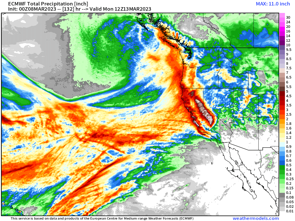
Rather than a big snow across our area to end the week the main weather story through the weekend will be the continued onslaught of moisture into the West Coast. Heavy rain and snow is back in the forecast for California, with flooding an increasing concern over the coming days.
A bit of a disappointing outlook for the snow-lovers in the group I know, but given everything the outlook could be much worse! Great to see more snow coming to our mountains, and it's early March with a rather active large-scale pattern in place, let's not sleep on the pattern.