
Denver weather: First 70-degree day since November possible on Wednesday!

In the week's State of the Atmosphere we focused on two things, the warm up and then the drop with rain and snow showers. The warm up is more impressive than we led on, we have the potential to his the 70s in Denver for the first time since early November (Nov 8th hit 74°)!
No this isn't early, the "average" first 70°F day in Denver history is March 9th.
Here's a timeline of temperatures for Denver for the next three days.
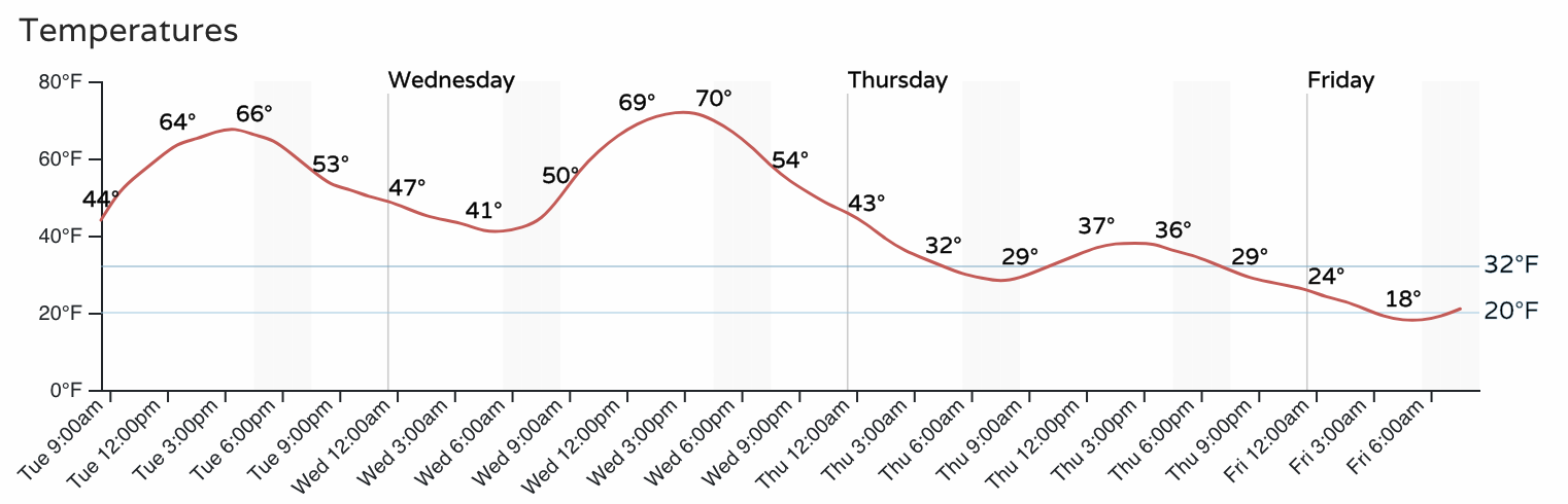
From the upper 60s°F today (warmest day of the year thus far, February 12th hit 65) to near or into the low 70s for many of us tomorrow. While warm, no records across the metro should be in danger on Wednesday as the record high for the date in Denver is 79°F set back in 2015.
Then look what happens as Thursday's temperatures struggle.
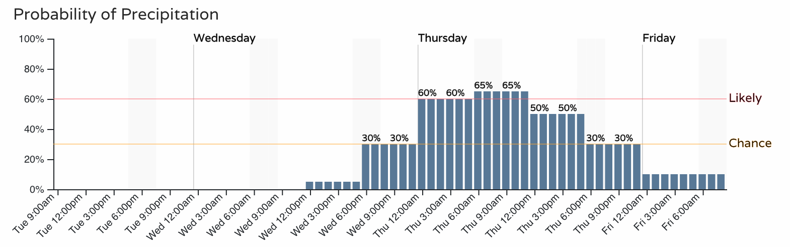
Let's bring in the hourly precipitation chances and you'll see Thursday's temperature drop comes with rain/snow chances.
From this point forward we are discussing the rain and snow on the way. If you prefer a video of that discussion, that is posted here, and continue on to take a closer look at the forecast graphics.
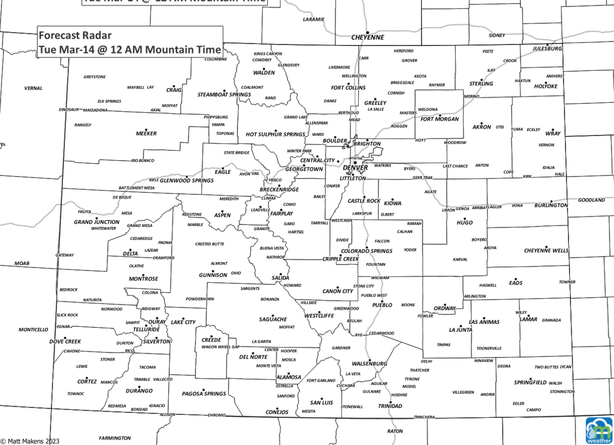
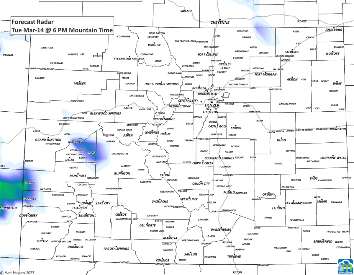
Let's watch the forecast radar to show showers as they move through parts of Colorado the next several days.
Rather scattered, almost disheveled, looking showers aren't they? They will be hit and miss for the Front Range and Plains, giving most of their focus to the mountains. This comes as no surprise to our members, we previously discussed modeling and how this storm has undergone modeled changes with our Insiders yesterday:
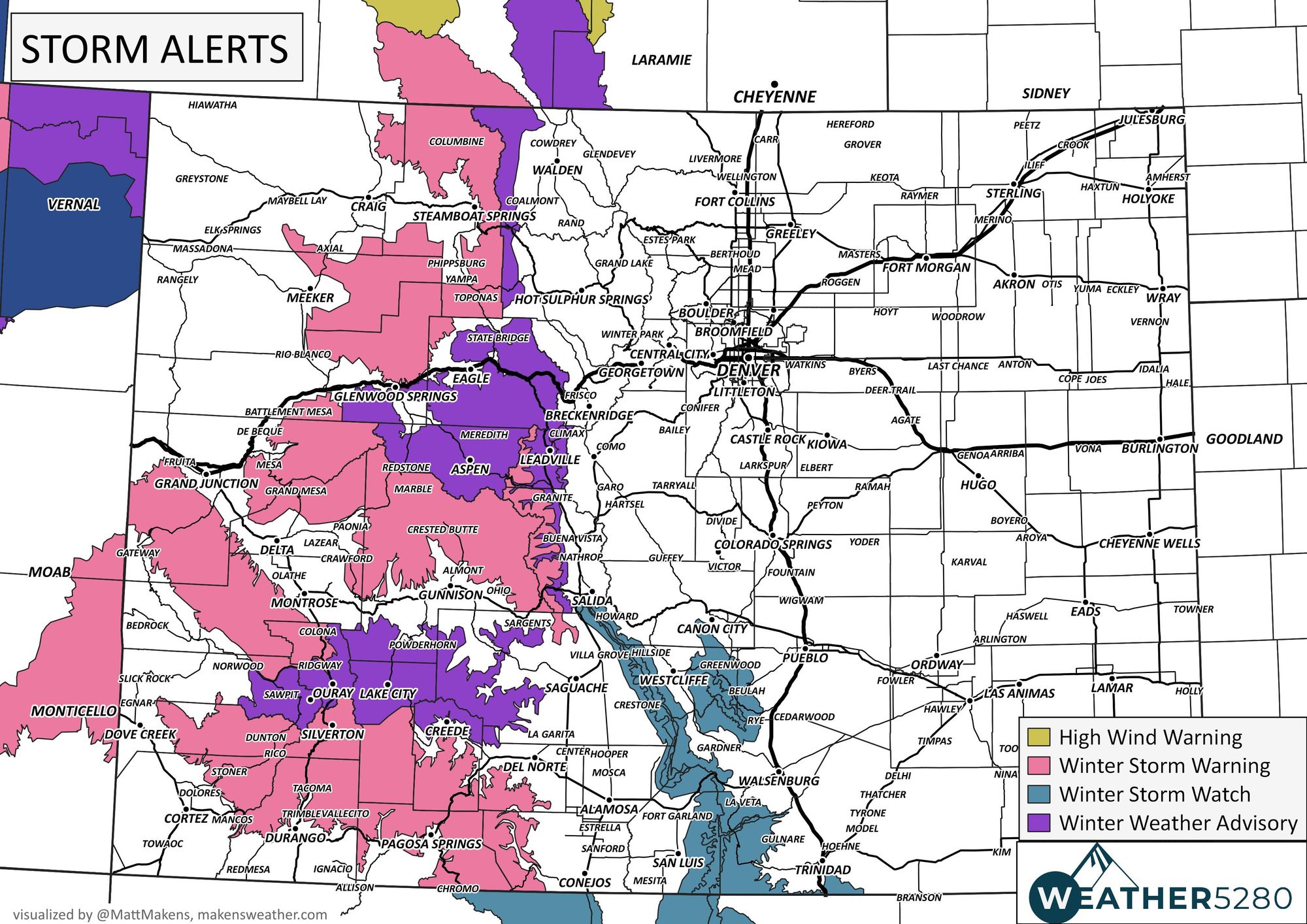
That's where we have the current warnings, watches, and advisories – more snow is headed for the Colorado high country!
Let's see an estimated total precipitation map as a result of the showers the next three days.
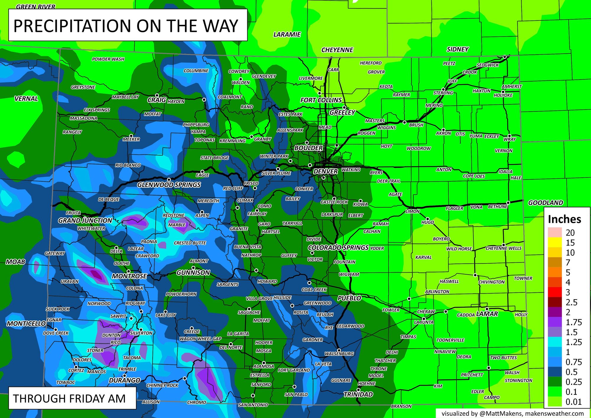
The San Juans will have the most water for the state, but areas near Denver and Colorado Springs may be able to go between 0.10 to 0.25".
In terms of snowfall, we have:
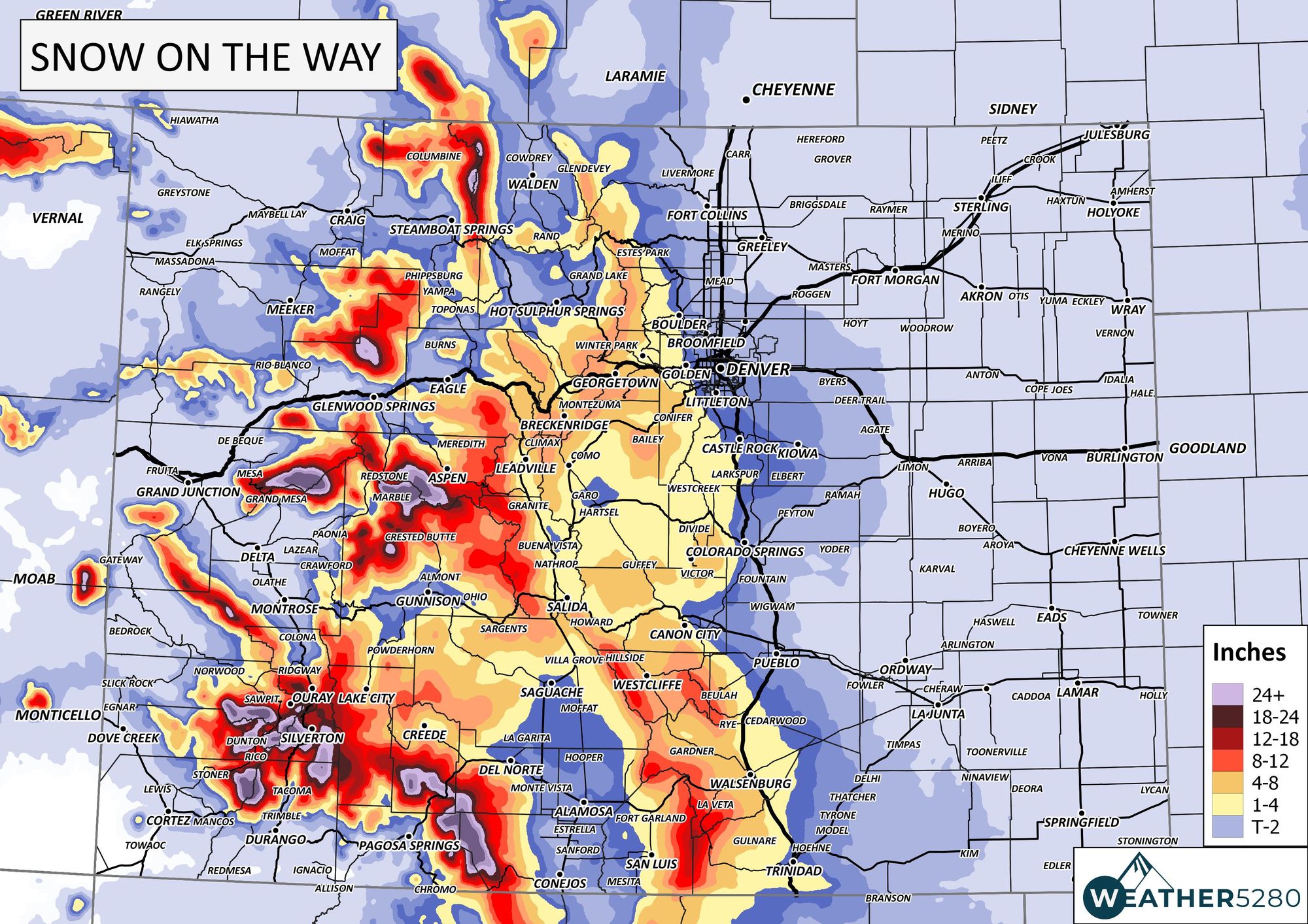
Another couple of feet and more for the San Juans is on tap, the mountains west of Denver are within the 4 to 8" range nearing a foot in isolated cases. Let's zoom in to see how the accumulation looks for the Front Range from Colorado Springs to Fort Collins.
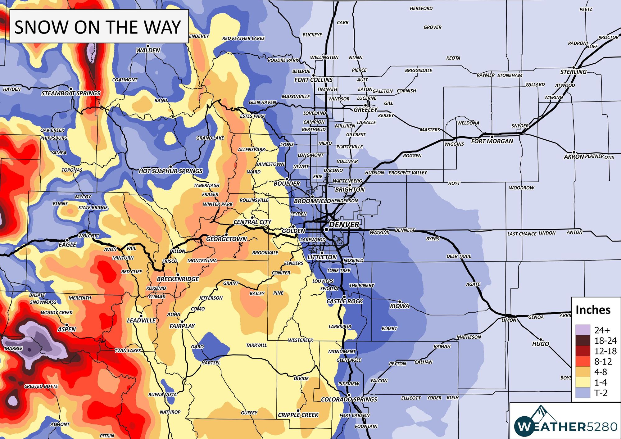
There's a little area of accumulating snow that wants to move off the mountains and sit on the Palmer Divide, including areas near Larkspur and Castle Rock to Sedalia. That line of possible accumulation tends to follow C-470 and Hwy 85 through our foothills.
In those higher elevations, we may see a higher impact to drivers. This impact will be greatest later Wednesday through Thursday for the mountains, and mostly Thursday for the metro areas.
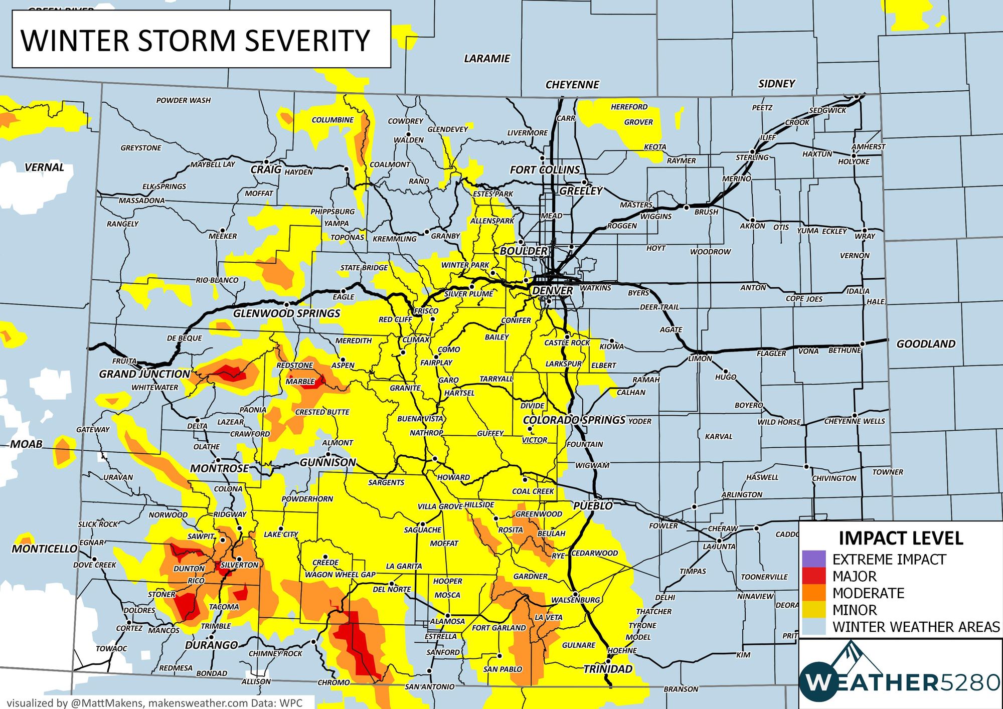
Bottom Line: We have very warm days ahead before a quick moving system brings some of us showers with some impact from snowfall accumulation in isolated cases for the metro areas along I-25.
We will have updates on the storm as it gets closer – subscribe to our email list today – we send you an email when there's important information and Colorado forecasts to deliver.