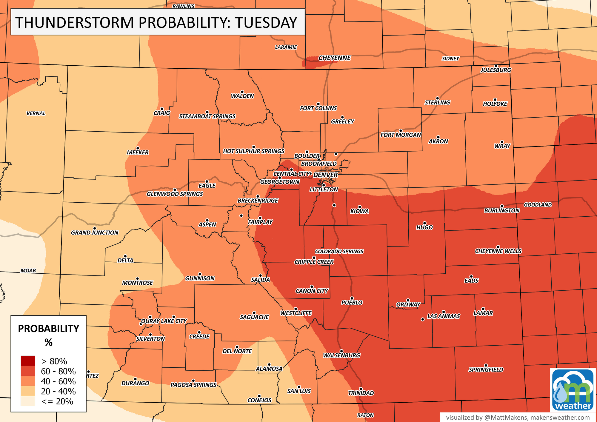
Colorado Weather: Thunderstorm chances highest to the south Tuesday

Tuesday's thunderstorm chances are highest across the south, Denver's chance drops as compared to Monday.
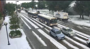
Speaking of Monday, it brought quite an active day of thunderstorms. Boulder got wacked during lunch as we wrote about with some impressive imagery:
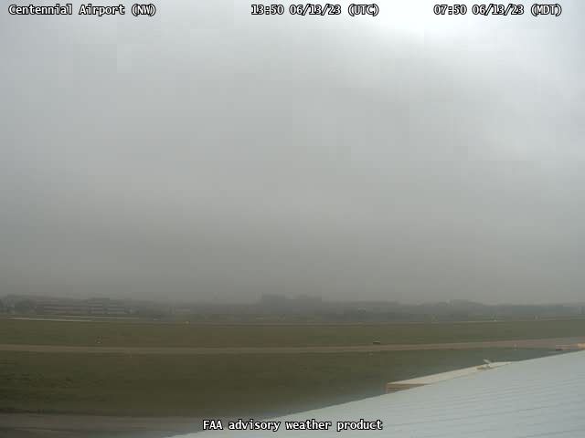
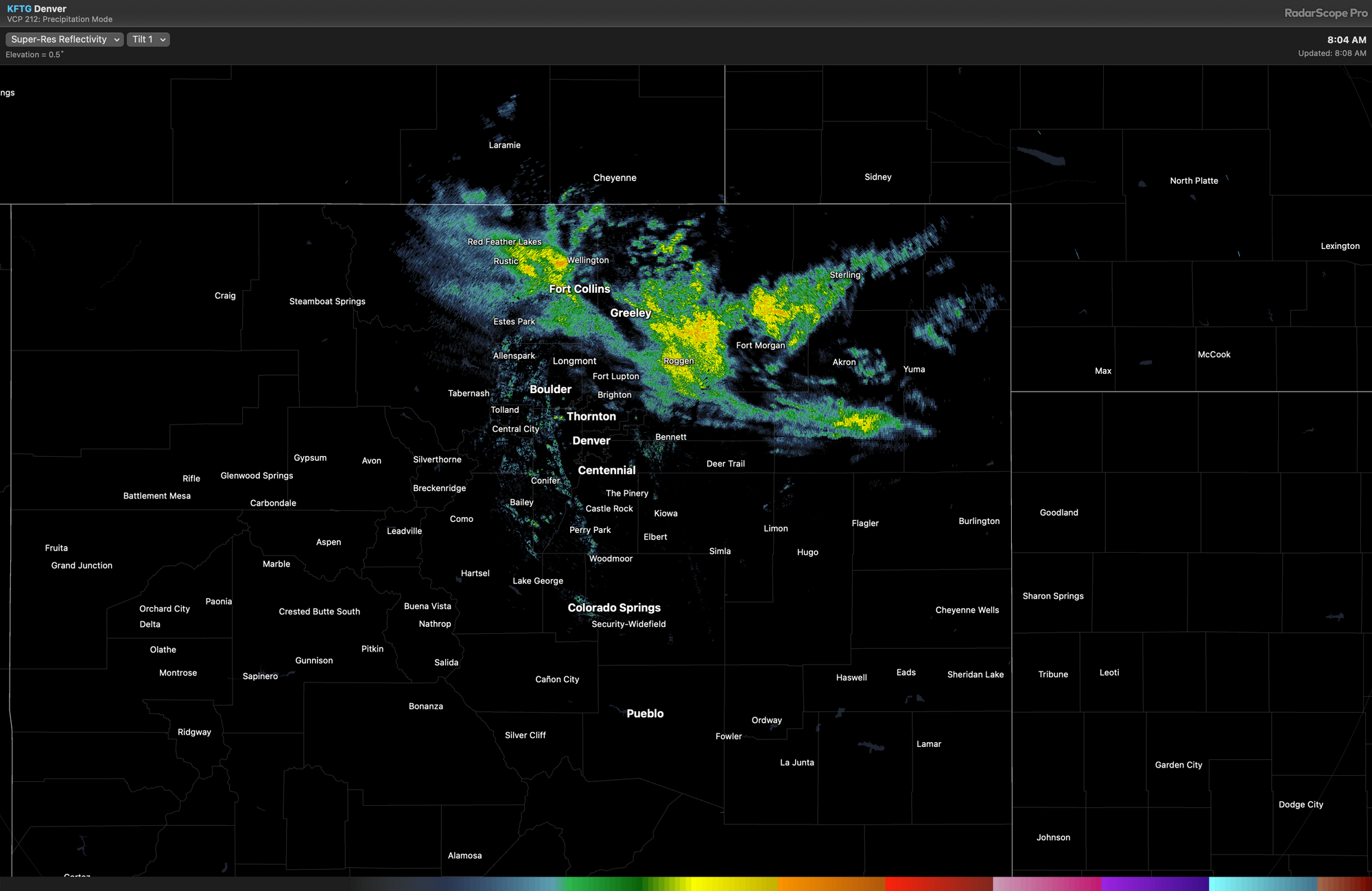
Following the soggy day, fog formed overnight and still covers some of us this morning. Plus, a few showers are floating across NoCo.
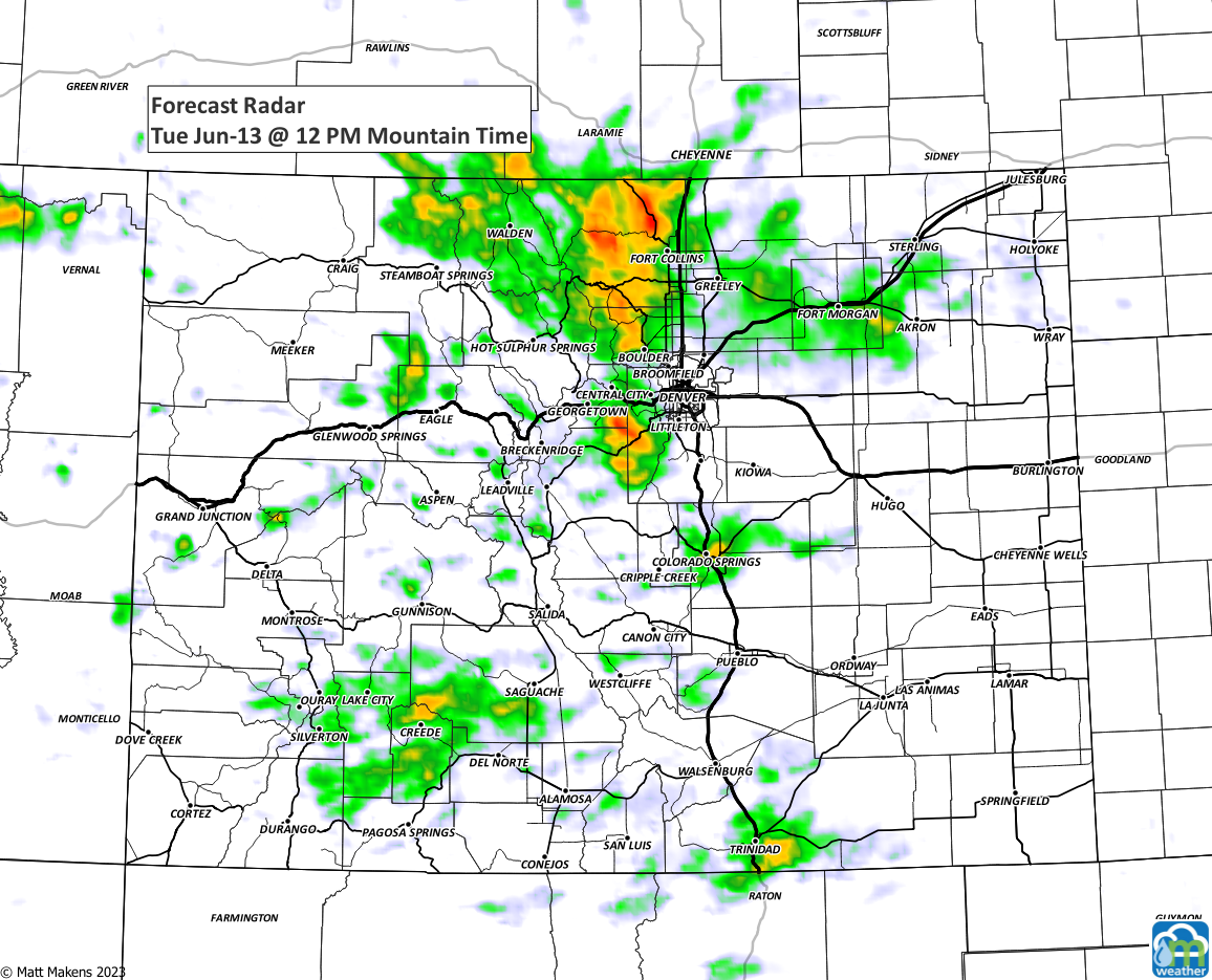
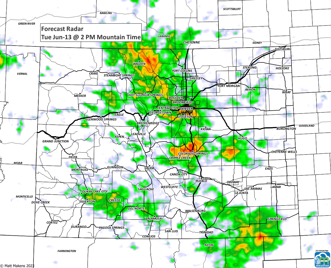
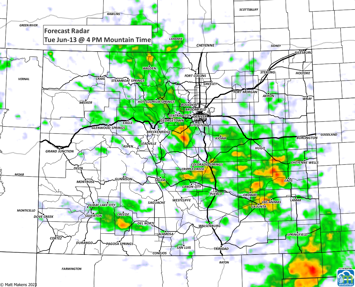
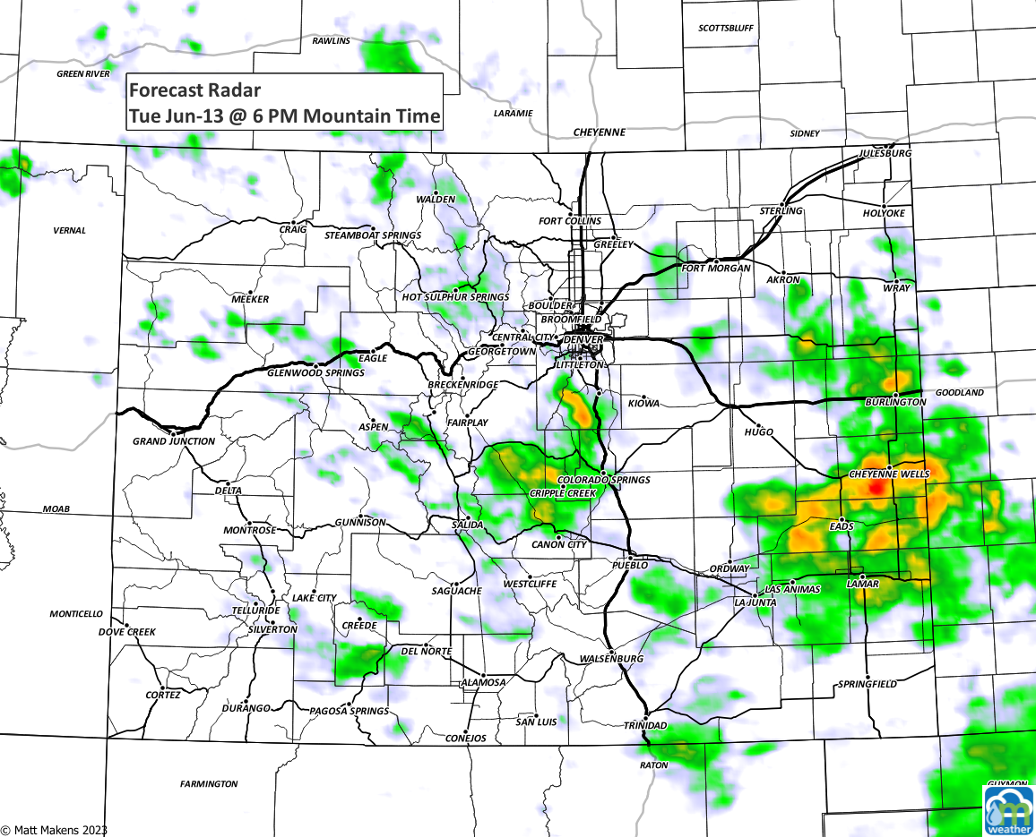
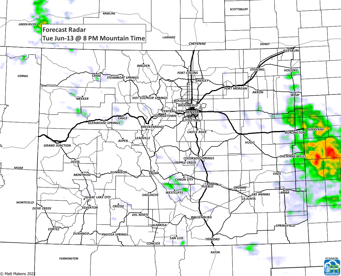
As that fog clears, sunshine will destabilize the atmosphere and give energy for storm development around midday. Overall, today's higher chances shift south, as shown here.

This isn't to say a storm doesn't pop up, as we will have scattered storms. The risks again will be heavy rainfall leading to some street flooding as well as hail which may accumulate.
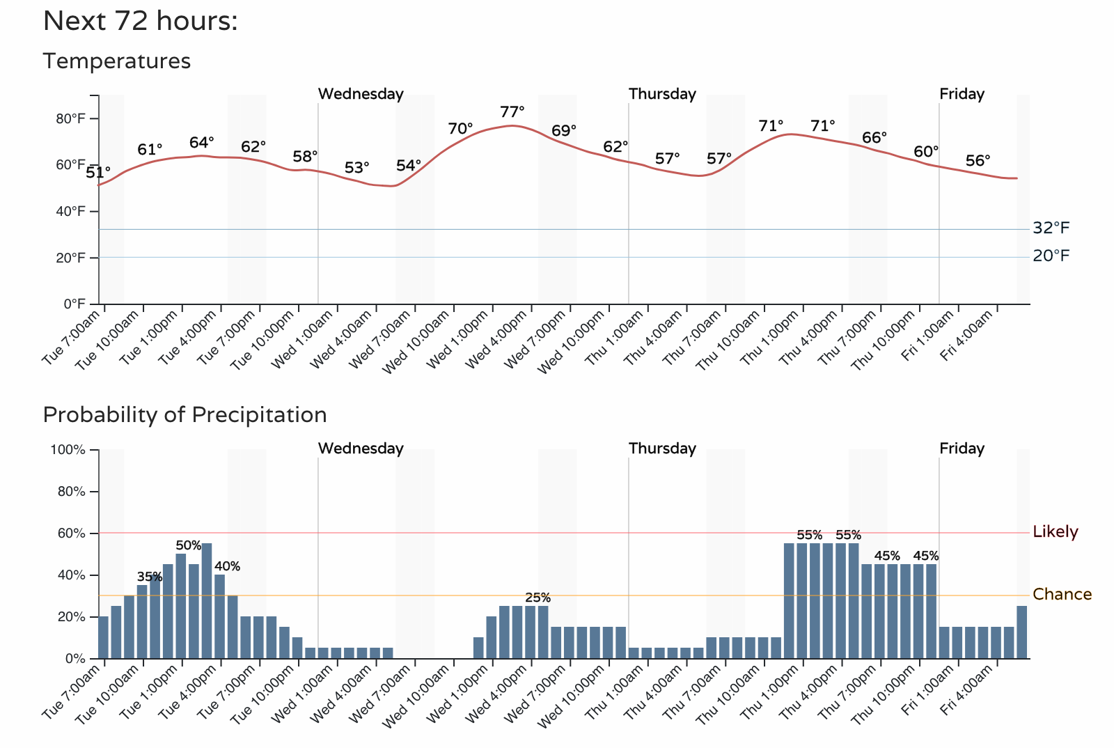
With the fewest storms expected tomorrow, before chances increase Thursday and Friday, temperatures around the city will warm-up. Middle 70s on tap for Wednesday - maybe I'll hit up the pool (backyard rain puddles ;-)).
We are nearing Father's Day, and if you are looking for the perfect weather station for Dad, here are our recommendations based on our personal use of each.
Tempest°: (Enter "weather5280" at checkout to receive an additional 10% off)
Ambient Weather WS-5000
KestrelMet 6000