Denver weather: Calm now, severe weather possible on plains as thunderstorms increase area wide

It's a calm and beautiful start to Thursday, but an approaching system (the first of a few that we have discussed previously) will bring a risk of damaging thunderstorms and very heavy moisture to parts of the Front Range and Eastern Plains in just a few hours.
First, a timeline for the state:
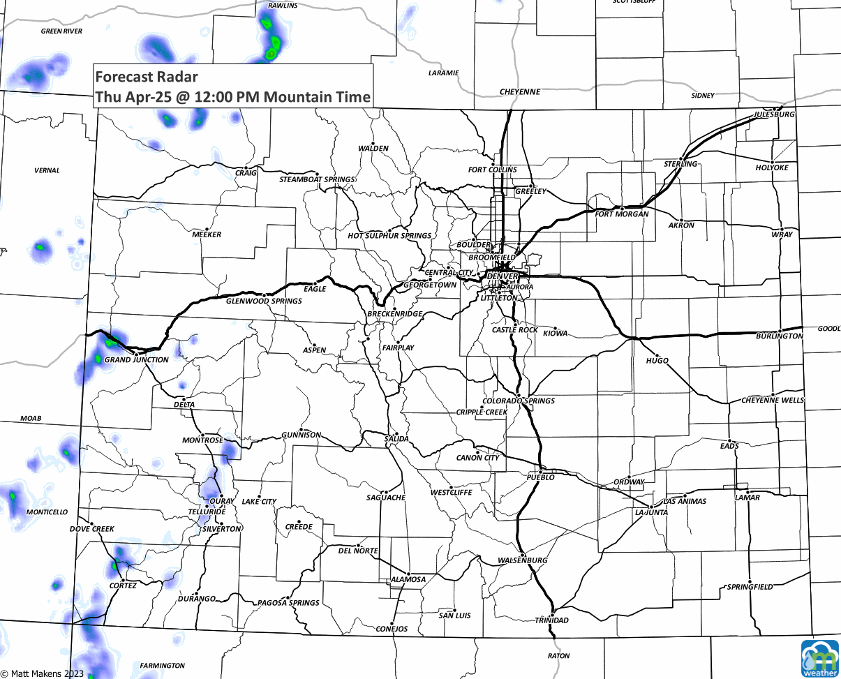
That animation will show some isolated storms on the plains this afternoon and early evening ( these have the risk of being damaging ) and then a widespread area of heavy rain, snow for some, overnight for much of the Denver Metro Area and Front Range.
First, the severe weather risk areas are shown with the far northeastern tip of the state covered with the higher probability of a severe thunderstorm:
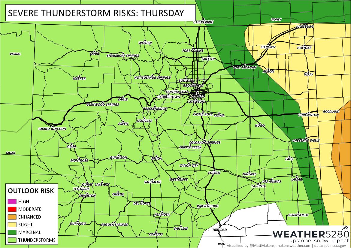
The risk of a severe storm greatly diminishes for the metro areas, where there will be a heavy rainfall potential over the coming days – although you may hear thunder, too.
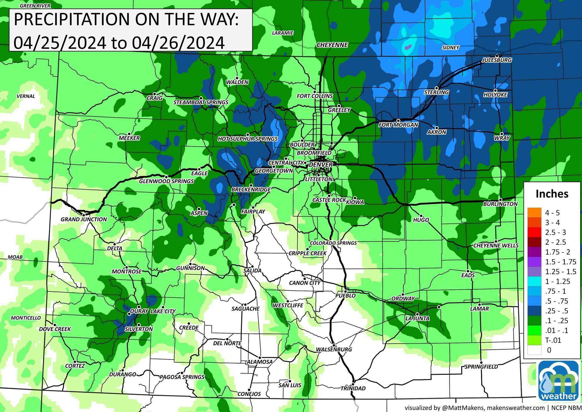
If we look at the rainfall forecast for today (just through the early morning hours Friday), we see most of the heavier precipitation is expected west and east of I-25. This does NOT mean a storm can't pass over the urban corridor, and any such storm that does will be able to produce some heavy rainfall. For the northeast plains, later today and tonight look active - stay weather aware.
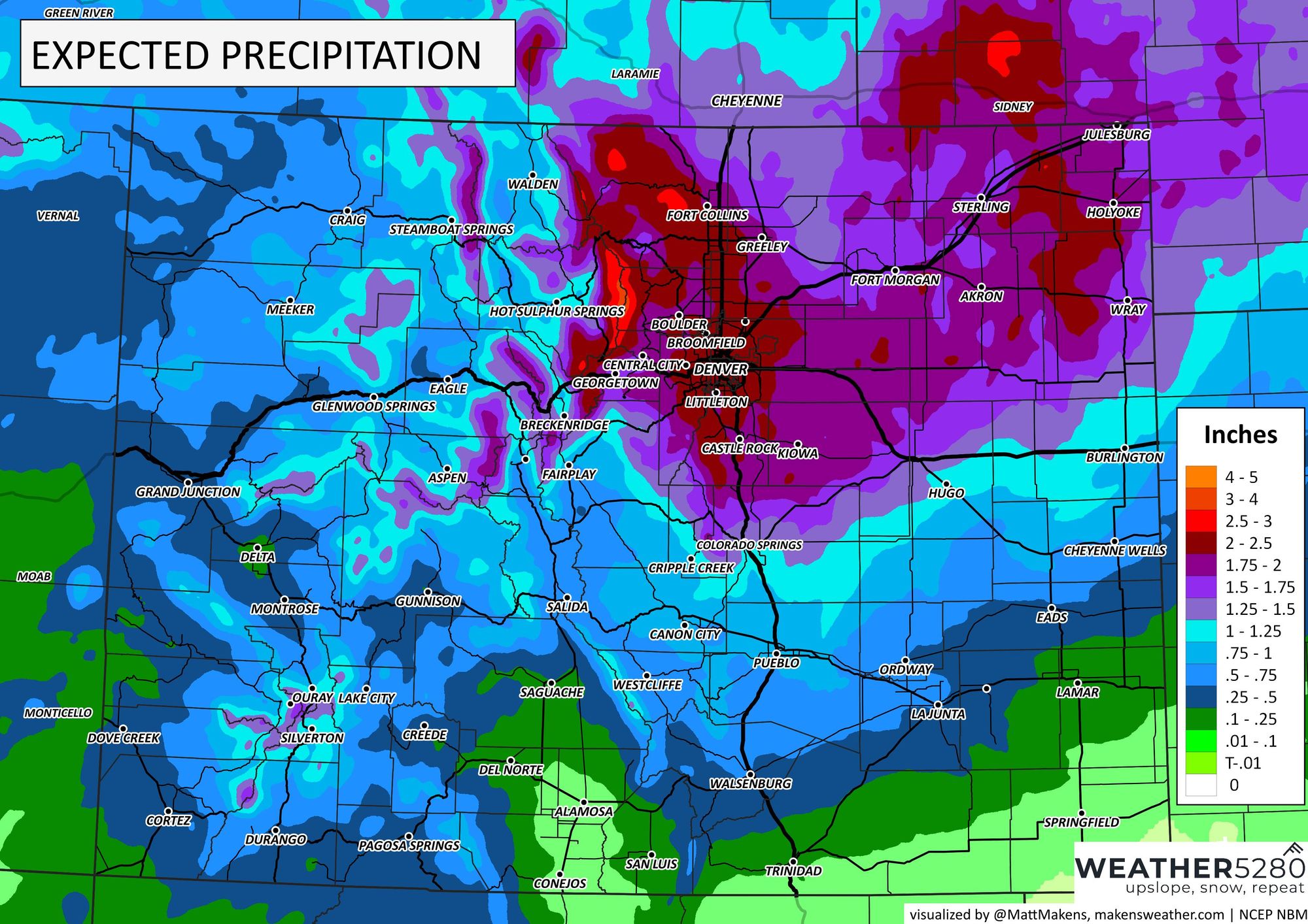
Now, let's look farther: Rainfall totals over the next three days (including today) shows we still expect most locales to pick up some good moisture by the end of the weekend. All of those deep reds, well, that is at least two inches of total water. This water may be an opportunity for you to spread some fertilizer...
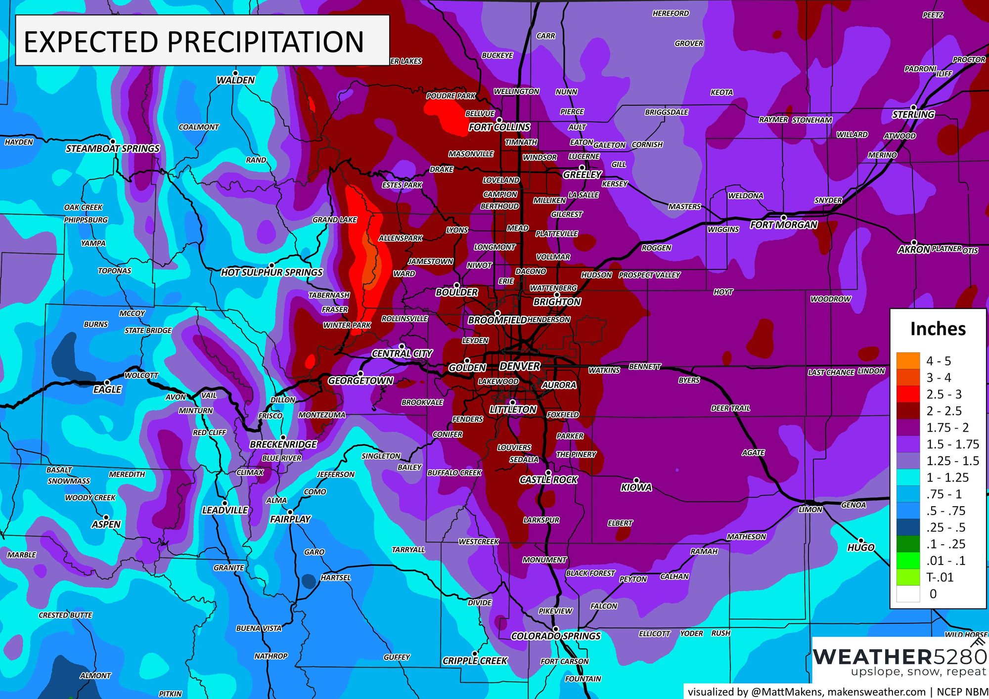
To the state view, you see the bullseye of water is the Northern Front Range and northeastern portion of the state.
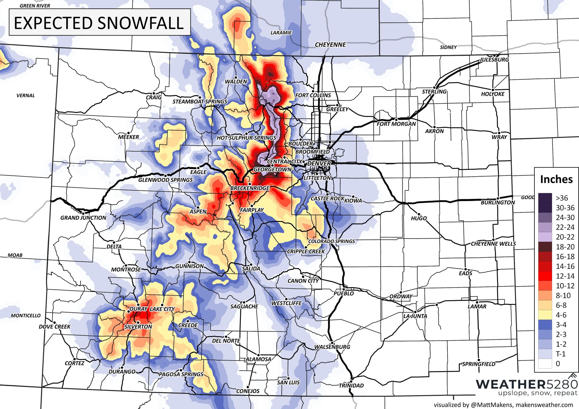
Are we worried about snow bringing an impact to the city? Not really, no, but there will be some heavy snow falling in the foothills and mountains. Turning to those maps now will show you a swath of two-foot-plus totals on the mountains just west of the city.
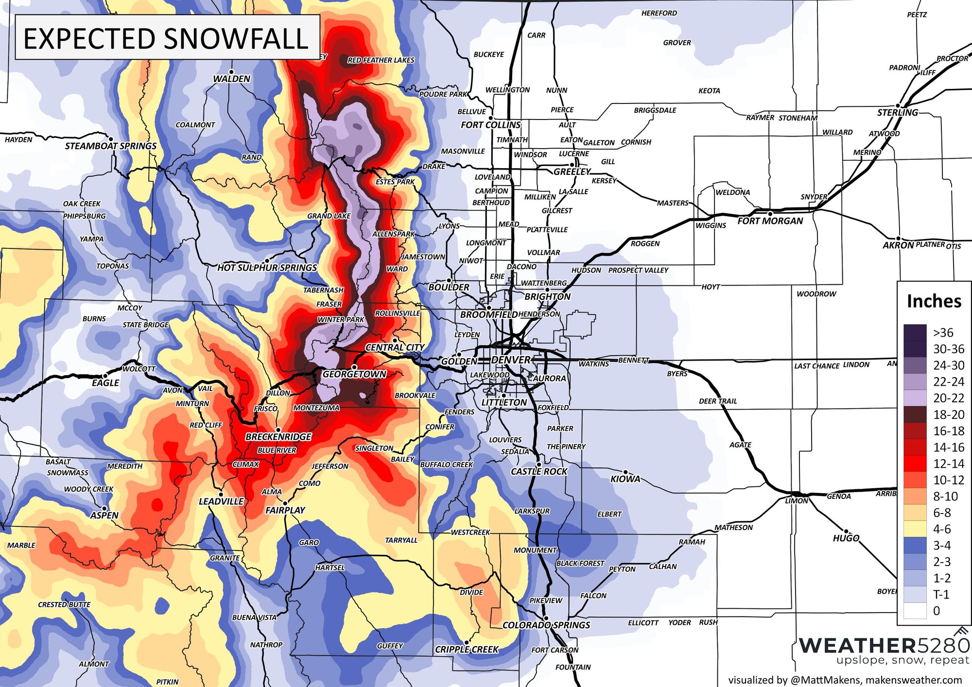
Bring that map in closer so we can see the extent of snowfall on the Palmer Divide, which shows just a hint of a bit of slush the next three days for parts of Denver to Colorado Springs - focusing a bit on Larkspur and Monument.
Again, there will be active weather increasing today and tonight, then a bit of a break, then we gear up for the stronger round of weather late Friday through Saturday. Here's an hourly timeline for Denver:
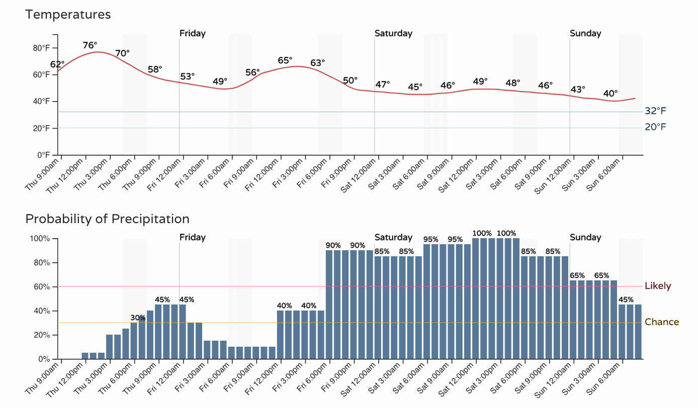
Tonight's chances for moisture are really a teaser for the bigger stuff to come into the weekend. As discussed yesterday, we feel there will be some need to change your plans and don't be surprised if some sports are canceled.
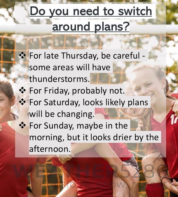
Do you need to switch around plans?
- For late Thursday, be careful - some areas will have thunderstorms, especially east/northeast of Denver
- For Friday, probably not.
- For Saturday, looks likely plans will be changing.
- For Sunday, maybe in the morning, but it looks drier by the afternoon.
We'll continue to watch the progress of the storm into the weekend, so stick with us for the latest updates (sign up now for emails when we post something you need to be aware of)!