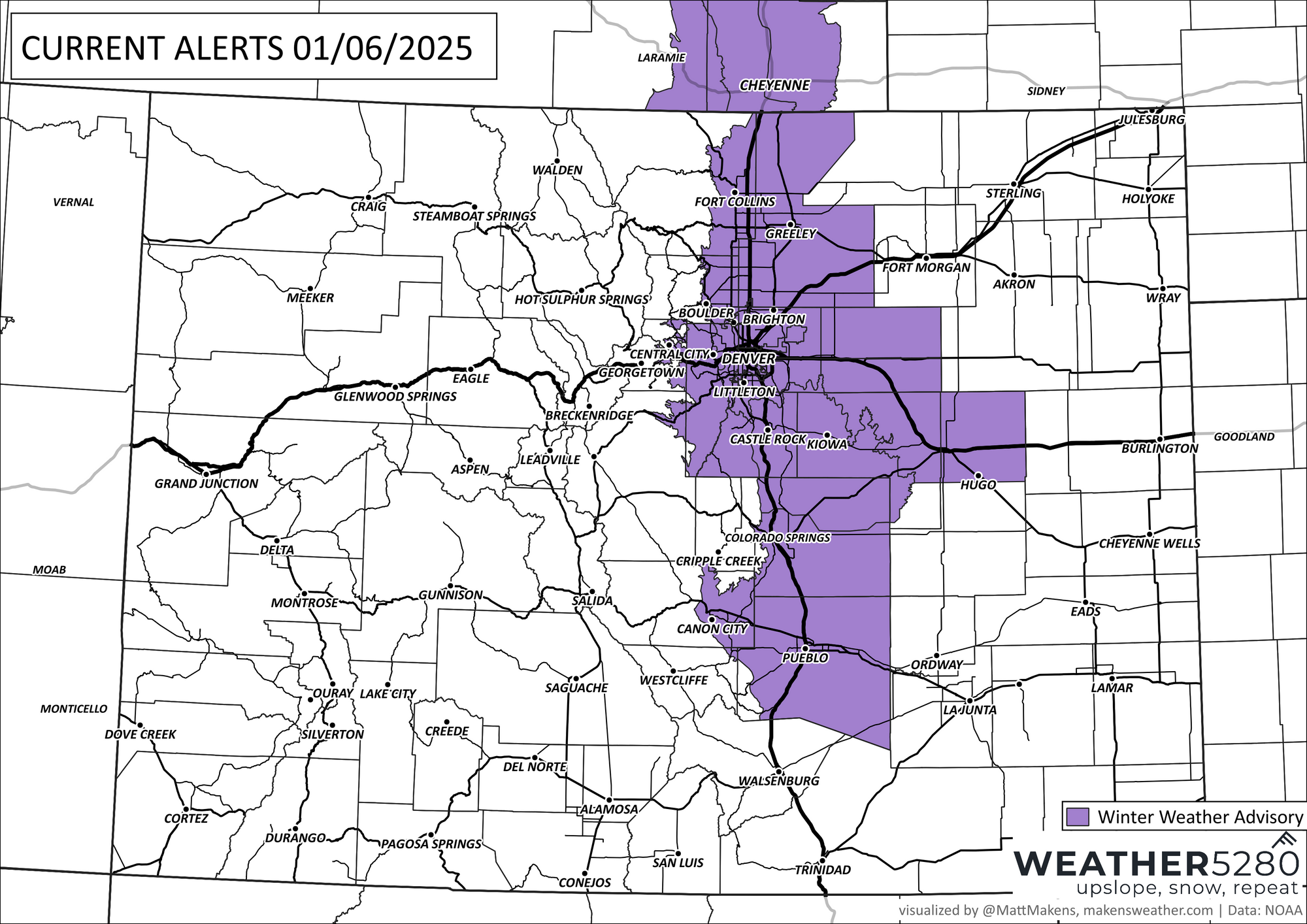
Winter Weather Advisory posted for Denver, Front Range of Colorado

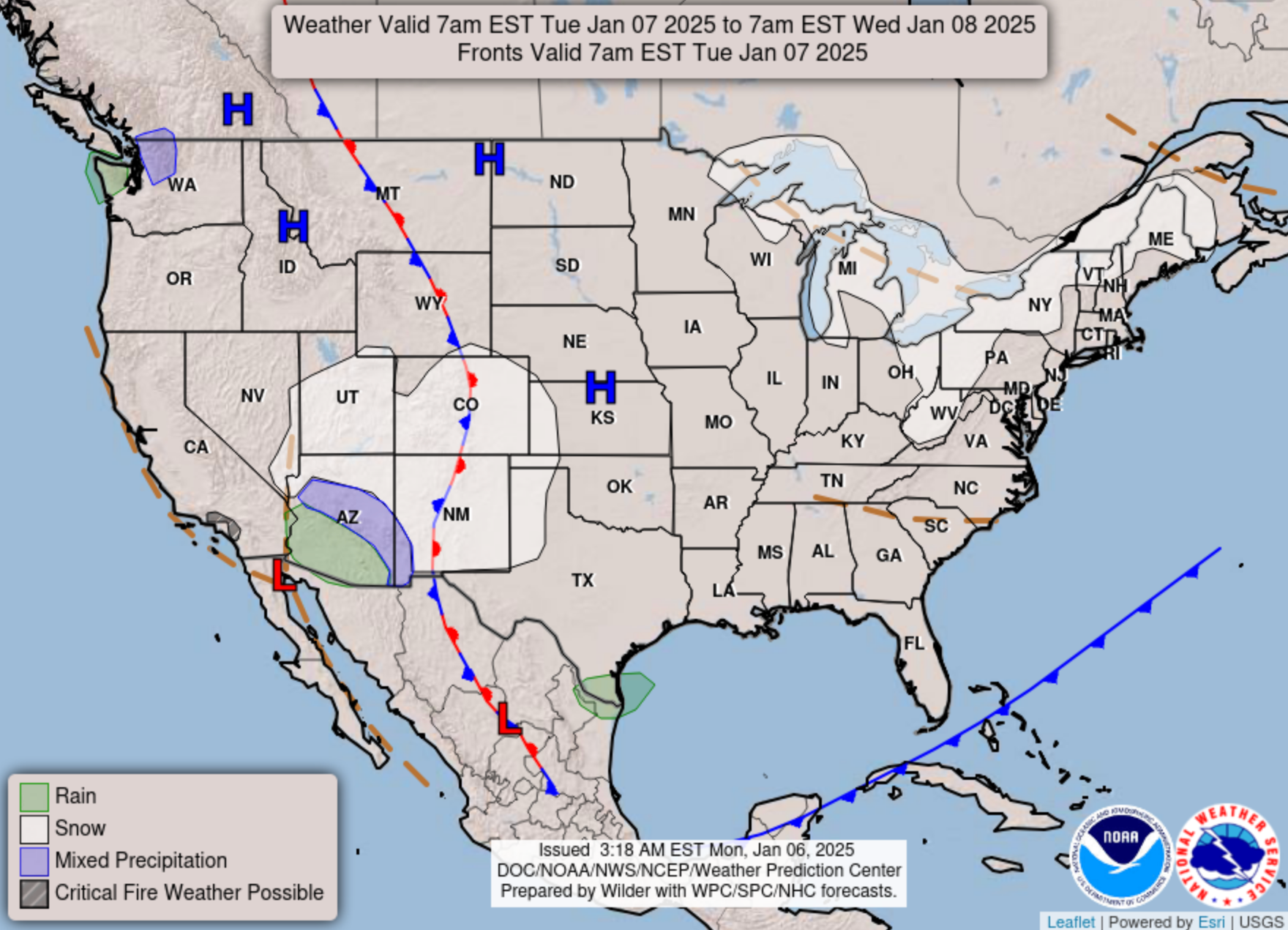
As discussed yesterday, our next system quickly approaches as our weekend storm is now delivering a wintry wallop to Washington DC in one last hurrah for a storm that brought a serious bit of winter to central CONUS over the last couple of days.
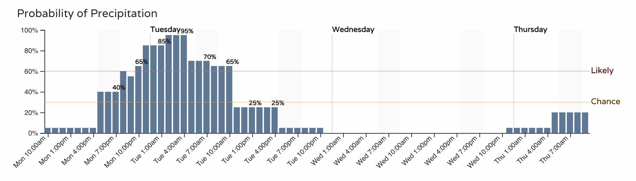
While the Denver area didn't see much in th way of snow from the last system, there's a better shot incoming this evening, extending through Tuesday morning. This snow chance will be accompanied by a pretty good shot of cold air as well.
A Winter Weather Advisory goes into effect at 11pm this evening for the urban corridor and extends through Tuesday morning. Several inches will be possible from this system.
Timing and impact
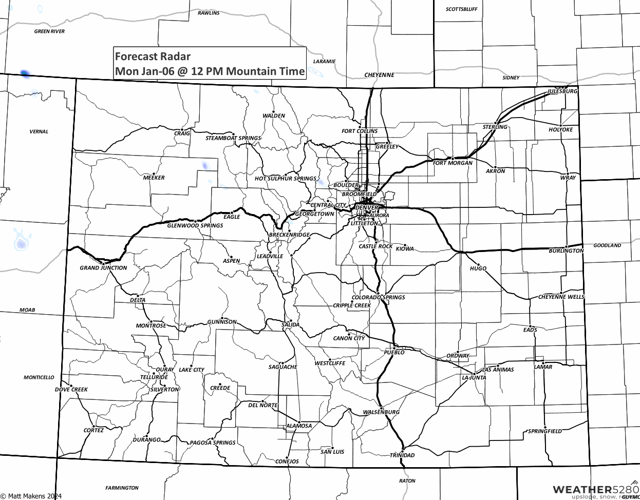
The snow develop along the Front Range later today, and will diminish from north to south Tuesday:
Up first will be the Fort Collins area, with a 70% chance of seeing some of that snow by the evening commute this evening, and good chance we see snow even before that as usually systems like this move through faster than forecast.
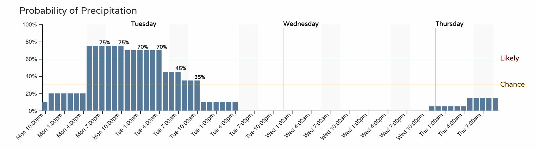
For Denver the best chance comes a bit later in the evening, but again, wouldn't be shocked to see these timelines moved up a bit as well.
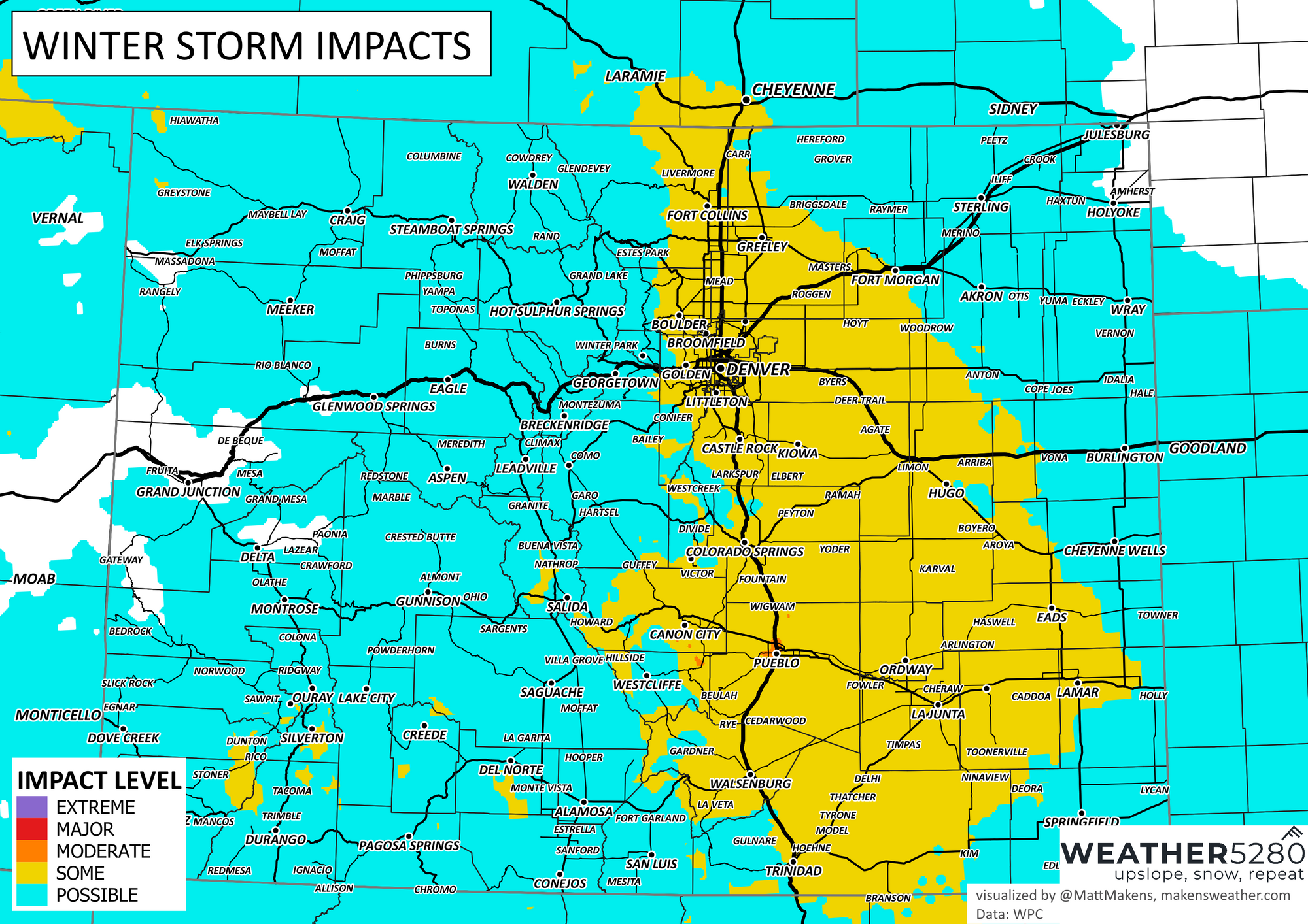
Current impact map shows expected impacts from this system up and down the Front Range, but this may be underdone depending on timing. It won't take much snow to mess up the evening commute up north, or morning commutes north to south.
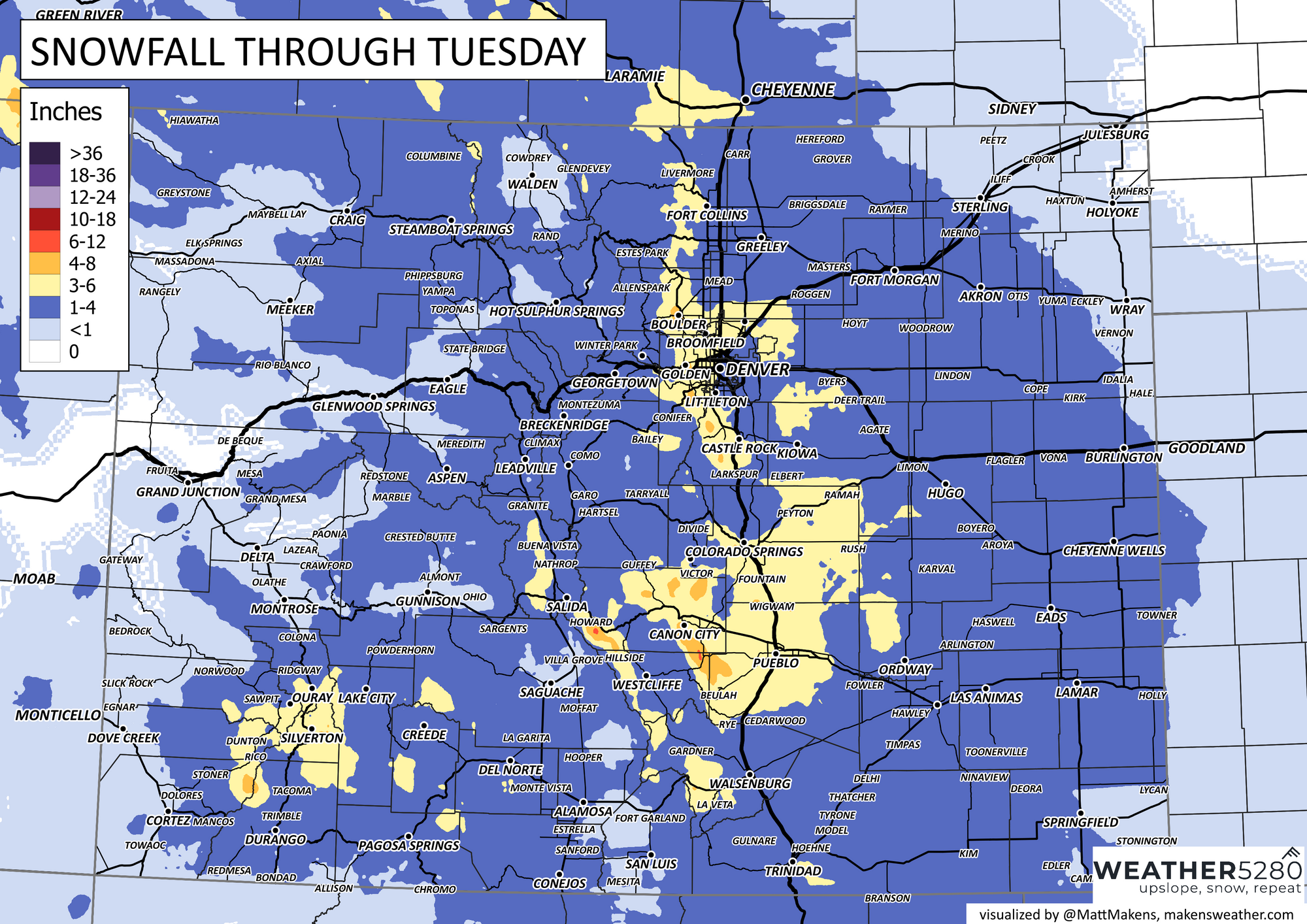
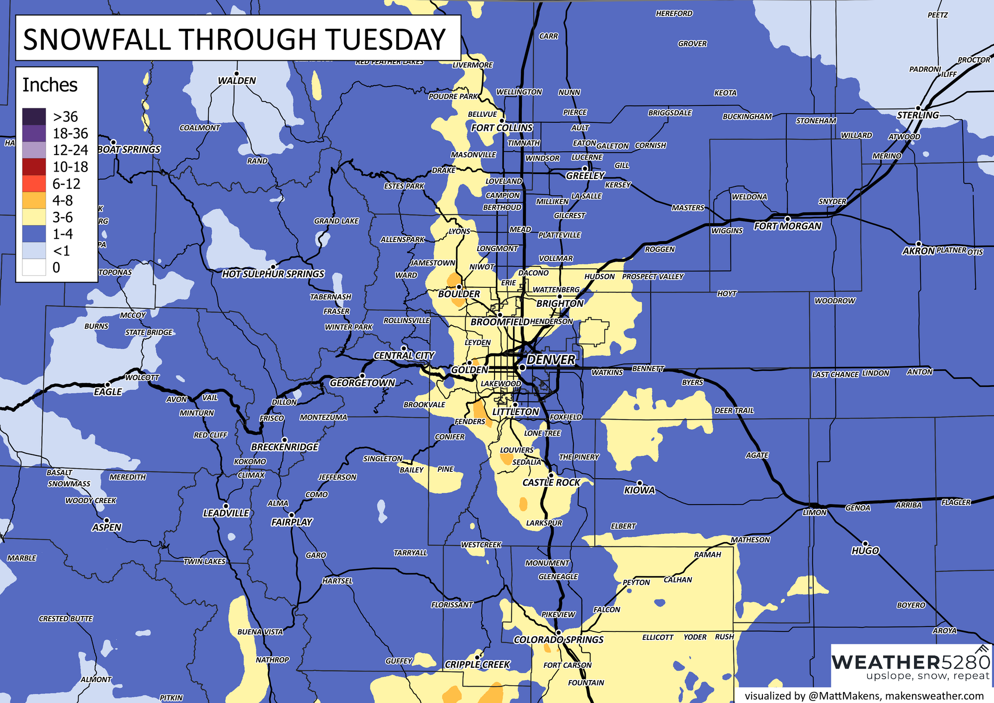
Snowfall forecast
Much of the state sees snow with this system, with the greatest totals expected right along the Front Range foothills, along and west of I-25. Some chance we see some enhanced snowfall totals south and southeast of Colorado Springs as well.
We think nearly everyone manages 1 - 4" of snow, with pockets of 3 - 6" totals possible, if not even likely. Snowfall ratios should be good, and a few high-resolution models are coming in hot this morning, with 5 - 7" across the greater Denver metro area!
For now, I like the odds for 3 - 6" for most of the metro areas – Fort Collins south through Colorado Springs – with locally higher totals possible, especially in the hills west of the interstate.
Cold, too!
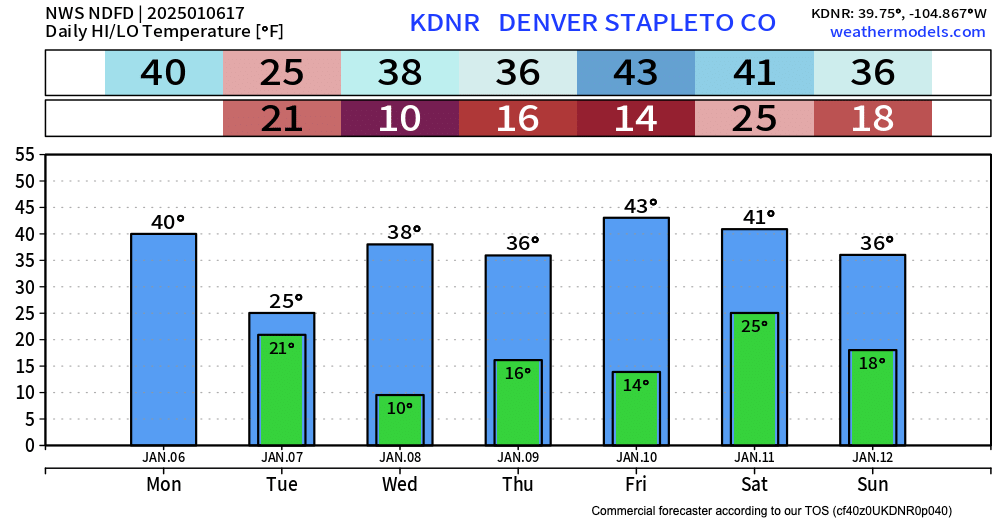
With the arrival of the snow will be a good shot of cold air as well. Today's highs will push 40°F in Denver, but we'll only be in the 20s Tuesday, with wind chills well below that. Single digit lows will be possible Tuesday night.
We "warm up" a bit for Wednesday, but no newsworthy January heatwave in the forecast at this time.
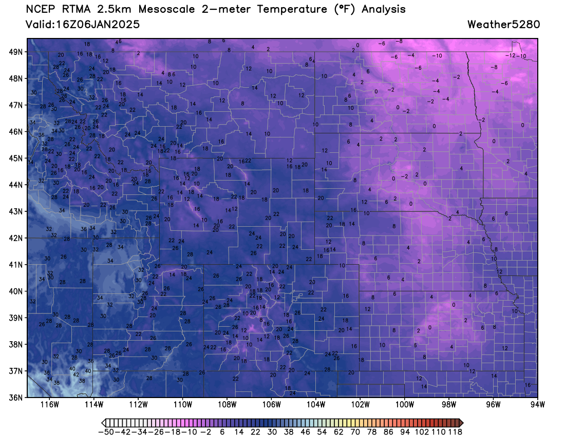
Take a look at the midmorning temperature map for the U.S. Bitter cold across the CONUS outside of the extreme southeast, but even there will see the cold push in the coming days.

Regionally we see lots of single digit and below readings this mornig northe north and northeast of Colorado – some of that cold air filters in to our state later today and tonight. Bundle up!
Keep us posted in the comments below!