The State of the Atmosphere: Sunday, December 18, 2016

It has been quite the chilly weekend across northeastern Colorado, and the majority of the country for that matter. Denver broke the old record low maximum temperature for the day on Saturday (7°F), which was set back in 1884. Denver International Airport recorded a high of 3°F, which was recorded at 12:19 AM MST. Granted, records that date back as far as 1884 were recorded in downtown Denver which is a considerable distance from DIA. We also broke the record low temperature for the day on Saturday, as DIA managed to drop off to -15°F!
Today, temperatures feel much more comfortable than what we experienced yesterday, but still well below average. Denver managed to hit 17°F today, which is still 24°F below our average high of 42°F. Still, I'm sure today felt milder to everyone in comparison to the bone-chilling cold that we saw throughout the last 36 hours, especially as the city was a bit warmer than out at DIA.
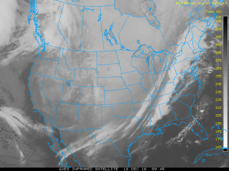
Infrared satellite actually shows much of the extreme cold across the Northern and Central Plains. Note the "milky" hue across these regions, along with the sharp cold front that is starting to impact the East Coast.
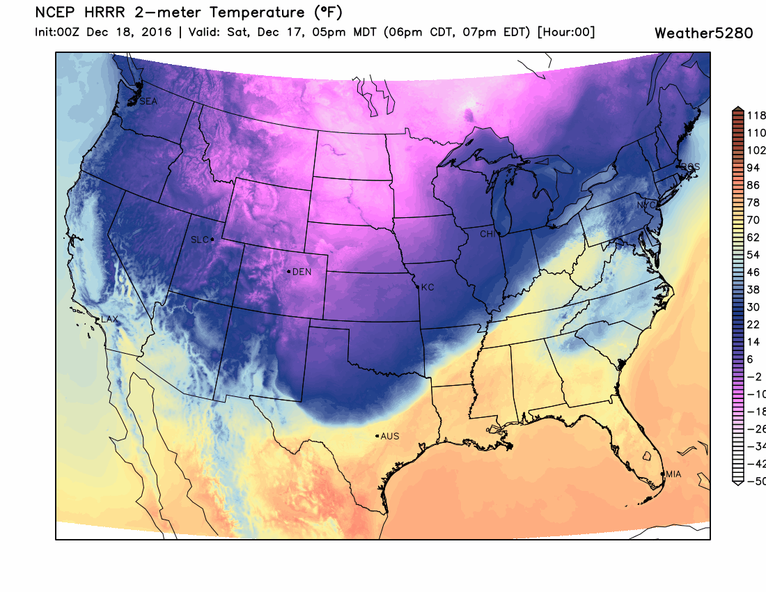
Here was the cold front as it was advancing last night – pretty spectacular!
In the infrared above we can also see another Pacific system that is bringing the lowlands of western Washington some snow, and more moisture to the Cascades. Unfortunately, it doesn't look like much of this moisture will impact northeastern Colorado down the road.
Under northwesterly flow aloft, we should remain mostly dry through the work week, with some possible changes as we head into the weekend.
Depending on how much snow cover remains along with your elevation, temperatures should manage to climb above freezing on Monday in most spots. Areas southeast of Denver will likely see some of the higher readings as places such as Monument Hill and Elizabeth will likely be above the shallow inversion that tends to limit warming in low-lying spots such as Greeley. We can see this by looking at forecast soundings for Platteville and Centennial Airport from the 12Z GFS:
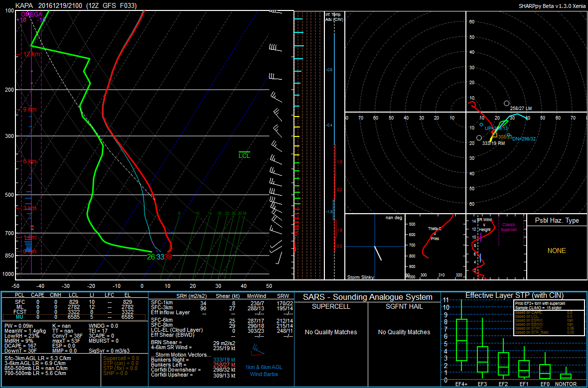
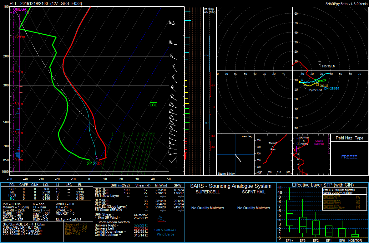
Notice how the low-level inversion sticks around through the afternoon in Platteville (a low-lying area in the Platte River Valley), while the Centennial Airport is located above the inversion. There is also warm air advection which can be denoted by the veering wind profile, or clockwise turning of the wind with height. Generally speaking, highs tomorrow should top out around 40°F at higher elevations, with low-lying areas hovering at or slightly above the freezing mark.
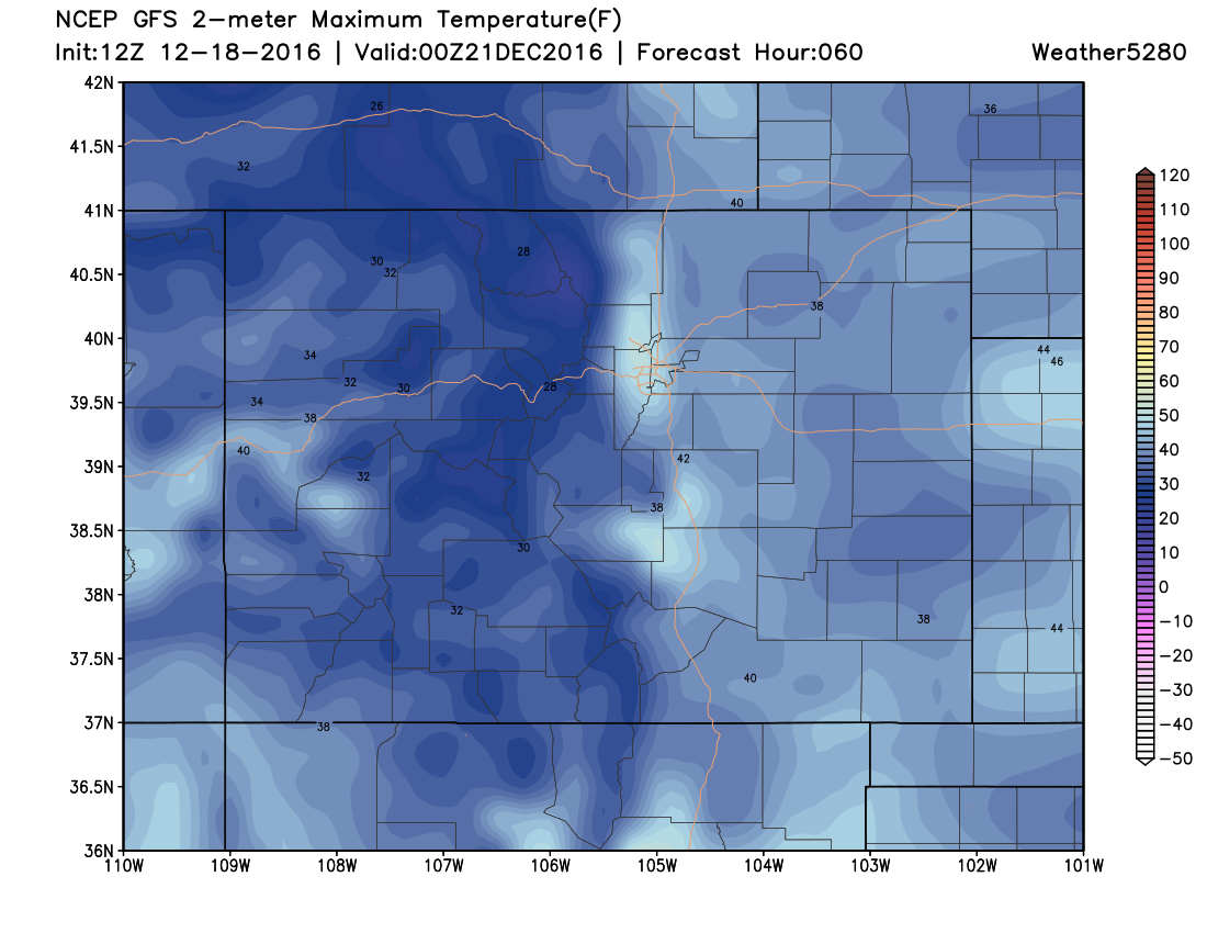
On Tuesday, we should be able to melt away the majority of any remaining snow cover across the plains, with 25-30 knot west/northwesterly flow at 700 mb in place. This translates to downsloping east of the Front Range, which is a warming process. Winds will also be gusty during the day on Tuesday. Areas close to the foothills such as Boulder and Golden will likely see the warmest readings, possibly reaching the mid to upper 50s. However, a mountain wave cloud could limit this warm up.
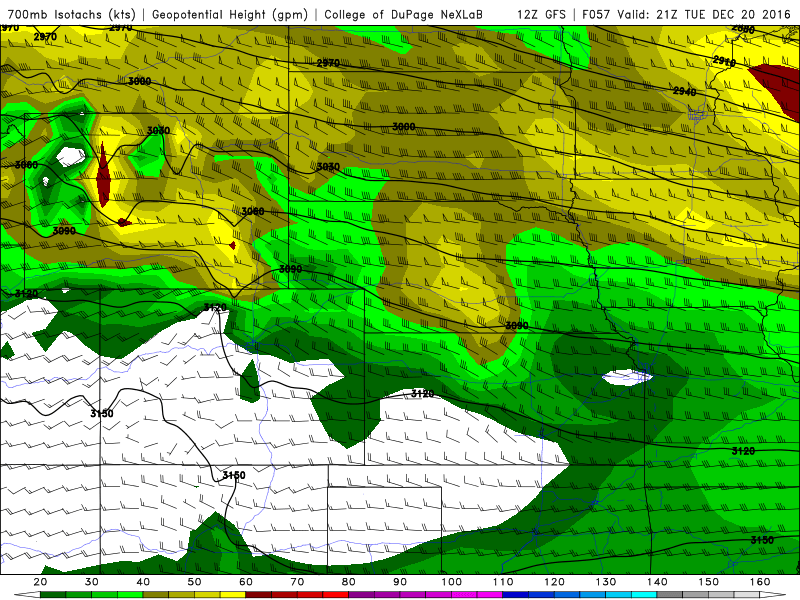
This is reflected well on the models, with the warmer temperatures remaining along the foothills:
On Tuesday night into Wednesday, northeastern Colorado will be located in the right-entrance region of a 140 knot jet streak. At this point, we can't entirely rule out the possibility of seeing some snow, especially close to the Colorado-Wyoming border. Jet-induced snow bands are extremely difficult to pinpoint and forecast, however a few lucky spots might manage to see an inch of snow if they happen to be underneath one of these bands.
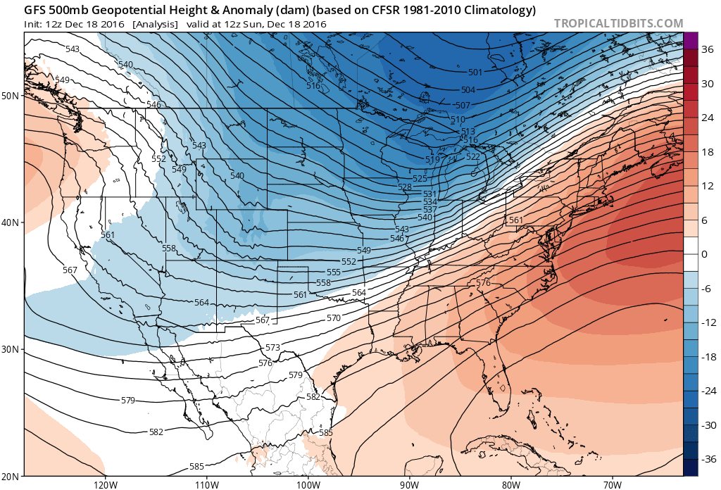
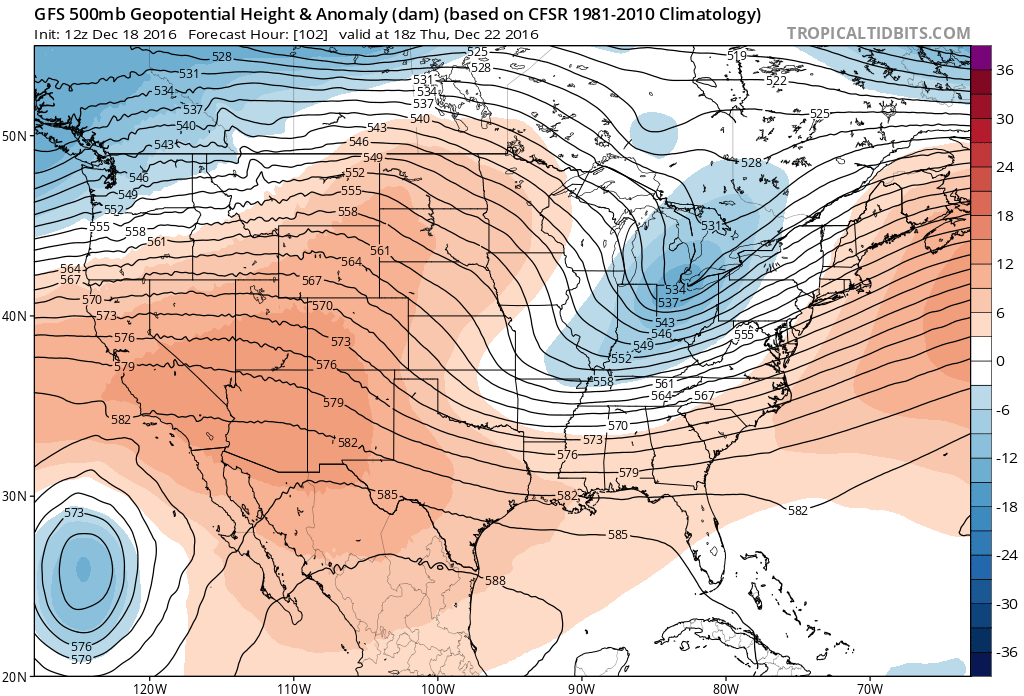
Temperatures should warm up once again to near 50°F on Thursday as weak ridging builds in across the west (the redder colors depicted below):
Heading into the weekend, we will likely see some changes as another trough digs down from the northwest and closes off somewhere in the vicinity of eastern Colorado, the Texas Panhandle, or western Kansas. The track of the low will no doubt determine how much snow we will see (or if we see snow) here in Denver. It is more certain that we will see cooler temperatures for Christmas Eve and Christmas Day, with highs likely remaining below average.
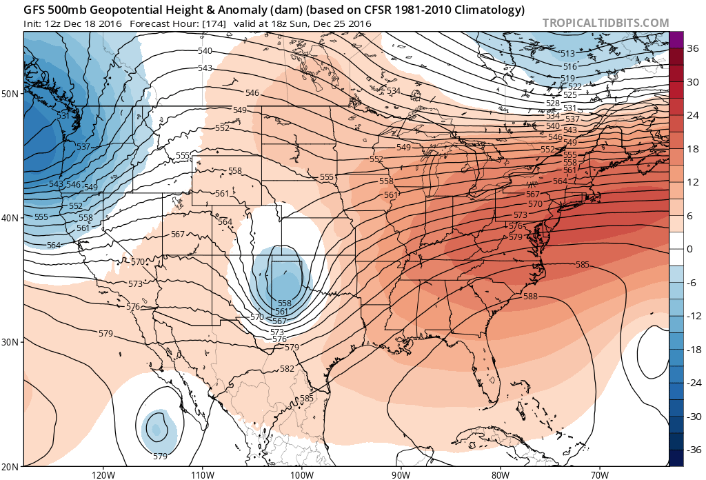
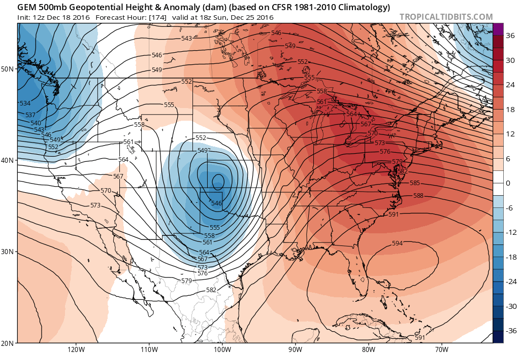
The Canadian solution is similar to the GFS, but closes off the low further north and east over western Kansas:
Definitely something we'll be watching closely as the week progresses, as folks both have travel plans around the Christmas holiday, and may even be eager for a fresh coat of snow to make the day extra special. Stay tuned to Weather5280 as we will continue to keep you updated on the potential of seeing some snow this weekend.