
The State of the Atmosphere: Sunday, January 26th, 2020

Four weeks ago had you told me we'd be closing in on a snowless, precipitation-less January I probably would have applauded your pessimism but would have tried to assure you I thought we'd steal a storm during the latter half of the month. This was my expectation, and while at times we've seen fantasy storms show up in the NWP models, they've been quick to evaporate from any reality.
The reality is, this dry month was actually well telegraphed coming off December, 2019.
It's been 29 days since Denver's seen precipitation (h/t NWS Boulder). While remarkable, this streak doesn't even break into the top 20 of precipitation-less streaks in Denver. To do so we'll have to stay dry through Feb 3rd, with a long way to go to hit the all-time record of 52 days set back in 1933 Dec-Jan 1933-34.
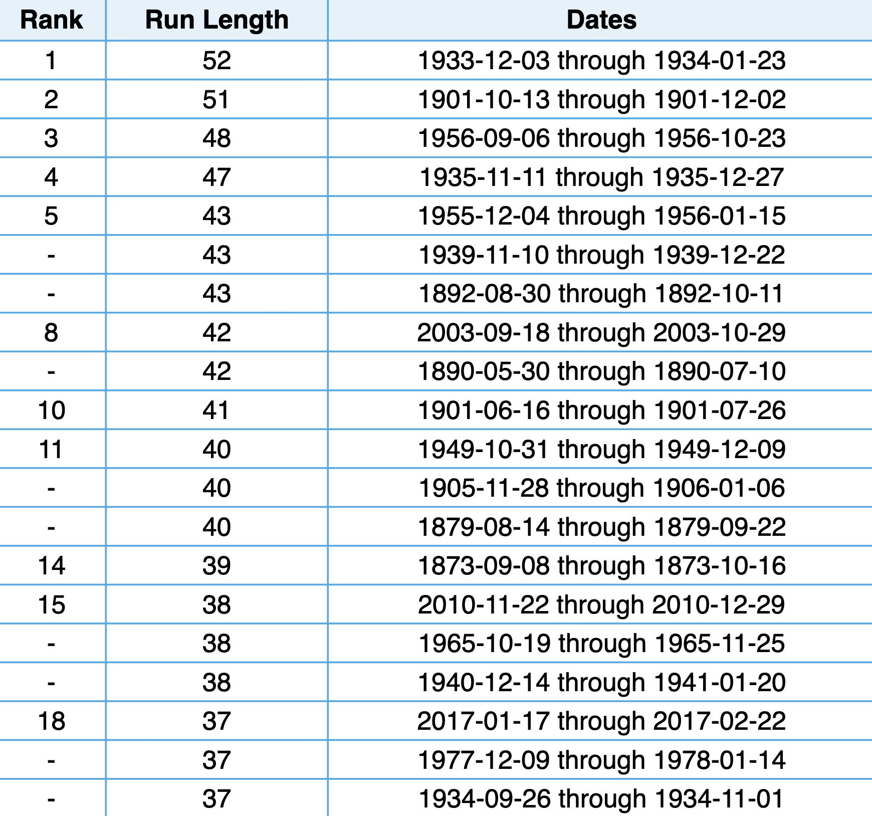
The last time we saw a January with no measurable snowfall was in 2003, the only time on record prior to that was in 1934 (and the top of the dry list above!). Might 2020 make that snowless list? Perhaps.
Without any snow between now and the end of the week January will end where December left off with our season-to-date snowfall total at 29.0" for Denver. Incredibly, this means Denver will end the month still above average on the season (27.4" is average to end January), even after a dismal December and January for snow!
The week ahead
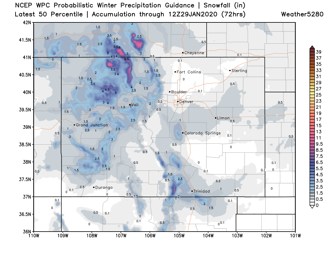
We see two rain and snow chances in the forecast for Eastern Colorado through the end of the month. Neither looks all that convincing, and at least one (Monday) may end up as rain for many, if anything at all. That said, enough of a chance that I think making the top 20 dry streaks on record looks to be in jeopardy.
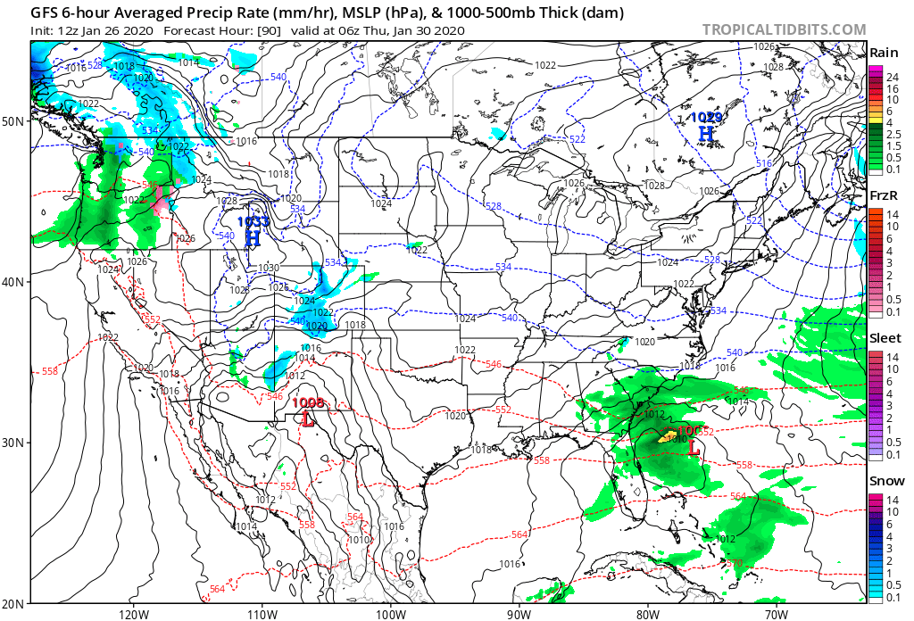
The GFS shows mountain snow and rain and snow showers across the plains Monday afternoon:
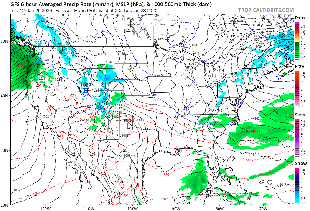
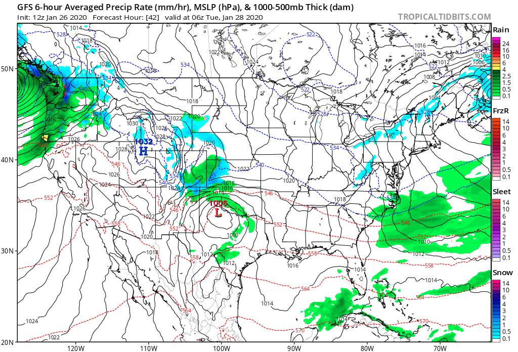
Overnight Monday into Tuesday the beast chance of rain and show drops southeast, with only lingering snow showers across the northern Front Range mountains:
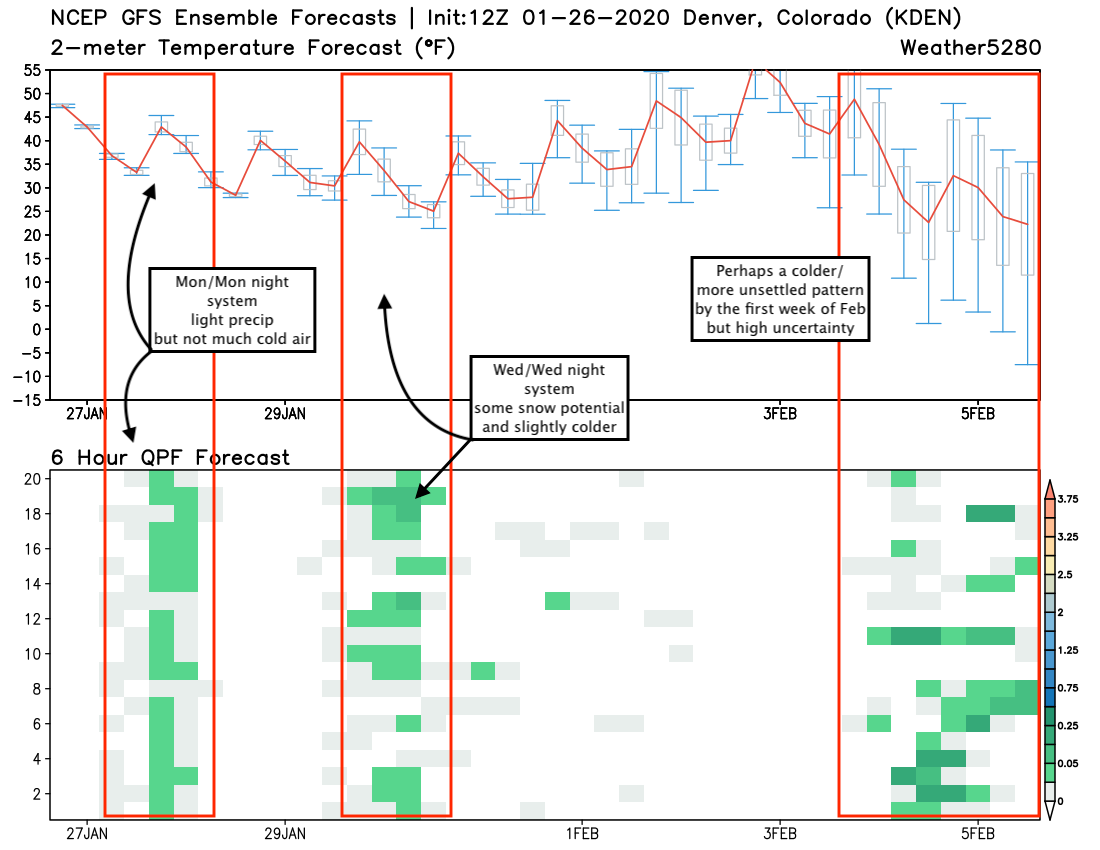
For Denver this will equate to a cooler day on Monday (highs in the 40s), with about a 40 to 50% chance of rain and snow. As you can see, even by late Monday night/early Tuesday morning temperatures have only fallen into the upper 20s, so not exactly a cold system on the way:
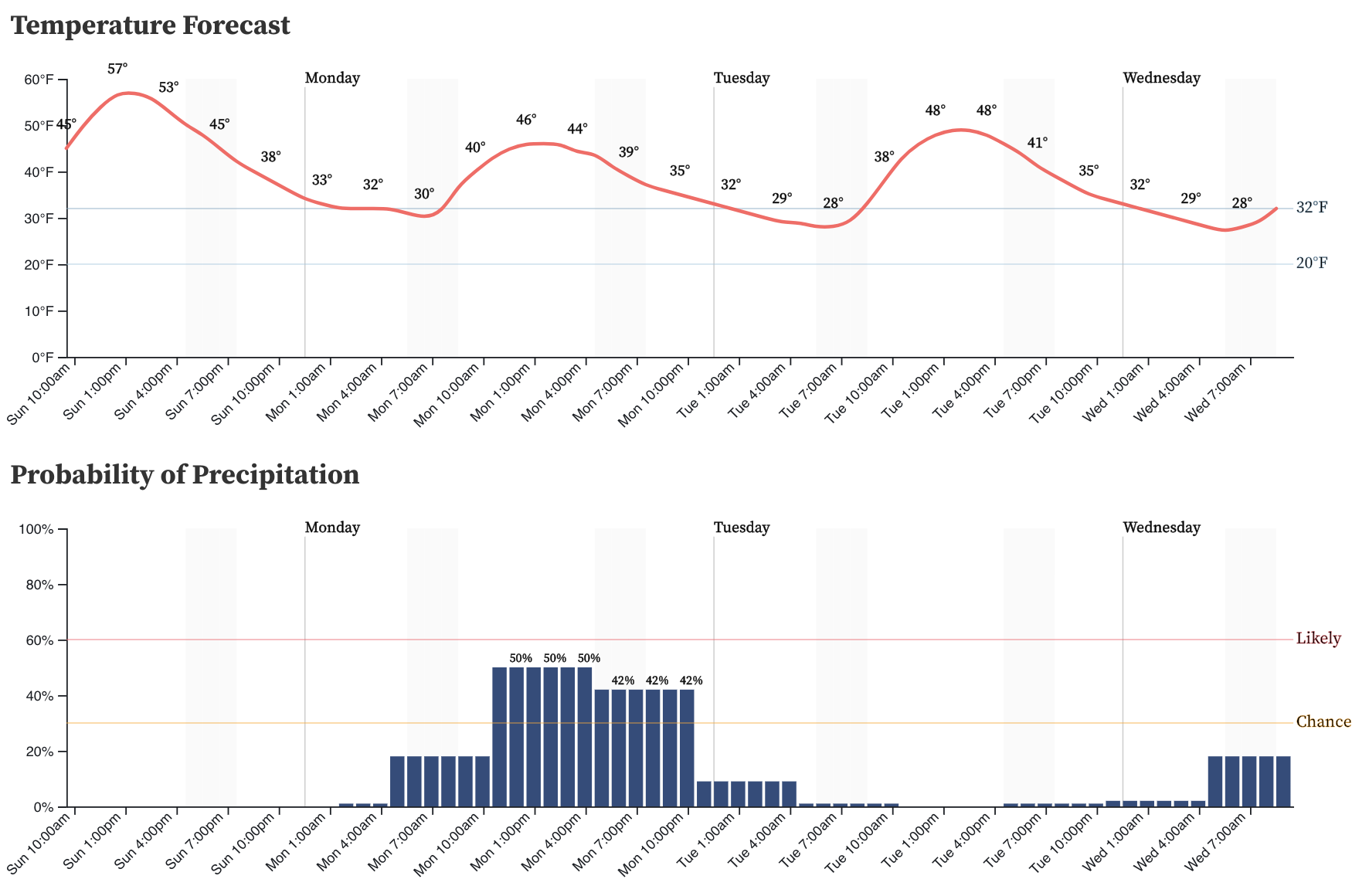
For snow totals, we aren't expecting much. Some models have a Trace to 1" scattered across Eastern Colorado, which seems reasonable enough. For many it'll just be too warm for accumulation even if we do see the flakes fly. Still, do not be shocked to see a quick coating to 1 or 2", especially across the Palmer Divide where Douglas and Elbert counties, and even across Northeast El Paso county could end up with best chances to see some spotty accumulation.
By Wednesday afternoon and night another quick-hitting system moves through. To me this one shows a least a bit more potential for a quick burst snow across the urban corridor than Monday's system, but not huge confidence in this materializing at this point. Still, another chance for some wet weather to move through, so something to definitely keep an eye on as we head into the work week just in case.
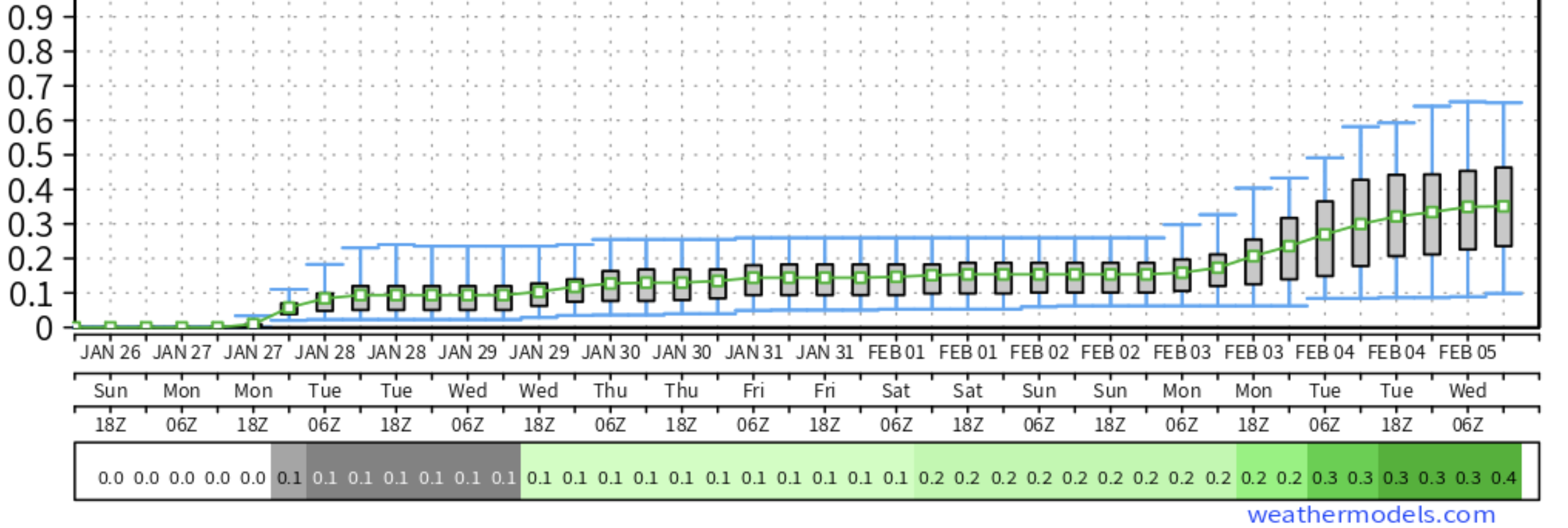
If we look at the GEFS 10 day meteogram below, we see a few things. First are our two systems this week outlined in red. The top graph shows the mean temperature forecast in red, with the bottom graph showing precipitation forecasts by each ensemble member (y axis).
We see for Monday/Monday night most member show the chance for light precipitation in Denver (light green), but relatively mild temperatures. For Wednesday more of a spread in precipitation totals between the various members, slightly cooler temperatures but still not January cold.
Temperatures are expected to moderate as we head into next weekend, with a mostly dry forecast on tap as well. By early next week some models show a more potent cold front moving through. You can see in this GEFS forecast the temperature spread is quite large, with a number of solutions for precipitation chances as well -- not high confidence, and 8 to 10 days out.
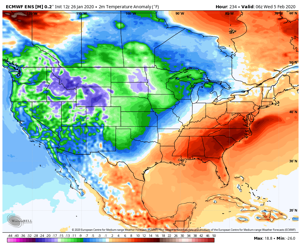
Meanwhile, the European ensemble is much more bullish on finally delivering a shot of cold air early next week –– something almost universally lacking across the CONUS this January:
We shall see, but for those craving some winter back in our forecast this may be the best chance we've seen in a long time. I'm definitely ready, but also somewhat remarkably only just this weekend managed to finally scrape the last of the ice from my driveway –– which was still about 3 or 4 inches thick dating back all the way to our Thanksgiving snow.
So, while we wait to see how that early February pattern will evolve, let's see if we can at least get SOME precipitation to move through this week and break our dry streak. The European ensemble mean has 0.1" through Feb 2nd, and another 0.2" on the 3rd. So decent odds we break the streak before landing in the top 20, but not exactly overwhelming confidence in that at this point either.
Stay tuned!