The State of the Atmosphere: Monday, March 1st, 2021

It's March, and the first day of climatological spring! After last week's big snowstorm, we know many of the snow lovers in the group are looking ahead to Denver's snowiest month on average and wondering if it'll pick up where February left off.

For week one, the answer is probably not. While we do have a cutoff low to watch this week (yay for cutoff low season!), temperatures will be quite mild to kick off the month, and the track will likely end up less than favorable for heavy snow along the northern Front Range.
Instead, an absolutely beautiful start to the week, followed by a chance of rain and perhaps snow for some by Thursday and Thursday night.
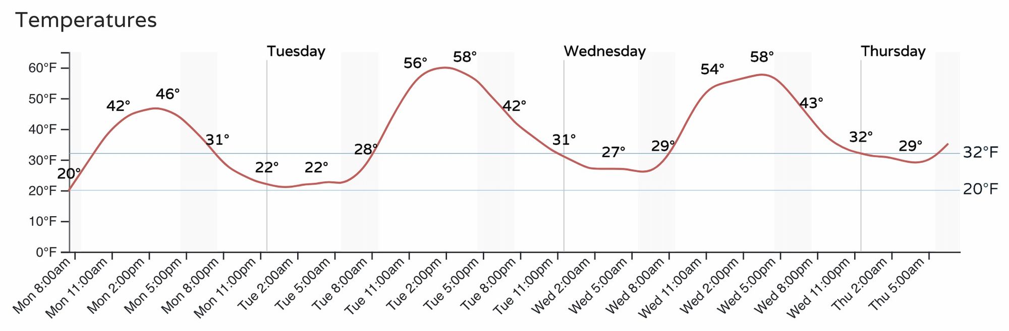
The hourly forecast for Denver shows highs approaching 50°F today, followed by highs near 60°F both Tuesday and Wednesday:
If we look across the region, and a bit further down the road, we see a lot of mild air in the patter to start the month – even on Thursday as the next system moves through! Hard to get much snow with highs in the mid 50s, so we'll rely on what locations can cool enough Thursday night to see rain transition to snow for some.
The system to watch, if you will, will moving into Southern California Wednesday evening and begin to chip into the ridge overhead for the latter half of the week.
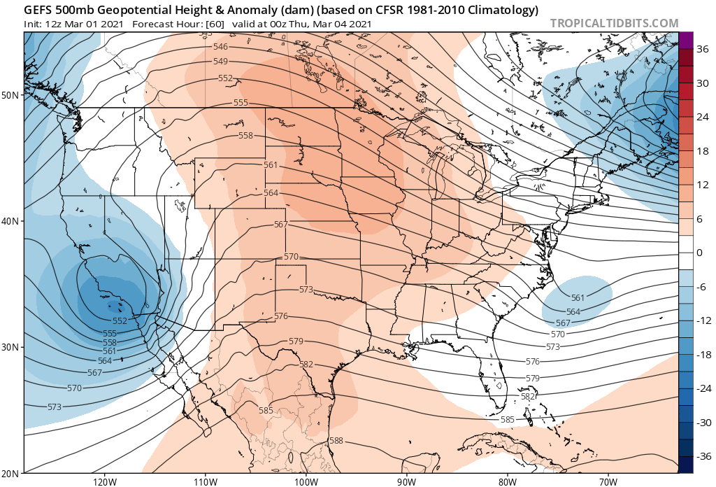
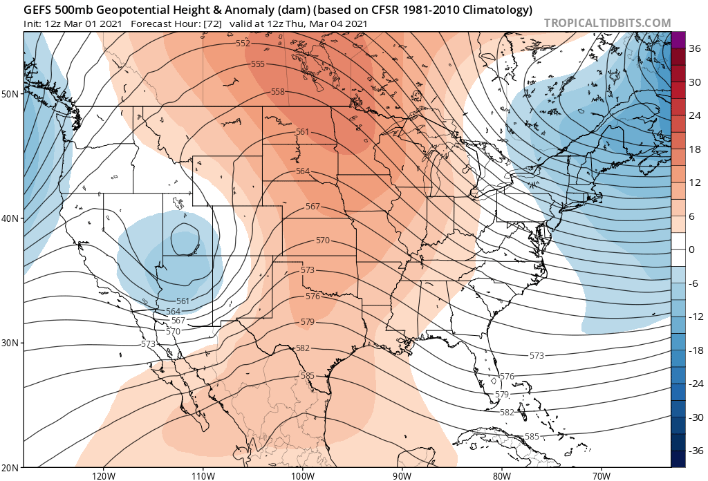
By early Thursday morning the low moves into the Great Basin and begins to cutoff from the overall flow:
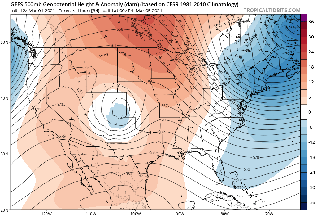
Thursday night into Friday that low tracks across Colorado and will bring with it a chance of rain and snow to much of the state. Here's the low by Friday evening according to the GEFS:
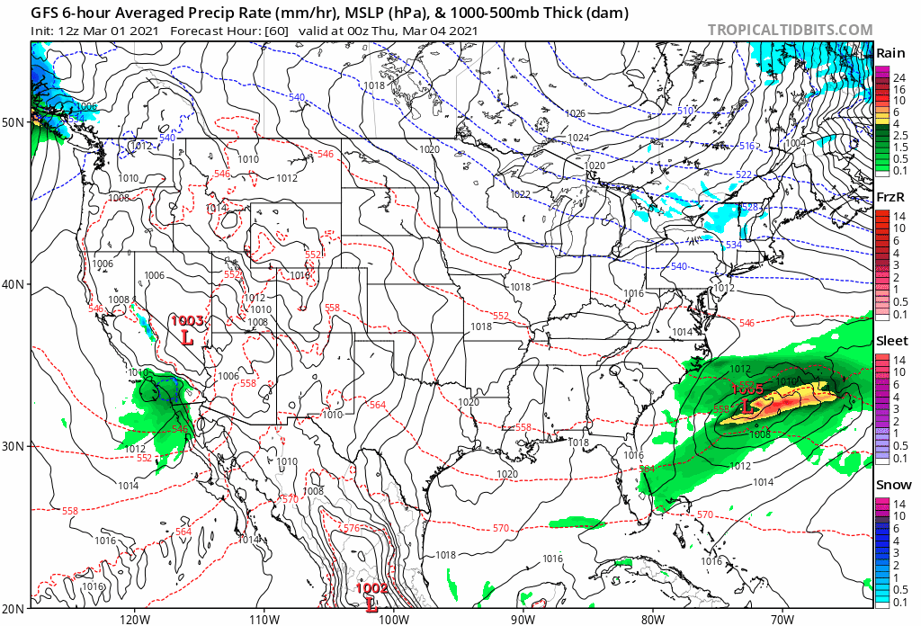
At the surface, we see rain and snow pushing into the Southwest U.S. Wednesdsay evening, into the Great Basin early Thursday, and through Colorado Thursday night and Friday. Note that there's plenty of blue (snow) for the high country, but the lack of cold air points to many areas seeing only rain (or a mix of rain and snow) at lower elevations east of the hills:
The track has trended a bit further north in recent runs after being rather consistently favoring southern Colorado. We expect the track of the low to continue to wobble in the days to come, as cutoffs are in no way easy to resolve for as they move over the Rockies.
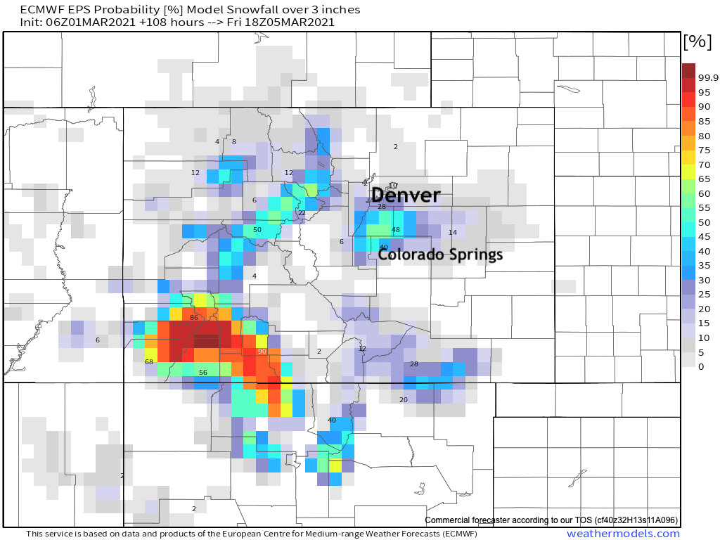
What we don't see, even with the more northerly track, is much support for any abundance of cold air. Areas at higher elevations west and south of Denver (namely the Palmer Divide) will probably see the greatest chance for snow by Thursday night into Friday. Will we manage to cool enough at lower elevations to see some snow as well? We'll see.
Right now, the areas favored for the greatest snowfall totals are the mountains of Southwest Colorado. Closer to home, let's keep an eye on the Palmer Divide for some snow to end the week, and see what trends we see in the coming day as we watch this lumbering low move our way.
For now, enjoy the warm spring weather to kick off a new month, and we'll be in touch! As you saw above, it looks like whatever the late-week system ends up doing, we'll be right back to beautifully mild weather by the weekend!